A gentle trail through Hemlocks and Laurels
|
A gentle trail through Hemlocks and Laurels |
|
Click here for a complete album of photos from this hike Click here for an album of wild flowers seen along the trail Click for Papa Bear's Home Page Click for the Backpacking Page |
y first section hike of this season was northbound through Maryland and the southern part of Pennsylvania. I started on May 10th. I would have started a month earlier in April, but at that time I was busy getting ready for and running the 2003 Boston Marathon, so you could say the start of my hiking season was delayed by the end of my running season.
Most appraisals rate the trail in Maryland and southern Pennsylvania as the easiest of the entire AT. I can't speak about the entire AT, but I've hiked most of the trail from New Jersey north, and for me this was certainly the easiest. I would say 80% to 90% of the route was on old woods roads over very easy, well graded terrain. There were a few rock fields and climbs in the last 10 miles of Maryland and a few more in Pennsylvania.
There was a gradual, but noticeable increase in the rockiness as you moved north. Contrast the first ascent of Weverton Cliffs in Southern Maryland, which consisted of well graded switchbacks with no rocks to speak of, to the final descent of Cove Mountain into Duncannon which had several rocks slides and some stiff descents over rocks. This was but a shadow of the true Pennsylvania rocks to be expected further north, but it was nonetheless a real trend.
The most interesting section by far was the set of rocky pinnacles along the ridge line that the trail wandered through
 At last, a real trail! |
Without exception, the woods were relatively open second growth forest. In only one or two places was there an echo of what the original forest must have been like - some large Hemlocks along the creek in Caledonia State Park, some dense Laurel in the area around Quarry Gap Shelters.
There were numerous road crossings. Someone counted 16 road crossings on the day we crossed the Cumberland Valley. That valley is almost all farm lands so that the reach of civilization was very close along practically the whole route.
I was out on the trail for 10 days. Of these 10 days only one had blue sky and sun all day (my last day) and one other day was mostly sunny. On a couple of days the sky cleared in the late afternoon and there was an inkling of sun before it set for the day. We had rain and fog during some or all of 8 days. Several nights it rained all night. The treadway was often filled with mud and deep puddles. In spite of the easy terrain, trying to avoid the puddles and mud, often times deeper than my boots, was very tiring. Crossing the Cumberland Valley in a light rain was an exercise in mud avoidance. There was mud splashed on my rain pants practically all the way up to my middle. I didn't get my boots and pants really cleaned until I got home.
Nevertheless, there was never a downpour, and I was always able to change into dry things at night, and start each day relatively dry. The weather gave the woods a gray, misty feeling, which sometimes added to my sense of isolation.
 A Monument on a foggy day |
Everywhere I went there were signs and markers commemorating Civil War battles and happenings. There were old trenches still visible, stone walls that were used in battles and lots of monuments and roadside signs. This area was right where the North and South fought many of the skirmishes and battles of the "Northern front" during that war. I skipped the big attractions such as Gettysburg and Antietam where truly major battles took place, but these are actually quite close to the trail for those interested in visiting them.
The history and culture of this area goes back to the very beginnings of the European settlement of the mid Atlantic region and there was little or no sign left of the pre-European wilderness in even the most remote spots along the trail. There were lots of old farmsteads, old stone foundations, iron mills, quarries, old roads through the mountain gaps and the ubiquitous stone walls everywhere.
I met lots of hikers and a few town's people. I made a stop at South Mountain, Pennsylvania to pick up a mail drop, to have lunch and to do a little shopping. This was a very "back woods" small town. There was the usual group of old codgers at the bar at mid day and hanging out at the gas station. The folks were uniformly nice and to a man (and woman), were interested in my hiking. Any number of them asked where I was coming from, where I was headed, what was in my pack, how much it weighed, etc. Some took great pleasure in telling how they had met another hiker that morning or perhaps the day before. They had no concept of the trail as a whole, or what a thru-hiker was, and in fact one old guy I talked to didn't know where Duncannon was. I told him "Up near Harrisburg" and he was impressed by that. The last person I talked to at the gas station was very pleased to meet me and introduced himself and shook my hand. He asked me my name twice to be sure he got it right.
Vicky, the woman at the bar at the Doyle Hotel in Duncannon, was much more trail savvy, since that was a good part of her clientele. She couldn't have been nicer to me or the other hikers who were stopping off there. I would highly recommend this place as a stopping point to anyone passing through Duncannon.
I never tried to hitch, since I never strayed far from the trail. I've been told it's hard to get rides in this area but I didn't find that out for myself.
I thought the people were great and I'm glad I had a chance to meet a few of them.
I did not expect to see many NOBOs in May this far north. I was wrong, I met over 20 of them and for the most part they were all moving very fast. Seldom would I meet them more than once, either on the trail or overnight at a shelter. With a few exceptions they were male, young (20 - 30) and competitive. These were the front of the pack (although the actual absolute front of the pack was probably close to New Jersey by this point). They liked to say which number there were in passing through Harpers Ferry. "I was number 26", "I was number 42". Several of them hiked across Maryland (41 miles) in one day, which is a thing (I guess like the half gallon challenge) that thru-hikers do. Or a few of them at least. There were also a few who did not fit this demographic. A few older and wiser sorts whom I stayed with for several days.
The sections in both Maryland and Pennsylvania south of Pine Grove Furnace State Park are maintained by the Potomac ATC and the sections north of there are maintained by the Mountain Club of Maryland and the Cumberland Valley AT Management Association. The trail and the shelters were very well maintained throughout this whole 2 state region. I counted but one blowdown in the whole PATC area and perhaps a few more in the other area. The shelters were in good shape in spite of the fact that some of them date to the 1940s. One or two could use a broom but there was very little to find fault with.
A number of shelters were in pairs. This was unusual and I'm told you will only find these double shelters in this part of the AT.
 Quarry Gap, through the Laurels! |
At Rocky Run Shelter in Maryland, dating from the 1940s, someone had built a couple of platforms with seats for dining and a wooden swing for just relaxing, and it even had a couple of flower boxes built in front of the shelter. Even if you don't intend to spend the night here it's worth a visit - a very lovely site.
Quarry Gap Shelters in Pennsylvania, likewise built in the 1940s also showed signs of great care. Above the roof at the front was a sign saying "Jim Stauch, Innkeeper". Good job, Jim!
This personal care and commitment
on the part of volunteers showed much love of the trail and it's amenities. Thank you volunteers, thank you very much.
Your work did not go unnoticed!
The actual end points of my section were the ATC building in Harpers Ferry to The Doyle Hotel in Duncannon. This comes to over 124 miles or an average of 12.4 trail miles a day. I figured I also hiked about 13 non-trail miles (going to fetch water, going off to see a nice view, etc.) for a total of 138 miles.
My shortest day (the first) was a bit under 9 miles, and the longest (crossing the Cumberland Valley) was over 20 miles (including a road walk to a diner for lunch). But the easy terrain in this valley made this long day not too onerous (although the constant mud didn't help).
I enjoyed this section very much. The gentle terrain plus the gray weather gave the hiking an easy but eerie quality. I'm not sure what it would have been like to have done it entirely under clear blue skies, perhaps I would have been more cognizant of the closeness of farms and towns from every outlook along the way.
I would suggest this would be an ideal starter section for doing the AT. Easy going and time to build up your strength and fitness before hitting the tougher sections further to the north and to the south.
ay 1 actually started in New York City. I had packed and checked and double checked my equipment the night before, and except for a few items in the refrigerator, I was all set to go. My wife took the obligatory leaving-home photo and I was off to the Port Authority Bus terminal to get the 8:00 AM bus to Easton, Pennsylvania. At about 9:40 I arrived at this small town on the Delaware River and was met by my shuttle Grey Owl and his wife, who would be driving me to Harpers Ferry.
Originally I had contemplated taking the train to Harpers Ferry, but that would have gotten me there late in the afternoon and I would have been unable to start hiking till the next day. Finding the shuttle was a much easier way to get started. It was foggy with occasional rain and progress on the roads was a little slower than anticipated. I hoped to get hiking by 1:00 PM but we were slightly behind that schedule.
 The first blaze (in the rain) |
I walked around to the front of the building and was disappointed to find that the place was closed on this rainy Saturday. I had hoped to fill my water here (and use the restroom) but I would have to make other arrangements. I had one problem that I should have checked at home: when I extended my Leki poles to the proper length, one of the segments was stuck in the collapsed position, so I had to extend the other segment as far as it would go. This pole ended up a few inches too short, but it would be serviceable. I got going about 1:40 and headed down the blue blazed trail to the AT. At 1:45 I hit the first white blaze and I was officially on the AT. After being off the trail since last September 21st, I was once again hiking the AT!
The rain was increasing, but with temperatures in the upper 60s, I was heating up. My fleece shirt was too much and I knew when I got to the tourist section of town in about a half mile, I would have to change into something lighter. I passed Jefferson Rock where a few small children were exploring the area in their colorful rain ponchos, and at about 2:00 PM I arrived at the historic old section of town. This was largely overrun with tourists and I couldn't find any source of water. I asked a National Park ranger if there was water in the train station. She said that was closed to
 At the RR bridge over the Potomac |
At 2:15 I started over the walkway which is along side the tracks on the old RR bridge just as a freight was passing over from the Maryland side. Soon I was on the north side of the Potomac in Maryland on the old tow path. That's two states in less than in hour! The tow path is a remnant of the Chesapeake and Ohio Canal which was built along the river from Washington DC up to Cumberland, about 185 miles. It was originally proposed as a route through the mountains to the Ohio Valley to the west, but was never built that far. The canal was finished in 1850 and operated until 1924 but was never economically viable since the railroads soon took over the bulk of the business.
The rain had stopped and hiking was very easy and fast along this well graded flat segment. My legs, getting used to some unfamiliar stress, had a few aches and pains. In about an hour I left the tow path and started up under the highway along side the picturesque Israel Creek, far below in a ravine, and up the only climb of the day: Weverton Cliffs - which is the south end of South Mountain which we would follow through most of Maryland. The climb was well graded with switch backs and in spite of the heavy pack on my back, was not too tough.
 View of the Potomac |
The trail from the cliffs to the shelter evened out and was a rather easy, well graded walk. I arrived at the Ed Garvey Shelter around 4:00 PM, just as a trail maintainer was arriving from the north. The shelter is a new two story building which was very well taken care of. An older solo weekender was sitting at the picnic table with a woman named Eileen who had thru-hiked a few years ago and was also out for the weekend. A group of 4 who had just started that day from Crampton Gap (about 4 miles to the north) were setting up tents in the area. Another solo hiker named Gayland was doing a shakedown hike for a SOBO thru-hike he planned to undertake starting June 15 from Katahdin. He was very overweight and I speculated to myself that he wouldn't make it. But you never know, where there's a will there's a way.
The spring was .4 miles down a rather steep hill. Gayland said this was the
 The gang at Ed Garvey |
I was the only one sleeping in the main part of the shelter. Four slept upstairs, and the rest used their tents. It sprinkled during the night but I slept quite well for the first night on the trail.
hen I planned my daily hiking for this trip I laid out two alternatives: a 10 day plan and an 11 day plan. The 11 day plan had slightly shorter distances so that it would stretch out over one more day. Both plans had the Ed Garvey Shelter as the first day's spot, but the second day would either be at the Rocky Run Shelter (just over 9 miles) or the Dahlgren backpacker area (around 11 miles). Since it was likely to be wet, I opted for the shorter distance, firstly to have a shelter over my head if it rained, and secondly to keep the daily hiking distances modest for the first few days. If I really got ambitious, I could always make up the extra day later in the section.
I woke at 6:00 AM to a cool, foggy and humid day. I was the first up but the others soon started to rouse. I was not yet too efficient at breaking camp so I didn't get on the trail till nearly 8:00 AM. I would get better as the days went by.
The trail for the next two or three days follows along the ridge line of South Mountain, and today it was a uniformly
easy walk through open second-growth hardwoods. It was easy to the point of being boring, especially since the fog
shrouded any possible views to the east or west. A deer crossed my path and then I passed a group of about 10 scouts
hiking the other way. These were the high points of the morning's trek!

I arrived at Crampton Gap in light rain and fog. There were some old ruins of a 19th century building on the trail and a monument to Civil War newspaper correspondents at the road. I got back into the woods and had a small but tiring climb out of the gap to the ridge line, then more easy walking. A few SOBOs passed me and then first Cakes and then Jackass passed me. They were the thru-hikers who had arrived late last night.
White Rock Cliffs came up on the right, and although a dramatic drop off, the fog precluded any view.
When I arrived at Rocky Run Shelter it was only 12:30 PM. I had put in hardly half a day
 The spring at Rocky Run |
Rocky Run Shelter is a beautiful spot! This shelter was built in the 1940s but it was evident that someone was devoting a lot of care and attention to it. There were recently built platforms with seats, a wooden swing and even some flower boxes. The spring was flowing lustily and it fed a stream which crossed in front of the shelter with the tent sites on the other side. A more perfect little vale would be hard to imagine. If you are hiking this section, stop off here even if you don't plan on staying. It's well worth a visit.
After rinsing a few sweaty things, I was pumping water for dinner when a guy somewhere in his 60s came in and joined me at the shelter. He called himself Jake but he said he had done a thru-hike in 1987 with the trail name "Georgia Ridgerunner". He had just started in Harpers Ferry and planned to hike north until he felt like stopping. He was fit as a fiddle and had plenty of stories and experiences.
About 4:30 PM Kerry and Leese arrived. They were the 2 girls who had arrived late at Ed Garvey the previous night. Leese had some bad blisters which she tended to. They said their original plan was to hike to Penn Mar and back, but they weren't sure they would make it in the time available to them. But as the previous night, they were good
 Rocky Run Shelter |
I got some good rest for my sore muscles and had a chance to do some reading of the paperback I had brought: John Irving's The Fourth Hand. You don't want to know the plot. Let's just say it was a good trail book. Not too deep.
That evening the weather cleared and we got to see some blue sky, although it was too late in the day to see the
sun. Jake and I saw a couple of Scarlet Tanagers which are among the most brilliantly beautiful birds you will see
in these parts. As the night came on, it got cooler and rather windy. We hoped the weather had broken and we had
seen the last of the fog and rain.
awoke around 6:00 AM and noticed that Jake was up and about. He ate a cold breakfast so he got off quickly. He was gone by 6:45. I was just crawling out of my bag by then. The 2 girls were still asleep.
There were a few blue patches of sky but the hopes of last night for a break
 The Dahlgren Chapel |
As usual it was easy going and the weather started on the hopeful side with the sun trying to poke through the clouds, but by 9:00 AM when I crossed US Alt-40 it had gotten dark and windy. This road crossing was just overflowing with history: there stood the Old South Mountain Inn, a stately mansion on one side of the road, the gray stone Dahlgren Chapel, on the other side and a commerative sign for the "Stonewall Regiment", A Michigan militia that had fought a battle here during the Civil War. Interestingly, this sign here in the middle of Maryland was erected by the State of Michigan and was labeled as a "Michigan Historic Site". It mentioned the number of casualties (114 out of 500) suffered but did not mention the number of casualties on the other side!
A few miles later, the trail passes through Washington Monument State Park and I checked out the stone tower (built in 1827) at the top of the hill.
 Washington Monument |
It started to rain lightly and I put on my pack cover and Frogg Toggs top. It didn't last long, less than an hour. I crossed over I-70 and took the side trail to Pine Knob Shelter for a lunch break. It was warm so I got out of my rain gear and figured with just a Coolmax shirt and shorts I would be better off on a warm day such as this.
A short time later I saw a mildly suspicious thing. A person with some kind of headdress or scarf over his/her head was off to the side of the trail in a long trench coat (down to the knees) and there were what looked like some pruning shears laying on the ground in front of him/her. The person seemed to be hiding something or other. I nodded but didn't say anything and simply hiked on by.
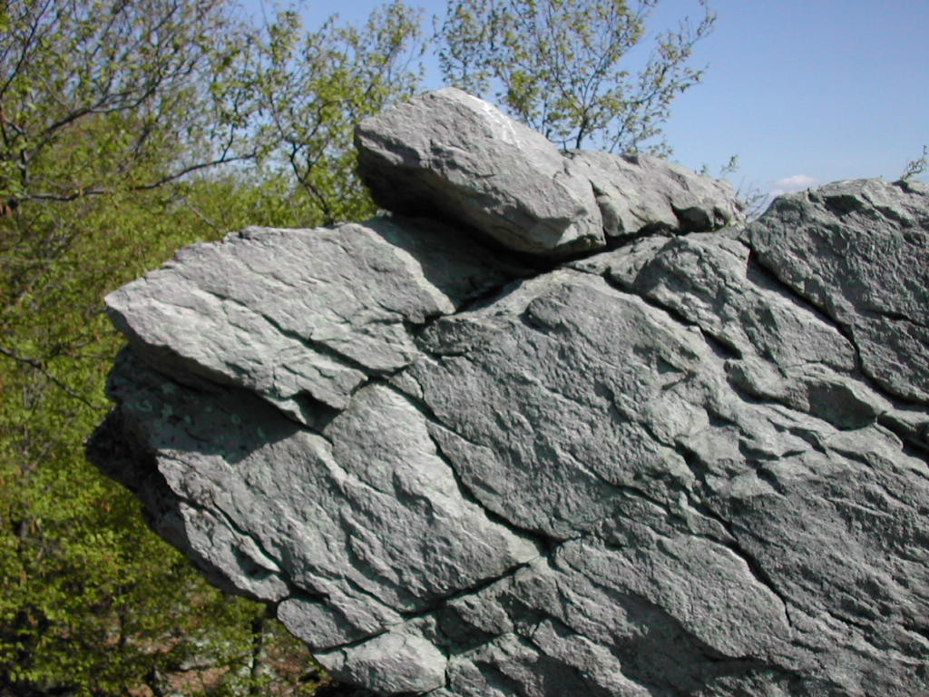
I took the side trail to Annapolis Rocks and this was well worth the extra
 Annapolis Rocks |
A short distance later Black Rock Cliffs were on the left. The book said these had an even better view. I checked these out but the wind had risen and the fog was rolling in so there were no views whatsoever.
I noticed some low level soreness in my legs at this point but nothing too alarming. Alas, it takes more than 2 days to get back into fit hiking shape.
Just as I was approaching the Pogo Memorial campsite I passed two women in their 50s who were moving slowly NOBO and who had just decided to stop at the campsite. They introduced themselves as "Anklebear" and "Sleepy Jean".
 Pink Azalea |
Then, whom should I see sitting and resting at the side of the trail, but the strange person with the headdress I had seen earlier. She was no longer strange. Just a woman with red hiking poles. I think I had managed to catch her before just as she was about to take a pee, and all my thoughts of suspicious behavior dissolved in a (silent) chuckle as I said hello.
I slowed my pace a little so my leg soreness would not become a problem. There were more sprinkles and the easy walking soon got tough as I crossed a rocky area. I wasn't watching my step and suddenly took a hard fall onto my right side. I hurt my right hand and shoulder, but luckily nothing seemed to be broken or bloody. The weight of my pack had sent me crashing down where I would probably have been able to catch my balance if I were just walking with no pack. I figured I would be sore that night. I took two Advils and got up and moved on.
There was one last steep ascent followed by a steep descent to Wolfsville Road. This section, with some rock steps over rough terrain reminded me of a lot of the New Jersey and southern New York trail. It was out of character for Maryland.
The rain was increasing and so I put my Frogg Toggs top back on and soon arrived at the Ensign Cowall Shelter. Jake was already here, resting in his bag. It was 4:00 PM so I got to work and pumped some water and then set up my stuff in the shelter. I managed to spill some water on my Thermarest but luckily this was not disastrous. My right hand was sore from my fall but it didn't feel too bad.
As I was getting settled, a young guy showed up. He introduced himself as "Witt" and said he was from Atlanta, was 18 and had just graduated from high school. He and 3 others were doing the "Maryland Challenge" - hiking the whole state of Maryland in one day. He seemed a bit exhausted and chilly so I hoped he would be OK. He had another 9 miles to go and it was getting dark out and it was raining lightly.
A little while later "Lucky Day" passed through. He was not doing the Maryland Challenge (just going on to the next shelter) but he knew the other guys who were. A much more sensible person. I finished supper and read a chapter in my book. It was getting cold so I put on my hat and gloves and continued my reading. Then Patrick and Patrick (yes, really) showed up for the night. They were newbies who were hiking from Penn Mar to Harpers Ferry and this was their first stop. They had 50 lb packs and were a bit beat. They had far too much food and too much of most everything else.
Lastly the 3 remaining Maryland Challenge guys ("Nickel", "Dime", and "Ben") came by. It was about 8:00 PM and we told them Witt was about 2 hours ahead. They were a bit older and seemed in better condition than Witt. With the temperature about 50 and the wind rising, they hiked into the darkness towards Pennsylvania.
t was cloudy, windy and chilly when I awoke. As before, Jake was off quickly at 6:45 AM. I got up, cooked breakfast and was off by 8:15 wearing my Frogg Toggs - not for rain but for warmth!
I warmed up and after 20 minutes took off my gloves. The hands and the head are the first to get warm. The trail followed a power line for a short distance and then resumed it's easy course. I passed through some Hemlocks,
 Raven Rock |
After crossing Route 491, a small brown duck appeared and made a lot of noise and scampered through the brush in front of me. It seemed to be a diversion, and sure enough she soon scampered back and started shepherding about 8 to 10 tiny ducklings away from me. It was a female Wood Duck. I tried to get some pictures but it was difficult. Nature photography is hard because the subjects insist on running away!
There followed a tough climb with some rock stairs until it leveled off again. Slowly one could detect a change in the terrain. A few more rocky areas, a few tough climbs. About a mile past the road I took the side trail to the Devil's Racecourse Shelter. There was supposed to be a peculiar field of rocks there, so I went to check it out. Well, if you read my reports you will know that I like to take all the side trips and enjoy the views and features that are out there off the trail. But for once, this one was a loser. It was about .4 mile (down hill, of course) off the trail, and the shelter was kind of dumpy. Probably the least well cared for in my whole hike. Maybe nobody ever goes there? And the Devil's Racecourse was no big deal. A field full of boulders. Looked like a rock slide from the mountain. You can skip this side trip!
Back on the trail, I passed two SOBOs who called themselves the "Tennessee Two". They were a couple of friendly 60ish guys who seemed to enjoy what
 High Rock |
At this point the ball of my right foot was hurting. I looked for a blister and couldn't find one. It was probably a little blister under the callous where I couldn't get at it. I made a positive discovery however: I had put a lightweight windbreaker on over my Coolmax shirt earlier in the morning. By now it was sweaty and I was chilly. I found that I was warmer with just the shirt and no windbreaker. The ability of the shirt material to wick away moisture was more important than the extra layer. The temperature had stayed around 50° all morning with one sprinkle.
I took the short trail to High Rock and enjoyed some very nice views. This was to the east - all the other views were towards the west. There followed several rocky areas where the trail was difficult to follow. You had to really look for the blazes. The treadway was no where to be seen. If you got slightly off the trail and didn't see a blaze, you'd be lost. All directions looked the same. This must have been "interesting" for those 4 guys who came through here last night in the dark, exhausted!
I next passed "Padre Bob", a section hiker moving south. When I mentioned the rocky area I had just
passed through, he said "That's nothing - wait till you get to Pennsylvania". Finally I arrived at
Penn Mar Park - the northern end of the trail in Maryland - and passed into
Pennsylvania and looked for the rocks! Nope, none yet. Later I guess.
I took another break at Falls Creek; I was feeling good, my legs were good and it was great hiking weather (in spite of the lack of views). I could
 Falls Creek |
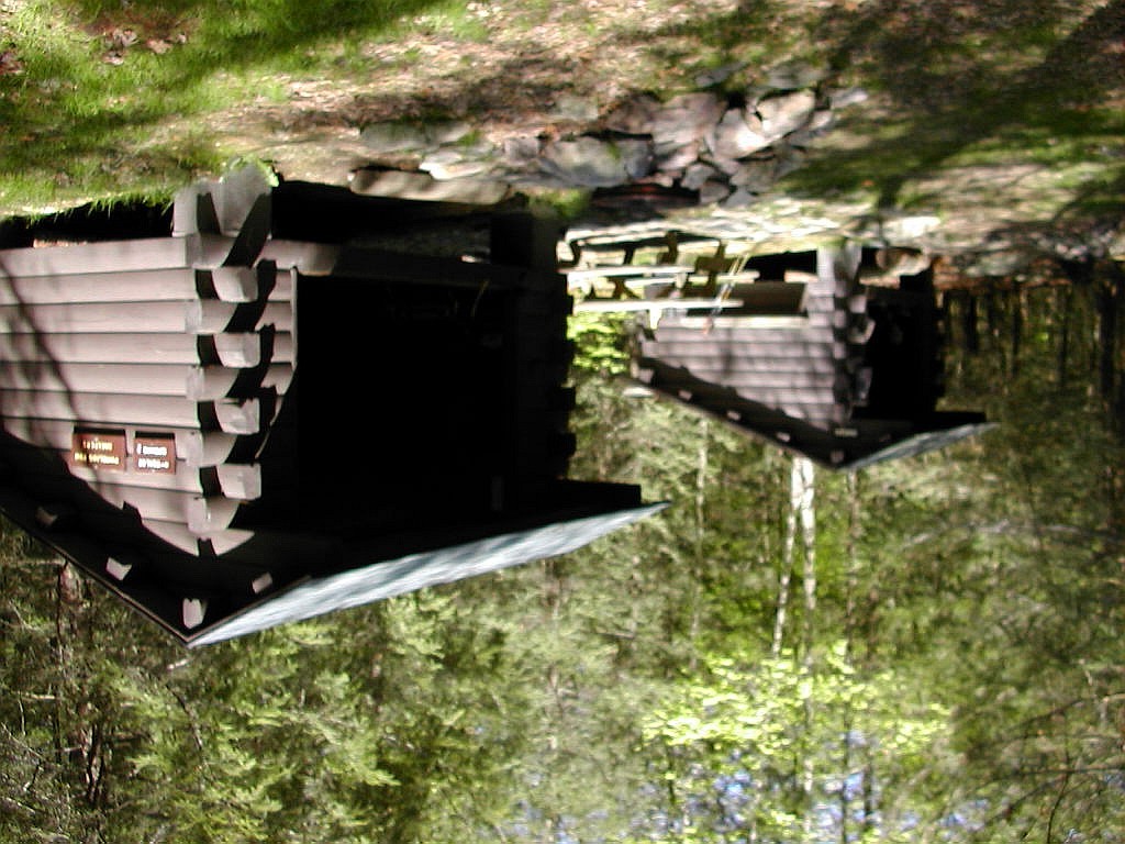
This was the first of the double shelters that apparently are unique to this part of Pennsylvania. It seems that building 2 small shelters (4 to 6 persons maximum) was preferable to one larger one. A few of these double shelters had "snoring room" posted on one of them, but I doubt that was the compelling reason that they were built in pairs. The book said these shelters were built in the 1940s but this particular pair looked new. They didn't have the large uneven logs with white cement between the logs that some of the older shelters had. One problem here: not enough nails for hanging things. The drainage in front of the shelters might also be improved - it was a bit of a mud field.
The book said the spring was .25 miles down a blue blaze trail but I walked a good distance and never found it. Then I found aother spring just a few yards down the trail on the right which was flowing nicely.
Since it was early, I lay down on my pad and did some reading. The temperature which had risen to about 65° during the day was back down to 60° so I put on some warm things.
It had been a lonely day. I had seen but 3 hikers all day and the trail was a little boring. But about 4:30 a thru-hiker "Shuk" showed up. He said he had hiked from Rocky Run Shelter (29 miles). This was what I had done in 2 days of hiking, and I said "That's too far". He said "Yes, you're right". He was older than the usual young bucks, probably around 40. He had been off the trail for a few days and seemed to be catching up, big time. He was from Canada and his wife had given him his name. It's from an Inuit name "Anuk Shuk" which he said is the thing the Inuits put on top of the cairns they build across the tundra to point to the right way to go. Cool name. And nice guy.
"Firewood" showed up around 7:00 and later "Squeaky" and his dog "Chewy". He was just out for a few days and was trying to get his dog used to the trail and to the other hikers (with not a lot of success). They stayed in the other shelter so there was plenty of room for everyone.
Supper was good, and I called my wife. Everything at home was A-OK. The night got cooler, falling below 50°. When I got up to make a midnight pit stop, the moon could be seen through thin clouds. Great to be out here!
awoke about 6:00 AM and actually saw the sun rise through the trees from where I was lying in my bag. Shuk was up early and I managed to crawl out by 6:30 AM. The temperature was under 50° but at last it looked like it would be a sunny, or at least partly sunny day. I did my normal morning routine and got moving by 7:45, just after Firewood took off. My first pre-8:00 AM start of the trip, hooray!
 Antietam Creek |
I got to the Antietam Shelter about 8:40 and took a break. This is in a lovely spot right on the (East Branch of the) Antietam Creek. I always like it when you can hear water gurgling nearby when you are in a shelter. I had started the day with my fleece shirt but now I changed to my Coolmax. It looked like a great day. Firewood was at the shelter taking a break and refilling his water supply, but he moved on.
Not a mile later, I arrived at the Tumbling Run Shelters. One of the shelters was labeled "Snoring" and two people were sleeping in it.
 Chimney Rocks |
I took the short side trail to Chimney Rocks and was well rewarded. This was an outstanding view from a dramatic rock formation. The nice weather enhanced the experience considerably. This was probably the first viewpoint of the entire hike where the sun was shining!
Back on the AT, I started off down the hill and enjoyed the easy downslope. With a pack on your back you notice the difference between up and down slopes even when it is a very meager sized hill. The forest was the open second growth woods that has been the norm all along this section. As I dropped lower, there was a good amount of Mountain Laurel along the trail.
I soon arrived at a pair of shelters, and two guys were rousing from the second one.
 Tumbling Run Shelters |
The shelters were the Tumbling Run Shelters and I checked my page from the trail guide to see where I was since I didn't think there would be another set of shelters so soon. I was confused since the mileage for these shelters was less (8.3) than that at the top of the hill (9.6).
DANG!! I had gone the wrong way! When I got back from the Chimney Rocks viewpoint I must have taken the AT down the hill to the south, not the north. I sheepishly explained what I had done to the two guys there (whom now I realized I had seen sleeping here when I passed this way the first time over an hour ago) and they said yes, I had come down the trail from the north.
There was nothing to do but hike up that d*mn hill again. Now it was not just the only climb of the day, it was a royal pain in the *ss. But I had no one but myself to blame. I just wish I could somehow rewind about an hour or so of hiking time and magically arrive back at the top of the hill - facing the right direction.
S H A Z A M !
! M A Z A H S
|
.noitcerid thgir eht gnicaf - llih eht fo pot eht ta kcab evirra yllacigam dna emit gnikih fo os ro ruoh na tuoba dniwer wohemos dluoc I hsiw tsuj I .emalb ot flesym tub eno on dah I tuB .ss* eht ni niap layor a saw ti ,yad eht fo bmilc ylno eht tsuj ton saw ti woN .niaga llih nm*d taht pu ekih tub od ot gnihton saw erehT
|
It was about 11:15 AM and I was back at the AT on the top of Buzzard Peak. I checked the sign and made sure I was heading down the north side of the hill. Boy, where does the time go - it seems like I should have been here over an hour ago!
The going was rather easy as I crossed a pipe line, and for the first time this week I almost felt hot. It was up to about 70° and the gnats were getting pesky. I soon crossed Snowy Mountain Road and there was a sign to South Mountain - where I needed to pick up a mail drop. I had assumed I would connect with this town by walking out on Route 233 (still about a mile ahead) but I hadn't thought of taking a "short cut" using this dirt road. I checked the map carefully and determined an even better short cut would be to go out on Swamp Road, about another half mile ahead. This would get me to the town in an almost perpendicular direction from the trail. No backtracking involved. So I hiked on a bit and got to that road about 12:40.
The Companion said the post office would close for an hour for lunch at 1:00 PM, so I hustled along the dirt road, and then the paved Route 233 about .8 of a mile and got to the post office exactly at 12:58. Curiously, lots of cars were pulling up at that exact moment. Seems like I was not the only one who wanted to do some last minute post office business before the post lady took her lunch break.
I got my package and discarded the box and some trash and squeezed all the stuff into my pack. Sigh ... my pack suddenly seemed like it was 10 lbs. heavier! Well, you gotta eat, and 5 days of food is 5 days of food, so there was nothing to do but trek on. There were exactly three public
 South Mountain, PA Post Office |
The book said the "Sou Mont Hotel" served lunch and dinner. With a name like that I thought this might be Korean or Japanese or something, but duh, it's just shorthand for South Mountain! They just ran out of space on the sign. It was a big, run down old building with a few old codgers smoking at the bar and a big woman who took care of everything. I sat in the "dining room" which was kept at about 100°, and ordered my cheeseburger with fries and a coke (the menu said "fries" not "French Fries" - don't know if they were being "patriotic", or more likely just saving space on the menu which looked about 25 years old!) This was a very back-woods kind of place with a genuine friendliness and a curiosity or perhaps admiration with the idea that I was hiking. A few folks asked me where I came from or how far I was going, and were always impressed by my responses.
That done, I went to the gas station - food mart. I was pleased to see they had a deli section with real Swiss Cheese! I ordered a chunk of that and some Gatorade - which I drank on the spot - and was ready to go. Outside there was a man pumping gas who was really friendly and interested in the idea of me being a hiker. He asked what was in my pack, how much it weighed and how far I was going. I said "Duncannon." "Where's that?" "Up near Harrisburg." "Yeah?" He said he had met another hiker just that morning and then introduced himself and shook my hand. He asked my name twice to be sure he got it right and seemed delighted to meet me.
Having "done" the town, I made my way back to the trail. The biggest employer in town seemed to be a large complex of old brick buildings labeled "South Mountain Restoration". There were dozens of cars parked around it. There seemed more people there than in the three "establishments" combined. I have no idea what it was - some conservation organization? land development? historical restoration? Anyone out there know?
I was back on the trail a little after 2:00 PM. Not a bad town stop. As I got back onto the trail from Swamp Road, I was passed by two thru-hikers: "Southern Yankee" and "Lieutenant". My pack was now heavy but my spirit was light. The trail was easy and I got to the shelter side trail about 3:00 PM and shortly thereafter to the Rocky Mountain Shelters. I sorted my new food out, pumped water, rinsed some of my sweaty stuff and took a
 Rocky Mountain Shelter |
I figured somehow I would be alone here tonight, but a thru-hiker named "Sub-man" showed up around 4:30 PM. he seemed to be in his late 40s. Then about 6:15 "Moose Killer" showed up. He was doing south bound sections and seemed to be at least 70 years old. He was slow but he had been doing this for years. He had an ADK 46er patch on his pack (meaning he had hiked all the high peaks in the Adirondacks in New York) so he had certainly been around. I was in one shelter and Sub-man was in the other. Moose Killer decided to stay with me but he also unfortunately almost talked my ear off. When I finally stopped answering and pretended to be asleep, he just went over to the other shelter and talked to Sub-man.
It had been a very good day in spite of my lost time on Buzzard Peak - the first fair weather day of my trip . Very good hiking weather. I checked my blisters (not bad) did some reading and got off to sleep. Once again the moon shone through thin clouds late that night.
he sun was visible for sunrise through the trees and I tried to get a picture of it from where I was lying in my bag. It was not a good shot but I tried. Unfortunately, that was the best view of the sun all day. By the time I was up and about around 7:30 AM, the sky was covered by thin clouds with a bright spot in the direction of the sun.
I chatted with Moose Killer as I made breakfast and then broke camp, and I got moving around 8:30. Sub-man had already left.
A word on Moose Killer's trail name: he had been hiking in Baxter State Park several years ago in August, which he said was rutting season for moose up there. A bull moose saw him and approached him menacingly. M-K ran and got behind a tree and avoided the moose's advances by dodging first one way then the other around the tree as the moose attacked.
 Confusing white paint marks |
The going was easy with the exception of a few rocky spots. At one point the trail went over some rocky pinnacles and I momentarily lost it. I thought it continued along the rocky ridge line, and there were some white paint marks on the rocks and trees that I tried to follow, but I then realized that these were not AT blazes, but more likely marked the State Forest boundary. Sheesh - this was confusing - they should use another color to mark the boundary! I back tracked a bit and found the real trail which turned down to the west off of the rocky area. At this point a little break was in order and I changed into my Coolmax shirt from my fleece.
 Along Conococheague Creek in Caledonia State Park |
At this point "Demian" (which he pronounced "Dee-me-an"), a north bound thru-hiker, passed me moving rather fast. In fact I hardly caught his name before he was long gone. There followed a couple of climbs - "heavy breathers" you might call them - as I ascended through thick laurel groves - at one place it was virtually a tunnel of laurel. I'm not sure what is the distinction between Mountain Laurel and Rhododendron, but these were rather imposing shrubs - well over head height.
I then came upon one of the prettiest shelter areas of my whole trek: Quarry Gap Shelters. Surrounded by laurel groves and with a little brook running along the front were two shelters joined by a common roof, with a picnic table between them. Although the buildings were of 1940s vintage, the whole area was in great shape and exhibited a great deal of care. Hanging from the roof in the front, was a sign: "Quarry Gap Shelters - Jim Stauch, Inn Keeper". I have learned that this was placed here by hikers who appreciated
 Quarrry Gap Shelters |
The weather had become cool and cloudy, actually fairly good for hiking. Occasionally the sun would try to burn through. At the warmest, the day's temperature reached around 70°.
There were a couple of climbs after Quarry Gap which tired my legs a bit, but the terrain was mostly rather gentle. In some sections it was a bit lonely and perhaps boring. But for the fleeting encounter with Demian, I had not seen a soul on the trail all day (aside for some folks in Caledonia State Park - who don't really count) since leaving Rocky Mountain Shelter. It was quiet hiking - no birds, just a few bugs buzzing by.
I crossed a woods road and then passed near the PATC Milesburn Cabin. This is situated just above a stream crossing and would make an ideal camping spot if only it weren't already taken. These cabins are available on a rental basis through the PATC.
The last section of the trail passed through Rocky Knob State Forest and here I encountered the one and only blow-down in the entire PATC area I traversed. It was a recent fall (there were still green leaves on the branches) right where the trail intersects the Rocky Knob Hiking Trail. A sign identified this trail which interestingly, was a CCC project from the 1930s
 Grassy trail through White Pines |
A short time later I arrived at the day's destination - the Birch Run
Shelters. This was a pair of old shelters, but there was a construction
project going on between them. A number of concrete foundation pillars had
been put into the ground in a rectangular pattern. I would assume by next
year the shelters would be replaced by a new structure. A thru-hiker
"Whisper" was there when I arrived. He was replenishing his water supply
and was soon off. He was a young man from Hanover NH. We had a short
conversation but he knew neither Bill Bryson nor Baltimore
Jack.
I did the usual chores: pumped some water, rinsed my shirt, and then took a rest. A few thru-hikers came through on the way to the next shelter: "A-Train" (from Brooklyn), "Squirts", and "Grub". A-Train knew Sub-man and had been hiking with him off an on for the last several weeks. I mentioned that Sub-man camped with me last night. As they moved on it started to get chillier and the rain started, lightly at first. I was glad I was done hiking for the day and was in a dry place.
 Birch Run Shelters showing construction |
After supper it started to rain in earnest. The tin roof of the shelter magnified the sound of the rain. But I wasn't particularly worried about getting soaked. Firstly, all my stuff was dry and I was safe in the shelter, and secondly, tomorrow I would be going to the AYH Hostel in Pine Grove Furnace State Park, where I could dry out anything that happened to get wet along the way.
The rain did however add to the sense of isolation and aloneness (not loneliness, but aloneness). There was no cell phone signal so I just relaxed and enjoyed being totally by myself - a state we seldom attain to in this day and age. It rained and it poured all night. A couple of times I needed to get up to pee. With these interruptions, together with the loud noise of the rain on the roof, I slept fitfully.
awoke for the final (but not for the first) time around 6:30 AM. It had rained all night and the ground outside the shelter was a combination of mud and puddles. I had an unusual problem today: the hiking distance was too short! Let me explain: tonight I would be staying at the AYH Hostel at Pine Grove Furnace State Park, aka the "Ironmasters Mansion". It was only 10 miles distant over a very easy trail. However, the hostel is not open to accept incoming guests till 5:00 PM. If I left around 8:00 AM as I usually do, and hiked at my normal pace, I would arrive before 1:00 PM and I would have 4 hours of waiting (in the rain, as it appeared) until I could get into the hostel.
Solution: stay here and read a book all morning. Well, something like that. I was through breakfast and cleaned up by 8:00 AM and I went back into my bag and read. This eventually got rather boooooooring and by 10:00 AM I had had it. So I packed up and started hiking into the chill rain just before 11:00 AM. By 1:05 I had reached Toms Run Shelters and took a lunch break. The trail had been very easy but because of the almost continuous string of puddles, some over the top of my boots, I got very tired trying to walk on the side of the puddles without slipping in. It was a losing battle. But the Gortex in my boots did it's job and my feet stayed warm and toasty.
Before long I was starting to get a chill so I set off again. I took but one picture (which didn't come out) the whole way. In the last couple of miles I fell twice on slippery rocks and mud. This was not a lot of fun! I finally got to Pine Grove about 2:25 PM, just under 3 1/2 hours, record time for 10 miles! Nothing in the Park was open, not the general store (it was a Friday and they are only open weekends) and no one was around. I couldn't find the hostel although I knew it was close by somewhere. Luckily I found a ranger getting into his car after checking something and asked where the
 The Ironmasters Mansion (AYH Hostel) in the rain |
I took off my wet things so I wouldn't get a chill, and put on my hat and gloves. Still in this atmosphere I was chilly. But I was feeling good - it had been a fast easy hike (in spite of the puddles) mostly down hill, and I was through with my work for the day. So there I sat and read, a little chilly and a little bored but hey, I had made it!
Around 3:30 PM, a woman thru-hiker named "Loki" (probably in her late 40s) climbed the steps and surprised me: "You must be Papa Bear". "Yes, that's me". I then think I surprised her when I said: "Loki, isn't he the gremlin from the Germanic gods?" She said: "Yes, Norwegian." I forget how I knew that. She had seen my register entries for the last couple of days and knew I was headed here today. She had been one shelter behind me for the last few days. Besides the ranger, she was the first person I had seen all day. She dropped her pack on the porch and said she had to pick up a mail drop at the park headquarters and so I was alone again on the porch.
Around 4:00 PM someone came out from inside to dump some water over the porch railing. He said his name was Shawn and they would open at 5:00 PM for business. Well, I had another hour to wait but at least I knew this place wasn't totally deserted! Somehow the hour passed and at 5:00 I went inside. Several others had entered from the front door including Loki, her husband Pokey (No Germanic god, he!), a hiker named Eric and someone here for an AMC sponsored hike that was happening tomorrow. We all checked in with Shawn. When I asked was there anyone else expected tonight, Shawn said yes, he
 The hostel had a well appointed kitchen |
Before things got too crowded, I showered, used the kitchen to cook my
supper and hung up the several items I had that had gotten wet today. I found a
bunk
where I had been assigned - lukily not where the Boy Scouts would be. I
called my wife on the pay phone and settled down for the night. I finished
the John Irving book (They all lived happily ever after.
) and left it on
the hostel's reading shelf, and then relaxed until the Boy Scouts showed up. I chatted a
bit with Loki. They were from Bethel, Maine (A few miles off the trail at the far western part of the state) and
she was a school teacher taking a sabbatical while her husband had worked for
the forest service and just quit his job. They had started their hike last year
and now were finishing it up. They started a week or so ago in Front Royal, Virginia.
Soon thereafter I watched as the Boy Scouts with their attendant chaos arrived en masse. They were actually fairly well regimented, in a top-down sort of way. The only problem, aside from the inevitable noise of the first hour as they got organized, was a continuous crashing in the area just above my room. It sounded like they were practicing the Olympic long jump up there! I don't know what it was, but the noise eventually stopped and I got a reasonable night's sleep.
was up at 6:00 AM and my goal was to be out of the Hostel by 7:00 AM so as to avoid the chaos of the Boy Scouts making breakfast. I cooked my breakfast, packed up and was out the door by 7:05. Almost made it. A few
 The Half Way Point Sign |
Outside, the weather seemed much as it had been the evening before. Chilly, fog with occasional sprinkles. But it wasn't really raining in earnest, and for that I was grateful. I walked through the park and just on the far side, I passed the AT Half Way Point sign. This signifies that there are 1069 miles south to Springer and 1069 miles north to Katahdin. A milestone for thru-hikers if there ever was one. (I'm told that due to recent trail relocations, the actual half way point is near the general store next to the AYH Hostel.)
In about an hour, I reached the Pole Steeple side trail. I had been told to check that out, so I started down the trail. But after about a quarter mile I lost interest. It seemed too far for a morning when the view would be next to nil. Back on the trail, I reached Lime Kiln Road (I love names like that) around 9:30 AM. That was 6 miles in two and a half hours, so I was making good time. The trail was easy, as was the norm. Gentle terrain, a few streams, a few rocks, same, same! I was not too sweaty today. The humidity had dropped and the temperature was cool - I was feeling good.
As I walked down the trail, two dogs - one a black Labrador, the other a Golden Retriever - came loping up the trail from the other direction. Suddenly they saw me and came to a screeching halt. I said "Hi doggies, where's your human?" They started barking at me, not viciously but with concern that I was entering their territory. First the Golden and then the Lab turned tail and ran since I didn't stop and kept coming. They would stop every 10 or 20 yards, turn towards me and bark some more, then turn again and run further down the trail. But after two or three attempts to halt my progress, they seemed to give it up, and high tailed it down the trail the way they had come. They were well groomed, clean and each had a collar, so I knew they were not strays, and I assumed they would soon be back with their human in tow to give them a little more courage. But the dogs never reappeared and no one whatsoever approached from that direction all day. There were a few old woods roads the trail crossed but no obvious place that the dogs had come from. Where did they come from? Where did they go? Well, I'll never know but at least the boredom was temporarily lifted.
The temperature was still around 50° when I stopped for a break. There were a few sprinkles or perhaps just dripping from the trees. I went down the side trail to Tagg Run Shelter - it seemed longer than the .2 miles the book indicated. This was a new two story shelter. Similar to, but a little smaller then Ed Garvey. The sign on the structure says: "James M Fry" but the books and signs still call it Tagg Run. Each time I stopped I felt chilly so I didn't stay long. I had a few hills and more than 8 miles between here and the Alek Kennedy Shelter, my destination for the night, so I was off again.
I was passed by two NOBO hikers whom I had seen that morning breaking camp just past Pine Grove. I would see them again later in the day and they were my only company on the trail (besides the two mystery dogs) the whole day.
I crossed Hunters Run Road and said hello two a couple of bikers out for a ride and then got onto an old RR bed. Although not identified as such, it
 Crossing an old disused rail line |
In a very short time I lost the trail. Seeing white blazes on a few trees, I went left instead of straight across a woods road and went down the road for a few tenths of a mile. But the blazes didn't look right - they were more blotches than rectangles - and I soon realized I was following the boundary of something, perhaps a State Forest area, rather than the trail. I back-tracked to the turn I had taken and discovered real (albeit very feint) blazes on the correct route.
I went through a rather pleasant area of open forests with Blueberries and Sassafras underneath and climbed a modest slope. Eventually I descended to Route 94 and took a break. It was about noon and the temperature had risen to about 55°. There was less than 5 miles to the shelter and although still feeling good, my legs were starting to get tired. There was some more easy going and finally a real climb. Rocks, rock steps, switch backs and then finally the ridge top. Wow! The trail actually went right along the ridge line over around and through a series of huge rocky pinnacles. This was the first challenging bit of trail I had seen all week. It was similar to what
 The trail hits some rocky pinnacles |
Then it was down to Whiskey Spring Road where the same two hikers I had seen twice that day were taking a break. They were finishing up cooking some sort of lunch. Stewart and Kif were their names, and I thought they might be brothers. They said they were finishing a section today at Boiling Springs. They had 4 miles farther to go than I did today, but it was their last day out.
The rest was an easy, mostly down hill walk to the shelter. I crossed a stream (Little Dogwood Run) with a nice camping area and soon reached the side trail to Alek Kennedy Shelter just after 3:00 PM. I got to the shelter and Oops! what did I find, but about 20 Boy Scouts! Oh no, Boy Scouts at both ends of the day. I looked around at the small shelter and at the plethora of boys, and turned right around and headed back to that nice area by the stream.
 Set up for the night |
A while after that, first Loki and Pokey and finally "Flick" - a thru hiker from Tennessee - arrived and, being apprised of what lay ahead at the shelter, opted to join us and set up here. Everyone got busy doing their own thing. It's always more work to set up a tent, but you certainly have more flexibility. I convinced everyone that we should get off early the next morning, and go down to Boiling Springs (about 4 miles) for breakfast, and all readily agreed. There's nothing like real food to a hiker, especially when someone else does the cooking.
Loki related what had happened at the Hostel in Pine Grove after I left that morning. The Boy Scouts got up and soon overran the place. The cooking crew made French toast and bacon but managed to burn the bacon, filling the place with bacon smells and smoke. It drove everyone out of the place while at the same time made everyone very hungry. It sounded just like the delightful chaos I hoped - and succeeded - to avoid.
hat night after supper Loki related a another story, amusing but potentially scary.
It seems that a couple of thru-hikers - "Latch" and "Demian" (whom I had met on the trail a few days before) - together with a section hiker, decided to "Aqua-blaze" the section between Waynesboro, VA and Harpers Ferry. Now you've heard of blue-blazing and yellow-blazing and maybe a few others, but what in blazes , you may ask, is aqua-blazing?
Simple: aqua-blazing is covering the distance via canoe or other manually powered craft along a suitable river or creek paralleling the trail. Makes sense to me. So they somehow got a canoe in Waynesboro and put in on the Shenandoah River, threw in all their stuff and headed downstream, about 70 miles to Harpers Ferry. At this point they were promptly pulled over. The river police, aka a park ranger, busted them for overloading the canoe. He gave them a ticket and made the section hiker get out, since the craft could safely carry only two. He actually gave the section hiker a lift to Harpers Ferry - he turned out to be the lucky one. He also made the two others tie their stuff securely to the canoe.
So off went a chastened Latch and Demian down the Shenandoah. At a point about 10 miles short of Harpers Ferry they hit some rapids and managed to capsize twice, almost drowning in the process. Completely soaked and having lost various odds and ends which were not tied down, they pulled over. I guess it was time for a break. They pulled their craft up onto the bank of the river and stowed their packs underneath, and then walked into town for some lunch and recuperation. An hour or two later they returned to the river, only to discover their packs had been stolen! And the word was that Last had just bought all new stuff in Damascus for something on the order of $1400! So ends the story of the two aqua-blazers. After a few days and calls home to get their "old stuff" back, they both returned to the trail.
On July 11th (nearly two months after writing this report), at the Pierce Pond Lean-to near the Kennebec River in Maine, I had just settled down for the night, when in walks a slim young man who immediately said "I know you, you were hiking a few months ago in Pennsylvania" (click here for story). Sure enough it was none other than Demian, who recognized me from that 30 second encounter on the trail in Caledonia State Park on May 15th. By the greatest of coincidences, his thru-hike had brought him to this Lean-to the very night I was staying there on my Maine section hike.
He provided a few more details on the above sad story. It went largely as I have it set down, but his old pack was actually one of the extra packs that got taken out of the canoe, so he had stuff to hike with right away after the loss of his new stuff. He did order another new pack from the outfitter in Front Royal but that didn't catch up to him on the trail till sometime later. He said he and Latch never knew there were rapids on the river, the ranger had not mentioned it. He also said when he got ashore after the near drowning, he was so wet and cold and having nothing to eat or drink was almost hypothermic until they could get to a place in town.
It was nice to know that after such a close call he went on, and by now has finished the trail having summited Katahdin sometime around July 20th.
Well, the stories over, it started to rain at 6:15 PM, so there was nothing
to do but crawl into the tent for a long night. Too bad I had finished my
book the previous evening. But I did have an old magazine in my pack, so I read
that. A story about Karl Rove - give me John Irving anytime!
oday was the longest hiking day planned - crossing the Cumberland Valley, over 18 miles. There is no camping allowed in the Valley - except for a spot outside of Boiling Springs (which did not appear particularly inviting), so we all had to trek across to Darlington Shelter on the far side of the Valley. It had rained all night and it continued raining lightly as we got up and packed up our stuff. One of the pains of tenting in the rain is packing up a wet tent, which tends to get everything else in your pack wet if you're not careful. But there was no putting it off, and we were all looking forward to breakfast in Boiling Springs. I was up and about at 6:15 AM and was on the trail just after 7:00. There was but one hill followed by some flat walking through farm fields along the 4 miles to Boiling Springs.
 Coming out onto the farm fields in the rain Notice the thin line of green where the trail runs |
In this situation I could see the trail both in front of me and behind for at least a half mile. A zig-zagging grassy strip crossing the brown fields. The rain and mist made it more eerie. I saw way up in front, Southern Yankee making his way along, and way behind, another hiker following, most likely Loki. Just before Boiling Springs the trail crossed Yellow Breeches Creek on a pretty bridge of stone arches.
 Crossing Yellow Breeches Creek near Boiling Springs |
I got to the ATC office at 8:30 AM and found Flick and Southern Yankee on the porch talking to "Dallas", an ATC volunteer. The ATC had just started opening the place up on weekends and it was a welcome spot to find open on this wet Sunday morning. Within 15 minutes Loki and Pokey showed up. We all stowed our packs on the porch and went to find the Lake View Cafe, which the Companion indicated was open for breakfast and lunch. Visions of pancakes, scrambled eggs, bacon and home fries - with ketchup - danced in my head. We walked several blocks around the end of the lake and found the restaurant.
DRAT! The sign said "Open Sundays 10:00 AM to 6:00 PM". There was vast collective disappointment from five hungry hikers. We walked across the street to a gas station where a few locals were hanging out in the drizzle, and asked them if they knew any place that might be open for breakfast. They were fairly useless and soon got into a discussion with each other along the lines of: "Gee, someone should open a restaurant." "Yeah, let's open a restaurant, that would be an easy way to make money." "Blah, blah, blah."
We went inside the food mart that was part of the gas station and scurried around looking for things to eat. Oreos, candy bars, potato chips, soda, whatever. I discovered that they had hot dogs grilling in an electric grill that kept about 6 rows of dogs grilling on rollers that were slowly turning. I figured well, at least that would be something hot, so I got two dogs and some Gatorade. The hot dogs were AWEFUL! Luke-warm (or more like luke-cold) and no taste whatsoever. I gobbled them down nevertheless, drank the Gatorade and headed back to the ATC. So much for my long anticipated breakfast - I was outta here!
At the ATC office I made a few calls - one to my hiking partner whom I would be meeting on the trail tomorrow. I had to leave a message, which I hate - you never know if they'll get the message or if they left town for the next month or what. So off again I was by 9:15 AM. There were 8 very wet miles ahead of me to get to Route 11. There I would have another chance for a meal. This section was not so much through fields as through marginal land between roads and fields - mostly bottom lands crossing many creeks and boggy areas. The worst wasn't the rain, which was fairly light, but the constant mud. The entire trail was through grass where a treadway had been worn by many hiker feet into soft dirt. After a few days of rain this was a mud path, sometimes 6 inches deep. My boots, my gaiters, and my Frogg Togg pants were covered with mud. The pants had mud splashed up on the inside of both legs all the way up to the crotch!
I reached US Route 11 just after 12:00 noon. Dallas had assured me that the Middlesex Diner was just .4 miles down the road, not the 1 mile it said in the Companion. From the place where the AT crossed the highway on a pedestrian bridge I could see a myriad of trucking facilities, and maybe that was a diner way down the road a piece. There were truck depots, truck repair facilities, truck diesel stations and even companies that specialize in truck wrecks! I figured well, this diner will be a truck stop, no doubt about it. I walked the 10 minutes it took along the edge of the highway, crossed over to the diner and what to my surprise do I see but well dressed people everywhere. Grandmothers in Sunday clothes, well scrubbed children, fathers with ties on. mothers carrying babies - this did not look like a trucker crowd. In my scruffy beard, wet pack, mud covered boots and clothes I definitely DID NOT flit in! But the young lady at the desk was nice enough to pretend not to notice. I said "One". She said "Oh,would you like to sit at the counter?" "Sure" I said. But then I lucked out. The only two disreputable looking guys in the whole place were seated there. Guys with long hair and dirty shirts and rough language. I had found my element! I ordered a huge lunch with home fries, sweet potatoes, (hey, I get two vegetables!), and home made meat loaf with gravy. Tons of good greasy food. I relished it. And only $6.95 plus tax and tip (You know the tax in Pennsylvania on restaurant meals is over 10% - isn't that a bit much?) After eating, I tried the phone again and this time managed to hook up with Fresh Air, my hiking partner, and we arranged a rendezvous tomorrow on the trail on Cove Mountain.
I walked back along the highway to the trail and from a distance saw a hiker crossing the bridge over the highway, so I knew one of my compatriots was just a little ways ahead of me. As I got up onto the pedestrian bridge, what was that in front of me? - a shadow! Well, not exactly a shadow - more like a shadow of a shadow - but it was there. The rain was abating and the sun was struggling to burn through the clouds.
I managed to catch up to Loki and Pokey as they took a break just before the overpass over I-81. It was Pokey I had seen crossing the pedestrian bridge over Route 11. I said the diner was great, they should have tried it. But Loki said the bad hot dogs she had for breakfast were solidly sitting in her stomach and she had lost her appetite for the day. Well I
 The muddy Conodoguinet Creek |
The valley walk was coming to an end and after crossing Route 944 around 3:00 PM as the trail entered real woods and started to climb. Thank goodness, I would at last be leaving the mud behind. The climb was at first easy, then a little stiffer, and finally it was a full fledged climb with rock steps and switchbacks. Near the top there was a beautiful viewpoint looking back over the Cumberland Valley. A seat had been fashioned out of rocks right at the side of the trail. The rocks said "Sit here and tarry a while." The sun had by now made a reappearance in the sky and the valley below was green and verdant in the afternoon sun.
But unfortunately I was not done for the day, so I moved on over the top of the ridge and arrived at the Darlington Shelter a little after 4:00 PM. I
 Darlington Shelter |
Loki and Pokey showed up and did the same chores. Finally Flick showed up and we were a foursome. Flick might have been expected to be way ahead of us, but he had stayed in Boiling Springs till around 11:00 AM since he needed to resupply. He had a bag full of food he had bought - it must have weighed 10 or 12 lbs. We kidded him about his now rather heavy pack, but he was very proud of managing to get all the supplies he needed and make it here through the mud after such a long day. Southern Yankee, who had been with us last night, had kept going to the next shelter. By 6:00 PM the sky was clear, the air was cool and it was a beautiful day - finally.
The Darlington Shelter is a bit unusual. It is made of plywood and what seems like construction cardboard. The floor boards are all chewed up, probably by Porcupines, and in one place a piece of plywood was nailed to the floor over a hole. This made that spot impossible to sleep on due to the hard bump this "repair" had created. It is painted red with white trim, and it looks more like an old tool shed you might see behind a farm house than a shelter.
I got to sleep and slept rather well. Then when I got up a little past 11:00 PM to take a pee, I noticed two very remarkable things: number one - the stars were out, shining brightly, and number two - there was an electric head lamp shining from the picnic table. At first I thought one of us had got up to do something and I went over and found someone reading under the picnic table. I said "What are you doing here?", still thinking it was one of us. He said "I just got here and didn't want to disturb anyone. I hiked 36 miles to get here today!". Wow! talk about crazy! His name was "Afterburner" and he had to meet a friend in Duncannon the next day so he had to make time. With that and a shrug, I went back to bed.
y last day! And finally the weather is great. Aside from a mostly sunny day last Wednesday, this hike has been a series of rainy and foggy days. Now at last when I'm about to be done, the weather turns nice! Everyone was in good moods since the weather had turned and everyone was looking forward to the town stop in Duncannon. We all planned on stopping at the Doyle Hotel, and a few would take a day off the trail and stay overnight there. It turns out that our night time arrival - Afterburner - knew Flick and we had a nice conversation. He said walking through the mud across the Cumberland Valley in the dark was daunting, to say the least! As usual, Flick was off early while I was still working on breakfast.
I finished breakfast, packed up and got off by 8:15 AM and walked a few yards. Oops, I had forgotten the clothes line I had strung up yesterday to hang everything out to dry. Back to get it, then off again.
The trail was over gentle terrain through lovely woods downhill, then up and over a small ridge and then down across some bottom lands and finally entered a valley with farms. I thought we had left the farms behind in the Cumberland Valley, but this
 Crossing the farm lands in the little valley |
There was one small problem in navigation. When the trail crossed Millers Gap Road, a little before Route 850, the trail seemed to disappear. I thought it might have turned up or down this road but after exploring a few hundred yards in either direction I could find no blazes on trees or telephone poles or anywhere. I was stymied, so I dug out my map and it showed the trail crossing straight across this road into the fields on the other side - but where was it? I carefully examined the grass, up and down the side of the road, and finally found a feint treadway leading off through the tall grass. I could spot none of the expected blazes on wooden posts off in the field, but this was the only choice. So off I went through the grass, and finally there was a blaze on a post which, perhaps due to the shape of the terrain or maybe the morning sun, was not visible from the road.
A short time later as I was still trekking through the grass, I was passed by Afterburner. I asked if he had trouble finding the trail at that road, and he said he couldn't find the trail either, but he saw me off in the distance and just followed.
 Lady's Slippers on the trail |
I walked along the ridge line for perhaps a mile, then sat down for a break. I saw some Lady's Slippers there, so I got a few pictures. It was nice with the sun out - you could actually take pictures and expect to get some good shots for once. While I sat there eating my last power bar, who should show up, but Fresh Air. It was good to see him - we had hiked over 500 miles together last year and he was just getting back after sustaining a bad ankle break last fall. Besides, he was my ride home.
We walked along and then down to the Cove Mountain Shelter and had a nice
 Enjoing the view at Hawk Rock |
The temperature had risen to the 60°s and it was a gorgeous day. There were a few rock fields that the trail crossed and then a fairly steep descent to Hawk Rock. This was a viewpoint with a magnificent view of Duncannon, the Susquehanna and the surrounding area. Thank goodness for a clear sunny day. After taking a few pictures, we were off again, now descending down a very steep slope with numerous rock steps, switchbacks etc. This just might have been the steepest section of my entire hike, but this close to the end, who cares!
We got to what seemed like the bottom and then the trail suddenly veered to the right, up the slope again! Hey, what was this all about? Thankfully, this unexpected climb was rather brief (undoubtedly the result of some intervening property that the trail had to skirt) and we soon arrived at the road. The trail was at an end.
 View from Sherman's Creek Bridge |
The blazes were a little hard to follow in town but I didn't get lost and soon stood at my last blaze (a double blaze signalling a left turn up Cumberland Street) and saw the real end of the Journey - The Doyle Hotel - a block ahead.
We settled in at the bar and had a couple of hiker sized beers and a "small" order of fries which was more than enough for two of us. Flick, A-Train, Squirts and Grunt were there checking into the Hotel, and Loki and Pokey soon showed up. It was old home week at the Doyle. The Hotel was looking good, and we chatted with Vicky, one of the new owners, who proudly told us of their efforts over the last couple of years to clean and fix the place up. But all good things must come to an and, and after finishing our food, Fresh Air and I got into his car and started on the drive back to New York City. The journey was truly over.
Stuff: I would say almost all the major items of equipmet performed well. I made no changes to speak of from what I was carrying last year. For specifics:
Fitness: I was just returning to hiking from running a marathon. I had a few small blisters the first few days, but I managed to increase my mileage over the course of the trip and felt pretty hiker-fit by the end.
Planning, schedule, etc.: It was a good trip. The more agressive mileage goals of my "10 day plan" prooved quite attainable.
|
Click here for a complete album of photos from this hike Click for Papa Bear's Home Page Click for the Backpacking Page |