
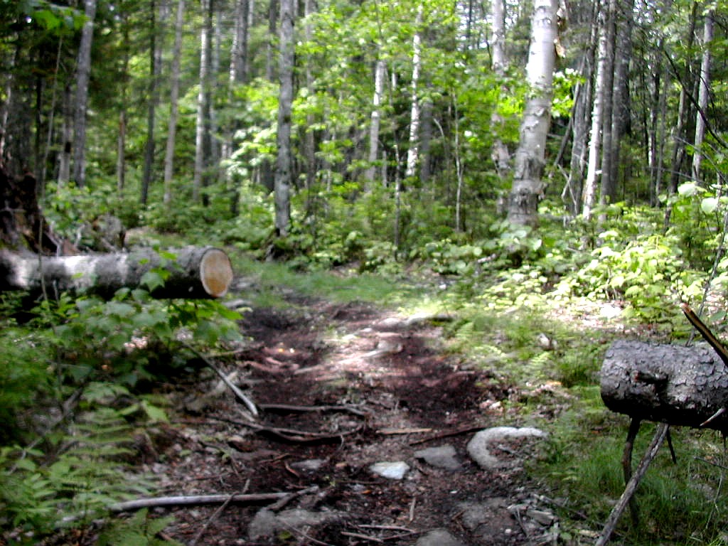
Chain of Ponds Snow from the approach trail
(Click on this or any picture for a larger image)
|
Chain of Ponds Snow from the approach trail (Click on this or any picture for a larger image) |
|
Click on an entry to jump to a particular section: |
|
Western Maine Peaks Monday: Chain of Ponds Snow Tuesday: White Cap and North Kennebago Divide Wednesday: Boundary Peak (AM), Kibby Mountain (PM) Thursday: Cupsuptic Snow Friday: East Kennebago |
|
Click here for a complete set of albums of these hikes Return to Papa Bear Home Page |
| I |
Joining us were Marge, Julie (Cantdog) and Kris (Little Bear). There were lots of peaks bagged. I climbed 6 from the New England Hundred Highest (numbers 59 - 64 for me) and two from the Fifty Finest, Julie climbed 8 of the HH (81 - 88 for her), Audrey and Pat have long since finished the 100, and Marge, on Thursday on the summit of Cupsuptic Snow, finished her # 100!
The New England Hundred Highest list is somewhat self explanatory. With some technical details concerning what is a real peak as opposed to a mere bump on another peak, it's a list starting with Mount Washington (#1) on down to #100 - the Northeast Peak of Cannonballs in New Hampshire. Many of the lower, less well known peaks have no trails to them. One must find the way through the woods and brambles and thickets with map and compass. This is called "bushwhacking". Sound like fun? You bet! Of the 6 western Maine peaks on the Hundred Highes list, 4 are bushwhacks.
A couple of the peaks are on another list called the New England Fifty Finest (one peak is on both lists). The New England Fifty Finest (NE FF) list, also known as the fifty most prominent peaks in New England. For Background, check the link above for the list of these fifty peaks, and check here to learn about "prominence": Topographic Prominence. And here's a map of New England (also New York) showing (most of) these "most prominent" peaks: NE Prominence map. In one sentence, "topographic prominence" is a measure of how much a peak rises (topographically) from its neighbors, how much it "sticks out", so to speak.
Here are some pictures from around and about Audrey and Pat's cottage: Cottage Album
Now, enough of this! On to the peaks!
| W |
So I took the bus to Natick on Sunday and stayed the afternoon and night with my son and his family. I got to see my new grand daughter for another short period. At this point (5 weeks old) they grow like mad. I picked the car up Monday morning and got rolling by 8:00 AM. Now I had a different problem: I should arrive by about 1:00 PM when the rest of them would be sweating on Elephant and I didn't feel like just sitting idly by the lake. Actually I wouldn't mind doing that now, but I digress. So I looked at the map and decided I could fit in an "easy" peak on Monday afternoon and get a head start. This just might give me some extra time to fit in the two Fifty Finest peaks I also wanted to bag: Kibby and Caribou, both to be found off a logging road north of Stratton. The HH peak that was the easy one - with a trail and a fire tower on top - was Chain of Ponds Snow, also north of Stratton. So now I had a
 The lower woods road |
I got to Stratton at 12:40 PM and after getting gas, headed north on Route 27, looking for the town line sign Gene mentions. Well, this sign is gone or I missed it so I went too far, but finally found the road after circling back. It is 13.3 miles north of Stratton off of Route 27, and there is a sign there "Penobscot Indian Territory".
The logging road is in excellent shape and there are no real complications. Simply drive 3.9 miles along the road, passing a few trailer homes and then take the right fork down a slight incline and go 1.1 miles further to a parking area. There is a sign there saying the Snow Mountain trail is marked and would ATVs and snowmobiles please stay on the trail. Since Gene Daniel's directions were a little complicated at this point, I was glad to see the reality was actually very straightforward. The trails shown on the topo map are pretty accurate except for the part just past the parking area which is at the spot marked "1820" on the map.
 Snow Mountain Pond |
The roads ended when I reached Snow Mountain Pond - a lovely body of water. There looked like a bit of a camping area here and a sign "Fires by permit only". I did manage to miss the turn where the real trail begins - I followed the road along the side of the pond as it got muddier and muddier and finally came to a little cabin where the road dissapeared. But the terrain and directions of the road seemed wrong. After checking my compass I figured I had come too far so I turned back and in about 10 minutes, where the real muddy part had started I found the real trail heading up the mountain. I had lost about 20 minutes in this little error.
 View from the summit |
I drove back to Route 27, down to Stratton, over to Rangeley on Route 4, then across to Oquossoc, down Route 17 and finally found Audrey's cottage just in time for dinner. What great timing. So it was one down and counting.
Delorme Atlas: Map #28
Driving directions:
|
Take Route 27 north from Stratton for 13.3 miles Go left on logging road "Penobscot Indian Territory" for 3.9 miles Go right at fork on logging road for 1.1 miles to parking area. |
Lists of John: Chain of Ponds Snow Map
Distance on foot (one way): Woods roads: 2 miles; trail: 1.3 miles
Total distance: 6.6 miles
Elevation gain: 2170'
Total time: 3:28
Pictures: Chain of Ponds Snow Album
| T |
 Moving up Bear Brook Road |
It was a sunny day - in fact a sunscreen day, given the long road walk, and the mosquitoes were a bit bothersome, but once we got moving we were cooled by a breeze and it was an extremely pleasant walk. The Bear Brook Road turns
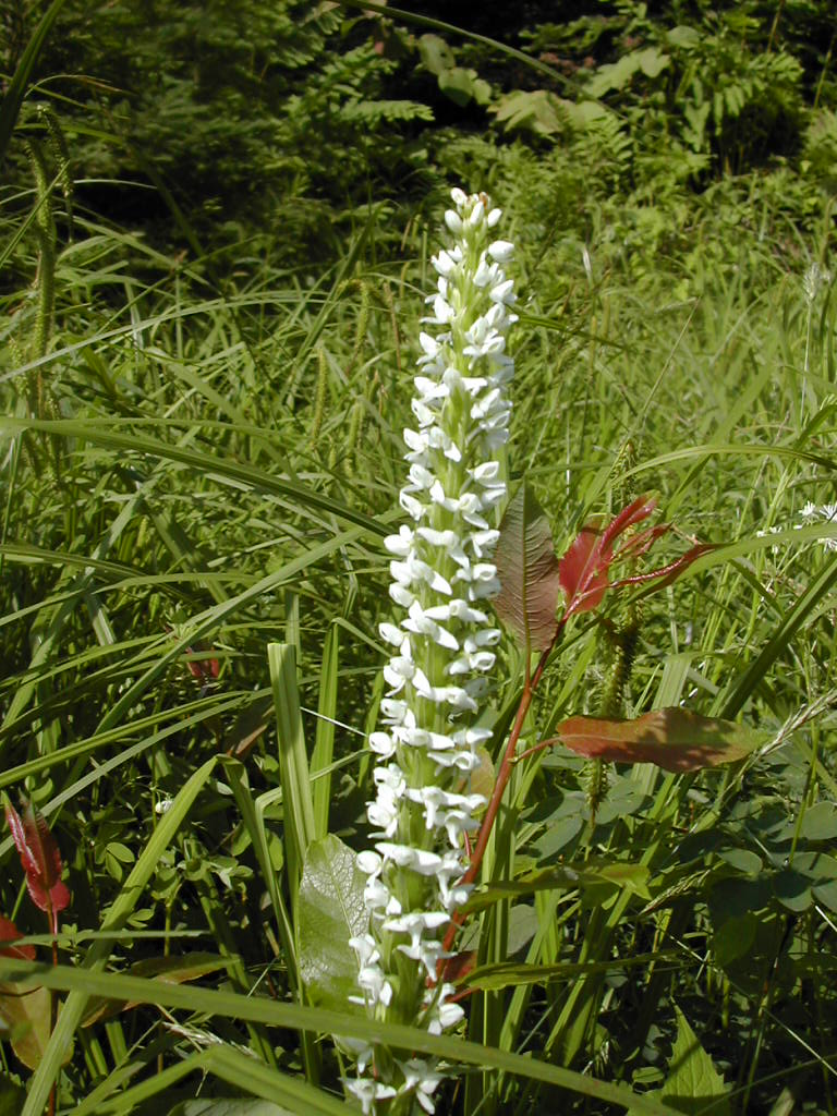 Bog Orchid at the roadside |
The road got a bit hard to follow as it rose, but never actually disappeared and we went higher and higher. The topo map shows it rising to just over 3000' before disappearing, but we had no problem following it further up. At about 3200' we noticed another road angling off to the left towards NKD, and we noted that might be a good route to try when we did that peak later in the day. The main road kept rising until finally at about 3450' we reached the height of land (probably just north of the actual col) and lo and behold there was the herd path from Porter Brook going down to the left, and the herd path to White Cap rising towards the right (north). We had arrived at the col with absolutely no nasty areas whatsoever. It had taken us about 2 and a half hours (including a break) from the car to do the long but pleasant road walk. Stan and Eric's route was a true work of art. Not only was it easy, but it was lovely to experience.
We took the path to White Cap which starts out as a remnant of an old woods road. After about 15 minutes we turned left into the woods and followed various herd paths up along the ridge line to the peak. Cantdog was in the lead
 At the White Cap summit |
We made our way down and just before noon we started off towards North Kennebago Divide on the side path we had spotted on the way up. It was a considered decision to give up about 250' of elevation with the hope that it would be easier going. Audrey had warned us that it was a tough bushwhack to get from the col over onto the NKD ridge before eventually picking up herd paths. Cantdog was again in the lead and after traversing perhaps a tenth of a mile, the woods road disappeared and we found a herd path up to the right. Possibly we were finding remnants of the path shown on the topo but we would never know for sure. We worked our way up to the ridge line and then south along it towards the peak. Although we checked our compass bearing against the map, on the whole we were following the path of least resistance. We did encounter a few nasty areas and then we found ourselves on an even contour on the right of the ridge below the peak. We decided to back track and when we got back to the crest of the ridge we started working
 Moose antler at the NKD summit |
There was a moose antler there and we had a good rest, eat a second lunch and relaxed. We got back moving at 1:23 with Marge in the lead this time. Marge did a great job pathfinding. I swear we never hit a nasty patch and she followed herd paths practically the whole way and hit the side road off of Bear Brook Road right on the dot. What had taken an hour going up took just under 45 minutes going down. I learned again that the compass never lies, but to be a slave to it is foolish. The trick is to follow the compass AND find the path(s) of least resistance. We had a couple of good samples of that today.
The walk back to the car was uneventful, and pleasant as it was, I must admit I was getting tired of it by the end.
We had hiked over 12 miles today, most of it on the road. But it was now three down and we were all feeling rather
pleased that we had knocked off these two via a rather nice alternate to the "standard" route.
White Cap, elevation 3856', #82 of NE HH
North Peak of Kennebago Divide, elevation 3775', #96 of NE HH
Delorme Atlas: Map #28
Driving directions:
|
Take Route 16 northwest from Oquossuc for 4.8 miles Go right on dirt Mortons Cutoff for 3.1 miles Go right on dirt Lincoln Pond Road for 7.6 miles Go left on dirt Canada Road for 3.2 miles Go left on dirt Wiggle Brook Road for .1 miles. Park on the right before the bridge Note: the bridge on Wiggle Brook Road (over the Kennebago River) just past where it turns off of Canada Road, was impassable. |
Lists of John:
White Cap & North Kennebago Divide Topo Map
Distance on foot (one way): Bear Brook Road to col: 4.9 miles; bw to White Cap: .6 miles; bw to NKD: .8 miles
Total distance: 12.6 miles
Elevation gain: 2620'
Total time: 7:38
Pictures:
Whitecap Album
Pictures:
North Kennebego Divide Album
| W |
So we got a real early start, getting up at 5:00 AM and getting out the door at 6:11 (target was 6:00 AM, not bad). So it was up 17 to Oquossuc, over to Rangeley, then to Stratton and then north on Route 27. Pat filled up with gas in Eustis. I was driving my own car because of plans we had for the afternoon and I dropped it off at the start of
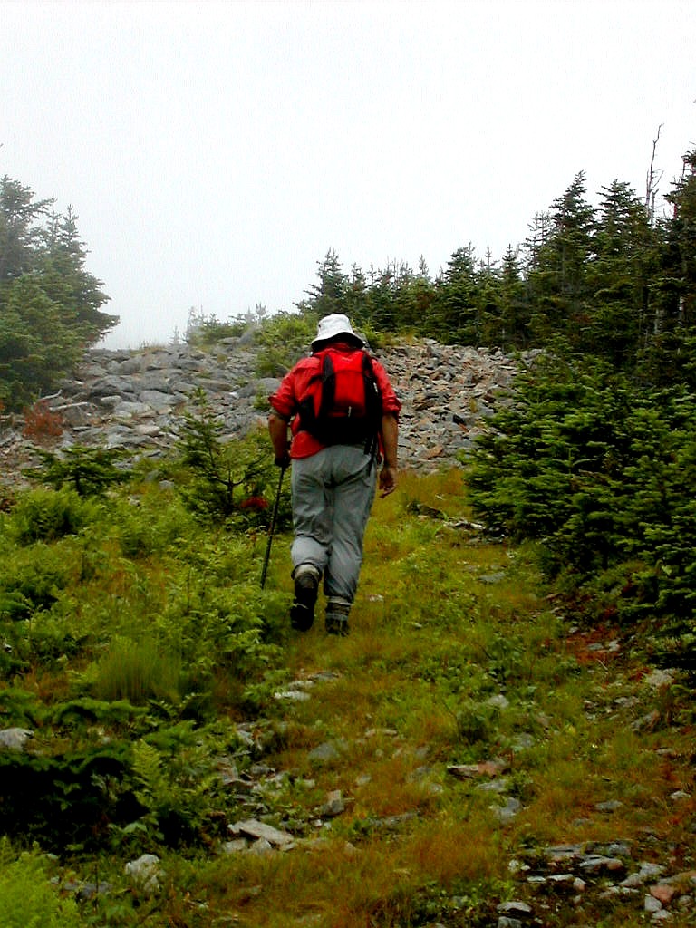
 Starting up the ATV trail |
At 7:53 we got to the border and the nice man asked more questions than usual and checked all our IDs. We said we were hikers, and I guess we looked honest. The only strange thing was he kept asking Audrey if she had been here before - I guess she has a familiar looking face. We got through after a few minutes and proceeded straight on what was now Route 161 to Woburn. Audrey reminded Pat several time that the speed limits posted were in Kilometers per hour, so slow down. We didn't particularly want to get stopped for speeding where we couldn't speak the local language. After about 3 miles we reached the small town of Woburn and took a left on Route 212. Then about 2 miles later we saw the sign for Mount Gosford on a dirt road on the left: "ZEC Louise Gosford". Much relieved, we could now follow Ridgeruner's excellent directions which I had a copy of (via Meo via Arm via SherpaK). 3.8 miles down the road, sure enough there was a gate hose on the left. Pat went in and did the talking. We stayed in the car and argued whether the sign (in French) meant $5 per vehicle or $5 per person (it was per vehicle). To pass the time, several of us used the out house conveniently placed there. I'm told it was pretty smelly inside. You might want to bring one of those paper toilet seat covers if you are sensitive to these things. But then again you wouldn't be a hiker if you were that sensitive.
 The boundary swath |
Moving right along, we went down the road and checked off Ridgeruner's milestones one by one. The stop sign, the Gosford trailhead, the bridge, the second bridge, the fork, the right turn and there we were at the gravel pit where we parked. It was 8:45, a little more than 2 and a half hours from Oquossuc. And to top it off there was another (smelly) outhouse here. It seems this whole area is some kind of reserve for hikers and hunters and there were a number of indications that it was well used in hunting season.
The route started in the forward corner of the parking area, where there was a tumbled down cairn (which Cantdog rebuilt a bit after returning). The weather was foggy and chilly. No sunscreen today! We crossed a stream, passed across an meadow and immediately started up a steep well worn trail. It looked exactly like an ATV trail in spite of the "NO ATV" signs (an icon of a 4 wheeler with a red slash across it) both here and at the top. There was also a sign "Chasseur � L`aff�t" at the bottom (and top) of this trail with a silhouette of a hunter and a gun on either side of the words. The trail climbed the ridge line coming west off the boundary from monument 447. See the topo map. The red cross on the topo is the approximate location of the gravel pit. The ATV trail follows the path shown on the map going southeast up to the ridge and then follows the ridge crest to the boundary, hitting the swath just south of the hill. It was quite steep and rocky in the lower section but once on the ridge it was a rather pleasant woods road. It was clearly well maintained. It was much more prominent than any side trails and it would be impossible to lose it. I assume the hunters or snowmobilers maintain it (ATVers never maintain nuthin'). When we hit the boundary, the map indicated we were just north of monument 447 but in the fog we didn't see it. It took us 32 minutes from the car to the boundary, all of it on this well maintained path.
We then turned left on the boundary and we climbed one intermediate peak (about 3690') after about half a mile. We came down off this and in the col we found boundary monument 446. This was an interesting construction. Originally
 Boundary Monument 446 |
After about 15 minutes at the summit (there were no views - just clouds blowing through) we started back. Audrey showed us where she and Pat had to bushwhack from Monument 446 back to their car when they did this peak years before and they were running out of time and dark was approaching. Cantdog said "you had to bushwhack down through that stuff?" It looked pretty thick. Audrey said that yeah, it was pretty thick. Along this section of the swath, on the Canadian side were a number of hunting blinds. It's apparently a shooting gallery here for Moose during hunting season. They put out salt licks and drinking troughs and when the Moose come by it's bang bang, bye bye. Sporting.
We found our ATV trail and moved on down. The steep eroded part took a fair amount of care to avoid falling on the downward trip. We reached the car at 11:15. It took about 2:15 including rests. Not bad.
 The group at the summit cairn |
The trip back in the car was similar to the journey up, but now it was the US border guard who asked us polite questions. It went well until he asked if we had bought anything we were bringing back. Pat hesitated and said "no, nothing". Then I thought I heard a voice from the back seat "except some blisters". I don't think the nice man understood sarcasm and although I think he missed the comment, he did go back and inspect the contents of Audrey's pack. But the stuff inside a hikers pack is not the stuff of intrigue and he let us go. This time.
When we passed the road construction on Route 27 we saw a logging truck with a full load which had tipped over onto it's side. It was a rather frightening scene. I hope no one was hurt. It looked like the truck was not moving fast since there was no forward spill from his load and the cab was relatively undamaged. I would think the driver would have been unhurt if he had been wearing his seat belt. Let's hope so. We finally reached the Chain of Ponds Snow logging road at 1:05 PM. I got into my car to drive up to Kibby Mountain and the rest started in to do Snow Mountain. Today would be another double.
Boundary Peak, elevation 3855', # 83 of NE HH
Delorme Atlas: Map # 28 (and # 38 for the start of the road in Canada)
Driving (Ridgerunner's directions):
|
Take Route 27 north from Stratton to the Canadian border Pass through the customs station into Canada Go straight on Route 161 for 3 miles to Woburn Go left on Route 212 for 2 miles. Look for sign "ZEC Louise Gosford" on the left Go left on dirt road for 3.8 miles to gate house on left. Go in, fill out the form and pay $5. Proceed on dirt road past the gate, set your odometer to 0 miles
|
Lists of John: Boundary Topo Map
Distance on foot (one way): woods road (ATV trail) .8 miles; boundary swath 1.0 miles
Total distance: 3.6 miles
Elevation gain: 1080'
Total time: 2:15
Pictures: Boundary Album
| K |
Since it lies off of the Gold Brook Road, which turns off Route 27 about 16 miles north of Stratton, I decided to climb it on the way back from Boundary Peak. The others in the group would be climbing Chain of Ponds Snow while I climbed Kibby.
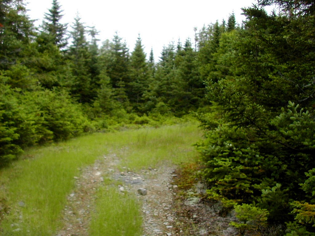 The lovely woods road to Kibby |
The trail description is given in the new MMG (page 202) so I'll be brief in this report. The main surprise was when I got to where the trailhead should be, about 9 miles up the Gold Brook Road, there was instead of a trailhead, a 4 lane superhighway of a logging road, newly built. Oops, I thought my mileage was off so I searched further along the
 The tower in the fog |
I climbed the easy woods road in about an hour from the logging road, climbed the observation tower there and got great views of clouds swirling around me. I looked over towards Snow Mountain where my friends also had a fire tower, but today was not the day to wave at each other.
I was down in less than an hour and back to the cottage where I was able to get my shower in before the others returned. Life was good.
Kibby Mountain, elevation 3654', prominence 2264', #26 of NE FF (ambiguous with Caribou Mountain)
Delorme Atlas: Map # 28
Driving directions:
|
Take Route 27 north of Stratton for 16.3 miles Go right on dirt Gold Brook Road for 9.2 miles Go right on new logging road up the hill for .4 mile The trailhead is on the on left at a widening in the road |
Lists of John: Kibby Topo Map
Distance on foot (one way): logging road .4 miles; woods road 2.3 miles
Total distance: 5.4 miles.
Elevation gain: 1290'
Total time: 2:12
Pictures: Kibby Album
 Cupsuptic Snow |
| T |
We got out the door and followed the same driving route as we had on Tuesday, and parked as before just before the sagging bridge at the start of Wiggle Brook Road. Marge had decided she would do the long road walk in her sneakers and save her boots for the climb. The rest of us just went ahead with our boots on. Today we were joined by Little Bear (Kris) who had arrived at the cottage last night and was thrilled to be doing this celebratory climb, although she had already bagged this peak on her own HH list.
[From my earlier report on White Cap / North Kennebago Divide] The bridge over the Kennebago River was blocked by boulders and the bridge was sagging towards the right. We looked at the layout and yes, we might have been able to cross the span and drive around the boulders. Looking at the underside of the bridge shows the right
 Start of the woods road from Wiggle Brook Road |
We got walking at 10:20 with mosquitoes and light rain in the air. The rain was not quite heavy enough for me to put on rain gear, and actually as long as I kept moving it was a little bit refreshing in what would otherwise have been a very muggy morning. The road walk had been measured before as 4.3 miles which agrees with my tracing from the map. The woods road starts up towards Snow from Wiggle Brook Road towards the southeast just before (.2 miles) Cupsuptic Road turns off Wiggle Brook Road. We got there about 11:50 and Audrey said it didn't look quite right. It was just at the height of land (about 2500') and is shown on the topo map. Just to be sure, we scouted down to where Cupsuptic road turns off and since it was the only woods road turning in that direction, and since it agreed with the map, Audrey acquiesced. Last time she was here she was riding in the bumpy back of Stan's pickup truck and Stan had actually driven up the woods road probably 3/4 of a mile, so her memory was perhaps jarred.
From what I could see, the woods road followed the path marked on the topo map up to where it turns to the right around 2900' - 3000', so we took our compass bearing from that point on the map. The woods road was generally easy going and we took the straight course, or slightly left, whenever there were possible side roads. We seemed to head towards the knob (3221') shown on the map to the west of Snow somewhat more than the map would indicate, but that was perhaps just due to turns in the road. When we got to about 2950' there was a grassy path crossing our path at right angles and a cairn straight across the intersection. We took this as out bushwhack starting point and set our compasses from the map (approximately ESE) towards the summit.
Cantdog led again and did a marvelous job. I was a little apprehensive that her excursions around nasty areas and her endeavors to find herd paths were taking us too far to the right of our bearing, but I was wrong. As
 More of a "fernwhack" than a bushwhack |
Marge's first words when she got to the canister (the kind you unscrew from the bottom) were "Why do they have to screw these things so f*cking tight?" Way to go Marge, one small step for a woman, one giant leap for womankind indeed. Here is Marge at the canister.
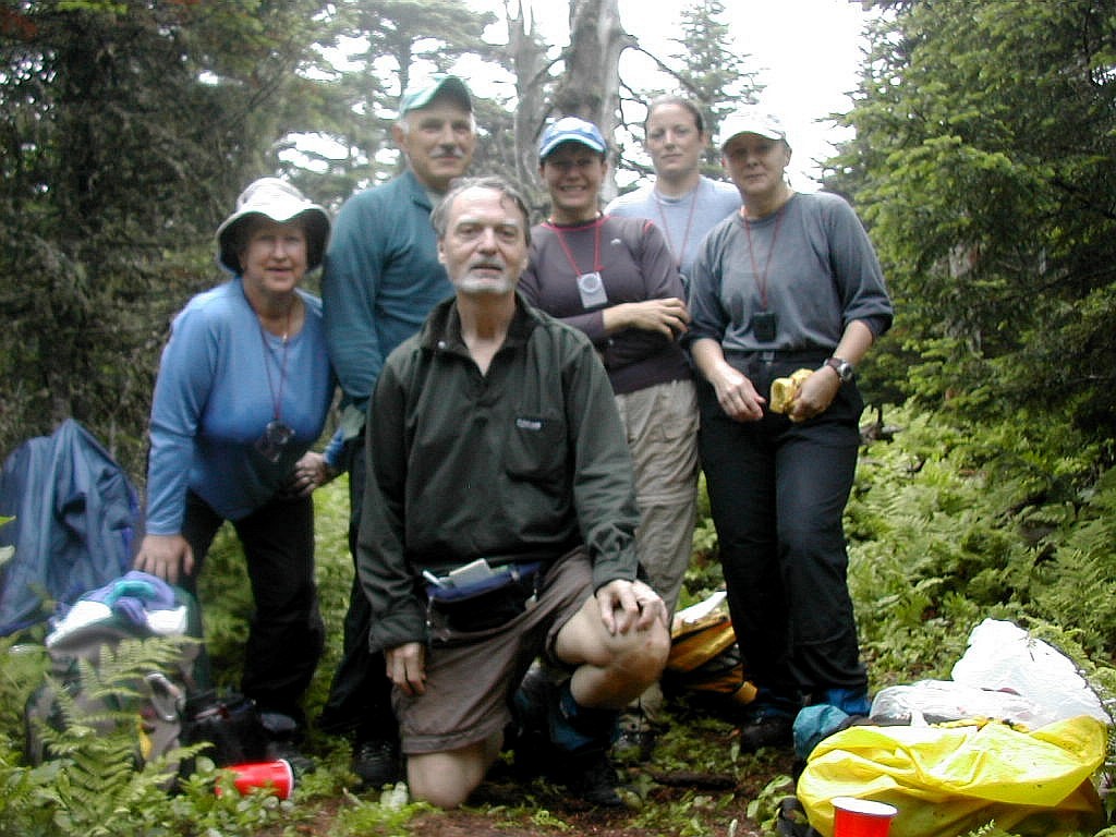 The Group |
Congratulations Marge, 31 years after climbing that first 4000 footer in 1973, the New England Hundred Highest were yours. We took numerous pictures and enjoyed the food and drink, but all good things must come to an end and it was time to start down.
Audrey told Cantdog "Lead the way down exactly the same way as we came up". And sure enough, avoiding all nasties we arrived at the cairn at the top of the woods road on the dot 50 minutes later. Once again an excellent pathfinding job.
The rest was a boring walk back to the car, but we were at least afforded a clear view of "Marge's" peak for the first time today. And would you believe, 15 minutes before hitting the car, the rain and mosquitoes were back. That's Maine!
Snow Mountain (Little Kennebago quadrangle) commonly known as Cupsuptic Snow, elevation 3784', #94 of NE HH
Delorme Atlas: Map #28
Driving directions:
|
Take Route 16 northwest from Oquossuc for 4.8 miles Go right on dirt Mortons Cutoff for 3.1 miles Go right on dirt Lincoln Pond Road for 7.6 miles Go left on dirt Canada Road for 3.2 miles Go left on dirt Wiggle Brook Road for .1 miles Park on the right before the bridge Note: the bridge on Wiggle Brook Road (over the Kennebago River) just past where it turns off of Canada Road, was impassable. |
Lists of John: Cupsuptic Snow Topo Map
Distance on foot (one way): Wiggle Brook Road 4.3 miles; Woods road .9 miles; bw .7 miles
Total distance: 11.8 miles
Elevation gain: 1970'
Total time: 6:32
Pictures: Cupsuptic Snow Album
| O |
 The start of the boundary line |
The hike up the woods road was easy going. It was grassy up above where vehicles were able to drive. There seemed to be a lot of logging activity to the right (downhill side) of the road with alternating areas of clear cut and uncut areas and skid roads running down the slope. This continued up to about 2600' after which we had uncut forests on both sides of the road. After hiking about 1.4 miles we reached the boundary line. It was marked with a small cairn on the left (uphill side) and yellow paint blazes (splotches, really) on trees along the line. It ran in a B-line diagonally up to the left. The forest was fairly open here and the boundary line was not cleared, but was easy to follow due to it's straight line nature and the occasional yellow blaze. It was relatively easy going.
After about .4 miles and 23 minutes, we reached the height of land and the boundary flattened out. This was about 3300'. We set our compass bearing from the map and headed into the woods. The forest was mid aged with a number of older trees and an extraordinary amount of biomass underfoot. The mulch in places was 2 feet deep. The route was fairly steep at first and there were a few thickets of younger Spruce but it was not tough going. There were no
 Open woods for the bushwhack |
Cantdog had a very big smile when she reached the canister. Her revenge was sweet after missing this peak a few days earlier. We saw the note in the log that Audrey had left on the previous Sunday: "We lost Julie!". Cantdog (Julie) wrote a cute reply "Yeah, I'm late for dinner here". The important thing is we made it and we felt great. Another entry just above Audrey's said "6-21-04 Found It!! Second attempt and almost gave up today. #99 and one more to go. Now I hope I can find my car". Yes we hope he did find his car. We had a bite to eat and then returned the way we had come.
On the way down we strayed slightly to the right (west) and found ourselves with a few "cliffy" areas. If you try this route, err to the left on the way down, and on the way up start up from the boundary line as soon as you reach the height of land. Don't go too far along or you'll hit a fairly steep slope. Look at the topo map and you'll see what I mean. We were back to the woods road in about 55 minutes and back at the car about a half hour later. The sun was making occasional appearances, we were done and it was just 12:20.
 Looking over Lake Mooselookmeguntic From the Bald Mountain Tower |
That afternoon we hiked Bald Mountain, near Audrey's cottage. A nice "dessert" hike as Cantdog called it. There were beautiful views from a lookout tower of Rangeley Lake and Lake Mooslookmeguntic. When we got back to the cottage, Marge swears she saw us on the tower through her binoculars from the lake shore at the cottage. Who knows, could have been. Oh, and we saw a moose on the drive back. It was a nice end to a great week of peak bagging.
East Kennebago Mountain, elevation 3791', #91 of NE HH
Delorme Atlas: Map # 28
Driving directions:
|
Take Route 16 north from Rangeley for 9.8 miles Go left on dirt Langtown Main Road, over bridge and right at T for .9 miles Go right at fork for 1.4 miles Go left at fork onto rocky road for .8 miles Go left onto "rugged" road, slow going for .8 miles Park where a road goes up to the left just after an open area. Path is straight ahead on the woods road. |
Lists of John: East Kennebago Topo Map
Distance on foot (one way): woods road 1.4 miles; boundary line .4 miles; bw .3 miles
Total distance: 4.2 miles.
Elevation gain: 1450'
Total time: 3:29
Pictures: East Kennebago Album, Bald Mountain Tower Album
|
Click here for a complete set of albums of these hikes Return to Papa Bear Home Page |