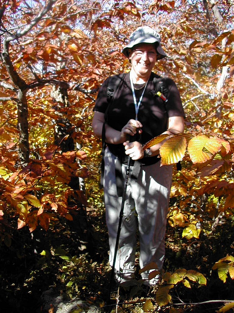
Closeup of Manning Lake from Belknap Mountain
(Click on this or any picture for a larger image)
|
Closeup of Manning Lake from Belknap Mountain (Click on this or any picture for a larger image) |
|
Click on an entry to jump to a particular section: |
|
|
The New England Fifty Finest Monadnock: October 10 Grass Mountain: October 11 Mount Ascutney: October 11 Mount Cardigan: October 12 |
Mount Kearsarge: October 12 Mount Shaw: October 13 Belknap Mountain: October 13 Reflections on the Hikes |
| W |
For Background, check the link for the list of these fifty peaks above, and check here to learn about "prominence": Topographic Prominence. And here's a map of New England (also New York) showing (most of) these "most prominent" peaks: NE Prominence map. (The map shows peaks with prominence over 2000', so Cardigan and Belknap are not on it.)
In one sentence, "topographic prominence" is a measure of how much a peak rises (topographically) from its neighbors, how much it "sticks out", so to speak.
I have started to climb the peaks on this list while simultaneously working on the New England Hundred Highest (NE HH) list. With this trip I have basically finished
all the "easy" peaks south of the White Mountains (I had already done Greylock in Massachusetts). Now it's onward
and upward to the good stuff. ... After a little rest.

Some useful resources for these hikes were the AMC's Southern New Hampshire Trail Guide (SNHG) 1999 edition, the GMC's Day Hiker's Guide to Vermont (DHG) 2002 edition, the DeLorme Atlas and Gazetteer for New Hampshire and Vermont, and the internet site Topozone which provides high quality online copies of USC&G topographic maps.
 Monadnock from Route 124 (Click on this or any picture for a larger image) |
| M |
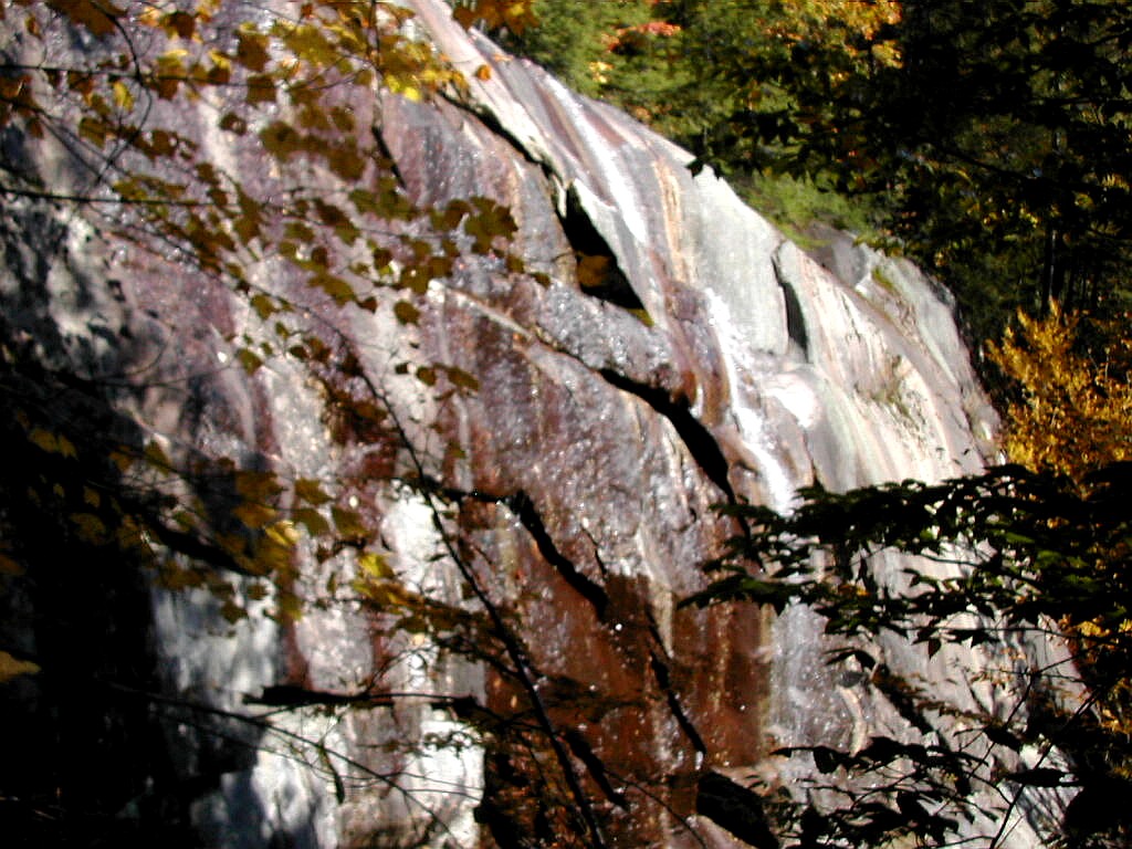
Monadnock is an Abnacki word for "mountain that stands alone". And it does. (Incidently, I have taken to calling it "Monadnock" instead of "Mount Monadnock" in view of what the Abnacki word means.) It towers 1500' to 2000' above the surrounding country side and is visible on a clear day from much of central New England, and views from its summit may extend to 6 states. Its topography is due to a volcanic "dike", or intrusion that forced its way up though the upper layers of the earth's crust and hardened. Eons later the surrounding land eroded away leaving the harder rock of the intrusion behind, creating a singular mountain peak standing above a relatively flat terrain. The word "monadnock" has been taken to identify any mountain formed in this way. They stand out prominently and you can spot them on a contour map right away: many circular contour lines around the peak. Some of the other peaks I hiked this weekend were monadnocks: Ascutney, Kearsarge and Shaw (actually part of a more unique formation called a ring dike).
Monadnock has an open summit, caused by repeated fires in the 19th century, so that its peak resembles many much higher peaks in the White Mountains that extend above treeline. Monadnock is supposed to be the most climbed mountain in the world. Or maybe it's second to Mount Fuji in Japan, I've heard both. But whichever it is, first or second, it gets lots and lots of people and over the Columbus weekend with the Fall foliage in full color, it would be as crowded as it gets. I was hoping an early Friday start would help me avoid the worst crowds.
I got to the parking lot about 10:15 AM and paid my $3.00. The ranger asked would I be climbing the mountain today and did I need a map. I said I had a map and I planned to go up the White Dot or White Cross Trail and then come down some of the trails that go down the south side and then get on the Lost Farm Trail and finally the Parker Trail
 Passing by the reservoir |
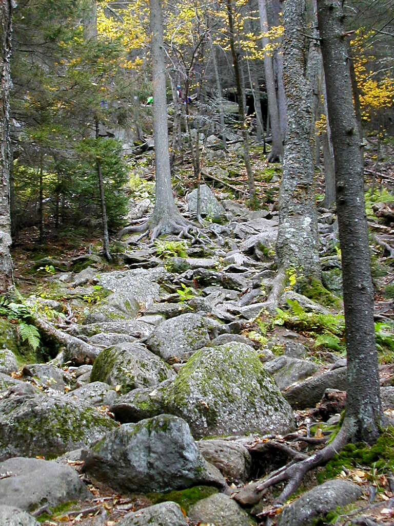
I started out passing by the reservoir and immediately I was struck by the lovely view of the mountain across the water with bright orange deciduous trees mixed with dark conifers around the reservoir. As I moved away from the park HQ, I left everyone behind and I was absolutely alone as I hiked up the Parker trail and the Lost Farm Trail. The terrain was characteristic of what I would encounter all weekend, wide easy grades below, followed by steeper, rockier ground as I climbed higher. I managed to twist my right ankle a couple of times and my foot hurt like hell. I had injured it in the summer and it was acting up again. I was afraid this problem would curtail my ambitious plan for the weekend so I was not thrilled, to say the least. But after resting a few minutes,and putting on an Ace Bandage ankle support, it seemed to get better. Somewhere along here, I saw a sign "Graphite Mine" with an arrow pointing down to the left. I searched down the unmarked path for about 10 minutes but I found nothing interesting, so I gave up and got back on the trail. Anyone know what and where this is?
 Bald Rock |
I got on the Smith Connector which curves around towards the east and then the Amphitheater Trail which leads to the bottom or the rocky dome of the summit. I passed above treeline on the White Arrow trail and made the final quarter mile of the climb to the top. As I got near the rocky approach to the summit, there were many hikers coming up and down and when I finally reached the summit there were perhaps 30 or 40 there. I was lucky however when I saw the 60 or so junior high kids had just started down, just as the ranger had predicted they would. It had taken me a little over 2 hours to climb to the summit at an easy pace over relatively easy terrain.
The peak really was glorious, in spite of the crowds. The sun was bright, the sky was blue, the temperatures were in the 60°s and life seemed awfully good. I took some photos and ate some food and eventually decided it was time
 Monadnock Summit |
I climbed down below the rocky dome and met some folks who had seen the junior high kids going down. They had taken the White Cross Trail, so I decided on the White Dot Trail to avoid them as much as I could. Nevertheless I still passed 25 or 30 folks moving up and down the trail on my way down. It was amusing to observe the Sunday stroller types when they came out of the trees and got a glimpse of the steep and rocky last 500' of the summit. Comments varied between "Wow" and "Oh no!".
The White Dot Trail down the east side of the mountain was significantly steeper than the route I had taken on the way up, and there were many sections of steep slabs. But it was not a hard mountain. If it were, you wouldn't have thousands climbing up here on a popular weekend. As I got lower, the trail got less rocky and gentler until towards the bottom it was literally a walk in the park.
I got back to the trailhead at the parking lot around 2:30 PM, a little under 4 hours round trip. It was a great hike on an impressive mountain. Some folks have told me that they only hike Monadnock in the rain, to avoid the crowds. I would say, no - go on a good day and just pick your route carefully.
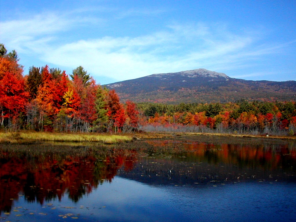
Next I had to get back into driving mode and drive another 2 hours to Hanover. But my experience with the mountain was not quite over. As I drove west on Rte. 124, I suddenly saw an incredible scene to the right. There was the mountain in all its glory standing in the distance across a small roadside pond ringed with bright Fall colors. I literally stopped, turned around, and drove back to enjoy the view. This was a one in a million view and it made my great day into an extraordinary day! (See the title picture for this section above.)
Monadnock: Jaffrey and Dublin, New Hampshire
No. 33 of the New England Fifty Finest
Elevation: 3150', prominence: 2169'
Trails up: Parker, Lost Farm, Cliff Walk, Smith Connector, Amphitheater and White Arrow Trails
Trail down: White Dot Trail
Distance hiked (rt): 5.0 miles, elevation gain: 2000'
Photos:
Album for Monadnock
Resources:
Trail guide: AMC Southern New Hampshire Trail Guide (1999)
Topozone:
Monadnock topographic map
DeLorme New Hampshire Atlas and Gazetteer (2001), page 20
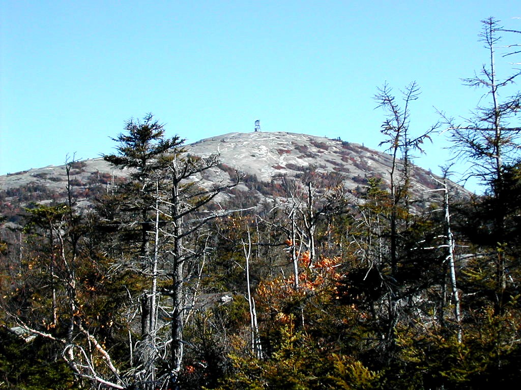
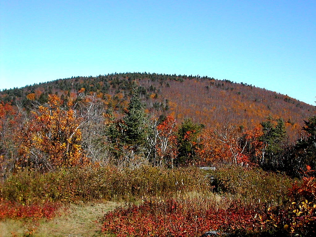
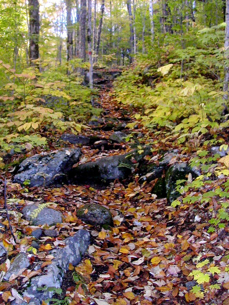
 An open area near the Grass Mountain summit (Click on this or any picture for a larger image) |
| S |
She followed me over several country roads through Shaftsbury: West Mountain Road, La Clair, Murphy Hill Road and finally Shaftsbury Hollow Road to where it ended at a fork in the road. Curiously, there was more traffic on West Mountain Road (2 pickup trucks following us) than I had seen on Route 7! We left my car here and consolidated ourselves into Audrey's car and made our way up the muddy rutted woods road that extended from the end of
 Audrey starts up the woods road |
We followed the woods road along Little White Creek which we crossed altogether 5 times - twice on culverts and 3 through shallow fords. In all cases we kept to the most heavily traveled path when there were forks, and always kept close to the stream. After the last crossing, the road headed up to the right and climbed 100' or more above the stream. Both the topographic map and DeLorme show the road veering to the left of the stream, but it actually goes to the right. Eventually we rejoined the stream, now just a trickle, and soon arrived at the col, where there was another woods road in fairly good shape coming down from the right over the flank of Spruce Peak, and a wrecked Subaru right at the col. Our woods road continued down the other side. My Suunto altimeter watch showed the col's elevation as 2570'. The topo shows the highest contour to be 2560' so this was pretty close. We would have to rely on this to some extent when we sought the highest point on the peak.
I oriented my map (which was printed from Topozone), and plotted a bearing of around 310� from the col to the peak. This bearing was not too critical since the woods were rather open and the direction of maximum gradient was fairly
 Audrey and Pat with the Subaru at the col |
The going was rather easy. It was a pleasure for once to be in a completely deciduous forest and not have needles in your eyes and down your back. There were a few blowdowns, easily skirted, and one minor ledge. After about 20 minutes, the forest opened out to a meadow-like area with solitary trees and ground cover of ferns rather than grass. It was rather pleasant, if unexpected. I would guess some pasture or farm field was here in years past. In another 10 minutes I arrived at the "top", but we spent at least 10 minutes trying to find the highest point. We generally worked forward, and the highest point we found was towards the "back left" (south-west) corner of the top area. This was a rock ledge a few yards from another ledge which had a view to the south-west and a drop-off in that direction. My Suunto showed 3120'. At the other possible spots we checked it registered 3110' The topo shows the elevation as 3109', so we were fairly sure we had found the right spot, but finding no register we could not be positive. Later that day Audrey found a reference in the Spruce Peak register to a new register being placed on Grass in 1999, so there is some possibility that we missed it. But if we did, I don't think it was by much and the elevation from my Suunto was on target (although with an uncertainty of 10'). We may go back again to look further. Audrey mentioned from a flower lover's point of view, it's worth a Spring trip to look at the flowers. She saw some interesting species on the way down, including Bottle Gentians, which she has seldom seen outside of New York.
|
|
|
| Audrey, Papa Bear and Pat at the high point | ||
Not surprisingly, the going was faster on the way down than up and I made it back to my car by 12:10 PM. I checked the elevation of the col on the way down as a consistency check, and I got 2580', so the drift was rather small over the period of over an hour we spent going up and back to Grass from the col.
This was a very pleasant and easy bushwhack on a fine October day. We probably took the longest road in. Two other routes are shown on the topo and DeLorme, which we may try if we go back.
Grass Mountain: Shaftsbury and Arlington, Vermont
No. 30 on the New England fifty Finest list
Elevation: 3109', prominence: 2199'
Trails: woods road up to the Grass-Spruce Peak col, bushwhack to Grass
Distance hiked (rt): 4.3 miles on woods road, 1.2 miles bushwhack, elevation gain 1800'
Photos:
Album for Grass Mountain
Resources:
Topozone:
Grass topographic map
DeLorme Vermont Atlas and Gazeteer (2000), page 20
 The Ascutney summit from the Hang-Glider's platform (Click on this or any picture for a larger image) |
| I |
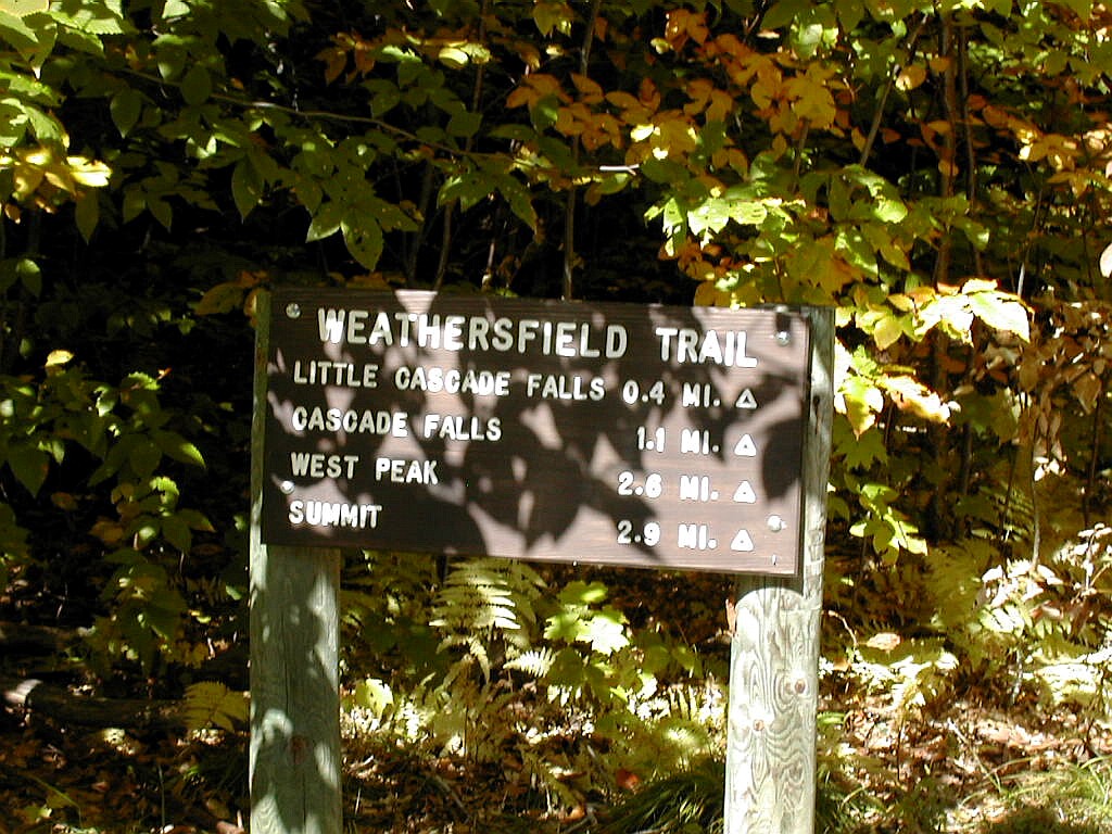 The Weathersfield Trailhead |
The parking lot was jammed and the trail was busy in the lower section. As was the pattern on many of my climbs over the weekend, the broad and gentle terrain on the lower section of the trail soon gave way to a steeper, rockier section. I passed a small cascade and then a deep cleft in a rock ledge off to the right. This was rather impressive. Then there was a ladder to help climb over this ledge. I passed a number of "tourist hikers", mostly going up, many with small kids in tow. After about a mile and 30 minutes of hiking, I got to Cascade Falls, which was the attraction that brought most of these folks here. I counted over 40 people on the trail going up or hanging out at the falls.
 The sheer cliff at Cascade falls |
At 3:00 PM I got going again up the trail and guess what? No more people! Hiking the mile to the waterfall was all that most of them had on their agenda. I did however soon catch up with a couple who were holding to a good pace and we got to talking. It turns out they were from New York City, my home town, and the husband was a marathon runner like me. They were Jerry and Carolyn, and although Jerry was almost a mirror of myself, I had never met him in the Big Apple. They were staying at a resort to the west of the mountain and had hiked Ascutney via another trail before. I mentioned that my only concern was to get back before dark, but they didn't seem to worry about that.
After passing a spot called Halfway Brooks, the trail left the stream and switch-backed up to the left through a mostly open Pine and Spruce forest which was very lovely. We asked several groups coming down how far it was to the top and they each said "15 minutes" even though we asked the question over a period of at least 20 minutes. One said "15 minutes to the top, further to the top top". Ahh, a hierarchy of summits! Finally one person said just 2 minutes more to the top, and then there we were at the little side trail to West Peak. This was evidently what they meant by the "top". The "top top" was the actual summit about .4 miles further on. West Peak had lovely
 The Valley to the west from the Hang-Glider's platform |
We noticed that suddenly there were lots of people on the trail, many of them not too fit looking. ("Fat people" was the name I not-so-euphemistically gave them.) How did these people make it up here and how would they ever make it down again? Well, the mystery was soon solved. There was another road that came up very close to the summit and they had to hike just a few tenths of a mile to get here. But several of them asked us "Which way to the parking lot?" as we passed, so they exhibited some concern to be done with their "outing".
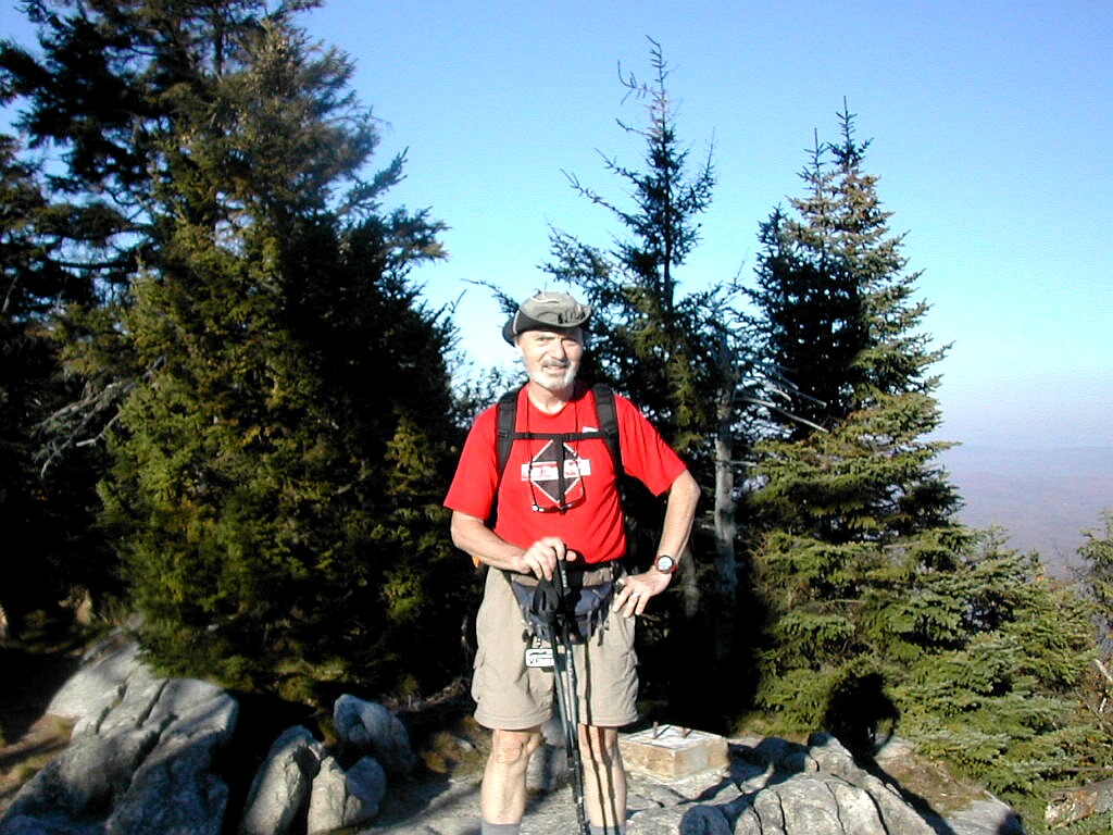
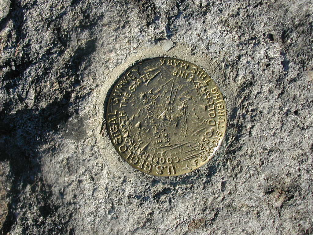
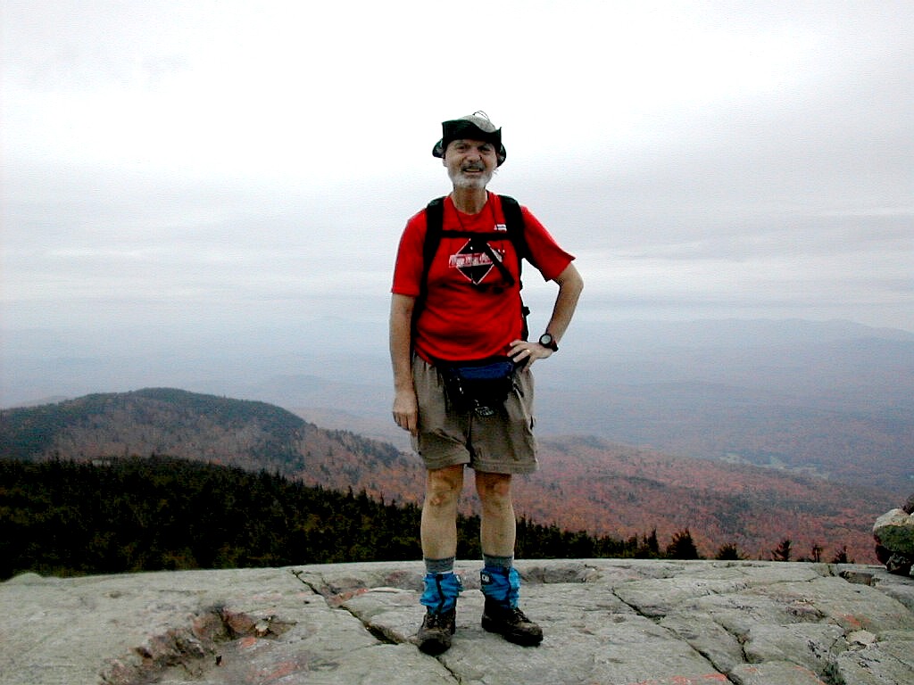
We climbed the last bit to the summit over some rocky ledges and there we beheld a tall radio tower, a not-so-tall lookout tower and more towers on another lower peak to the south-east. Most of the crowd was concentrated around the lookout tower but I went off 10 yards or so to the south where I found the true summit peak near the radio tower. There was a USCG bench mark there and I got a picture taken of myself and took one of Jerry and Carolyn. I took a few other shots from the tower but the late afternoon was hazier than it had been earlier so the views were good but not great.
|
|
| Papa Bear and the bench mark at the summit |
Going down was quicker than going up, but it really was getting darker as we got towards the bottom and as is often the case, the trail seemed longer going down than we had remembered. When we got to the falls around 10 minutes to 6, there was a family with about 4 kids still hanging around and we hoped they would not get caught by the dark. But there was worse: when we got very close to the parking lot, after 6:00 PM, we saw a young couple with two small kids and no discernable gear heading UP the trail. I mentioned that they should think about the coming darkness (which had really already come), but what could you do? The young wife looked skeptical and hopefully she would convince her gung-ho husband to turn around soon.
 Arriving at the car at dusk |
I then drove back to Hanover and grabbed a bite to eat and finally made it to the ALDHA session I wanted to hear:
Chris Townsend talking of his trek in Scotland where he bagged no less than 517 peaks in the Scottish Highlands!
Sheesh, and I though 7 in one weekend was something! I arrived at 7:45 PM (45 minutes late). It had been a long
day: 2 hikes each close to 4 hours and over 200 miles of driving. I would sleep well tonight.
Mount Ascutney: Windsor and West Windsor, Vermont
No. 25 of the New England Fifty Finest
Elevation: 3130', Prominence: 2290'
Trails: Weathersfield Trail
Distance hiked (rt): 6.1 miles, elevation gain: 2410'
Photos:
Album for Mount Ascutney
Resources:
Trail Guide: GMC Day Hiker's Guide to Vermont (2002)
Topozone:
Ascutney topographic map
DeLorme Vermont Atlas and Gazetteer (2000), page 31
 The Cardigan Summit from South Peak (Click on this or any picture for a larger image) |
| T |
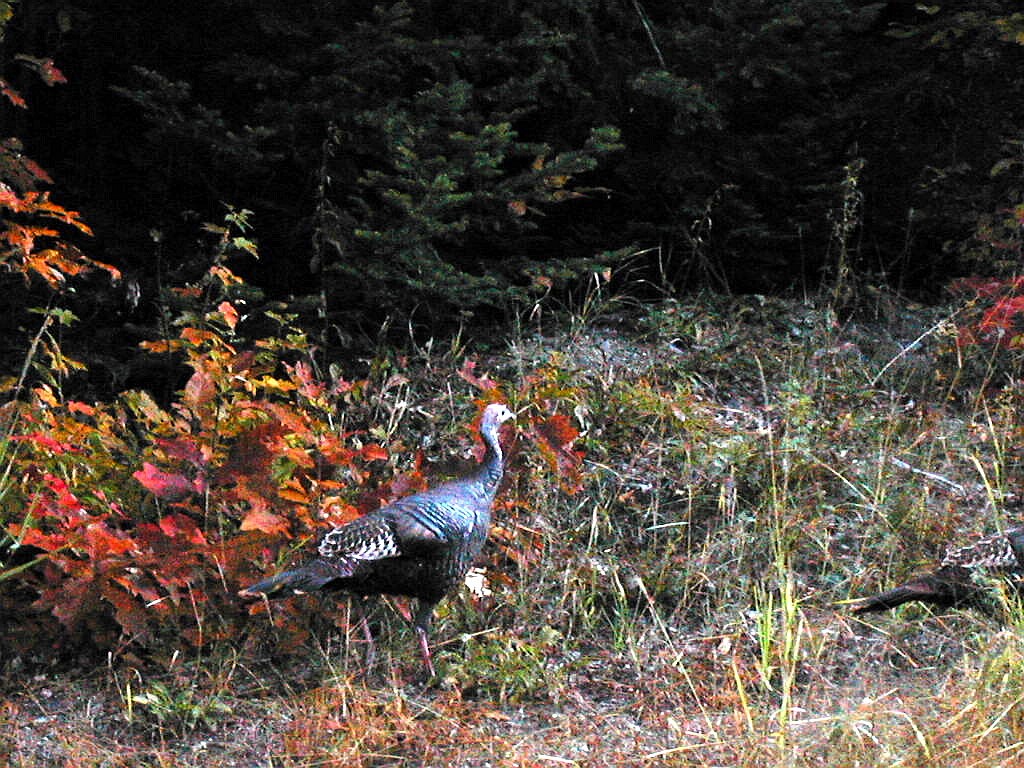 A Wild Turkey at roadside in the early morning |
The climb was typical: starting easy and then getting rocky. The views from the peak were striking on the way up. The open rocky summit had striations of many colors and it looked like the rock was painted with light and dark bands. Turning around towards the valleys, I could see a sea of fog filling the valleys like ethereal fjords. I
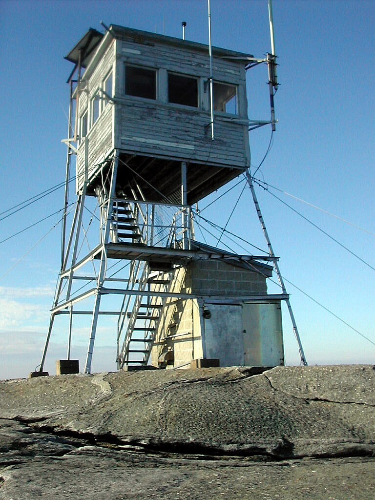 The Fire Tower on Mount Cardigan |
I reached the summit at 9:00 AM and the views were spectacular as was the summit itself. A wind that was probably 20 - 30 MPH was howling and I had to tie my hat to a girder at the base of the tower so it wouldn't blow away when I took my summit picture. I climbed the tower but the top level was locked. The next level down was plenty good enough, given the force of the wind. This summit, with sun and clear blue sky, strong winds, and nobody around but myself, was the best peak experience of the weekend by far, and better than many I have done in the past years. It doesn't get much better than this!
But since I wanted to save some time for a nap this afternoon (and the wind was blowing so hard), I had to start
down soon. The Clark Trail down to the fire warden's cabin had just one cairn on the summit dome, and then there
were no markings whatsoever. You just had to keep your eye on the cabin, just visible at treeline, and make your
way down over the slabs and through the krumholtz. It was easy in this weather but I suspect in fog you would
really need a compass to get to where you were going. When I got to the cabin, there were blazes and from there
on out there was no problem.
 Fog in the valleys below |
Past Rimrock, the trail fell over rocky ledges through spruce and fir and eventually entered the lower hardwood forest where it became rather gentle. A little before 10:00 AM I reached the junction with the West Ridge Trail, and soon was back at the parking lot. It had been a delightful hike of 2 hours over a great little peak. I wish I could have spend all day here but time was moving along.
Now it was back into the car and off to Mount Kearsarge, about 20 miles to the south as the crow flies.
Mount Cardigan: Orange and Alexandria, New Hampshire
No. 44 of the New England Fifty Finest
Elevation 3155', Prominence: 1922'
Trails: West Ridge Trail up, Clark, South Ridge Trails down
Distance hiked (rt): 3.6 miles, elevation gain: 1365'
Photos:
Album for Mount Ascutney
Resources:
Trail guide: AMC Southern New Hampshire Trail Guide (1999)
Topozone:
Cardigan topographic map
DeLorme New Hampshire Atlas and Gazetteer (2001), page 34
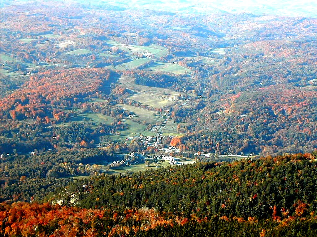
 View of Bradley Lake from the Mount Kearsarge summit (Click on this or any picture for a larger image) |
| I |
The weather had clouded over and a few sprinkles had hit the windshield as I was coming down Route 4. This was the first mountain all weekend so far when the weather was less than perfect. But this did not keep the tourists
 The Trail soon turns rocky |
I was off hiking on the Winslow Trail by 11:25 AM and the usual pattern of gentle then rocky terrain held true. It was a short ascent with not much to speak about till I got near the top. It was crowded however: I counted 43 coming down as I went up and 8 going up that I passed. The lookout tower at the top was uncommonly ugly: it had huge microwave dishes on its sides for some type of communication system. Check the picture, I'm sure you'll agree.
I wasn't sure where the high point was: first I thought it was the base of the tower but finally I decided it was a rock ledge to one side. I got someone to take my picture and then climbed the tower. It was actually open (the only one all weekend) and the fire warden was there doing his thing. He had set up a little string to separate his space from the tourists' space. He was happy because he said tomorrow was the last day of the season so he'd be done till next Spring. There were nice views in several directions, particularly Bradley Lake to the north-east and a view of what I think was I-89 to the south.
The sprinkles started coming down again so I started down the Barlow Trail. This was actually more interesting then the Winslow Trail. It wasn't so much less steep, but it went over rock slabs rather than just rocks and had
 On the Kearsarge summit |
Kearsarge was a short and easy hike, it was a bit crowded and the weather was a bit inclement, but nevertheless it was not a bad mountain. On a blue sky day with no one else around it would be rather charming.
I was back to the car at 1:30 PM. Some of the people were scurrying around to get away from the sprinkles and
others were working on lunch. I got driving, first back to Route 11 and then over to I-89 which I took back to
Lebanon and then got Route 120 up to Hanover. I had a nice shower and a nap and then a birthday dinner at Barry's
and finally I saw the excellent documentary on Katahdin at the ALDHA Gathering. A good day and a nice way to
celebrate my birthday. Climb a mountain! Climb two!
Mount Kearsarge: Warner, Wilmot, Andover and Salisbury, New Hampshire
No. 38 of the New England Fifty Finest
Elevation: 2920', prominence: 2100'
Trails: Winslow Trail up, Barlow Trail down
Distance hiked (rt): 4 miles, elevation gain: 1225'
Photos:
Album for Mount Kearsarge
Resources:
Trail guide: AMC Southern New Hampshire Trail Guide (1999)
Topozone:
Kearsarge topographic map
DeLorme New Hampshire Atlas and Gazetteer (2001), page 34
 Mount Shaw from Black Snout (Click on this or any picture for a larger image) |
| M |
I was up as usual in the dark, at 6:00 AM. But for once there was no fog. Yesterday afternoon's clouds had given way to clear skies and evidently the humidity had dropped sufficiently so we were without the usual morning fog. Today however I would be leaving Hanover for good so I had to pack everything up and get it into the trunk of the car. The night before I had made sure to keep my day hiking clothes and pack separate in the back seat, and now the tent, sleeping bag, etc. etc went into the trunk. Luckily only the tent fly was wet and that would have to
 The start of the woods road at Mount Shaw |
I started off on Route 120 and Route 4, and stopped again at Janet's Roadside Cafe for breakfast, but today I kept on Route 4 to Danbury and then got onto Route 104 through Bristol and up to Meredith at the west end of Lake Winnipesaukee. From Meredeth I circled around to the north side of the lake on Routes 25, 109 and finally 171. The AMC Southern New Hampshire Trail Guide is quite accurate in describing how to find the trailhead, just after a bridge over Fields Brook.
The Trail is called the Mount Shaw Trail in the book, but it is actually pieced together from three routes: a woods road that follows the stream up for a little over a mile, a trail, rather steep at times, up to near the summit, and finally some very well maintained carriage roads that take you at a leisurely pace and grade to the summit itself.
There were a couple of cars at the trailhead when I arrived and 4 hikers were getting ready, but they were headed for Bald Knob so I would not see them again. I was alone and on my own, which felt great. The day had become another beautiful sunny October day and I could feel that this last day of hiking would be very good, as the rest had been.
I was off hiking at just about 9:00 AM and the directions given in the AMC book were helpful. But I would say don't be too concerned about left and right turns and forks on the woods road. Just follow the most well trodden road and stick close to the stream.
The lower part of the road passes through a Hemlock grove where I could see several campgrounds across the stream, although
 The trail moves away from the woods road |
At about .7 miles the only turn that was AWAY from the stream occurred: a right turn at a fork. But even if you took the wrong turn here you would almost immediately hit a dead end at the stream, so you won't likely get lost. After 1.4 miles the route turns up to the right off the road and now resembles a real trail. Here the red blazes also started in earnest. Below this point the blazes were few and far between, mostly to keep you on the right route when there were forks in the road.
About half of the elevation gain to the summit (1200' out of 2400') occurs on this 1 mile section of trail which is at times rather steep. It crossed the stream twice and finally moved up to the right away from it. Finally at 2.5 miles from the trailhead I reached the carriage road. From here on to the summit it was literally a piece of cake.
In about .2 miles there is a side road up to the right which you MUST take. There is a yellow diamond shaped
 The side road to Black Snout, A fabulous lookout point |
Then I got back to the main carriage road and followed it on to the summit with very occasional red blazes. Just make sure you head upward. The road makes several sharp turns and there is another side road that goes off downhill to the left before the summit, but just stick to the main road. And don't take any shortcuts by bushwhacking up towards what you think is the peak from the meandering road. You will get lost on a false summit. The road builders knew what they were doing.
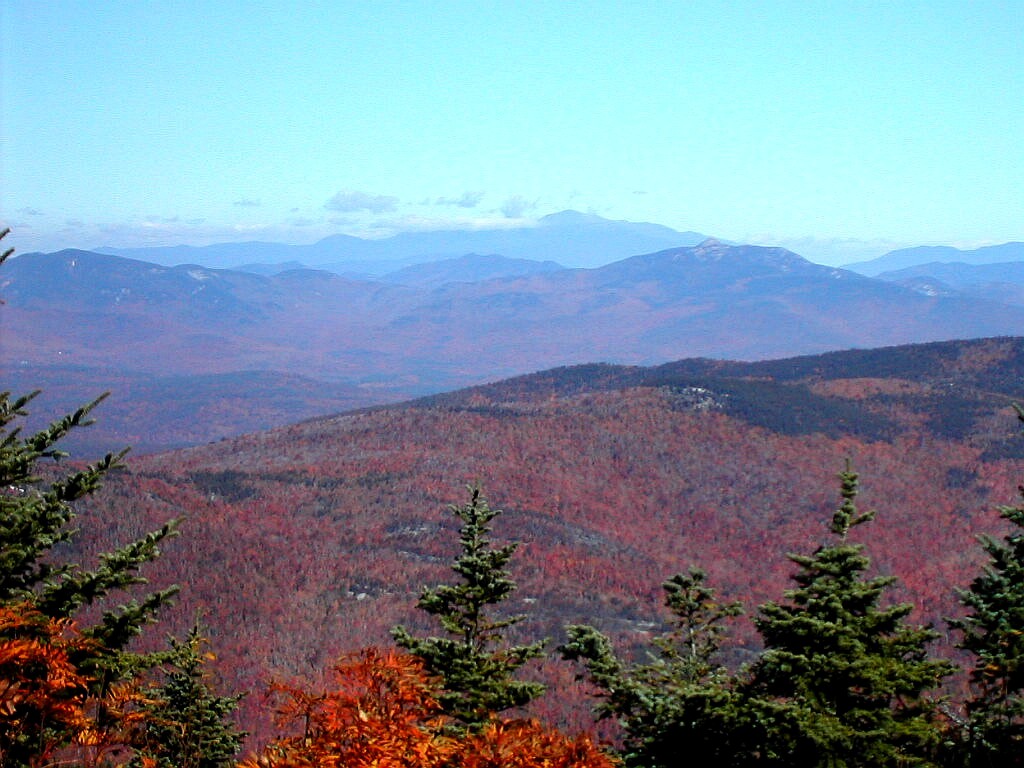
After several more meanders I arrived at the summit at 11:00 AM. The carriage road actually circled around and turned down on the north side forming a very small loop around the top. I stayed a while there and took some pictures and enjoyed the spectacular views to the north. The Franconia Ridge and Washington were visible with clouds trailing from their peaks. I could actually see the Lincoln Slide with its top resembling the thumb and fingers of an open hand. In the foreground were the Tripyramids, Whiteface, Passaconaway, Paugus and Chocorua. Closer to hand there were great views of Ossipee Lake and Green Mountain.
Leading south from the summit was a yellow blazed trail. Thinking it might lead to a higher high point I followed
 Clouds trailing from Mount Washington seen from Mount Shaw (Click on this one!) |
I reluctantly started down and made very good time, especially on the upper carriage road and lower woods road. I met a couple heading up on the mid section of the trail and we greeted each other with praises of the day and of the mountain. I said "It was just beautiful, however ..." (and they looked just a little doubtful) "I was all alone until I met you". They chuckled at that and said that I was also the first person they had seen since they started about an hour and a half ago. We went our separate ways and left each other each to our solitude, knowing we had found like minds on this special morning.
I reached the car at 12:42 PM, a bit faster going down than up. There were now around 8 cars at the trailhead. Since I had only seen 2 groups, I can only guess the rest were off exploring some exciting and beautiful area that I had yet to find. This is a place I would definitely want to return to.
But it was back into the car and off to my last goal, Mount Belknap.
Mount Shaw: Moultonborough and Tuftonboro, New Hampshire
No. 23 of the New England Fifty Finest
Elevation: 2990', prominence: 2340'
Trails: Mount Shaw Trail (combination woods road, train and carriage road)
Distance hiked (rt): 7.6 miles, elevation gain: 2400'
Photos:
Album for Mount Shaw
Resources:
Trail guide: AMC Southern New Hampshire Trail Guide (1999)
Topozone:
Shaw topographic map
DeLorme New Hampshire Atlas and Gazetteer (2001), page 40
And special thanks to members of VFTT for help in identfying the mountains in the views:
Discussion of mountains viewed from Shaw
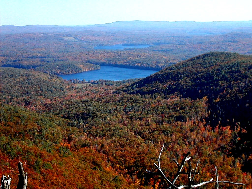
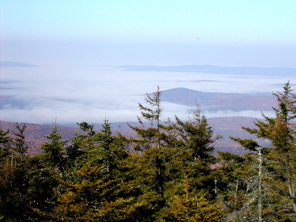
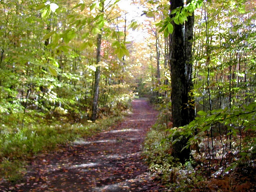
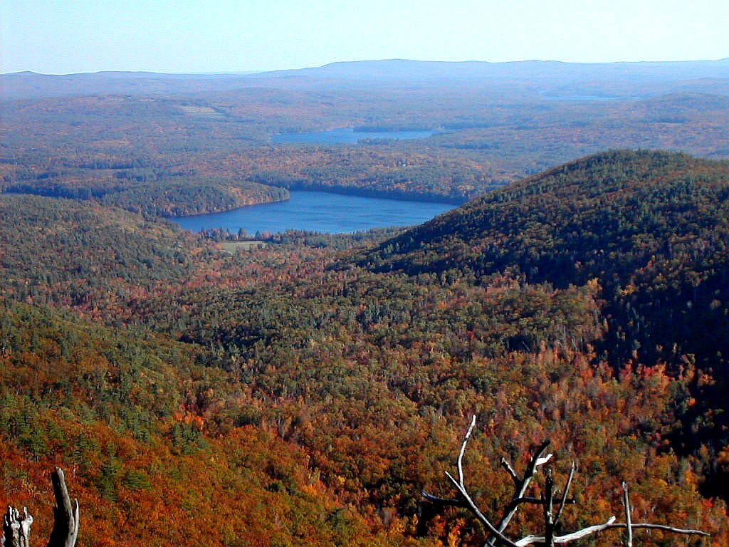 Manning Lake and Mount Piper ridge from Belknap Mountain (Click on this or any picture for a larger image) |
| I |
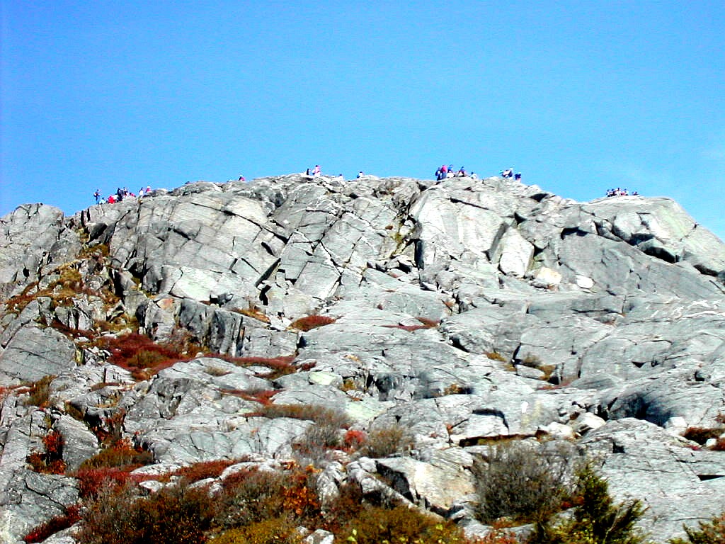
I drove around the east end of the lake from Mount Shaw on Route 109 (through Wolfeboro Falls) onto 28 and then to Route 11 and finally 11A to Gilford. Once again I used the AMC Southern New Hampshire Trail Guide for directions. As I went along the Lake on Route 11 just before getting to Route 11A, I passed the Mount Major Trailhead and there must have been at least 100 cars parked along the road and in the lot. I guess this is the prime viewing spot for the lake and on this sunny Columbus Day it was irresistible to many. I arrived at the Belknap parking lot at around
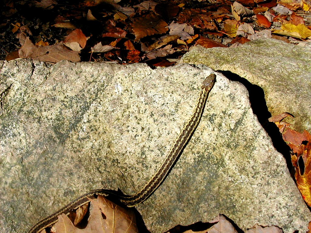 A small Garter Snake on the trail |
Since the trails to the summit were rather short, I chose the longest I could find to make a loop, the Blue trail going up and the White Trail coming down. These each went through the col on either side of the summit: the Blue through the Gunstock-Belknap col and the White through the Belknap-Piper col.
At the parking lot I had to dodge around two small boys throwing stones boisterously at trees as I approached the Blue Trailhead. Once on the trail it was quieter since most folks took the shorter Red or Green Trails. I saw a very small Garter Snake on a rock and took a picture of it before a family came by, perhaps to squash it. The woman asked if it were poisonous and I said no, just a Garter Snake. I said they eat mice and that reassured her. Once away from the parking lot I was quite alone up to the col (in a nice Spruce grove) and then over and up to the summit.
Just before the summit there was something of a view towards the north but the better views would come later. Just
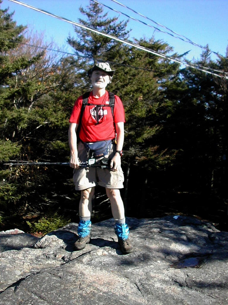 On the Belknap summit |
I took the White Trail and immediately I was rid of the summit clamor and found a lovely viewpoint. It was much nicer looking over the lake at Mount Shaw and beyond from this pretty sub-alpine rocky knob than on the lookout tower with the throng. I got a few more pictures and then proceeded down through the col, and then turned west again back towards the parking lot. But I soon discovered that the trail here had recently been relocated over several great viewpoints. One faced out along Piper Mountain towards Manning Lake and gave a nice view of this little jewel.
The trail worked its way over and down the slope and it was actually a rather nice route with good views and interesting terrain. But I soon came out on the road below the parking lot having seen no one at all on the trails up or back, but alas, many at the bottom and at the top. So pick your routes carefully and you will get a nice hike out of this. I could see with more time going all the way from Gunstock to Piper or other interesting peaks in the area.
I did the round trip in a little over an hour and a half, so this last mountain was the easiest and shortest. But there's no such thing as a bad mountain or an easy mountain, and even here I'd like to come back some time when it's less crowded and I have some time to explore more of the area.
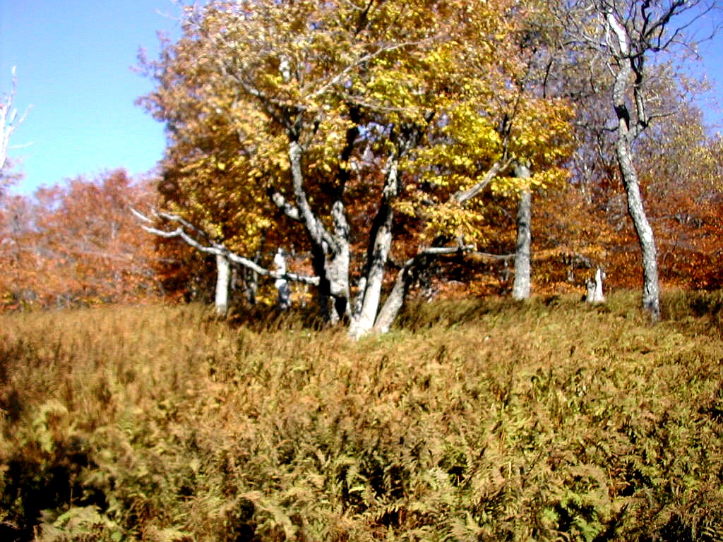
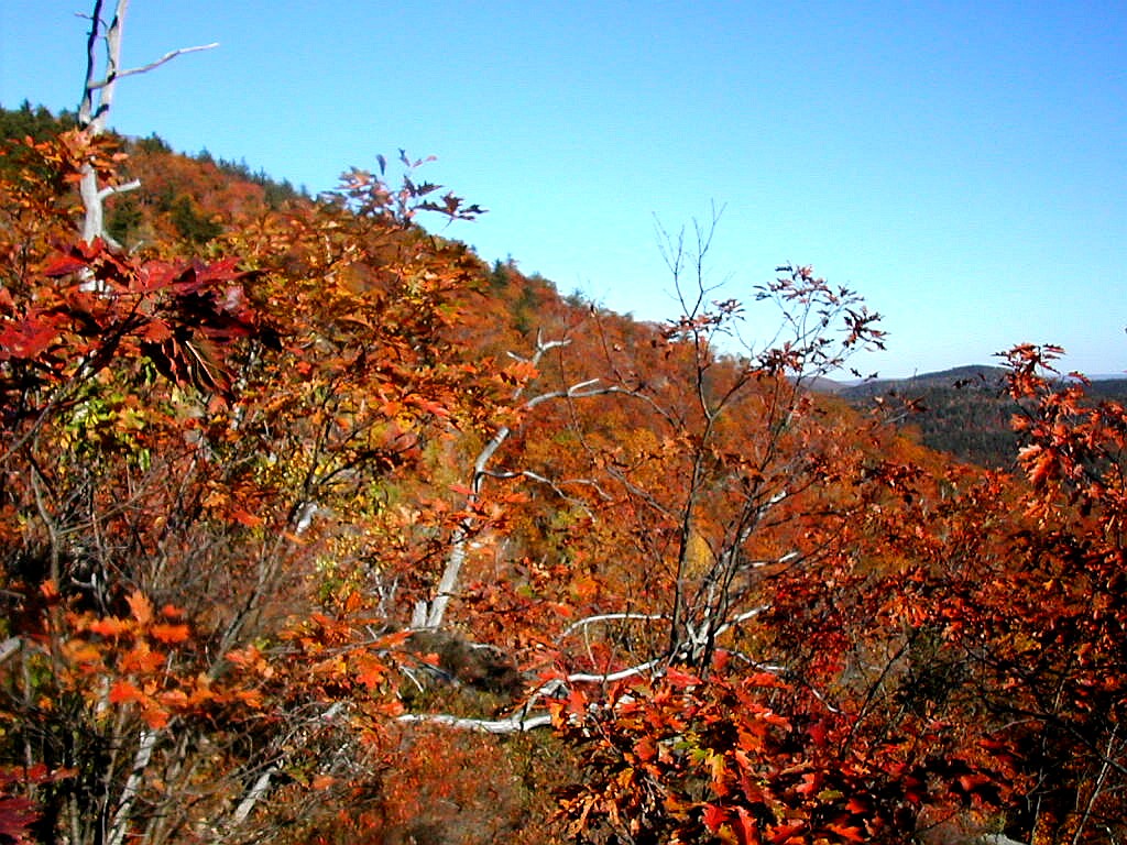 Fall Foliage on Belknap |
Belknap Mountain: Gilford, New Hampshire
No. 47 of the New England Fifty Finest
Elevation: 2382', prominence: 1872'
Trails: Blue Trail up, White Trail down
Distance hiked (rt): 2.2 miles, elevation gain 860'
Photos:
Album for Belknap Mountain
Resources:
Trail guide: AMC Southern New Hampshire Trail Guide (1999)
Topozone:
Belknap topographic map
DeLorme New Hampshire Atlas and Gazetteer (2001), page 36
| T |
My weekend, busy and with little time for rest, was one of those marathon experiences that sticks in the mind as such a sequence of great climbs and great views, one after the next, that they almost run together as of one enormous mountain that I kept climbing over and over. Hopefully this report will help the reader sort these experiences out: writing it and studying the maps and pictures surely helps me sort my memories out. The overall impression was that each and every peak diserves more attention and more exploration. So little time, and so much to do!
|
Lakes and mountains: beauty all around |
But the cumulative effect of the mileage driven and elevation hiked did add up, and by the end, my mind and body were suffering from lack of rest and proper time for recovery. On the last morning of my long weekend I was driving east on Route 4, feeling very sleepy and groggy. I had gotten up before the sun four mornings in a row and I hadn't slept all that well in my tent in Hanover. I was tired and I hadn't eaten more than a few proper meals all weekend. I got to wondering why was I doing this? At this hour it didn't seem like much fun at all.
An hour later I was on the carriage road nearing the top of Mount Shaw and I remembered my thoughts in the car.
In my solitude, I looked at the beauty all around me and I thought to myself: THIS is why I do this, THIS is why!