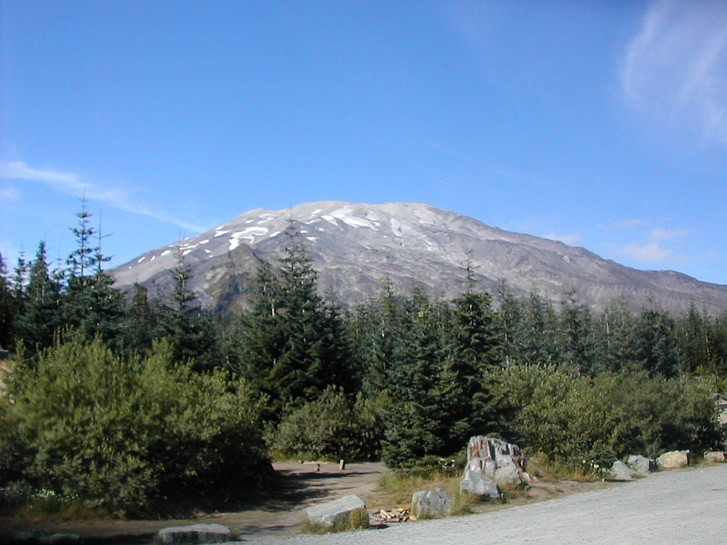
Mount Saint Helens
(Click on this or any picture for a larger image)
|
Mount Saint Helens (Click on this or any picture for a larger image) |
|
Click here for a complete set of albums of photos from this hike |
| M |
| M |
I have had lots of experience over the last couple of years climbing mountains. But all of these have been in the northeast. Some of my climbs have had elevation gains of close to 5000' but generally that has occurred over several peaks, not one big one. Furthermore, the terrain I am used to is very rocky, typically rock slabs and crags of granite, and some instances of Felsenmeer, which are fields of rocks one has to scramble over (such as at the summits of Washington, Jefferson and Adams in the White Mountains). These can be quite challenging and exhausting, but they are quite different from a volcano with it's soft rock and ash. In addition, the Cascade volcanoes, especially Mount Saint Helens, are extremely dry, especially in late summer. That is almost the opposite of what you will find in the northeast. So I was prepared for a very different type of climbing experience, but I was not sure exactly what it would be like. One thing was certain, this climb would require a lot of work and a good fitness level, and I felt prepared for that.
| I |
The next morning we were slightly delayed, but managed to get rolling about 5:40 AM. We got to Jack's about 6:10 AM and had to sign the register before proceding to the trailhead. This is supposed to be so they know who is on the mountain: you must sign out and sign in again when you return that night. I don't know if anyone checks this but the idea is a good one.
Next we got moving again and after 12 more miles on the highway we took a series of forest service roads and finally arrived at the parking lot about 6:45. There seemed less cars there than would carry 100 hikers (the maximum permits issued) but that was fine with us since we were hoping the trail would not be too crowded. The mountain stood there in the morning mist and luckily it was not cloud covered, but we knew anything could change rapidly as far as weather was concerned. It was a rather chilly 40 something degrees, but we would warm up as soon as we got going. I set my altimeter watch to 3700' which was the elevation of the trailhead according to the map. We would have about 4500' of absolute elevation to climb.
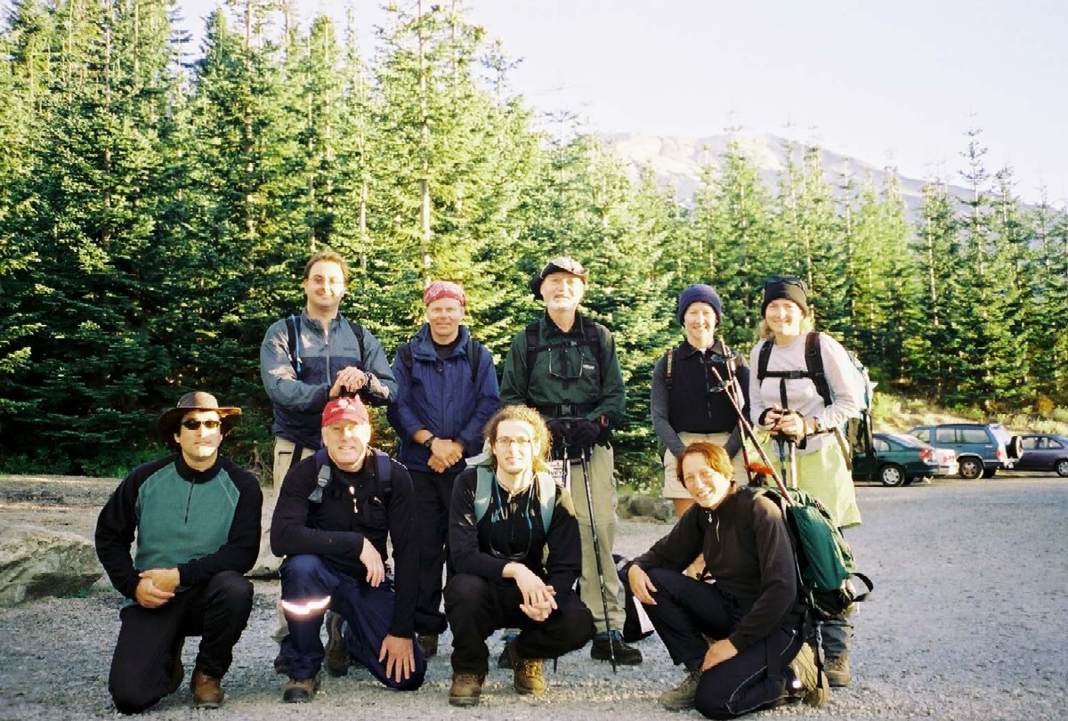 The group at the trail head |
| T |
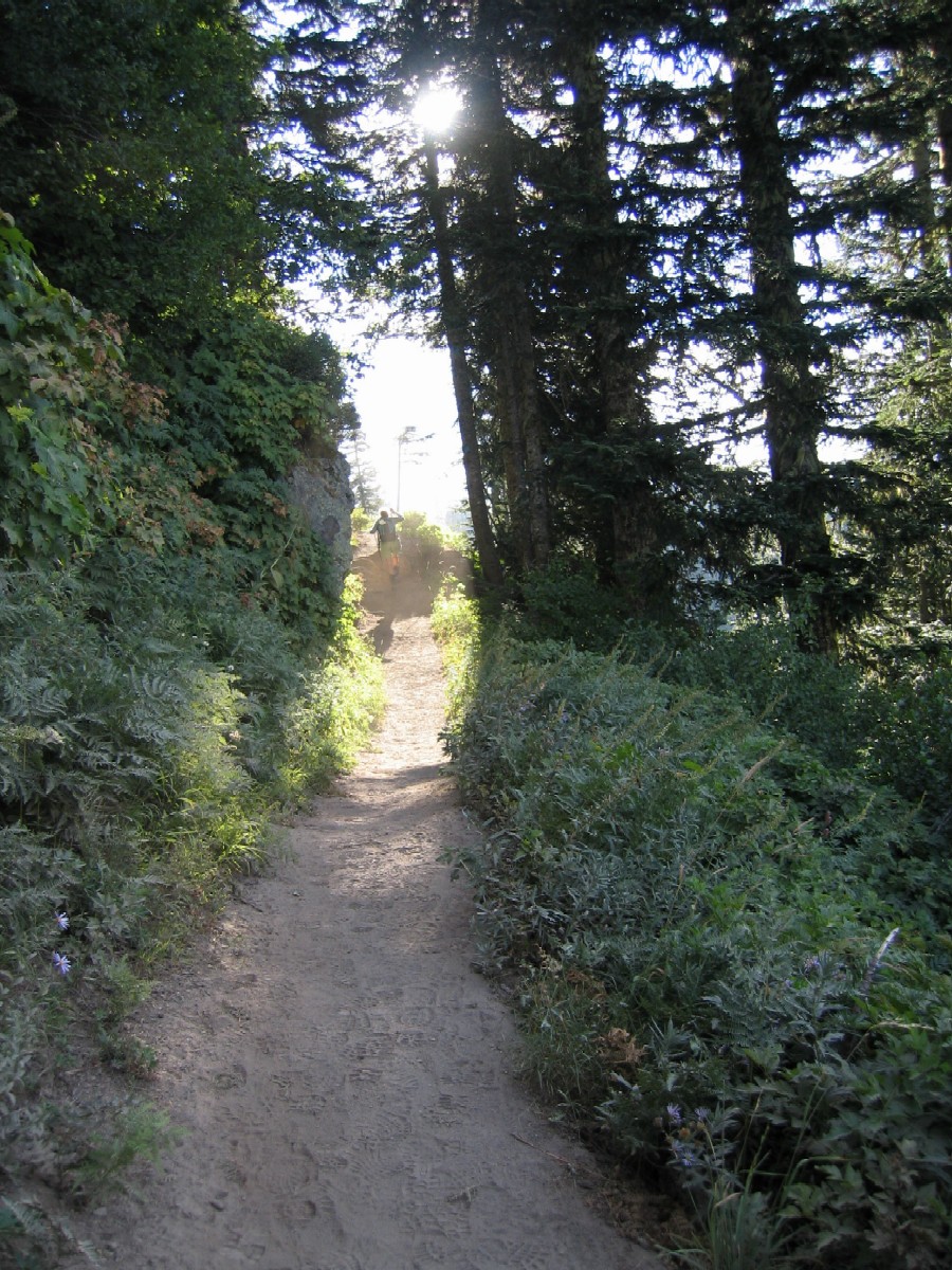 An easy, well graded trail |
I found the approach trail rather easy. They say it is graded for pack animals although I don't see what you would do with a pack animal up here. I suppose you could ride a horse up the trail, but since you couldn't get on to the mountain per se on a horse there wouldn't be much point to it. There were some nice views and tall, mature forests. I would not call it old growth, but hopefully the National Monument status will allow these trees to grow for many more years and eventually approach that status. If you didn't know you were climbing a mountain this would be a very easy walk, one you could easily do with young children.
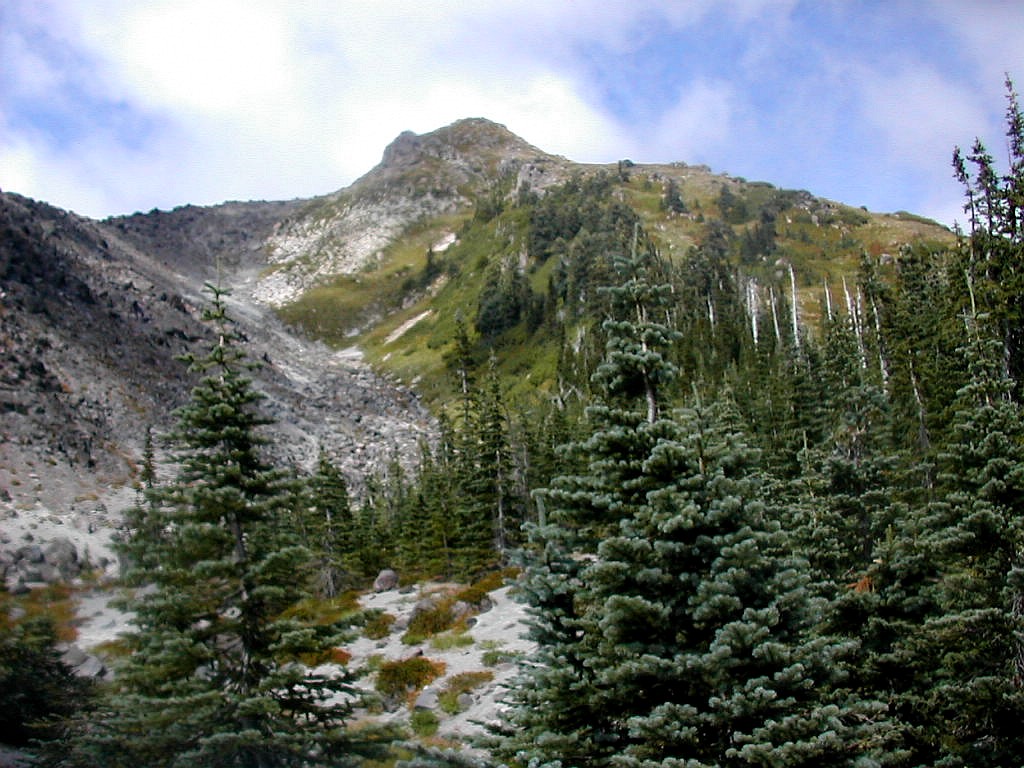
After about 1.5 miles, the trail parallels an open lava flow to the left. This was the Swift Creek Lava Flow and actually becomes the monitor ridge further up where the trail ends. (This flow is about 2000 years old and is unrelated to the recent 1980 eruption.) After about 2 miles, the trees thin out and the ground becomes rather sandy - actually it's volcanic ash. At the end of the trail one faces the steep side of the Monitor Ridge to the left, and a thin line of trees that extended a few tenths of a mile further up between two ridges. There was no transition of smaller and smaller trees with an area of krumholtz near treeline, more of an abrupt change from trees to lava. I suspect the treeline here (at about 4800') is due to the lava flows rather than the Alpine conditions. It was rather unlike the treelines I had crossed numerous times in New Hampshire and Maine.
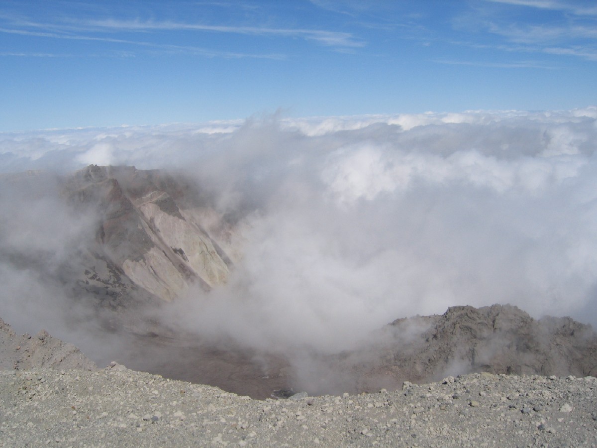
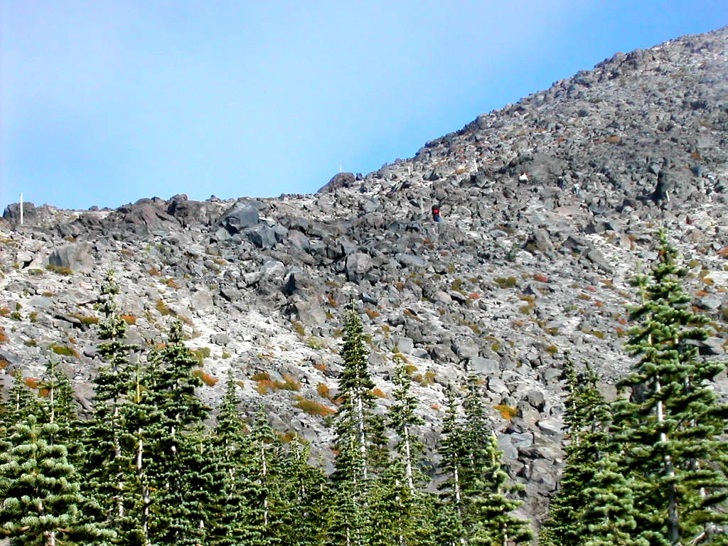 Monitor Ridge seen from treeline |
| F |
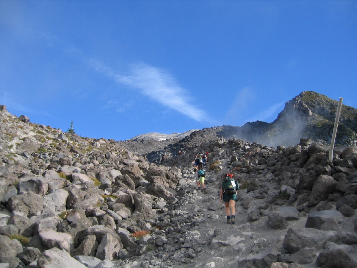 Climbing up the ridge Rocks and ash |
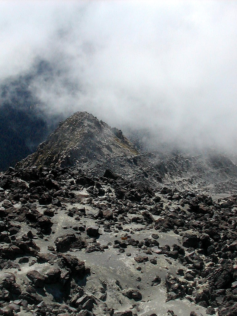
Once we started up the ridge however, I realized these were not rocky ridges at all, but rather a very loose ash base with rocks (largely pumice) strewn about. The few rock scrambles we did were the easy part. The hard part was just walking in the loose ash. It seemed like for every step up, you would slide halfway back down. It was tough and tiring but rather easy from a technical standpoint. Imagine hiking up a very soft sand dune for several thousand feet. That's about it.
Besides the tiring footing, as we got higher the wind and the sun started to take their toll. We had been prepared for the sun with hats, sunglasses, sunscreen, etc, and lots of drinking water, but the wind also became daunting. I would estimate the wind speed at over 40 MPH near the top of the ridge, and even higher on the final ascent of the cone. We took several breaks on the way up. We would find a rock pinnacle which would shield us from the wind but let the sun hit us to keep us from getting a chill. At one spot there were some overfed ground squirrels who
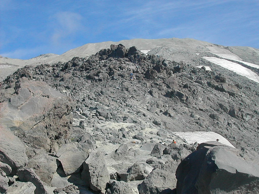 The top of the ridge with the cone above A few patches of snow are still present |
There was a small amount of vegetation but it did not at all resemble the alpine vegetation one finds above treeline in the northeast. This was a very dry desert climate.
The ridge is named after two small metal towers, one near the base and one near the top, which are used to monitor
the motion of the mountain by the use of mirrors and laser beams, so as to detect volcanic activity. Near the top
monitor we took our last break before venturing up the ash cone which had no shelter from the wind and no route
markings.
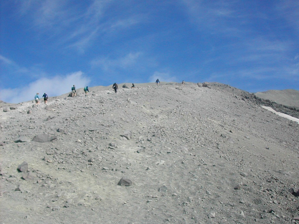 The climb up the cone |
| T |
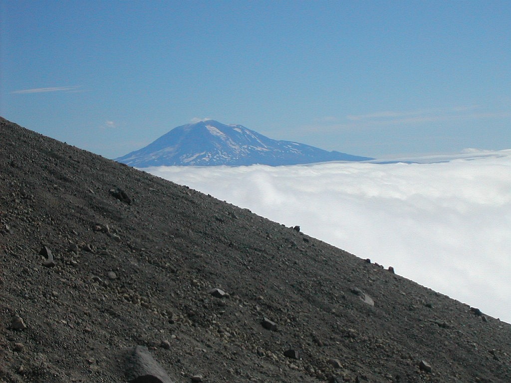 Mount Adams from the cone Cloud layer below us |
I found a small rock to hide behind and put on my Frogg Toggs top as a wind breaker and pushed on up. The going was
very slow and tiring. Not least because I haven't climbed above 6200' (Mt. Washington) before and I was now between
7000' and 8000'. As I looked up the peak remained cloud free, but looking back down behind me the ridge seemed to
be covered with clouds. It was as if the clouds were following us up the ridge but never covering us. We were in
sunlight all the way to the top, but there were always clouds behind us. Magic I guess?
As I finally made it to the top and looked out there was a sea of clouds below us, perhaps at 6000' or 7000' in all directions. And there behind us was Mt. Hood peeking above the clouds and Mt. Adams off to the right and Mt. Rainier to the north over the Mount Saint Helens rim. It was eerie seeing these 3 sentinels while standing on the 4th. It was as if these Cascade volcanoes were up above the clouds conversing in their own celestial world while the rest of the world lay oblivious below the clouds. It was wonderful. The rest of our group made their way to the rim and there were lots of pictures taken all around. We had made the ascent in between 4:00 and 4:30 hours. A pretty good pace.
 The rim looking west |
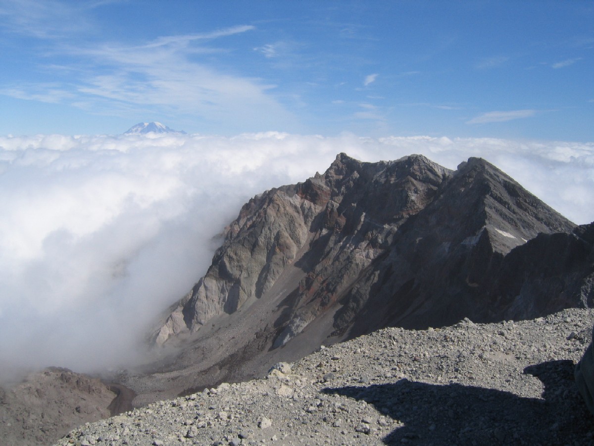 The rim looking east |
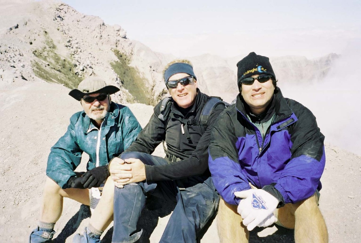 The Flyers on the rim |
But the sun and wind were taking their toll and the ash was flying. Any time anyone took a step a cloud of dust would fly and cover those who happened to be down stream. After about 20 minutes it was time to get moving down.
 Moving down to the ridge and the clouds |
| M |
The clouds were as illusive as ever. As we looked down the clouds seemed to cover the ridge and we expected a foggy
gloomy descent. But when we got there, the clouds seemed to disappear. Maybe it was the angle or maybe it was magic.
Look at the pictures, I'm not making this up.
We took a break at the upper monitor and again at treeline. Each part of the trip going down (except the cone) seemed longer and more tiring than going up. When we finally made our way along the easy approach trail back to the parking lot, it seemed to take forever. My foot hurt, my legs were tired and I was filthy. But I was as happy
 Back down at treeline |
When we got back to the cars and looked back, there was the mountain with not a cloud in the sky! Wow, how does that work?
| W |
We got to Jack's and signed the register but we couldn't just drive away. No, here was a place with the best local micro-brews from the area. So I had a nice cold Black Butte Porter. You know what? It woke me up for the drive back to Portland. Explain that one.
|
Click here for a complete set of albums of photos from this hike |