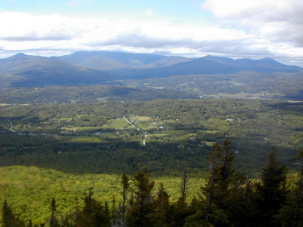
Mount Mansfield across the Stowe Valley
(Click on this or any picture for a larger image)
|
Mount Mansfield across the Stowe Valley (Click on this or any picture for a larger image) |
|
Click here for a complete album of photos from this hike Back to Papa Bear Home Page |
| I |
After a gorgeous Memorial Day weekend, the weather was wet from Tuesday till Thursday, but so what. Here is what I managed for each day:
Sunday: Donovan's Red
Monday: Long Trail Brown
Tuesday: Long Trail Amber
Wednesday: Coke (sorry!)
Thursday: Otter Creek
Friday: Gracies Amber (as only served at Gracies Restuarant in Stowe)
What? Oh yeah, the peaks. Well I did say six-pack. So here are the peaks:
Sunday: Battery Hill, Burlington. Elevation 300', prominence 0', distance 26.2 miles, #15 on my M list
Monday: day off
Tuesday: Gore Mountain, Avery's Gore. Elevation 3332', prominence 1994', distance 8.0 miles, #26 on my
NEFF list.
Wednesday: Worcester Range HP (Mount Putnam), Stowe (with Meo). Elevation 3642, prominence 2472', distance 8.6 miles,
#27 on my NYFF list.
Thursday #1: Mount Butterfield, Orange (with Tramper Al and Denis). Elevation 3167', HP of Orange County,
distance ~2 miles bushwhack plus 2.2 miles road walk in.
Thursday #2: Signal Mountain, Groton (with Tramper Al and Denis). Elevation 3360', prominence 2140', HP of
Caledonia County, distance ~ 2 miles bushwhack plus 3.0 miles road walk out. # 28 on my NEFF list.
Friday: East Mountain, East Haven. Elevation 3438', prominence 2227', HP of Essex County, distance 8 miles.
# 29 on my NEFF list.
Total distance on foot: 60 miles.
Total distance driven: 604 miles.
PS: There were virtually no bugs! I think I got all of two bites, both at the campsite Wednesday night. The mountains and trails were bug free!
| W |
We got situated at our hotel, and 6 of us had a grand dinner at Boves in downtown Burlington. Huge amounts of good food, cheap. Spaghetti and meatballs is their specialty. Check it out when you're in Burlington.
The hotel provided a 6:30 AM shuttle bus to the "trailhead" (also known as the "starting line"), and we got there in plenty of time for the group start at 8:00 AM. Did I mention this was a group affair with about 1000 participants? And support: water and food along the route. No packs. Just running shoes and shorts and singlets.
You should be getting the idea this was not your normal sort of hike. In fact given the mileage it was literally a marathon of a trek.
The start was delayed 5 minutes but we were off at 8:05 and I got into an 6 MPH pace up Pearl Street and along Church Street and into South Burlington. We looped back and then took a long traverse of the Northern Connector and then once again back through Burlington center. The terrain was smooth and by hiking standards flat as a pancake for the first 15 miles. Then the big hill was surmounted. All of 200' of vertical elevation gain and there it was the summit of Battery Hill. The emotional high point of the trek was actually at the base of the hill where a 40 piece Japanese drumming group literally pushed us up the hill.
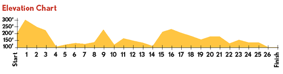 Elevation profile of the route |
But this was not the end of it. No, there was another 11 miles to finally get out to the finish at the waterfront park in Burlington. I was getting pretty beat by around mile 20, but held my pace pretty well and finished amid a tumult of people. Where did all these folks come from anyway? My total time was 4:18. Not bad, but I should be better next time!
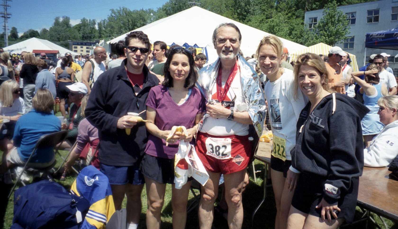 Papa Bear with friends after the trek (Click on this or any picture for a larger image) |
After it was all over I climbed up to Smokejacks (does this hiking never end?) on Church Street for a well deserved meal of French toast and of course, beer.
This was the fifteenth marathon I have completed, and although no means the fastest, it was one of the most beautiful courses and among the best organized of any I have done.
Battery Hill: elevation 300', prominence 0'
DeLorme Atlas: page 44
Map: Course map
Distance: 26.2 miles, Elevation gained: 400'
(By the way, this hike is also known as the Vermont City Marathon
 .)
.)
| I |
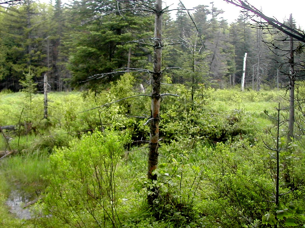 A beaver meadow near the Gore Mountain Trail (Click on this or any picture for a larger image) |
| G |
The day started with heavy rain. I was planning to climb Cold Hollow Mountain, about 50 miles southwest of Gore. Cold Hollow is a bushwhack and I was apprehensive about trying it alone in heavy rain. I drove north on Route 100 from Stowe starting around 6:00 AM and stopped for breakfast at Morrisville. When I got to the turnoff towards Cold Hollow at Route 118 in Eden, I decided to abort Cold Hollow and continue north and hike Gore which should be an easier rainy day hike.
One problem was that my DHG was safely stowed in my motel room in Stowe. The other problem was that Gore was not particluarly close to Cold Hollow. So I went up Route 100 and then east on Route 58 to Orleans. I asked at a convenience store in Orleans where I might find an outdoors store to buy another copy of the DHG. I would never find the trailhead without it. I was directed to Newport about 15 miles north off of Route 91. This was not turning out to be an optimum driving route! I got to Newport a little after 8:00 and waited nearly an hour for the "Great Outdoors" to open at 9:00 AM. When it opened (on time) the man said he didn't have the book, but try the book store down the block. Sure enough they had the book, and I was off again east on Route 111 and north on 114. I found the trailhead on the second pass and low and behold, about 4 hours and 86 miles from Stowe, I was ready to start my hike.
The trail is well described in the DHG. The first section is rather easy and flat with some beaver meadows and several old woods roads. There was an old piece of machinery about a mile up the trial and I wondered how and by whom such a piece of junk got here. After a stream crossing at about 1.5 miles, the trail went through some young forest which had evidently been cut over 10 years or so in the past. Here the white blazes dissapeared and were replaced by orange surveyor's tape hanging on trees. This threw me off at first. I thought I had lost the trail and was on a snowmobile route. I backtracked to the last blaze (near the stream crossing), but sure enough the orange tape was all there was. I also realized that this was clearly constructed as a trail with several puncheons. Eventually the trail reentered a more mature forest and the white blazes returned. We crossed two major logging roads and then the trial got rather steep and entered a spruce/fir forest. It was rather remote and idyllic in the fog and rain, and the uppermost section was actually rather easy going.
I crossed a few easy rock slabs and soon found myself at the summit area which was a small clearing with the foundations
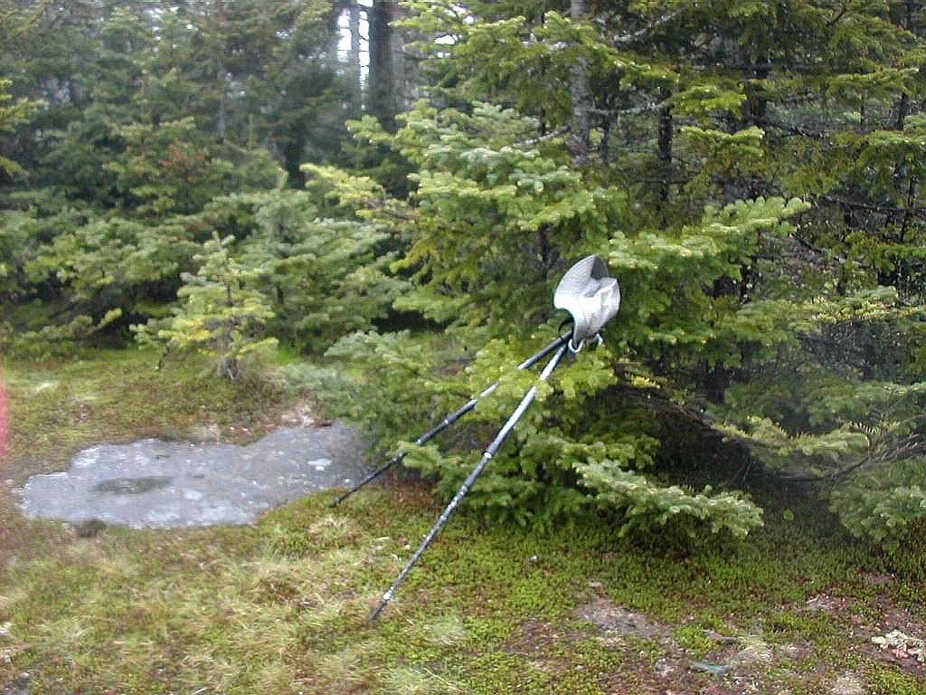 The summit of Gore Mountain |
The way down was uneventful and by the time I reached the car, the rain had stopped. My round trip time was 4:02.
Since it was still early in the day, I took the long way back (again!) and scouted out the woods roads leading to Cold Hollow from the town of Belvidere Center and thence back to Stowe. In all I had driven about 190 miles for the day!
Gore Mouintain: elevation 3332', prominence 1994'
DeLorme Atlas: page 55
GMC Day Hiker's Guide to Vermont: page 336
Topozone: Gore map
Distance hiked: 8.0 miles (including some backtracking), Elevation gained: 2220'
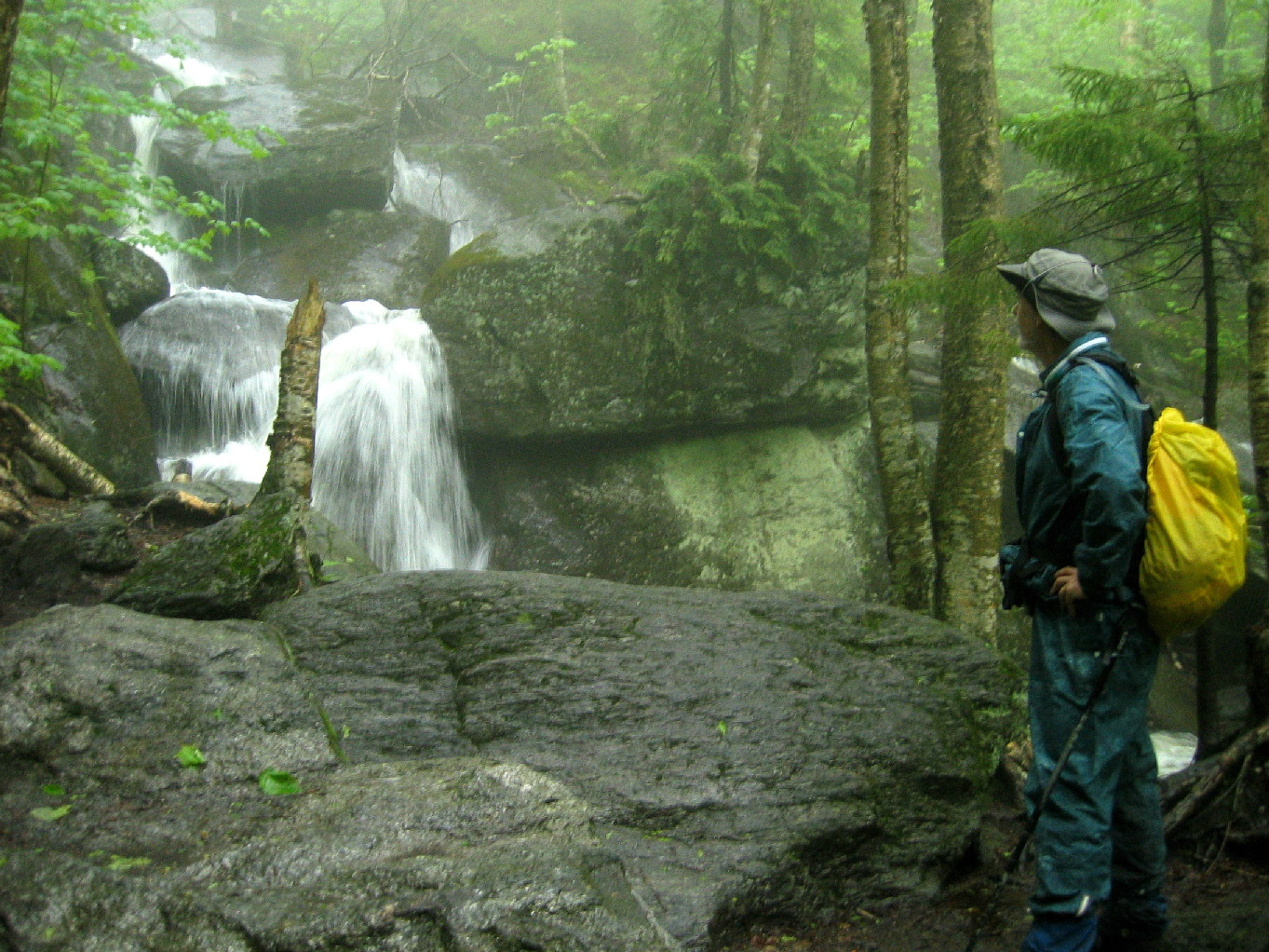 A Waterfall near the start of the Waterbury Trail (Click on this or any picture for a larger image) |
| S |
We left his car and got into my rented SUV and drove the 5 miles or so on the dirt roads to the Waterbury Trailhead. The rain was now coming in earnest.We saw a guy with a pickup truck at the parking lot and he was impressed that we would go out in such weather. He was piling flag stones into his truck which he said came from a quarry down the way and the owner had said he could take what he wanted. Whatever ...
We got into our rain gear and started up the trail to Hunger Mountain at 9:25. This is a fairly typical steep trail over rock ledges - made more slippery in the rain - with a few trees down. I assume Spring cleanup on this trail has not happened yet since mud season was just now over. Since there was no views this trail was less enjoyable than it should have been. Sometime around 10:30 we reached the junction with the trail to White Rock, and after a short discussion we decided to check it out. The sign said .6 miles. Well we hiked down and down and down and we saw nothing but more down in front of us. So after about 15 or 20 minutes we concluded that this was all a conspiracy and there was no such thing as White Rock, so we gave up and returned to the Waterbury Trail. I later checked the map and it surely does show White Rock with a rise of about 100' from it's col, but for us all we can say is "Where the Hell did White Rock go?"
Back on the regular trail, we made it to the clouded in summit of Mount Hunger about 11:35 and took a few pictures. We sat down for a snack and then got moving along the Skyline Trail. This trail, which follows the ridge line all
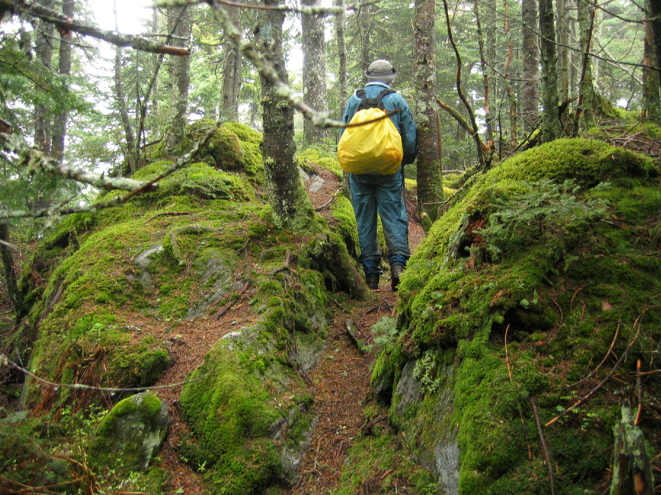 Along the Skyline trail |
We reached a view point towards the west and around 1:35 we reached the high point of the ridge. My altimeter showed two spots as the highest, both at 3700' (I didn't calibrate the device today and given the weather one would expect it to read high). The second one was the official point shown on the topo map, and it was about 5 yards off the trail and marked with surveyors tape. This is an unnamed peak but is locally known as Mount Putnam. We took a few pictures and continued on down a short distance to the intersection with the Pinnacle Trail, which would bring us back to our car.
The Pinnacle Trail was obviously the most used trail we would see today and had lots of muck and slippery slopes. I tend to go slower on this type of trail going down than going up, and today was no exception. We tried to figure out when we crossed Mount Hogback, but due to it's low prominence and the route of the trail we never did get a sense of where that peak was, or even if there was a peak at all. The map shows a slight prominence of maybe 40', but you couldn't prove it by us.
Stowe Pinnacle is another story. Although at around 2640' it is some 1000' lower than the high point, it has the best views of the whole route due to its rocky summit and its position off to the side of the range. The weather had substantially cleared when we got there and the views were awesome. Across the valley stood Mount Mansfield with its head in the clouds and to the south was Camels Hump. Behind us we could see the ridge to the north ending at Mount
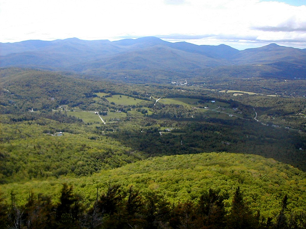 View from Stowe Pinnacle |
And now for the first time today, we saw some other people. Two couples were hiking up to the Pinnacle and a solo
woman down near the bottom was trying to keep the mud off her clean tennis shoes! When we saw her we knew we were near
the parking lot. We made it out about 3:55. We wondered why this 8.6 mile trip (including our unsuccessful search for
White Rock) had taken us 6 1/2 hours. Maybe the rain, maybe the slippery rocks. Or maybe it was just Meo slowing me
down
.
My "post-marathon legs" had held up well. The only soreness was on the down slopes where there was a bit of soreness in the quads above the knees, and some soreness outside the knees. This normal early season reaction to a good hiking day was not troublesome. Meo had a Presi Traverse schedule for the coming Saturday, so today was just a warm-up for him.
Meo had to go to work the next day so we didn't not have the opportunity to put down a celebratory cold one, and for my part I had to drive east where I would stay for the night a Ricker Pond campground in preparation for tomorrow's bushwhacks.
Rain or no rain, it was a great day on a beautiful trail. We'll be back.
Worcester high point: elevation 3642', prominence 2472'
DeLorme Atlas: page 46
GMC Day Hiker's Guide to Vermont: page 257
Topozone:
Worcester map
Total distance hiked: 8.6 miles, Elevation gain: 3370'.
|
|
|
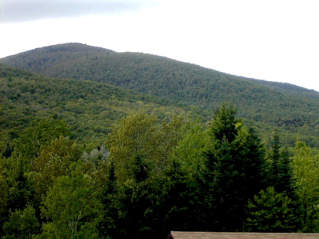
Butterfield and Signal from Route 302 (Click on either of these or any pictures for a larger image) | |
| B |
(I have since heard from Audrey, a hiking friend, that the gate was open two days later, so perhaps we were just unlucky or perhaps it was a scheduled opening after mud season was deemed to be over.)
We reached the spot which was mentioned in the reports: a grassy turnout just before a stream crossing, and this was where we started our bushwhack.
The terrain was relatively easy going. We started in towards the peak at a 255° magnetic bearing. We would have done better to follow the road down to the stream crossing and take a 240° magnetic bearing. This would have put us on the northeast ridge which is easier. I guess we were suckered by Al's GPS which pointed directly at the peak, in spite of the fact that several reports had mentioned that we should first get on the ridge line before ascending. In any case we followed some gullies up and eventually reached easier going with blackberries and animal tracks above about 2900'. Ironically the tough stuff was through boulders and young maple saplings lower down and blackberry bushes part way up. The upper section in the spruce/fir forest was rather easy.
Al spotted the register first, so he won the beer which we would enjoy later in the day. We signed the register
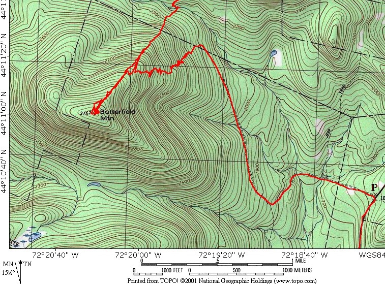 Bushwhack route on Butterfield Mountain (Click on this image for a larger view) |
The map posted shows our route as recorded by Al's GPS. The road is indicated (we walked in) and the start of the bushwhack is where our route suddenly turns left up the slope where the road reaches about 2200'. The ascent is shown by the track which zig-zags it's way up till it finally hits the ridge and easier going around 2900'. Then it was a straight shot up to the summit. The descent was straight down the ridge line to the stream. The road crosses the stream here although the topo doesn't show the road this far. In fact it's a very well maitained road down to the stream and well beyond.
Note: if you decide to try this route here's a couple of hints: 1) make sure you stay on the ridge line coming down. Don't stray to the left or right. 60° magnetic should do it but watch the terrain. 2) if you hit the stream instead of the road, don't cross it, just turn right and follow it down on the near side (south bank) and you will hit the road very shortly. Once you hit the road then go left on the road across the stream to do the Signal bushwhack.
The round trip time from the dirt road was 1:50 (plus 40 minutes for the road walk - one way).
Butterfield Bushwhack distance: ~ 2.0 miles
As noted above, we finished the Butterfield bushwhack where the stream crosses the road (through a culvert) about 2.5 miles from Route 302. We walked about 5 minutes further along this road, which turns east after the stream, to the height of land where there is a gravel pit on the left. (We started at a second gravel pit slightly further along, but we should have just started at the first.) After a false start towards the knoll at 2759', we settled on a bearing of due magnetic north straight up the south ridge. The terrain was in 3 sections: lower down were boulders and dense maple saplings and an occasional creek (similar to the lower terrain of Butterfield). The middle section from about 2600' to 3000' was rather steep with one rock ledge which we had to circumvent. This was rather tiring but not difficult from a bushwhack perspective. The top section from about 3000' to the summit was easy going. Al again found the register easily (sorry, you just get one
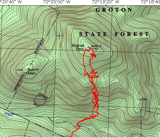 Bushwhack route on Signal Mountain (Click on this image for a larger view) |
We returned down the mountain on a due magnetic south bearing with no problems. Rain started about half way down but was no big deal. Al made a neat discovery on the way down of a pile of bones. These were clearly moose, judging by the size. Sorry, no antlers! We hit the road at the first gravel pit on the dot, and turned right onto the road. The route was easier than we expected. Round trip time 2:10. We then walked the 2+ miles back to Route 302 and the car.
The map posted here shows our route as recorded by Al's GPS. The route starts at the bottom of the frame. The first few hundred yards is actually the end of the Butterfield bushwhack. Where the track hits the stream, we got onto the road, which circles around after crossing the stream and heads eastward along the side of the lower slopes of Signal. The road reaches a height-of-land (at about 2300') at a gravel pit in about 1/4 mile. Just past this point we entered the woods bearing magnetic north (our ascending path is the right or eastern path shown leaving the road on the map). The ascending path actually placed us a little west of the summit but once in the summit area it was easy to find the high point. Going down the bearing was closer to true south. In actuality we were bearing magnetic south but we tended to slip slightly to our right because of the slope, so we ended up close to where we started. As in any bushwhack, reading the terrain is as important as reading your compass or GPS.
Signal Bushwhack distance: ~ 2.0 miles
The decision to return to the dirt road rather than bushwhacking directly from Butterfield to Signal was a good one. We had a nice day of two nice peaks.
Since it was around 1:00 PM when we got back to the cars we didn't feel like making the lengthy drive up to East Mountain, so we agreed to save that for another day.
Butterfield Mountain: elevation 3167', prominence 767'
Signal Mountain: elevation 3360', prominence 2140'
DeLorme Atlas: page 41
Topozone:
Butterfield and Signal map
Total Distance: 9.2 miles, Elevation gain: 2820'
We were each going off to a different destination that afternoon so we headed to Barre to find a place to eat and drink before splitting up. We stopped at a tourist information place in Barre and were directed to Mr. Z's Pizza, which is on Route 302 on the right just before the intersection with Route 62 leading to I-89. There we got the luncheon special of burgers, fries and a pint of Otter Creek for $8.49. A great deal and the beer just hit the spot. But I noticed the glasses were kind of small for a pint and mentioned it to the guys, but I was shy to mention it to the waitress. But Al had no such shyness and happened to be right at the sign advertising the special when the waitress walked by. He asked about our little pints and the waitress apologetically got us each another glass of beer (I'm sure the total was now more than a pint). So Al actually got himself the beer he had won on the mountain. And we did too. That's what I call a win, win, win!
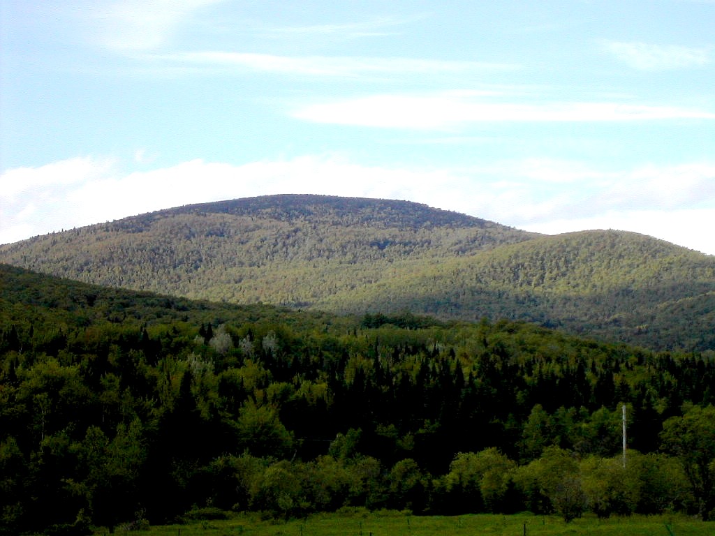
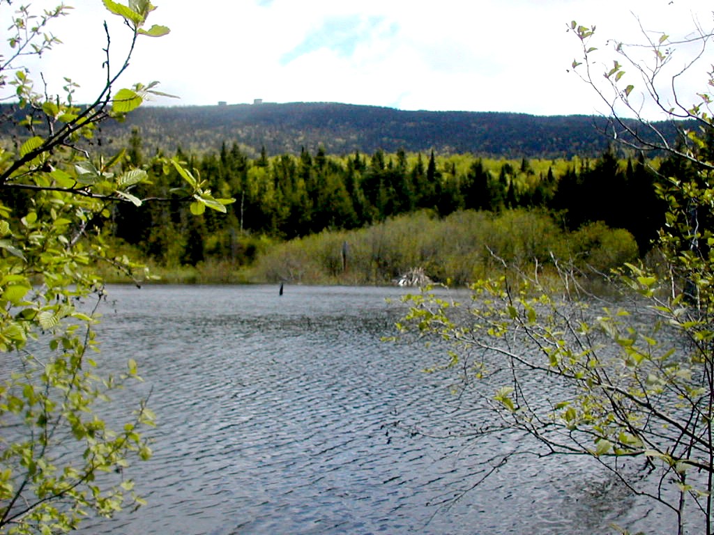 East Mountain seen across a pond (Click on this or any picture for a larger image) |
| E |
That night I returned to Stowe after a beer with Al and Denis in Barre, and finally got through to the caretaker for the wind farm company which owns the land on East (or at least some of the land). He said sure, hikers were welcome and I should just show up at his home which is by the gate in Hartwellville.
A word on East. There is an old abandoned radar installation on the summit which was run by the federal government in some years past and access is via a road which climbs 4 miles to the summit from another back country road, called "Radar Road". Radar Road is a rutted paved road which runs from Hartwellville on Route 114 to Gallup Mills on the Granby Road. There are gates at both ends of Radar Road and another gate where the East Mountain summit road joins Radar Road. Normal access is at Gallup Mills where the gate is supposed to be open. So from there you can drive to the upper gate and then hike the last 4 miles on the East Mountain road to the summit. But I was told to approach from the other end, so I did.
After breakfast at McCarthy's in Stowe, I was on the road by about 7:30. I took 100 south to I-89, east on I-89 to Montpelier where I picked up 2 east. Then onto I-91 north at Saint Johnsbury and off at the next exit at Lyndonville where I picked up 114 north. Then I turned into Radar Road (first called School Road and then Mountain Road until it became radar Road) and drove up 2 miles to the caretaker's house. This was about 80 miles and took me about 1:45. I met Del and he mentioned that I could have gone via Gallup Mills (slightly longer) since the gate to radar Road is open there, but since I came here at his request, he gave me the key to the gate at this point, and told me to lock
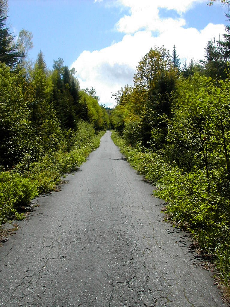 A long lonely road walk |
I then let myself in, relocked the gate and drove about 3.5 miles up to the upper gate where I parked and changed. I got walking a little before 10:00 AM at the upper gate. It is 4 miles and nearly 1700' of elevation to the top from this point.
It was a beautiful Vermont June day, with a mixture of sun and clouds, little humidity and temperatures in the 50s. And no black flies! It was somewhat boring and lonely walking up this long and long deserted road. There were some buildings after about a mile and then nothing but trees and the road, up and up and up. It was steep for a road but not particularly steep for a hike. The road curved around, approaching generally from the south and then turning towards the west in the last half mile. The trees changed from hardwoods to spruce and fir and it was actually a very beautiful area with nothing to be seen but trees in any direction. At last I reached the summit which was cluttered with old tumbling down buildings. I climbed one to the second floor and got some good views out some of the windows. There was a big warehouse looking building across the road where some ravens were hanging out and were making a huge racket. I had a snack, took some pictures and then it was back down the road.
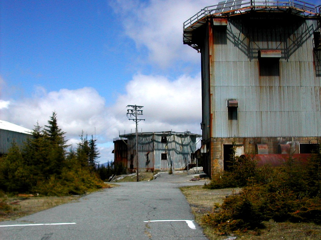 Old radar buildings on the summit |
Then it was back to Stowe, with a brief stop in Waterbury for a cold one at the Eclipse Bar. This was the first rainless hiking day all week and a fitting end to my week of hiking on such a beautiful and remote mountain (in spite of the ramshackled buildings on the summit).
East Mountain: elevation 3438', prominence 2227'
DeLorme Atlas: page 49
Topozone: East map
Total distance hiked: 8.0 miles, Elevation gain: 1670'
| I |
I also had a plan to do an early season trip to Vermont to do the 5 remaining peaks on my New England Fifty Finest list (click here for information on that list) which were off the beaten path, i.e. not on or near the Long Trail. I had already finished everything on this list south of Route 4. These peaks were Worcester, Signal, East, Gore and Cold Hollow.
With a less ambitious marathon plan (where hopefully I would finish the race with legs still hiker-ready) I put the two ideas together and made one week of it. Hence the "six-pack" came into being: one marathon and five peaks. Fate would have it that I missed Cold Hollow Mountain, but I added Butterfield so I still ended up with a six-pack! I had actually added Butterfield to get some friends to join me: since it and Signal are two County High Points that are usually done together, I hoped some CoHPers (click here for information on that group) would join me for those. I was not disappointed: Tramper Al and Denis Hanson joined me for that day.
Meo also planned to join me for the whole week, but a last minute schedule change at his work kept him away except for Wednesday when we had a very nice hike of the Worcester Range.
Well, the marathon went according to plan: I finished in a reasonable time in reasonable shape, and aside from a little rain (who's afraid of a little stinkin' rain) so did my peak bagging. So somehow it all worked out. It always seems to, don't you think!
|
Click here for a complete album of photos from this hike Return to Papa Bear Home Page |