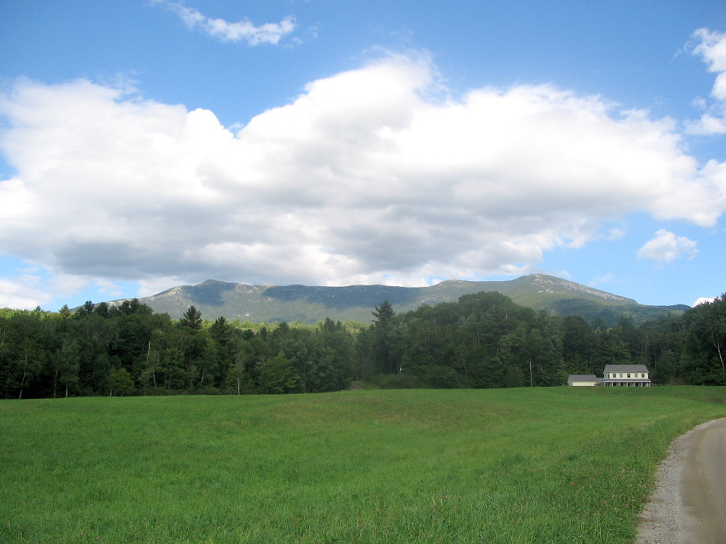
Mount Mansfield
(Click on this or any picture for a larger image)
|
Mount Mansfield (Click on this or any picture for a larger image) |
|
Click here for a complete album of photos from these hikes Back to Papa Bear Home Page |
| W |
Then "Onestep", whom I had met last month on several New Hampshire hikes, mentioned to me while we were doing PatN that he planned a Vermont Blitz in mid-August. So now there was a partner in crime! We made plans to meet up Monday the 15th of August. I took the JetBlue flight from NYC and at about 11:30 AM I met Onestep at the Burlington Airport and we were off to climb Breadloaf and Wilson. Onestep had figured this pair was best suited for a half day. The weather had turned cool and partly sunny with low humidity - perfect weather! Onestep had bad luck over the previous weekend with one hot-humid day and one rainy day.
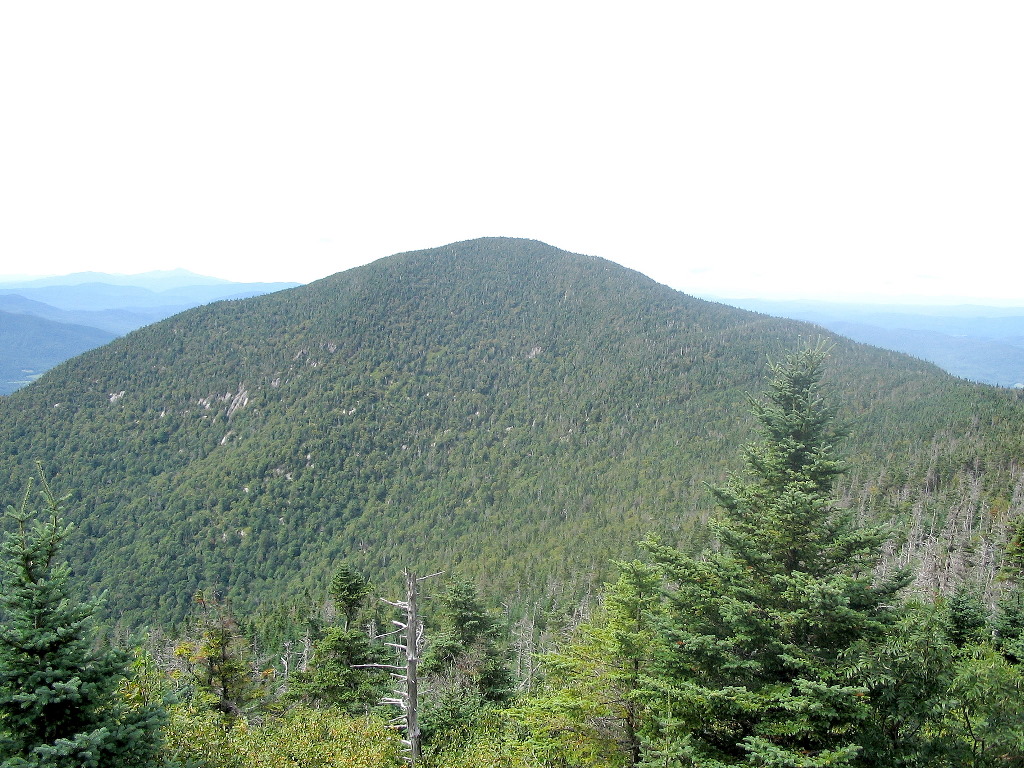
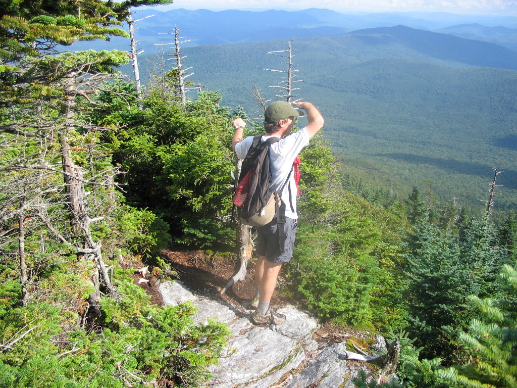 Mount Wilson viewpoint (Click on this or any picture for a larger image) |
| O |
We reached the Emily Proctor trailhead on the west side of the range and we were off and hiking at 1:35 PM. The trail was easy going, moving first along a stream and then turning up the ridge towards the LT. It got steep but the going was still easy. We reached the Emily Proctor shelter about 3:20 and met a couple of thru-hikers - a couple in their
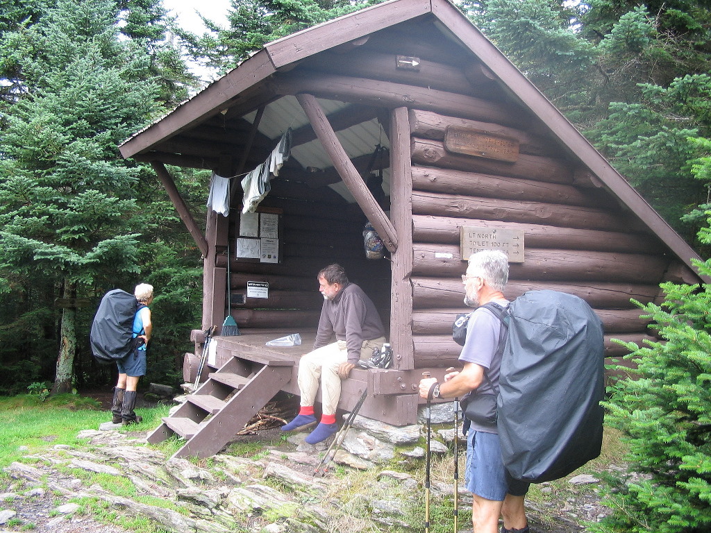 The Emily Proctor Shelter |
We continued up to Breadloaf, which is a wooded summit a short distance off the trail, had a bite to eat and then turned north to climb Mount Wilson which was about an equal distance in the opposite direction from the shelter. Wilson has a broad ridge and when going over it, it was not clear where the high point was. Someone had told us the summit is obvious, but it was not. We reached the end of the ridge which has a pointy peak with a nice viewpoint nearby about 4:30. I decided to check my altimeter carefully on the way back. Although this northernmost peak was more "peak-like", if you will, I wasn't convinced it was the highest. Sure enough, my altimeter showed two bumps along the ridge to the south of this point between 10 and 20 feet higher. Obsessives that we are, we even bushwhacked a short distance to a fourth bump, but that was indeed lacking. So we decided that one of the two southern bumps was the true summit, but we didn't know which one. When I got back I checked Topozone, and sure enough the north peak is clearly lower than the other two bumps (see Topozone map). So whichever one is the true peak, we got it - twice - both coming and going.
We went down past the shelter (for the third time) and said good by to the thru-hikers and they said "goodbye peakbaggers" and got back to the car by 6:25. I could really feel my knees going down that last slope.
We crossed the over range at Lincoln Gap and drove up Route 100 to Watertown and then found our home-away-from home for the week - Little River State Park. The road up to the park is just a few minutes west of town off Route 2. We got to the park around 8:00 PM, after the gate keepers had left, so we just took an available spot and decided we would square it with the park people in the morning.
Then we drove back to Watertown and had a nice dinner at Arvad's restaurant. We had agreed we would forego cooking meals at camp this week in favor of the luxury (and price) or eating out. I also started the week with a Vermont microbrew - something I would try each evening. A busy day but a good one.
Breadloaf Mountain, elevation: 3835' & Mount Wilson, elevation: 3790' (#92 and #93 of my HH)
Distance hiked: 10.2 miles
Elevation gained: 2680'
Time: 4:56
Photos:
Breadloaf & Wilson Album
Brew: Arvad's Ale (not bad)
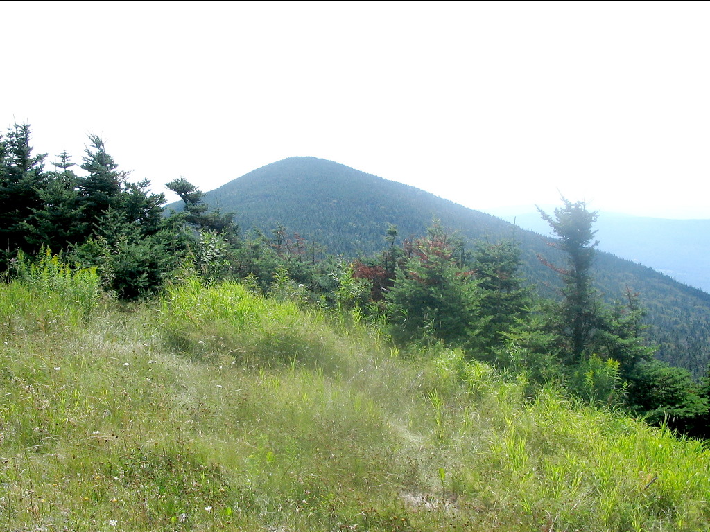 Mount Abraham from Mount Lincoln (Click on this or any picture for a larger image) |
| T |
Today a car spot would have helped. Ellen is almost 4 miles past Abraham which in turn is almost 3 miles from the road. Our round trip distance would be over 12 1/2 miles and we would be climbing Abraham twice - from the south and then from the north.
So off we went and found the trail at first gentle, but then steep and rocky. As it got steeper, we passed between two giant boulders known as "The Carpenters" (named for two trail maintainers) and then soon reached the Battell Shelter in a little over an hour and met a single hiker there who was taking a break. He would follow us up to Lincoln when we got going again. We crossed paths with one solo and one couple coming down but both said the fog had not yet burned off the Abraham summit.
After the shelter, the trail turned into steep ledges and then slabs to the top. At about 11:15 we reached the open summit. It's marked as an Alpine zone but the treeless area is quite small. There is a small shelter
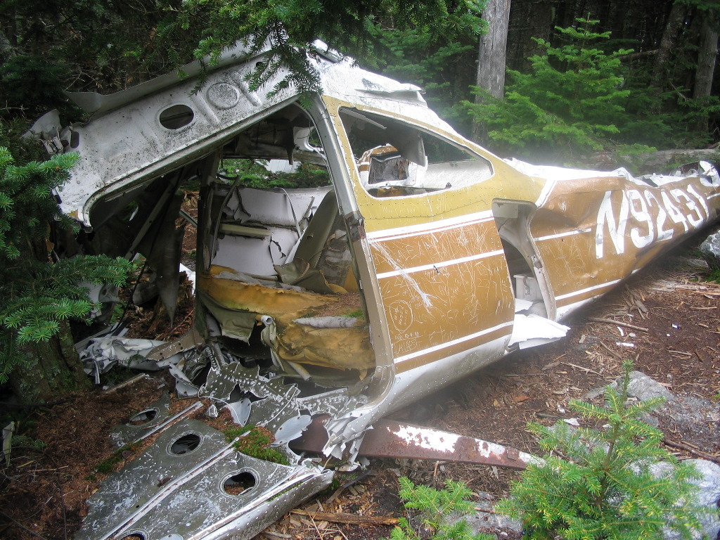 Plane wreck on Mount Abraham |
A few minutes north of the Abraham summit, we noticed a herd path off to the left. There looked like some sort of tent or tarp down there, so Onestep said "let's check it out". To our surprise, it was a plane wreck of a small two seater plane. The engine and propeller were missing and there were wing parts strewn about. We took some photos and noticed that graffiti on the fuselage went back to the late 80s, so this wreck may have been there close to 20 years. It was amazingly well preserved in view of that age.
| Note (May 4th, 2012): I learned from Ed Wandall, a poster on the CoHP Yahoo discussion group, that the plane was a Cesna 182 which crashed on June 28th, 1973 and all three occupants survived. Here's the NYSB report: NTSB Report. The fact that the wreck was 32 years old when I saw it is all the more remarkable. |
Then followed the long and very pleasant ridge walk to Ellen. There were a series of bumps (Little Abe, Lincoln, Nancy Hanks and Cutts) and we became aware of how much of this range is used for ski slopes. Between Lincoln and Ellen we crossed 3 ski trails with lifts, and from various viewpoints we could see many trails on the mountain side to the east. Interestingly, this area (Sugarbush) is not readily visible from the road. Since the tops of the peaks were all untouched and the trails were not unattractive, it did not bother me to see these areas here. Skiers are outdoors people too, after all.
About two-thirds of the way along the ridge, we passed a group of about 10 young people heading the other way. They
 Mount Ellen |
We finally got to Mount Ellen at 1:25 and took a break. We then walked down the trail a short distance north, and to our surprise there was a pick-up truck sitting on the trail at the top of a ski slope. It turns out there is a much easier way to this summit if you happen to work for Sagebrush. The two young men were doing a check of the water system for the snow making equipment and we had a short chat with them. But knowing it would be another 2 hours to get back to Abraham, we didn't dally.
We returned along the ridge, but the sun was now in the west and the fog had burned off so we saw all the peaks in a new light. It was sunburn weather and we were tired. Every trail tends to look different depending on the time of day and the direction of travel, and this was especially true here that day. We got back to Abraham at 3:20 and it seemed that everyone we passed on the way was hanging out here. The group of young people turned out to be a college group of freshmen doing a backpacking trip as some sort of freshman orientation. The SOBO was there too and they were all headed for the Battell shelter for the night.
We got the jump on the all and headed down the trail and took a short break at the shelter. As we were getting ready to leave, who should show up but yesterday's couple who immediately exclaimed "The peakbaggers" when they saw us. We chatted amiably and warned them of the hordes approaching, which were actually within earshot. They staked a claim to some of the shelter floor and as we were heading down we could hear the others approaching rapidly.
We reached the car shortly after 5:00. It was a long day but as my notes say "A grand and glorious ridge: great weather and good views, but rocky and tiring".
Back in Watertown we tried to get into the only other restaurant in town (the Alchemist) but there was a backlog, so it was Arvad's again.
Mount Abraham, elevation: 4006' & Mount Ellen, elevation: 4083' (#94 & #95 of my HH)
Distance hiked: 12.6 miles
Elevation gained: 3350'
Time: 7:29
USGS Abraham benchmark: BM data,
BM image
Photos:
Abraham & Ellen Album
Brew: Rock Art Ridge Runner Ale (nice - almost like stout)
 Camels Hump in the clouds (Click on this or any picture for a larger image) |
| O |
We were off hiking at 7:00 AM on the dot. The early start, essential for today's long schedule, unfortunately meant that the mountain tops were still fogged in. But the weather was cool (in the 50s) with low humidity, so it was a perfect hiking day. This area is within Camels Hump State Park and as a result the lower sections of the trail show no signs of recent logging and many large old hardwoods. There is also a park bench about a quarter mile from the parking lot (before the trail gets steep), which is perhaps as far as many of the visitors get.
 |
The final .3 mile climb to the top was over steep ledges and slabs and at 8:40 we reached the open, rocky summit. It was fogged in, as expected, and 55 degrees, but it was a great summit nevertheless. You can be sure I'll be back here when the sun is shining. We were alone on the summit, but not for long. Soon a group of 3 joined us. Since we were getting chilly and it was getting "crowded" up there, we started down again.
The hike down was easy, but I could "feel" my knees. I noticed that I was missing my micro-leatherman which I had last used in cutting some pepperoni on the way up. We checked carefully on the way down and even found the rock I had sat on eating the pepperoni, but the Leatherman was nowhere to be found. It was the only lost item of the entire week, but I miss that little all-in-one tool. I guess I'll replace it the next time I'm near an outdoor store.
When we reached the lower area, we were impressed by the old hardwoods we hiked through. Onestep also made a point of resting at the park bench. We reached the car about 10:10. This is a great little hike with a lot of pay back for the effort. Pick a sunny day and do it. You won't be disappointed.
Camels Hump, elevation 4083' (#96 of my HH)
Distance Hiked: 4.8 miles
Elevation Gained: 2245'
Time: 3:12
Photos:
Camels Hump Album
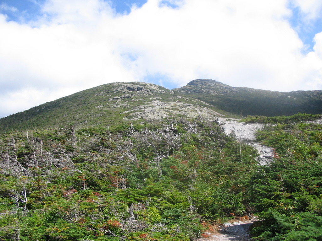 Mount Mansfield, Sunset Ridge (Click on this or any picture for a larger image) |
| A |
We were off about 11:30. The actual trailhead is about a mile up on a gravel road (The CCC Road) which is closed to traffic. But this was an good way to ease into the steep slope. We would be taking the Sunset Ridge Trail, which had been recommended by several others. Luckily the fog we had encountered in the morning was finally burned off
|
Mansfield's profile |
Mount Mansfield consists of a long ridge (about 1.2 miles long) with the high point at the north end of the ridge. The various bumps along the ridge are named for anatomical features of a face. Starting at the south there is the Forehead, the Nose and finally the Chin at the north end, which is the highest point of the ridge. Thus we would climb the Chin. Looking at the ridge from the west (with the Chin on the left). I tried to imagine a profile of a face, but I couldn't quite "get it". Look at the photo to the right, do you see it?
We started up the Sunset Ridge Trail and guess what? It was steep and rocky - surprise! We soon got to a trail sign announcing "Cantilever Rock .2 mi". Well, at .2 miles we couldn't resist, so we went off to see what this was all about. In a few minutes we passed some trail workers who were moving heavy rocks to help control erosion on this segment and we thanked them for their work. they said they worked for the State Park and they were quite impressed when we said we had hiked Camels Hump that morning. We were impressed at the size of the rocks they were moving.
We got to Cantilever Rock and found that it was a sharp prong sticking out of a large sheer cliff face. There was a nice flat rock opposite which gave great views both of the rock and of the valley below. We had a bite to eat and noticed a little ledge about 8 feet above the ground right below the rock. There seemed to be a path worn on this ledge but one could not get up there without a great deal of effort. We wondered where this path went, if any where.
We got back onto the Sunset Ridge Trail and were soon passed by a couple of trail runners. I thought I recognized the lead runner and I called "Hey Tim, Tim Seaver". Sure enough it was Tim and I introduced myself as Papa Bear, and he stopped briefly to chat. He asked if we were planning on traversing the ridge and we said no, we were just going up and back. They were planning on the loop over the ridge and off they went, and were out of sight in the twinkling of an eye. I love to meet internet hiking friends in the real mountains, and it was a pleasure to meet Tim in the flesh.
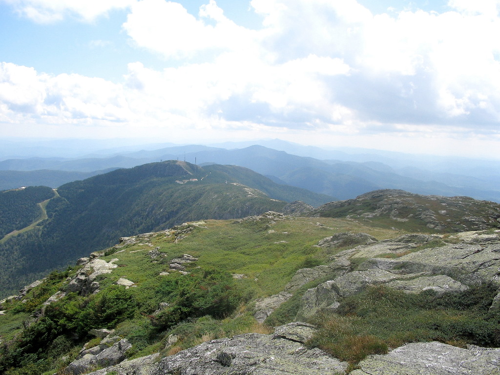
We soon hit the open part of the ridge, and I was very impressed by the beauty of this area. It rivals many of the alpine ridges in the whites and IMHO would compare favorably with the ridges of Mount Lafayette. We approached the high peak in front of us only to discover that the trail circles around to the right behind this bump - the actual high point was "hiding" behind this bump. With temperatures in the low 60s, and wind from the west, it was getting rather chilly until we circled around on the trail. There is a little flat spot after the trail reaches the Long Trail at this point, and we had a temporary respite from the chill wind.
There we were asked by a cold and tired looking woman with two daughters "Was this the way to the toll road?" After a short conversation, we found out that her husband had left them at some trail and was driving up to the parking lot at the other end of the ridge while they hiked up to this end. It was clear they had no concept of where they were
 Mansfield's ridge to the south |
At the top there were quite a few people - perhaps 20 - and a GMC ridge runner who was talking to folks and reminding them to stay off the delicate alpine areas. We took some photos and took a break in a sheltered spot. This was one beauty of a mountain summit. All the ski lodges and lifts were at the other end of the ridge (not so beautiful) but this end was unscarred. I was extremely impressed by this mountain, and those of you who are "stuck" in New Hampshire or Maine, get over to Vermont and check this out. You'll be impressed too, I guarantee it.
To make a loop out of our climb, we took the alternate trail down: the Laura Cowles Trail. This was just as steep or steeper than the Sunset Ridge Trail, but lacked the views, so I liked it less. We eventually got down to gentler terrain and finally rejoined the Sunset Ridge Trail near it's lower end. We found a straight trail that bypassed all the switchbacks of the CCC Road (the Eagles Cut Trail) and this saved us oh, maybe 1 minute of walking .
We got to the car at about a quarter to 4:00. What a great mountain and a great 4K double for the day.
We drove back to the campground, I had a shower and a nap and that evening we finally got a table at the Alchemist Restaurant for a scrumptious meal (and of course another micro brew). When we returned to the campground we noticed some rain had fallen, but there was no other rain all week long. Life was indeed very good.
Mount Mansfield, elevation: 4393' (#97 of my HH)
Distance Hiked: 6.6 miles
Elevation gained: 2625'
Time: 4:15
USGS Mansfield benchmark: BM Data,
BM image.
Photos:
Mansfield Album
Totals for the day
Total distance hiked: 11.4 miles
Total elevation gained: 4870'
Brew: Pappy's Porter (great, best brew of the week)
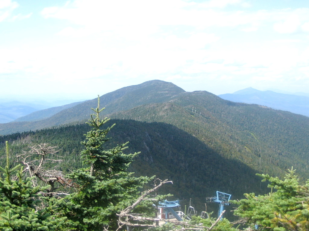
 Big Jay from Jay Peak (Click on this or any picture for a larger image) |
| O |
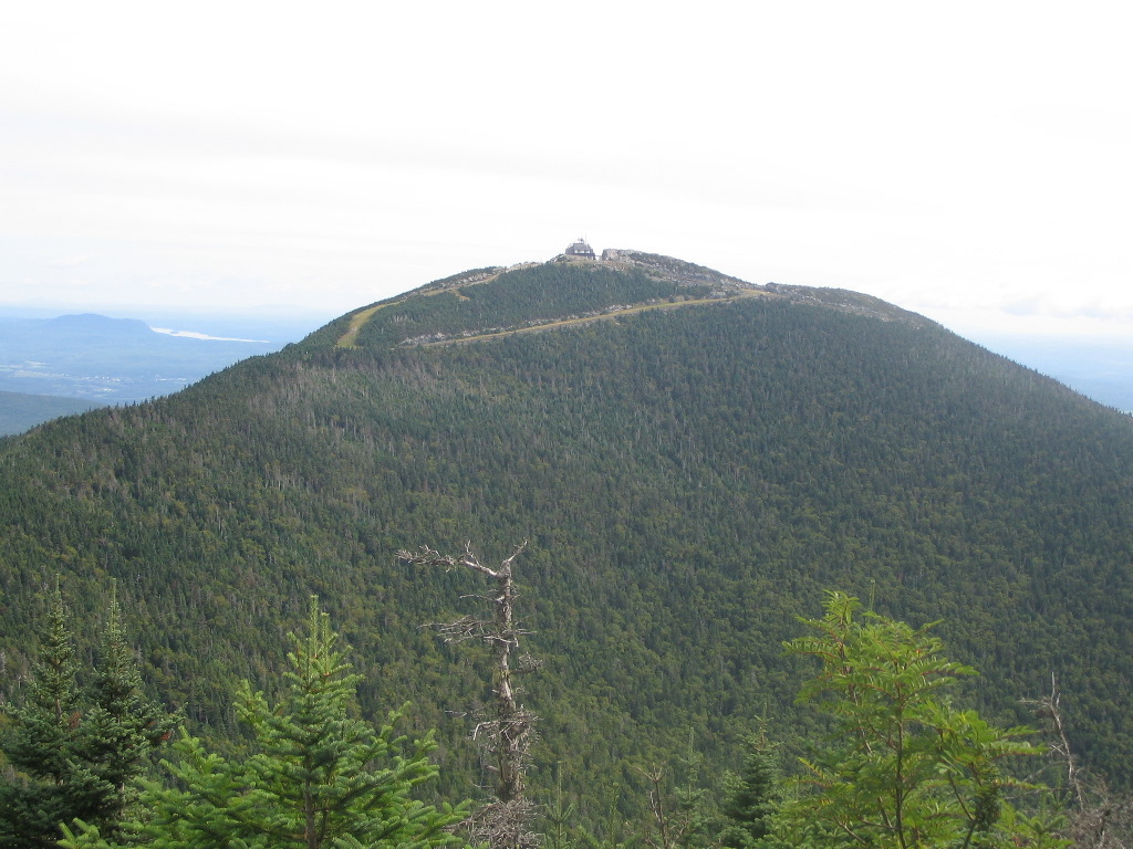
The next morning we got another early start. We took both vehicles, which turned out to be a good idea since later in the day we would split up. A little after 6:00 AM we headed up Route 100 through Stowe, Morrisville, Hyde park, Eden and Troy, then up Route 101 and southeast on Route 242 to Jay Pass. We were headed to Jay Peak and Big Jay, the northernmost major peaks on the Long Trail and the last two of our Hundred Highest peaks in Vermont. And they stood a mere 10 miles from the Canadian border.
As we turned onto 242, we could see the ski trails on the side of the mountain and the gondola towers and cable on the north side. The upper gondola terminal was an obtrusive structure right at the peak of the mountain, and unlike the structures on Ellen, or even the summit houses on Mansfield, this looked really out of place. It appeared all out of scale to the mountain. And driving by the base area there was very little evidence of parking lots, lodges, warming huts, etc. One wonders if this is a viable ski area so far from the tourist regions to the south.
We got to Jay Pass where the road crosses the Long Trail at the height-of land (at about 2200' elevation) about 7:50 AM, and by 8:00 we were off. The weather was partly cloudy and cool - another great hiking day was in the offing. The two peaks in store for us today would constitute the shortest trek of the week, and if not for the long drive up and back, could easily be combined with another hike.
A small shelter (the Atlas Valley Shelter) stood very near the road and might serve a place to stay overnight before an early ascent or after a late descent. But it was too close to the road for my liking. The book says it is "not intended for overnight use".
 Jay Peak, showing the gondola station on the summit |
We had a bite to eat on the porch of the station (which incidentally is closed, in case you were thinking of taking a short cut to the summit in the summer months). We got going again at 9:25 and followed the Long Trail north which follows another ski trail down off the summit. After about 5 minutes of walking, this ski trail meets the foul-weather bypass ski trail coming around the peak from the left and the Long Trail goes through the fence and leaves the ski trails altogether.
Big Jay stands on a ridge to the southwest of Jay Peak about a mile distant. Officially it is trailless, but in fact there is a very well trodden herd path along the ridge. It is nearly as well trodden as the trail up Mount Nancy to give you a comparison. There is evidence of past maintenance in that many stumps indicate a number of small trees along the path have been cleared in the past. I even wonder if this used to be a maintained trail. Anyone know?
The herd path leaves the Long Trail about 100' after the LT passes through the ski area fence. There are a few branches piled across the start of the path. I guess to disguise the fact that the path is here. Didn't fool us! Skimom led the way and there was only one blowdown that gave us pause as to the route. It was actually a rather pleasant ridge walk. At 10:05 we reached a small clearing and the canister. It took about 40 minutes from the summit of Jay Peak to reach this, our second Hundred Highest peak of the day.
 Big Jay |
At 10:20 we were off and we decided to take the foul-weather route going back which saved a few minutes. The going was quick and we reached the car at 11:52, just a hour and a half from Big Jay. On the way down we passed a few families going up, some of whom may have bitten off a bit more than they could chew, but then what do I know?
Since it was not yet noon, Skimom wanted to get another hike in so we showed her the directions to get to Mount Mansfield and gave her some hints we had learned the previous day for that climb. We agreed to meet at the campground at 6:00 PM and go out to dinner.
Onestep and I drove the 20 miles or so down to Belvedere on Route 109 and investigated the accessibility of the logging roads leading in to Cold Hollow Mountain, tomorrow's objective. We found what looked like the best choice and then headed back over to Route 100, via Route 118. We stopped at the Eden General Store for some sandwiches and then headed back to camp.
We got back by 4:00 and got cleaned up and generally took it easy. Just minutes before 6:00, Skimom pulled in. She had had a great climb of Mansfield, in spite of a few missed turns on the roads. At one point she said she found herself at an intersection and not knowing the correct road, she got out her compass and followed the road that went south. And she got the right road! You go grrl!
We had an enjoyable meal, and then Skimom, ever surprising, said she was going to drive over to the Daks to join the gathering which was happening that night. She wanted to join Audrey and Pat on their 115 hike the next day. The waitress had told us that rain was forecast off and on through the weekend, and we could actually see some rain over Lake Champlain on the New York side, but we had none that night nor the next day.
Another great day!
Jay Peak, elevation: 3858' & Big Jay, elevation: 3786' (#98 and #99 of my HH)
Distance hiked: 5.6 miles (approximate)
Elevation gained: 2510'
Time: 3:55
Photos:
The Jays Album
Brew: Trout Brook Red Ale (not bad)
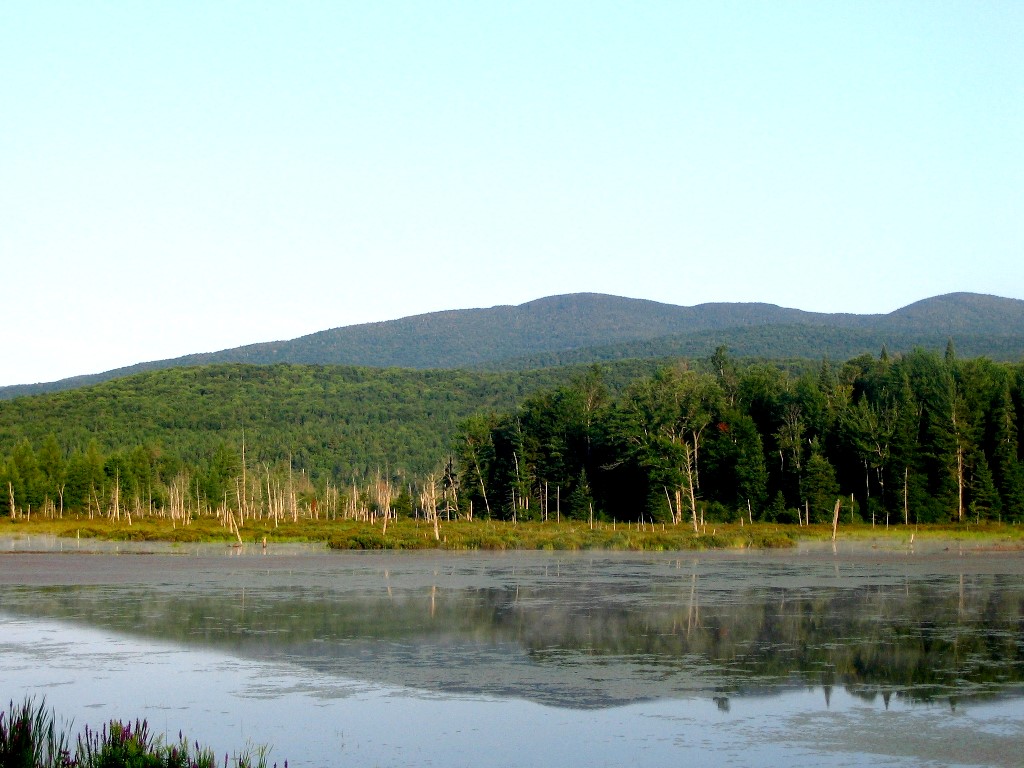 Cold Hollow Mountain View from Route 118 across Belvidere Pond (Click on this or any picture for a larger image) |
| W |
On Thursday, after climbing the Jays, we checked out the logging roads near Cold Hollow. There were three of interest: one on the west shown on the Topo and DeLorme and one on the East also shown on both sources. But we also had a Terraserver image of the area which showed another road on the east, closer to the mountain, which was not on the maps. We checked all three: they all were either gated or prohibited motor vehicles, so a walk was in order. The one not on the map showed the most promise since it got us closer to the long south ridge leading to the peak and it avoided crossing Rattling Brook which was an unknown to us.
So we got going around 6:15 AM and drove up Route 100 to Eden, then across Route 118 to Route 109. Just before we got to Route 109, we could see our peak across Belvidere Pond, so I stopped to take a picture. Oops, the camera said "change the battery". So instead of starting our climb, we drove another 10 miles or so to Waterville, the next town with an open general store. We got the batteries for the camera and drove back. We would start hiking up the logging road which leaves Route 109 just where the road turns a sharp right (going east) as it crossed Rattling Brook. The road was on the west side of the brook, so we would not need to cross that brook to get to the mountain.
I had recently got a new GPS, and I had put in waypoints of locations such as the start of the road, the center of the ridge, the summit, etc. I didn't know what I was doing with this thing, but it was fun to play with. But the real tools would be map and compass. We had laid out our bushwhack route on the map and plotted the compass bearings.
The mountain has a long south ridge which should be the ideal route. To get up onto the ridge, we would hike along the logging road about .5 miles and then climb the flank of the ridge to a knob at about 2200' which is where the ridge turns and heads straigh to the summit. If we got to this knob, it would be straight up the ridge, almost due north for about 1.2 miles. (see Topozone map).
After fiddling with the GPS, we got ourselves going at 8:20. We found that the logging road split after a few hundred yards. An older, rather overgrown road went straight up along the brook and a newer one veered up to the left (west). Although the new road looked tempting, we stuck to the old one since this was the one we had found on the Terraserver image and this is how we had plotted our route.
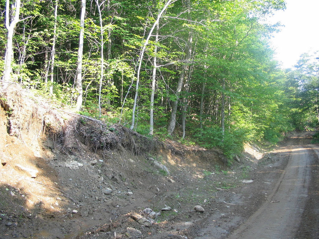 Crossing the new logging road |
We continued up on our bearing. The going was very steep at times and there were a few ledges to circumvent. Interestingly, there were quite a few boggy areas of moss over mud which would swallow our boots up to the ankles if we were not careful. This would be a tough area to traverse in the spring. The slope was also irregular so that although we were moving up the flank along the center line (according to the map) the slope would shift to the left or right randomly. We had to be careful to stick to our bearing.
Finally we reached a level area and could see the slope starting to drop off ahead of us to the west, so we knew we had reached the ridge line, probably just below the knob. We checked the GPS and my altimeter and set a new bearing of almost true north straight up the ridge.
As we started up the ridge, we found a red stake and triple paint blazes on the surrounding trees. This was obviously a boundary marker of some sort, but nothing that either DeLorme or the Topo showed. Probably a private property corner.
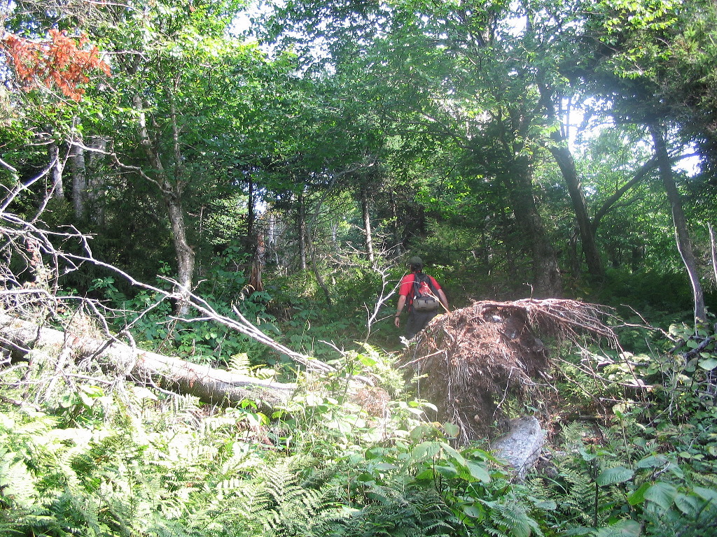 Open woods along the ridge |
There were several interesting features near the top: first we crossed a notch across the ridge where we dropped down about 10 feet over a ledge, and climbed a corresponding ledge on the other side. But the moose had already found the right spots to get down, across and up this notch. Then very near the top there was a rock ledge about 10 feet high across the path. The moose path took us around to the left and then headed up to the high point from a directions slightly to the west.
We found one then another and finally the highest high point and there, clear as day was the glass bottle "canister" tied to a tree. It was 10:31 - we had taken a little over 2 hours to reach the summit from the car and it was a great trek along a beautiful ridge.
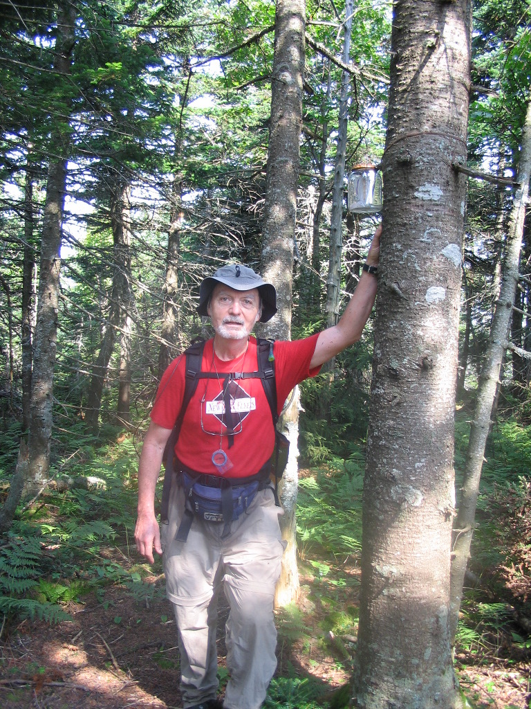 The summit canister |
The flies were getting bothersome, so we started back down about 11:00. After our experience on Scar Ridge, Onestep and I were very careful not to slip off the ridge. We made rapid progress and passed the red boundary mark we had seen on the way up and finally reached a flatter area a bit after 12:00. We must have gone a little too far down since the ridge changed directions here and our next bearing (down the flank to the logging road) seemed to take us back up to the left. But we trusted the compass and after passing over some ups and downs we found ourselves heading down the steep slope as expected. The terrain is a bit complicated at this spot. It's not as simple as the map shows, so use your compass and altimeter carefully.
I had managed to trip and hit the dirt 3 times by this point, and Onestep was smirking. But he soon caught up in this little competition and by the end he and I had both 3 falls to our (dis)credit. By 12:35 we got to the new logging road and after a short break we took this down to the right (south). My altimeter showed about 1750' where we hit this road, but this was not calibrated. Nevertheless it was a fair ways up the slope so it saved us a good bit of bushwhacking. Someone doing this bushwhack might want to go further up along this road and see how high it goes. Just don't get too far past the knob or you'll hit the very steep side of the ridge. If you could get up to a point due east of the knob that would probably be ideal.
About 15 minutes of walking brought us to the car. It had been a hugely successful climb over unknown but very attractive territory. And for me it was #48 of the New England Fifty Finest.
The rest of the day fades from memory. Drive, campground, shower, nap, dinner, brew, sleep and the next day I would rise before 4:00 AM to catch an early flight home. But it had been a fantastic day and a great ending to a wonderfully productive and fun week.
See you all in Vermont at the September VFTT gathering!
Cold Hollow Mountain, elevation: 3327', prominence: 2165'
Distance hiked: 5 miles (approximate)
Elevation gained: 2170'
Time: 4:35
Photos:
Cold Hollow Album
Brew: Donovan's Red Ale (a bit harsh)
|
Click here for a complete album of photos from these hikes Return to Papa Bear Home Page |