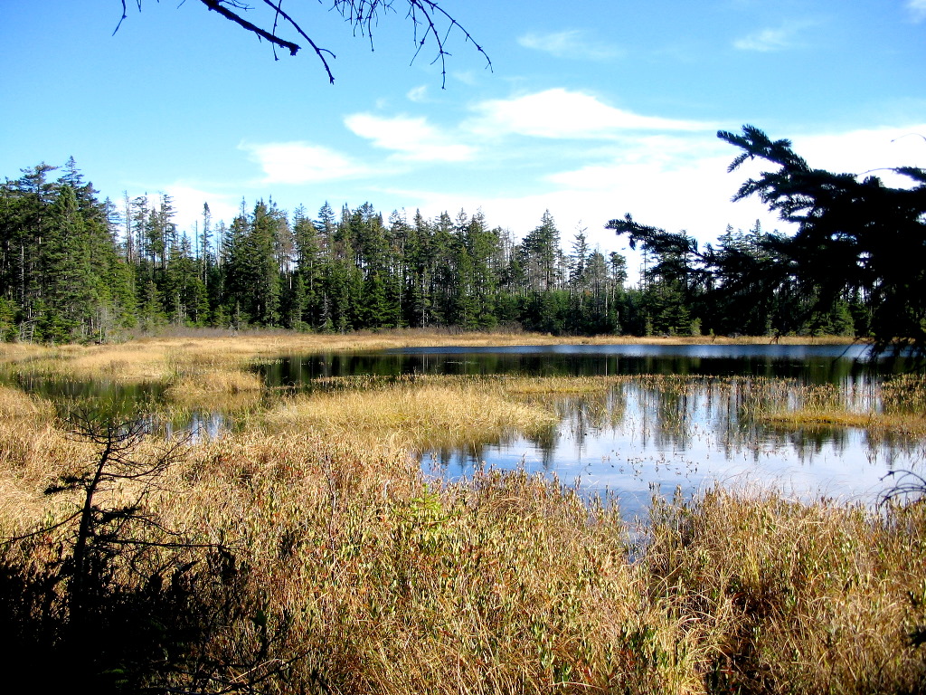
Fourth Connecticut Lake
(Click on this or any picture for a larger image)
|
Fourth Connecticut Lake (Click on this or any picture for a larger image) |
|
Click here for a complete set of albums from these hikes Back to the Hiking / Peakbagging Page Back to Papa Bear Home Page |
| I |
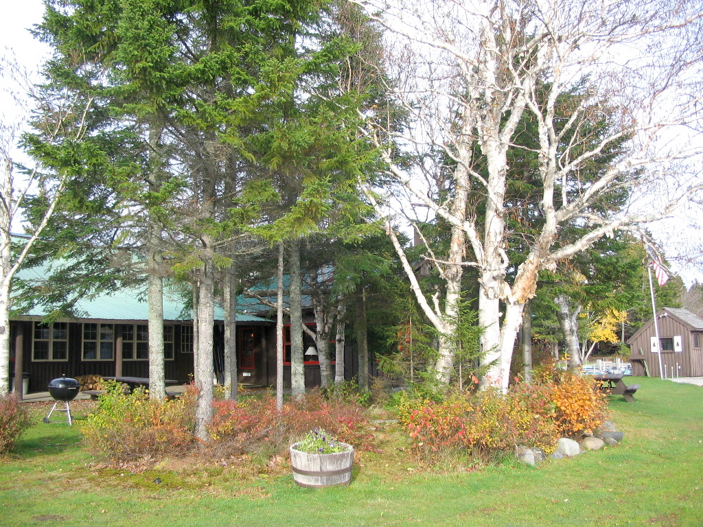 Talls Timbers Lodge, Pittsburg NH (Click for a larger image) |
Friday: in the AM I did Magalloway - easy hike with nice views from the tower, and then headed up to the border and hiked Prospect Hill, East and West Peaks and a side trip around 4th Ct. Lake. Very slow going on the border - recent cutting left slash everywhere.
Saturday: Met Gamehiker for breakfast at "Dube's Pittstop" at 6:00 AM. We then whacked Rump and recovered the NH/Maine boundary monument shown to the map on the way in. Took an easier way out. Very nice mountain and quite a good whack. In the PM we searched for but couldn't find another one of the state boundary markers (although blazes on the trees indicated we were at the right spot) and got some good views of several ponds. Sorry - no more peaks for Saturday.
Sunday: Gamehiker helped spot my car and then he took off for Canada and Saddle Hill. I then whacked up Salmon - very open and easy (but at
times steep) going and found Triangulation station "Salmon" as well as the jar. Then it was along the boundary vista to Trumbull (3277' aka
Snag Pond). One steep downhill was the "Vista from Hell" (Oncoman knows where I'm talking about
 ) then up to 3277. I also found triangulation station
"Trumbull" and of course the jar. Then it was the "Vista from Purgatory" (on the way to hell) the whole way to Boundary Pond and the car. This
whole section has just been cut. I say wait a year before you try this area. Some parts are well nigh impassable (but hey, we're bushwhackers!).
It's like walking throug a clear cut where they forgot to remove the trees!
) then up to 3277. I also found triangulation station
"Trumbull" and of course the jar. Then it was the "Vista from Purgatory" (on the way to hell) the whole way to Boundary Pond and the car. This
whole section has just been cut. I say wait a year before you try this area. Some parts are well nigh impassable (but hey, we're bushwhackers!).
It's like walking throug a clear cut where they forgot to remove the trees!
But it was a great day nevertheless, 2 peaks and 2 bench marks, who could ask for more. But ... asking for more, I hightailed it down East Inlet
Road (28 minutes), down Route 3 (20 minutes) and down Route 145 (20 minutes) to Colebrook, couldn't find the d*mn Bridge to Vermont till I passed
it 3 time. Not a single sign saying "This way to Vermont", but I finally saw "Bridge Street" and said "Hey, I wonder where that goes", and so
finally I was across the River. Turned left, drove south about a mile, decided this way was wrong, turned around and drove north past the bridge,
found the sand pit, went in and the trail sign. I had finally found Vermont's Monadnock! It was 4:00 PM. But guess what - it gets dark at 6:15.
Even Oncoman would have trouble doing this 4 hour book time (??) peak in 2 hours (but he would do it
), but reluctantly I decided to save
it for another day. A day where I could see the great views by daylight, not starlight. So it was back to Pittsburg and the local Pizza-pub (quite
a scene).
Monday: I left early and made it from Pittsburg to Natick Mass. in 4:20. Now that beats booktime bigtime!
| T |
It was a reasonably good traffic day and I got through Franconia Notch to where Route 3 and I-93 split apart in a little over 3 hours. From here on up it was nice. I actually like the older road and the small towns you go through (Twin Mountain, Whitefied, Lancaster, etc.), especially in good weather and light traffic. And that big old mill in Lancaster reminds you about what this part of the state is all about.
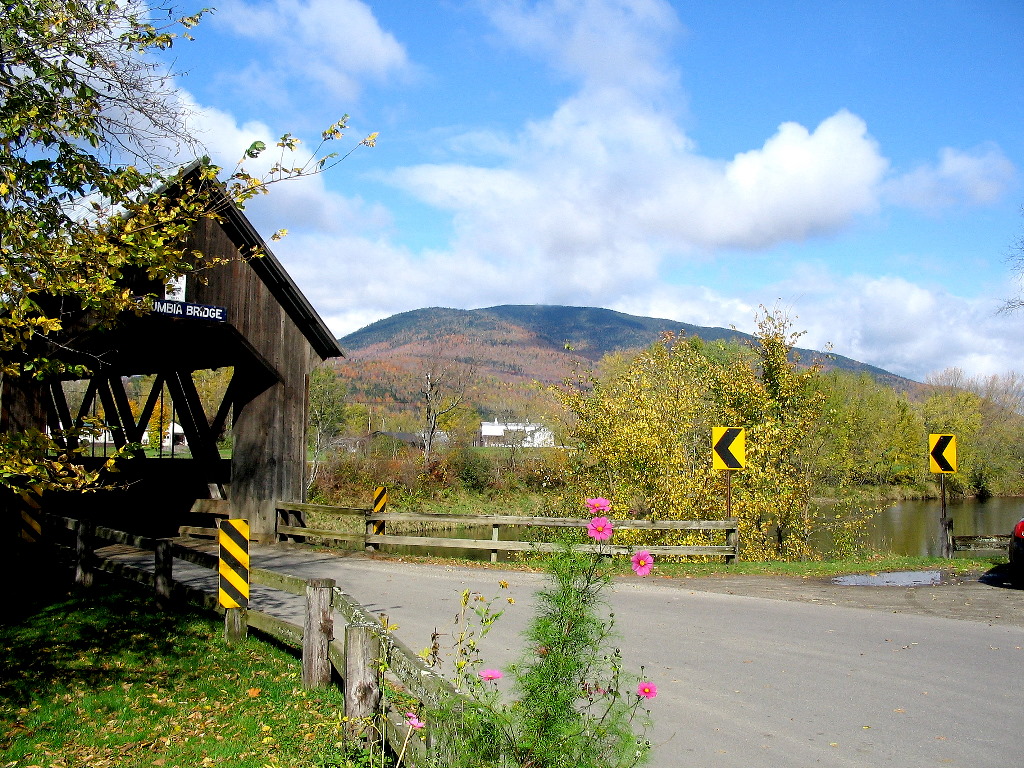 Monadnock seen across the Connecticut from the Columbia Covered Bridge (Click for a larger image) |
I decided to make a side trip at Beecher Falls to find some state and international boundary markers. I guess by now you know of my interest in those things. The boundaries in this area are interesting: the line between Vermont and New Hampshire goes along the Connecticut River (interestingly, it goes along the west shore of the river, so New Hampshire owns the navigation rights) until it intersects with the old (18th century) survey line for the 45th parallel. North of there, New Hampshire owns both sides of the river.
Take a look at a map of northern New Hampshire. The boundary with Canada goes along the ridge line in the far north until it reaches the headwaters of Halls Stream, the westernmost major tributary of the Connecticut, and then follows that stream down to the same old 45th parallel. But where Halls Stream hits the old 45th parallel, it's still about a half mile from the Connecticut, so you end up with that little sliver of Vermont that sticks into New Hampshire at Beecher Falls This is where I would explore.
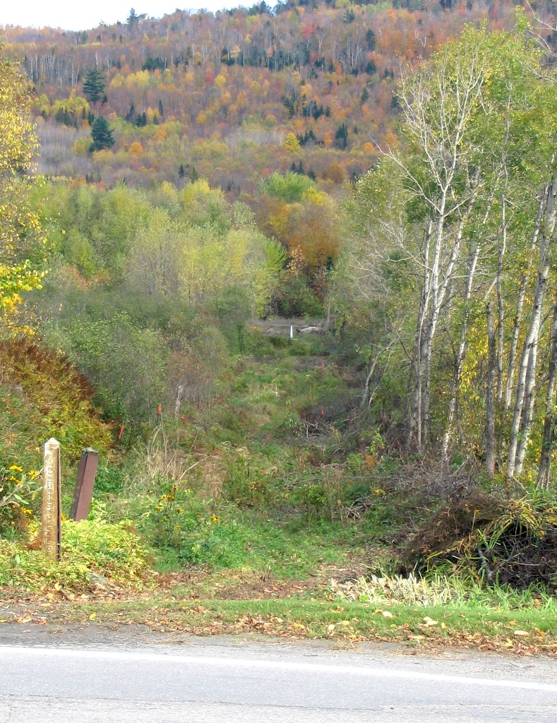 View from Route 253 along the boundary towards Halls Stream (Click for a larger image) |
The monument near Halls Stream (No. 518) is a special one: It's one of just 13 5 foot high cast iron posts (the usual ones are 3 foot high) that were set at major points along the New England and New York border. That's out of 775 land monuments from the Atlantic Ocean to the Saint Lawrence River. It was in fine shape, but I can't say as much for the small one (No. 518A) right by the road. There was also an old wooden post near 518A - I don't know what it was. Maybe just an old wooden post!
Benchmark log: MONUMENT 519A2
Benchmark log: MONUMENT 518A
Benchmark log: MONUMENT 518
Benchmark log: BOUNDARY REF MON 87
Benchmark log: BOUNDARY REF MON 86
Benchmark log: BOUNDARY MON 519A CD US
| A |
I set the alarm for 5:30 AM. Ouch - it's not summer any more. It's pitch black at 5:30. The overnight temteratures had been in the 30s and it was foggy everywhere. When I made my way off at 5:50 AM over unfamiliar back roads to Pittsburg center, I could only manage about 15 MPH with a visibility of about 50 feet. Luckily there was no one else on the road. When I got to Route 3 I managed to turn north instead of south but after about a mile I figured I was driving out of, not into town, so I turned around. I arrived at Dube's Pittstop jsut at 6:00 AM and it was a welcome sight. Lights on, and pickup trucks piled everywhere. Literally a beacon in the fog.
It's a great place if you're in the area. They open at 5:30 and they have good food (it's not your Gorham Dunkin Donuts, that's for sure). It's the local early morning hang out and it's open early 7 days a week. There's a gas pump in front (Gulf) so you can't miss it. BTW - if you order pancakes, you better order just 1. You have been warned.
After a great plate of French Toast and plenty of coffee, I got my engine going and was off by 6:45, headed up to Magalloway Mountain. Magalloway has a short trail and a tower with great views so how can you beat that. I drove north past lake Francis and First Connecticut Lake to the signed logging road which goes east off Route 3 between First and Second Lakes. It's 8 miles of dirt roads but each turn is marked. You won't get lost. As I started out it was still foggy, but by the time I got to First Lake the fog had burned off. It was a gorgeous, sunny, blue sky day.
BTW - am I the only one who thinks they have their lakes numbered backwards? Maybe they count down in New Hampshire vs. up in Maine? Or is it up vs. down?
 The sun on the Lakes below (Click for a larger image) |
The trail was your typical eroded fire warden's jeep road. Occasionally it would fork, and then rejoin, sort of like a stream going around an island on both sides. The old fire warden's cabin is now a camp near the parking lot (at least I think that was the old fire warden's cabin).
I got to the tower a little after 8:00 and climbed up to the top platform (the cabin was locked). Views were great but it was chilly and windy, so I didn't tarry. You name the mountain in northern NH, and you could see it.
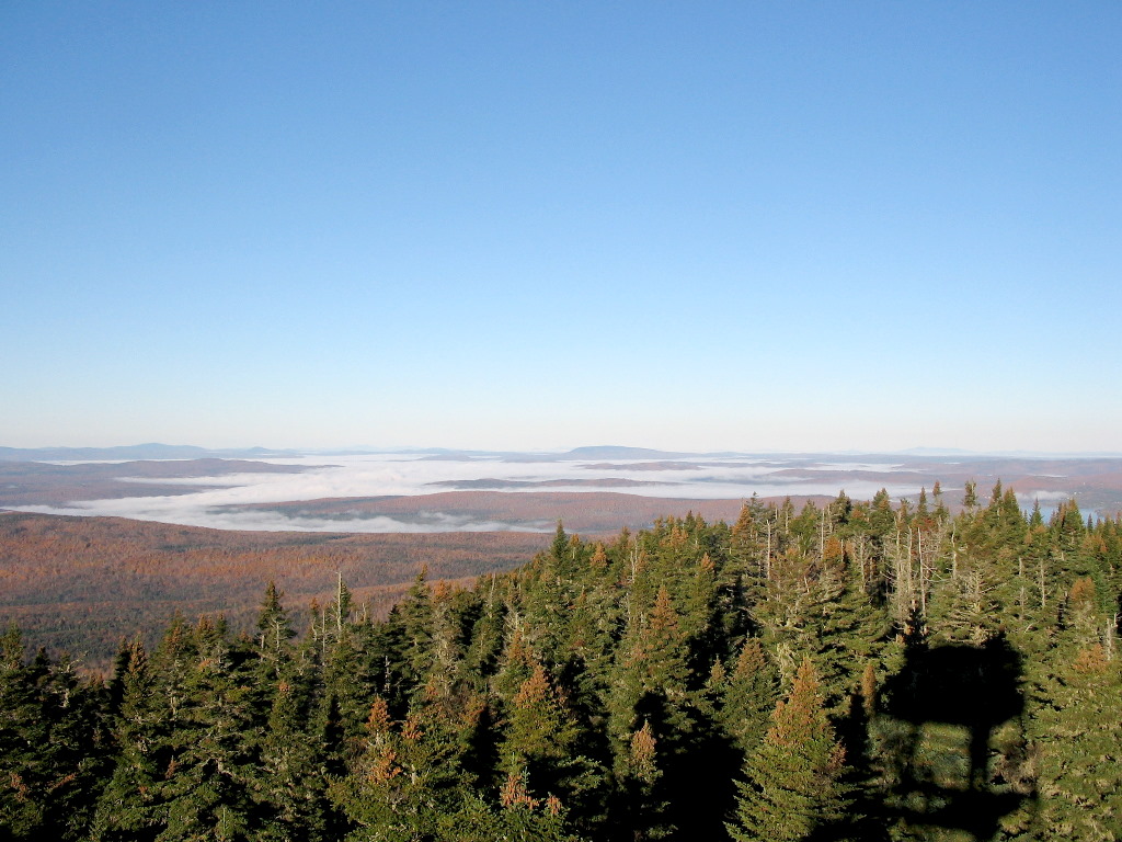 The lakes over the west peak from the tower (Click for a larger image) |
On the way down, I searched for the old tower which had been about 250' to the west. It had been replaced by the tower at the present location in the late 1920s. There was a benchmark mounted on the rock ledge under this old tower. Alas, there was no sign of it. No concrete footings, no rusty steel, no nothing. I guess that's what 80 years in the north woods will do. Sic transit gloria mundi!
I did discover a trail that went along the ridge line towards the west, as the fire warden's road fell off the ridge to the north. Does this go to the west peak? It seemed to be well troden. Perhaps it would be worth exploring another time.
I was back at the car by 9:10. Great mountain, greast views, easy hike. Check it out. BTW go early and beat the crowds.
Now it was off to the border crossing for Prospect Hill.
Benchmark log: MAGALLOWAY (Not Found)
| A |
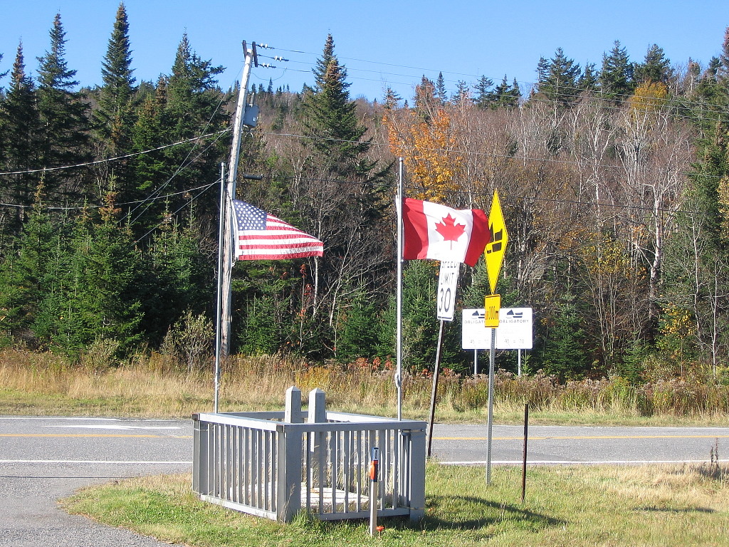 At the customs station on Route 3 (Click for a larger image) |
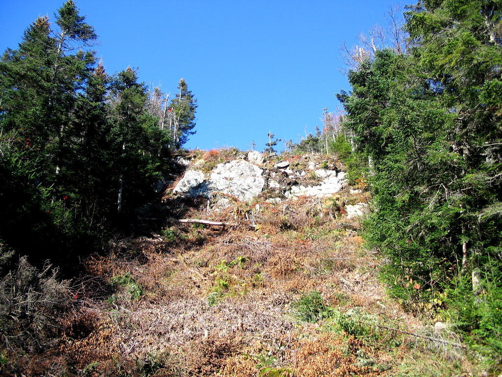
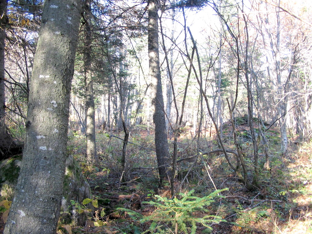
I got to the border on Route 3 and parked in the lot marked for hiking to 4th Connecticut lake. When the Nature Conservancy bought some of the land here a few years back, they set aside a few parcels as "Natural Areas", among them the land around 4th lake. They then developed a "trail" along the boundary vista to the lake. Basically this meant clearing some of the boundary slash away and putting in some puncheons in the boggy sections. It's not a highly engineered trail, you haven't got much choice along the boundary which takes no notice whatsoever of terrain, but it is a hellavalot better then the raw vista.
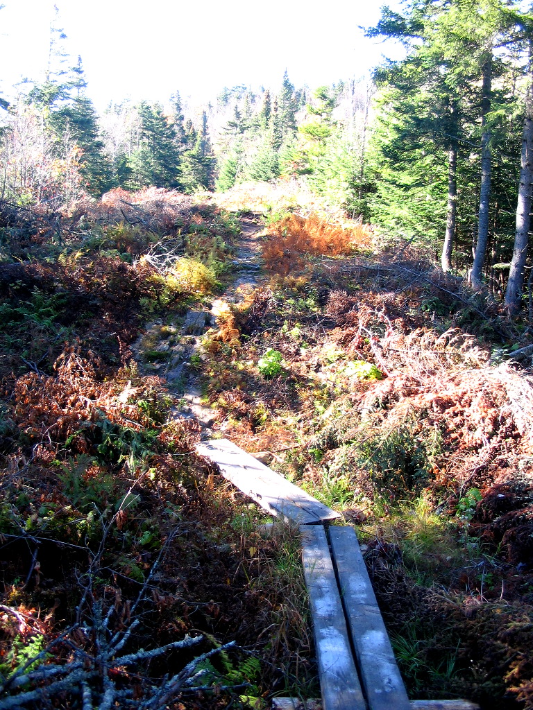 Some TNC trail work (Click for a larger image) |
I checked in at the customs station and said I was hiking to 4th Lake and Prospect Hill. They said fine, sign the register at the trailhead. I don't think they noticed that I mentioned "Prospect Hill" since nobody goes there (except of course some obsessed peakbaggers).
The west peak of Prospect Hill is on the NH200 list (is there no end to these lists? Is there a NH300 list? NH400?), but more to my interest, both peaks have IBC triangulation stations (aka benchmarks) set in 1916 when the boundary was reestablished and surveyed. The one on the East Peak is called PROS and the one on the West Peak is called SPECT. It took me a while to "get" this choice of names. How about you? Last August, Oncoman and I did the East Peak in the rain and found PROS. Today I would go after SPECT.
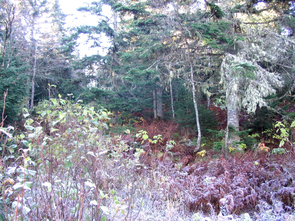
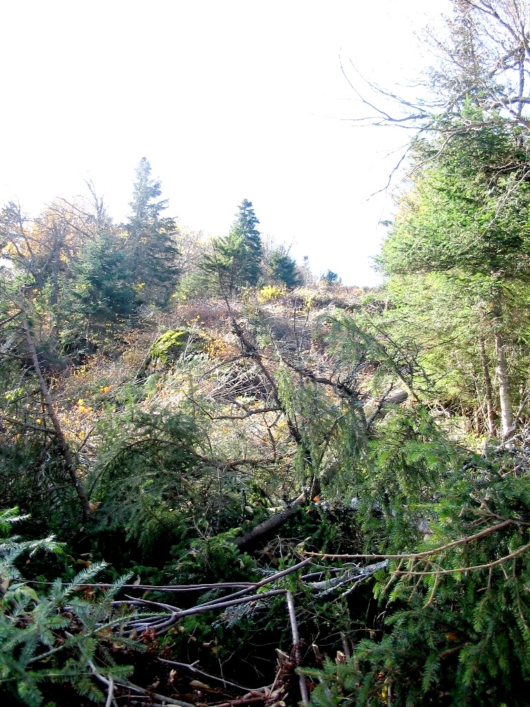
The hike is best thought of as 3 sections: from the road to 4th Lake (a trail); from 4th Lake to East Peak (slow going through slash); and East Peak to West Peak (slower going through slash over very rough terrain). I knew it would take longer than I thought it would take, but it actually took longer than that .
The day was beautiful, but with the open vista it actually got rather hot. Once past the cut off trail to 4th Lake I was getting wilted, especially with my stupid blaze orange knit hat (I thought it would be warmer than the baseball hat style they also had. It was!). Furthermore there were no (that is ZERO) hunters of any sort encountered.
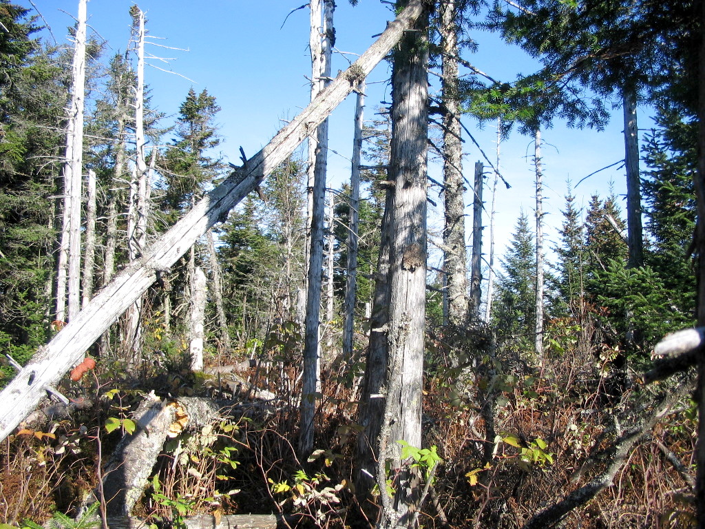
 The ledge before the East Peak (Click for a larger image) |
The going past East peak was slower still. The slash was more of a problem both because the cutting was more recent and because the vista is less often travelled and so there is less of a herd path through the slash. But the real kicker was the terrain. It was amazingly choppy. Right after East peak there were 3 knolls of about 10 - 12 feet in height in perhaps 100 yards. It wears you down.
I finally got to West Peak at about 12:30 - pretty good for 1/2 mile. I took a rest and a bite to eat and then started searching for SPECT. It was off the vista (so was PROS) and described as being on a ledge "at the extreme north northwest edge of the summit area". Not much to go on. I had the coordinates in my GPS which got me to within about 20-30 feet, but that left a lot of ground, mostly covered by blowdowns and scrub and with moss on every bit of rock. I found one partially exposed ledge in about the right spot and I scraped and dug and searched it but to no avail. I finally started back at 1:30. SPECK was unfortunately a DNF.
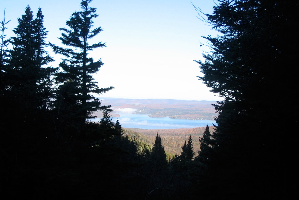
On the way back, I took fewer pictures and also did the side trip to 4th Lake. I got to the Lake at 2:40 and took the path that circles the Lake. It's a lovely little Lake (you would call it a pond) and at it's outlet, the Connecticut River was a mere trickle. It was idyllic and I would have stayed and just enjoyed it, but I was tired and it was getting late.
|
4th Connecticut Lake (Click for a larger image) |
I got back on the vista and made it to the car at 3:45. That's about 5 1/2 hours! Wow, that was sloooooow!
As I was getting my self unburdened and eating a few snacks at the car, the customs guy came ambling over. He said I took a much longer time than most people doing this hike. He said they were getting concerned. I got the idea they weren't worried about my safety but were suspicious I was somehow up to "no good" on the boundary. Well. I just played it straight and told him about my hike to Prospect Hill and how slow it was going through the recent cuttings, blah, blah, blah. After a bit of this chit-chat I guess he figured I was not smuggling any WMD into the country from a secret stash in Canada and ambled off.
If you do this peak, I'm sure you'll do it faster than me, but be prepared for rough going. And tell the customs guy that you will take significantly longer than those just going to 4th Lake.
By 4:30 I was back at Tall Timbers. It was a moderately long day, but I was very tired due to the nature of the boundary vista travel. I took a well diserved shower, a nap and had another scrumptious dinner.
Benchmark log: MON 484 WEST POST IBC (Found)
Benchmark log: PROS (Found)
Benchmark log: SPECT (Not Found)
| F |
I got to the place and it was immediately obvious which one was he was (I had never met him). He was the one who (like me) didn't look like a local. If you know the kind of place this is, you know exactly what I mean.
He had driven overnight from Maine and had arrived early and had stopped at First Comnecticut Lake to watch the full moon over the lake at 5:00 AM. We had our coffee and breakfast and decided on our agenda. We would start with Rump and then depending on the time, drive up to the end of East Inlet Road and either hit Monument 475 (above Rhubarb pond) or whack across to some logging roads in Maine to bag Bowman Hill.
I had a good idea of approaches to Rump and wanted to look for the ME/NH state boundary monument No. 118 that sits on its west slope. We took a logging road off of East Inlet Road about 6.5 miles in (just before a bridge which is just before a building) and followed it about a mile to where
 Into the woods (Click for a larger image) |
We headed into the woods at about 8:50 and headed for the state boundary monument, which was slightly south of a direct bearing to the peak. We went through fairly easy, open areas, but with a number of wet bogs. When we got to the boundary line we were lucky - surveyors had flagged most of the trees with orange flagging and also had placed small yellow boundary signs on major peaks. I figgured we were a little north of the monument, so we followed the line south and voilla! in about 50 yards, there it was! A stone with a brass disk mounted on top set in a cluster of other stones. It was in great shape and could not have been easier to find. It was around 9:30 when we found it and it made my day. I figured if we found nothing else, it would be a win for me. Gamehiker, of course, had other ideas, so yes we proceded onward to Rump's high point.
 ME/NH State line monument No. 118 (Click for a larger image) |
Now we were in Maine and it seemed like the way life should be . Rump has two peaks on the ridge line, the higher being to the east. We were south of the ridge line, so we decided to contour around the west peak and then follow the ridge on the south side. This side of the mountain gets fairly steep, so we had to move up onto the top of the ridge to avoid the worst terrain. Unfortunately this was rather scrappy. But it was not a tough bushwack. Somewhere between easy and hard (like most of life ) We got to a steeper (and scrappier) area close to the peak and finally found ourselves at the highh point. Actually high points! There were 3 high points and of course they all looked like they were the highest .
We tried them all and the last, nmost northerly one was paydirt. There we found not one , not two but three jars tied to the same tree. One was broken, one was half full of water and the third had a register. It was 11:10 AM.
As Gamehiker read through the log, I searched for the triangulation station that was supposed to be here. It was described as being on the highest peak of the mountain, but there was no guarantee that the surveyors who had set it in 1916 had picked the same point as the 3K baggers had picked.
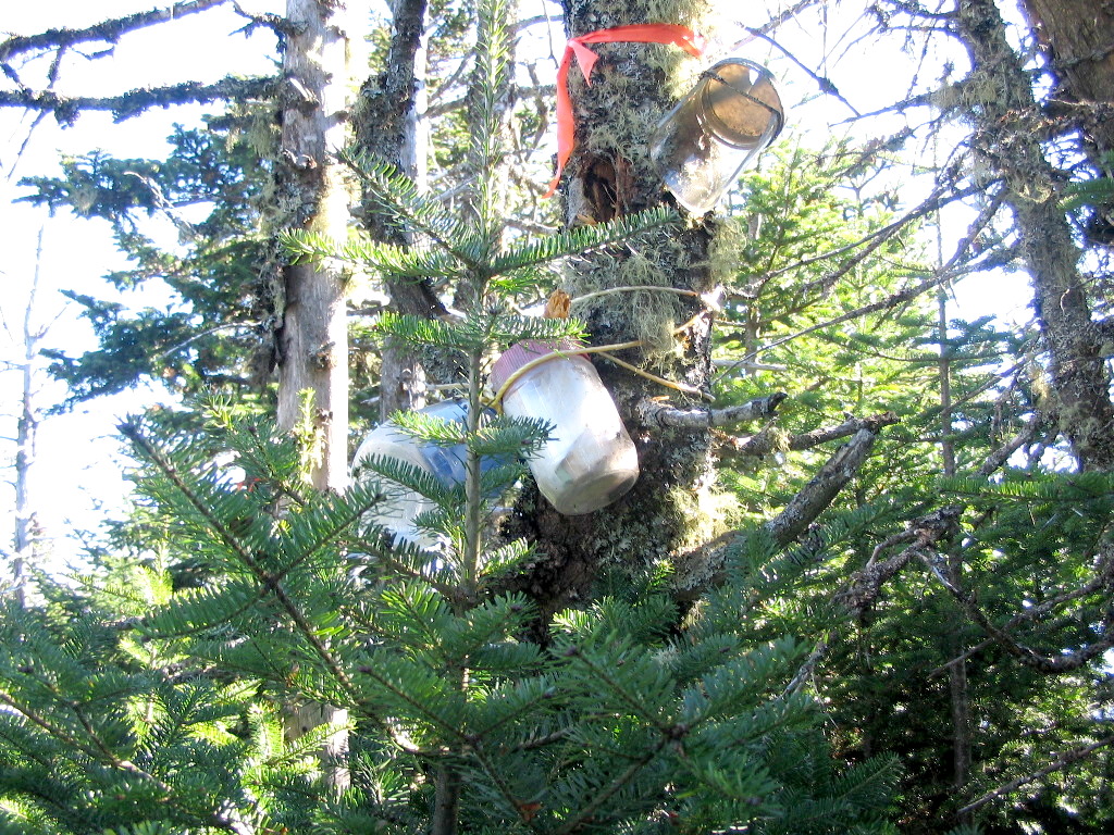 The three register tree (Click for a larger image) |
After about 1/2 hour we started back, but this time we decided to contour along the north edge of the ridge and we found the going much easier. Unless you are planning to look for the state boundary stone, I suggest this route. We eventually found our way out to the logging road we had taken in, but further north. We got to the car around 12:40, a much faster exit than our entry. It had been an easy whack, I found my boundary marker, we found the canister(s) and the day's weather was perfect.
Now we set off towards the end of East Inlet Road, but for several reasons we didn't bag either of our secondary goals. We attempted to find state line marker No. 122, but it was not there. We found the state line and we found the spot with flagging all around and trees blazed on either side of the spot, but no marker stone. We assumed the surveyors had been there and had found it damaged or missing. Too bad .
We did some site seeing at several lakes and ponds and got back to the Lodge a bit early. Gamehiker took a nap and I did some reading.
That night we went to the Buck Rub Pizza Pub and that place was a blast! If the Pittstop was a hang out for early risers, this was one for late night-outers who like their drinks. One drunk guy entertained us for most of an hour till he got tired and drove off in his pickup truck. I'm glad we were inside and not on the road. Another great day in the north country.
Benchmark log: RUMP IBC (Not Found)
| G |
Trumbull? Never heard of it? It's the unnamed 3277' peak between Salmon and Durban, sometimes known as Snag Pond. I call it Trumbull since the IBC triangulation station TRUMBULL sits right on the highest point of the peak, whereas Snag Pond is a small boggy body of water far below.
We ate at the Pittstop again and got driving by about 6:50. Spotting the car would take some time so we were looking for an early start. We arrived at the parking lot for Border Pond, about 13 miles up East Inlet Road, and I got my pack and supplies out and left the car. Then we took Gamehiker's car back to the Logging road that goes west towards Salmon about 10 miles from the start of East Inlet Road. It curves around towards the south and parallels Salmon's east ridge. The road deteriorated rapidly and I got out after about 1/2 mile and Gamehiker was off for his own adventure. It around 8:00 AM, not a bad start.
I had to walk about a mile along the logging road. There are several grassy open areas, perhaps long forgotten logging yards, and the road deteriorates into no more than a trail. The choice for the bushwhacker is how far to go along the road. The road and ridge line converge so the
 Open Hardwoods (Click for a larger image) |
The route was entirely open, mostly hardwoods until the steeper sections of the ridge. I erred to the right (west) consistantly so I ended up heading almost straight for the high point. There was a bit of scrambling and root grabbing on the steepest spots, but nothing at all problematic. After about 1 hour and 30 minutes I topped out on the ridge and found the herd paths I was hoping to find. Oncoman had done ths peak in August and described many paths leading down this ridge which I was ascending. After a mere 10 minutes I arrived at the high point which was an open area with numerous standing deadwoods. And there with no searching needed - the jar was tied to a tall deadwood in the center of the area.
I took a few minutes here ro read and sign the register. As I suspected, Oncoman's was the last entry. Then it was off the 100 yards or so to the boundary vista. Herd paths were waiting for me and the elevation dropped 20 feet of so and then I was there. I had made the trek from the dropoff point (including about a mile of road walk) in less than 2 hours. This was indeed and easy mountain.
 The Salmon Summit (can you spot the jar?) (Click for a larger image) |
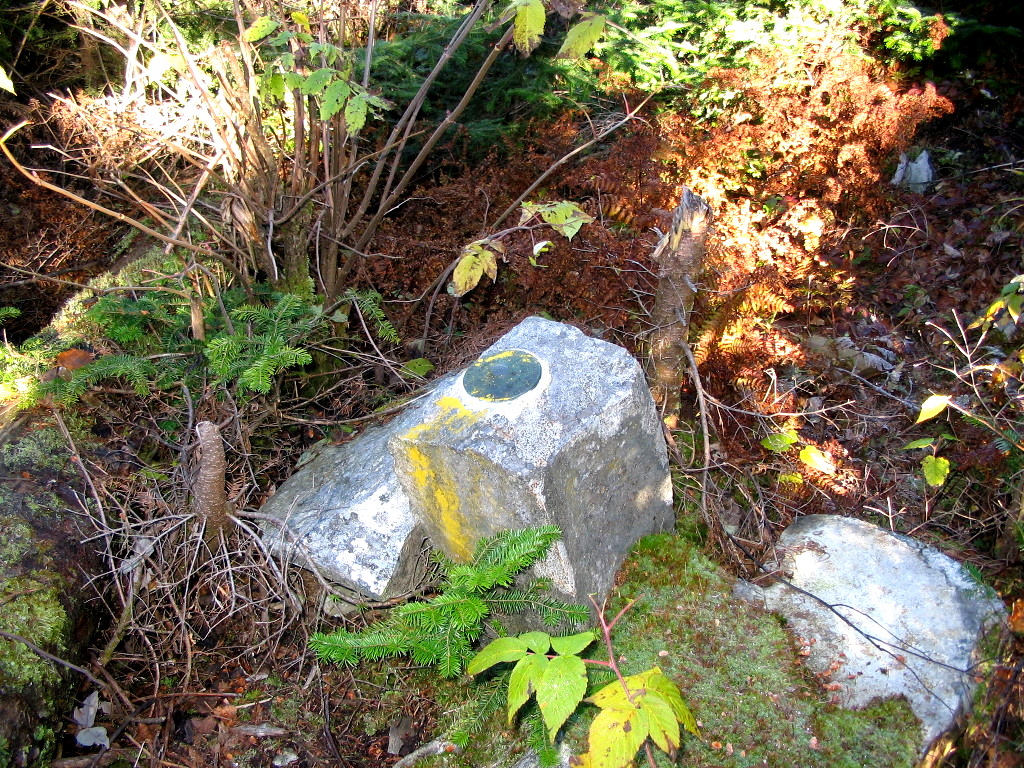
But I was not done. I intended to search for IBC traingulationm station SALMON which was described as on the boundary line at the highest point. That seemed to be off to the south and about 100 yards from where I was. There was a hunter's blind on the US side right at the top and as I got close I spotted a rock on the boundary right in front of it. And there in plain view was my marker. Like all of these marks set in 1916 it was a standard 2 inch brass disk engraved "U. S. & C. B. SURVEY" with a triangle in the center. There is no identification stamped on the disk. So it was one canister and one benchmark - I was hitting 1000 percent. - And it was still only10:00 AM.
I took some time for pictures and food and enjoyed the open views along the vista. Great peak, great weather.
Now it was off to Trumbull along the boundary vista. Oncoman had said that except for one bad spot, this section of the boundary was not too bad. Well, things had changed. It appears a crew had come through to clear all the brush and trees from the vista. And as per their custom (at least recently) the slash was left in place. Moreover, a number of fairly substantial trees which were at the edge of the vist had been cut, and naturally they fell across the vista. It was almost as if they were intentionally trying to make travel along the boundary difficult (for ATVs? terrorists?). And difficult it was.
Getting down off Salmon was not so bad, although it was slower going than some other spots I have hiked this year. But there was one spot just before the low point between the peaks which must have been Oncoman's "Vista from Hell". When he went through in August he described it as the
 The Vista from Hell (Click for a larger image) |
At the low point stands Monument 478, but the top was broken off. In this case I don't think it was vandalism. It was in a saddle with bogs on both sides and slopes too steep for ATVs on the vista. It may simply have rusted through. But its a shame seeing these historic monuments, set in 1845, destroyed.
From this point over to Trumbull, the going got worse. The slash was relentless and the few clear sections were quite a relief. I finally arrived at the summit at just about noon and there was the jar on the US side (behind a pile of slash you had to climb over) and there on the center of the vista were several rocks with some surveyors tape in the center. I looked down and there between the rocks, about 6 inches down, was my tri-station! This was unusual. The IBC mostly ignores these stations and they are more interested in finding the line markers which physically define the border. My guess is that they found this and thought it was a line marker, perhaps wondering at the peculiar design of the disk. There is supposed to be a line marker (No. 477-33) just 24 feet away which was not marked (and which was probably buried - I coiuldn't spot it). Perhaps they thought this disk was 477-33. But I knew what it was. Here's the picture:
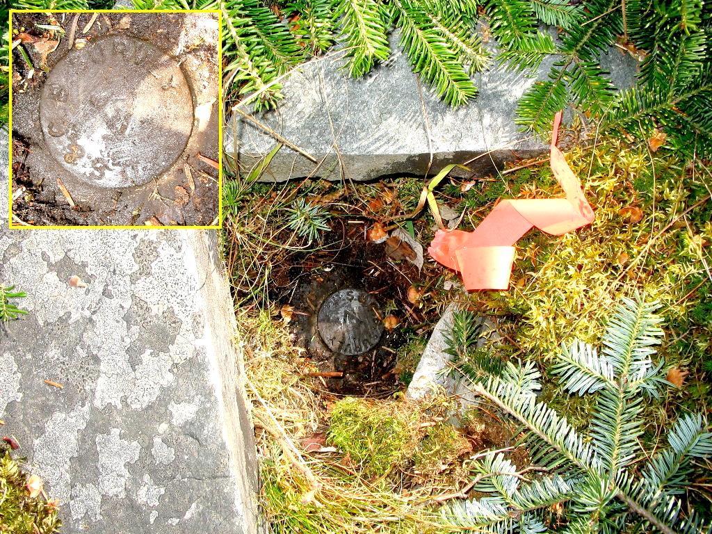 IBC Triangulation Station TRUMBULL (Click for a larger image) |
Now with two peaks, two canisters and two benchmarks for the day, I ws done . There was only one slight problem - getting back to the car. I had about a mile and a half of vista to traverse followed by a half mile on a very faint road. So off I got.
I must say the views from the vista on the north side of Trumbull were spectacular. Megantic, Marble and the two Saddles, Twin Peaks and Barker all stood out. But it was slow and tiring and I was hot from the extended time in the sun. Even beautiful fall days can have a downside.
I somehow got through this - at one point I whacked down a section in the woods on the US side of the vista to avoid the slash. Finally I got to monument 477. From this point you can practically dive into Boundary Pond and I could see all the way to the earthern dam that Gamehiker and I had visited yesterday. There was one more up hill which I plodded up to the point where the Boundary Pond road comes in from the right. This is hard to spot, but on the Canadian side it's a well defined road (plus there is a hunter's blind at this spot), so you will find it if you know where to look. As expected, I lost the road once, and found it again (just like in August). Finally at 2:25 I was at the car. A long, tiring but very productive day. Well worth the effort. Advice: if you do these peaks and hope to add Durban to the mix - prepare to move slower than you might think along the vista.
So now it was off to try to bag Vermont's Monadnock (which I arrived too late for), back to Tall Timbers, and another visit to Buck Rub's. Tomorrow I would be back in Natick with my family to celebrate my birthday.
Yes, I am having fun yet.
Benchmark log: SALMON IBC (Found)
Benchmark log: MON 478 IBC (Found)
Benchmark log: TRUMBULL IBC (Found)
|
Click here for a complete set of albums from these hikes Back to the Hiking / Peakbagging Page Back to Papa Bear Home Page |