The Map
(Click on this or any picture for a larger image)
|
The Map (Click on this or any picture for a larger image) |
|
Click here for a complete album of photos from this hike Back to Papa Bear Home Page |
|
Click on an entry to jump to a particular section: |
|
|
An Ordinary day Preparation The Bronx Manhattan |
Queens Brooklyn Staten Island What was it all about? |
| T |
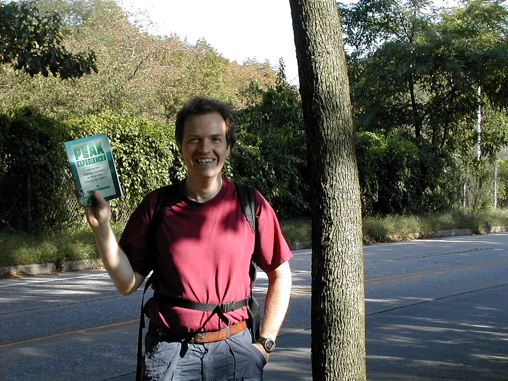
Yes, a very ordinary day in the city. ... But something out-of-the ordinary was about to happen. Something in fact so extraordinary that there is no record of it ever happening before. Funky Freddy and Papa Bear were about to match their wits, their courage and their strength against the topography, the mean streets and yea even against the best that the Metropolitan Transit Authority could throw at them. Fred and Papa Bear would attempt climb to the highest points in each of the 5 boroughs of the great city using only the power of their own legs and the publicly available services of the subways, the busses, the trains, the ferries and any and all types of conveyance the city had to offer.
There are records of the occasional intrepid soul who has summited all the city's high points, and even of one or two who managed this feat in one calendar day. But never has it been recorded that this was ever done in this unique and difficult way. In fact minutes of research (many minutes) on the internet turned up exactly no instances of this ever happening. Today all those soon-to-be former heroes with their SUVs and their Humvees and even their poor GEOs would be put to shame. Today was the day the New York City 5 Borough Mass Transit High Points Challenge would be accepted and accomplished.
| W |
| T |
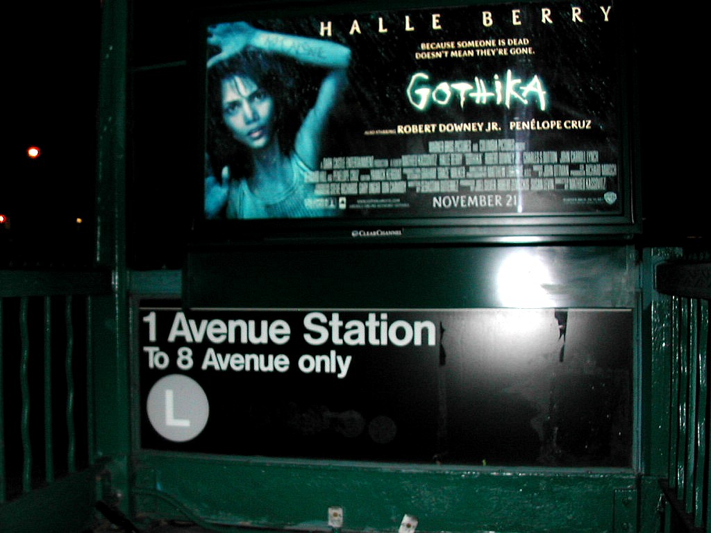 Gothika watching over the L Train Station |
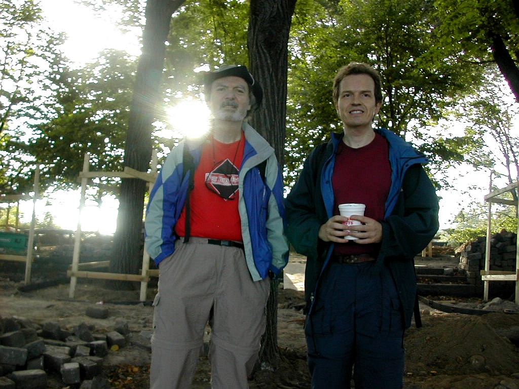
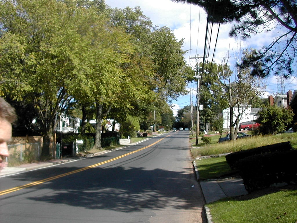
I was now officially off to the Bronx. Funky Freddy got on at Times Square as planned, and we chatted during the long ride all the way to the end of the line in the Bronx. I had met Fred on the Internet but this was the first time we had met in the flesh. After 40 minutes of travel time and 12.3 miles, we came to a halt at the final stop, the elevated station at Broadway and 242nd Street. The green of Van Cortland Park lay to the east of Broadway and small shops with houses and apartments behind lined the west side.
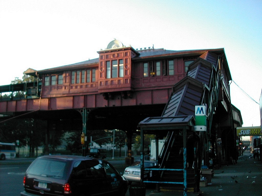 The elevated 242nd Street station |
| T |
We passed the impressive Horace Mann School on the right and after another block we swung to the right onto Waldo Avenue. Waldo swung around to the left as it climbed the hill and became 250th Street. We were now in the private community of Fieldston where the lawns were green and the houses were huge. The streets were marked "No Parking, Private Streets" and you could just smell the money. Some of the street signs were of a very old type with white writing on a blue background and these were nailed to very old and beautiful trees. We crossed the double laned Fieldston Road which seemed to be the central thoroughfare of the neighborhood. A few dog walkers and joggers were about and we amiable said "hello", "hello",
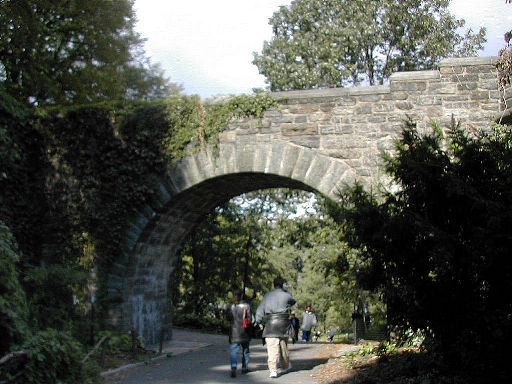
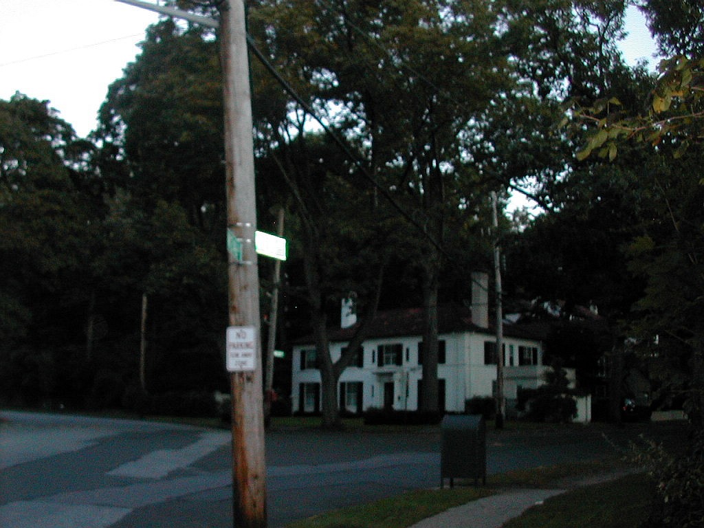 Turning onto a dark street |
One block past Fieldston Road we took a right on Goodrich Avenue which dead-ended in about a block. Some of the published directions say to go another block to Grosvernor Avenue before turning right. Grosvernor also dead-ends and is actually closer to the high point, but Goodrich leads to a gate into the enclosed area of the high point. Following Grosvernor will just bring you up against a tall chain link fence and all you can do is look through at the higher ground beyond.
For some reason, the very top of Fieldston Hill is totally undeveloped and is enclosed by a barbed wire topped fence. Access through the gate at the end of Goodrich must be obtained from the land owner. I called the owner's representative and he voiced no objections to my entering but he did say he would run it by his boss and get back to me. He never did, so I took silence for consent and in we went. The area is thickly wooded with second growth with a few old large trees, perhaps from an earlier era. There are a few cellar
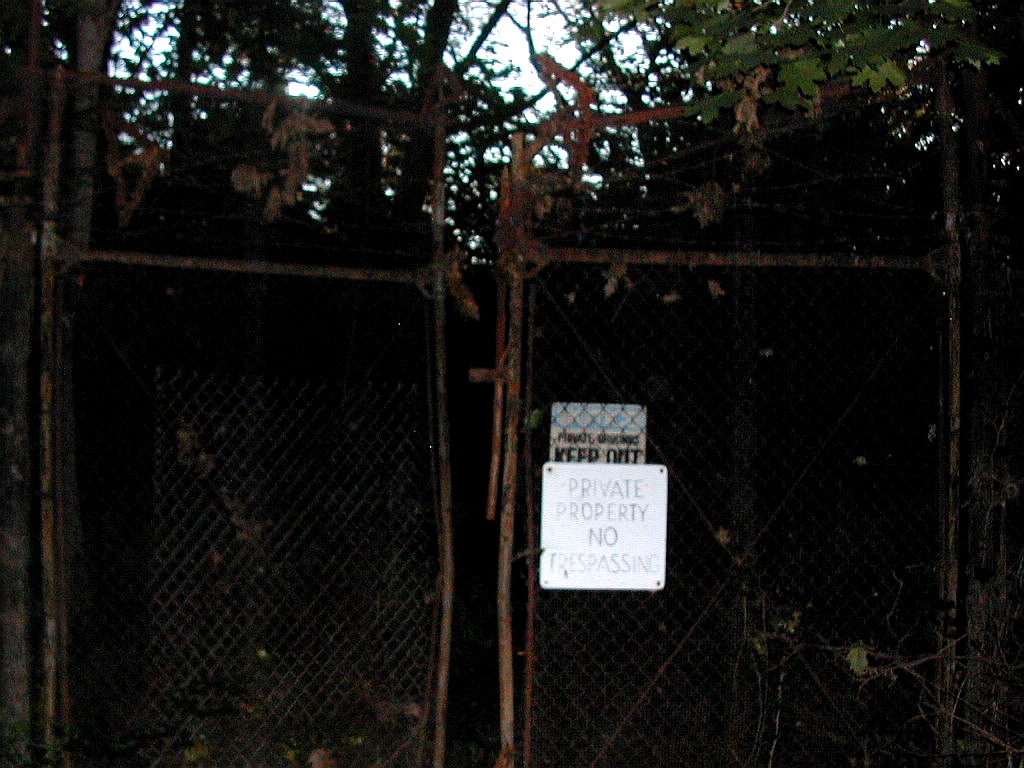 The gate to Fieldston Hill |
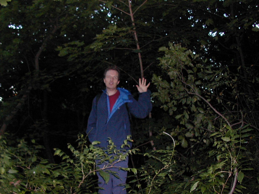
We worked our way in, climbing over the occasional abandoned car and stepping over trash and brush that had been stashed here. There was no discernable path and the ground was covered with briars and brambles. This was bushwhacking a la The Bronx. We found what seemed like the highest spot where a large rock lay after about 10 minutes. We were actually near the fence which ran along the south side of the lot and were probably near the end of Grosvernor. We could occasionally see a large house through the trees as we worked our way west. The Riverdale Country School is supposed to lay just to the north of this lot, but we had not a glimpse of it. There were no views whatsoever. We took the obligatory pictures and made our way back quickly. This was the sort of neighborhood you didn't want to be found prowling around behind these huge houses, permission or no permission. We got back out through the gate and set off, retracing our steps down the hill. The sun had risen sufficiently in the 20 or so minutes it took us to get here that it was now quite light out.
|
|
| Summiting Fieldston Hill | |
When we arrived back at Broadway it was almost 7:30 AM and we got some coffee and something to eat at the Dunkin Donuts near the train station. The trashy commercial area here was quite a contrast to the stately houses in Fieldston, a few blocks up the hill.
We climbed the stairs and got on the #1 Train headed back down to Manhattan. It was one down and four to go.
| M |
 Bennett Street beneath the escarpment |
We waited a moment for the car to arrive and then stepped in. These elevator cars are huge and must hold at least 20 people and are manually run by an operator. In this day and age don't ask me why that is. I'm sure you can think of a few reasons. I wanted to get a picture of the woman running the elevator and I was inspired to suddenly say "We're from Kansas, can we take you picture?" I figured she would know that no real New Yorker would want to take pictures in an old elevator car, but tourists certainly would. Fred bit his tongue to keep from bursting out laughing and went along with the gag. We got our picture and a pleasant "Have a nice day" and in a few minutes we on the top of the ridge at the entrance to Fort Tryon Park.
 The entrance to Fort Tryon Park |
The land for the Park was bought by John D. Rockefeller in the early part of the 20th century. In 1931 Rockefeller hired Frederick and John Olmstead, sons of the famous designer of Central Park to landscape the park, he financed the building of The Cloisters with its marvelous collection of medieval art, and proceeded to give it all to the City of New York. Now that's philanthropy! (Of course he got a good deal out of it: the city gave him several square blocks on the upper east side of Manhattan to build guess what? Rockefeller University!). When it was completed, Lewis Mumford, writing for the New Yorker in 1935 said: "I know of no landscape near a big city that
 "The Outlook" in Fort Tryon Park |
We entered the Park and walked north along a walkway and slowly climbed to the base of "The Outlook". This is the highest point in the park and consists of two sections:a stone rampart facing east topped with a flagpole, and a larger circular area facing west with a number of large trees on its flat top. Both sections look man made from the outside since a stone retaining wall 15 or 20' high circles both - which are connected by an obviously man-made archway. However it is impossible to know just what natural peak or pinnacle lies under the rock facing. The area had a construction sign and some yellow tape was strung to keep people from going up to the top, but we went anyway. After all we were on a mission.
A worker saw us and was about to say something, probably on the order of "you're not allowed up here", but I got the jump on him. Before he could say anything I immediately started to ask him questions. Basically I used the opportunity to 1) distract him and 2) find out if he knew what lay under the man made exterior of this high point. I asked if where they were working was it just dirt or rocks underneath? Was it natural or man made? He said both,
|
|
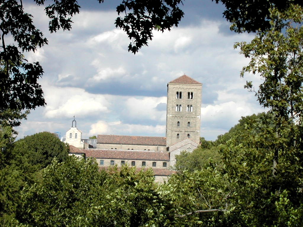
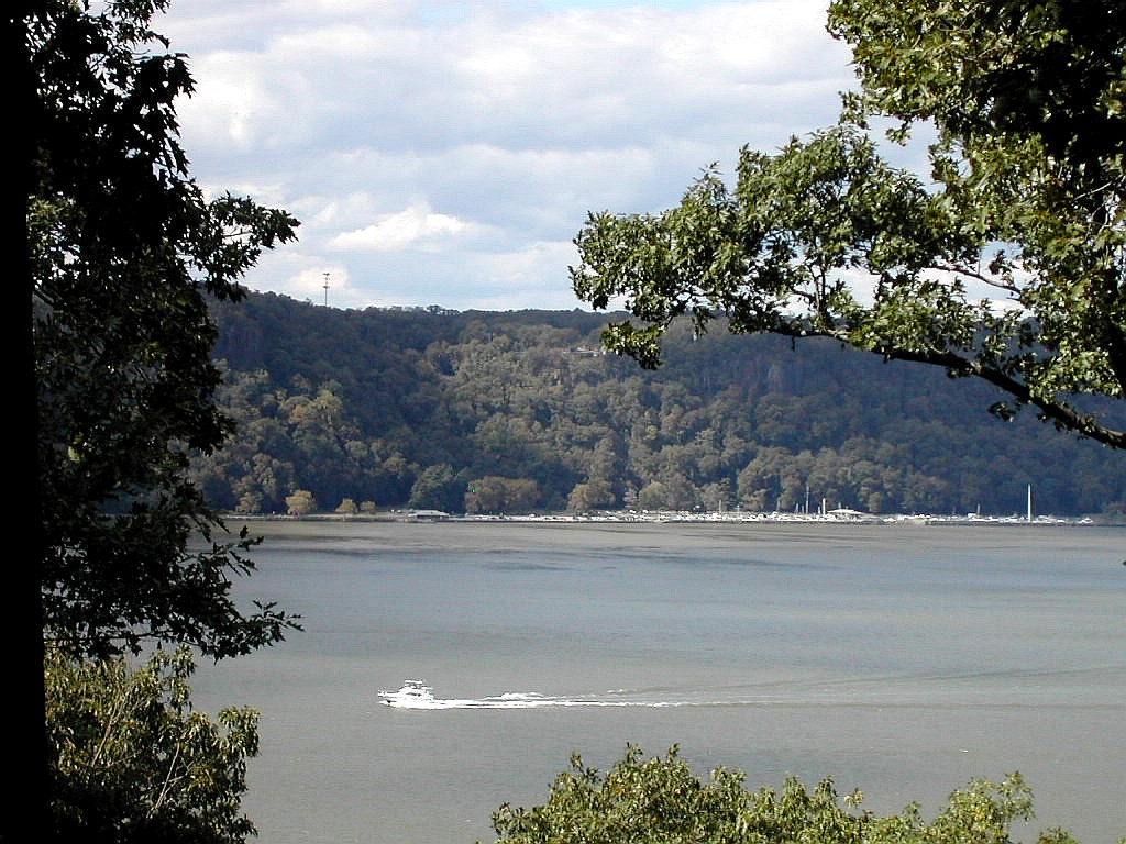
| Views of the Cloisters and the Palisades acrosss the Hudson River | |
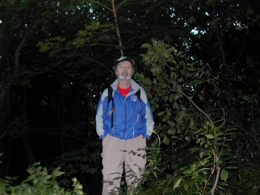
but he didn't really seem to understand what I was getting at. Fred then followed up with a line about making a film about the colonial era in cooperation with the Parks Department, and finally we co-opted him completely by making him a partner in our trespass: we asked him if he could please take our picture, which he was happy to do. We left, having summited the high point and knowing once again the truth of the saying that a little BS goes a long way in NY. Having done what we came to do, we took a few more photos of the spectacular views and headed south to Bennett Park which lies between 183rd and 184th Street. On the way we crossed the Tryon-Bennett col, also known as 187th Street. More impressive views are available from a lookout just to the west of this col. Soon after we came to Bennett Park.
As it happens, Bennett Park is where the main fortifications of
Fort Washington were located, so it is connected to
the high point in Fort Tryon Park by history as well as by elevation.
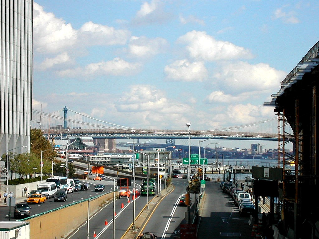
But we could not linger, we were on a schedule. We had a bus to Queens to catch in midtown at 9:00 AM and it
was 8:17 AM and we were miles away. We had to get a move on, so we headed down the 3 blocks along Fort Washington
Avenue to
181st Street to catch the A Train. By 8:25 AM we were headed downtown. Now it was two down and three
to go. Queens here we come!
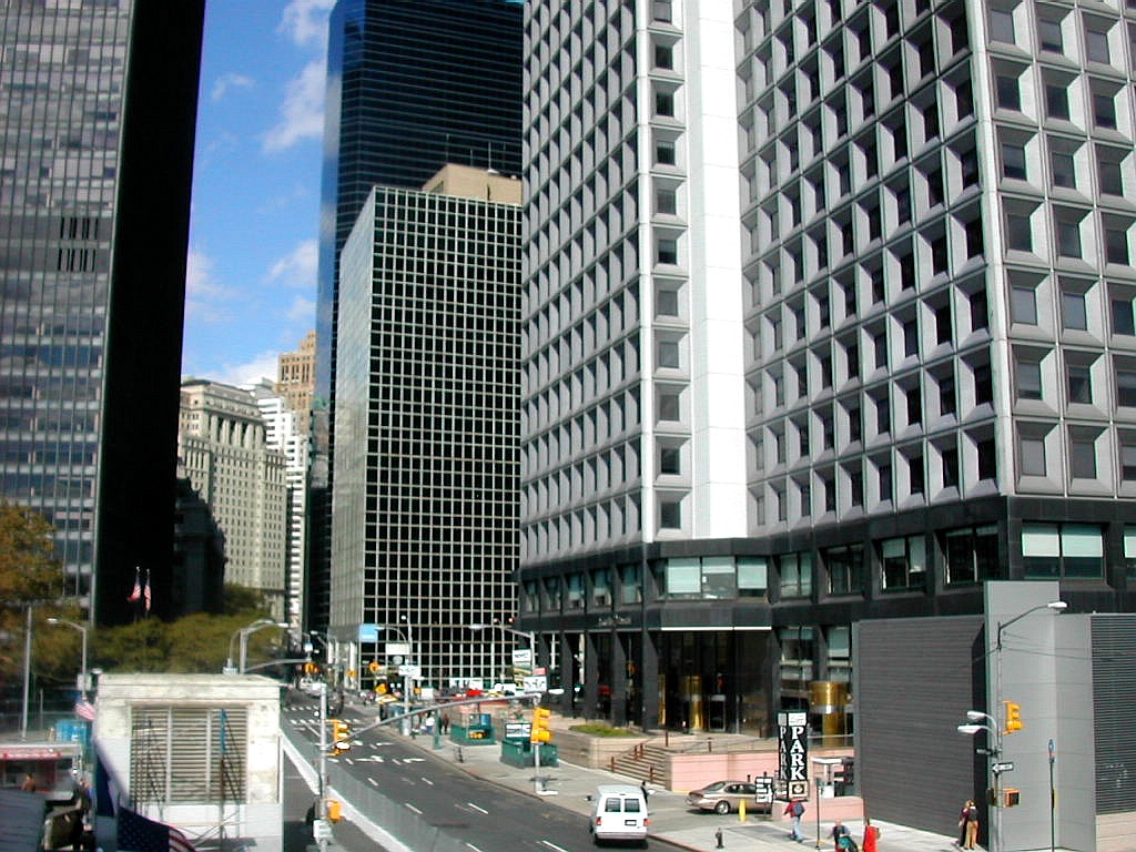
Manhattan stats:
| |
| Q |
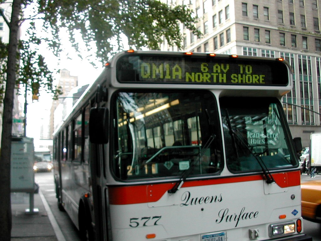 Boarding the express bus to Queens |
The driver was waiting in the bus when we got there and he opened the doors for us at 8:59 AM, and we took our seats in the back. Now we had over an hour and more than 20 miles to travel to just about the furthest point in Queens that you can get to: the village of Glen Oaks at an apartment complex known as the North Shore Towers. During the long trip we spent our time reading the NY Times and chuckled over the stories about Ming, the apartment tiger and the story about "Flugstag". We managed to get through the whole paper and had a few snacks to fuel us up for the grueling task which lay ahead of us.
 A small shelter on the way to the peak |
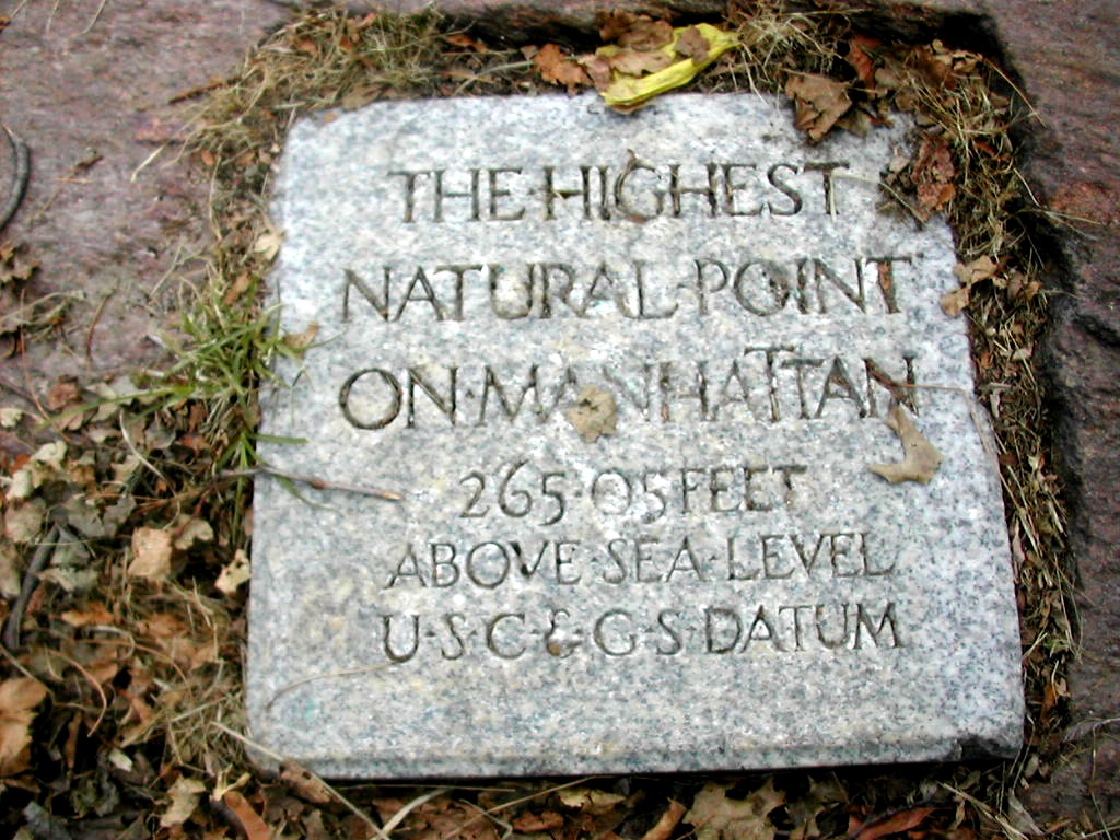
The high point was at a fairly obvious if inauspicious point on the side walk. "We came all the way out here for this!" Well, we chuckled at how silly this was, but we did the deed and took a few pictures. On the other side of the fence lay the golf course and we assured ourselves that nothing over there seemed to be higher than where we stood. We did not need another fence to climb today! Curiously the elevation (260+') was the same as the high point in Fort Tryon Park in Manhattan. The "+" means the high point is somewhere within the highest contour line, 260' in this case, with the actual high point unspecified on the topographic map. The spot here has no name and I dubbed it "Mount Queens". Another trip report I read called it "North Shore Towers Hill", but since the Towers will eventually fall, but the hill is forever, I think Mount Queens has a better "ring" to it.

|
|
| Atop Mount Queens | |
We did need to move along briskly however, since we had another .4 miles to walk to the Q79 bus stop and the bus was due to arrive in 7 or 8 minutes. At the bottom of the hill we crossed Little Neck Parkway just where Exit 24 of the Grand Central Parkway is located. The bus stop was right there and we had 3 or 4 minutes to spare.
The Q79 was right on time, as usual, and we were off to Floral Park. This is another pretty village that straddles the county line about 2 miles south of Glen Oaks. Before we knew it, we were there and we asked the driver for directions to the LIRR train station as we left the bus. "Just turn left at the Masonic Temple and you'll see the train station a few blocks down". As we walked down the lovely Tulip Street past the Floral Park Post Office we were
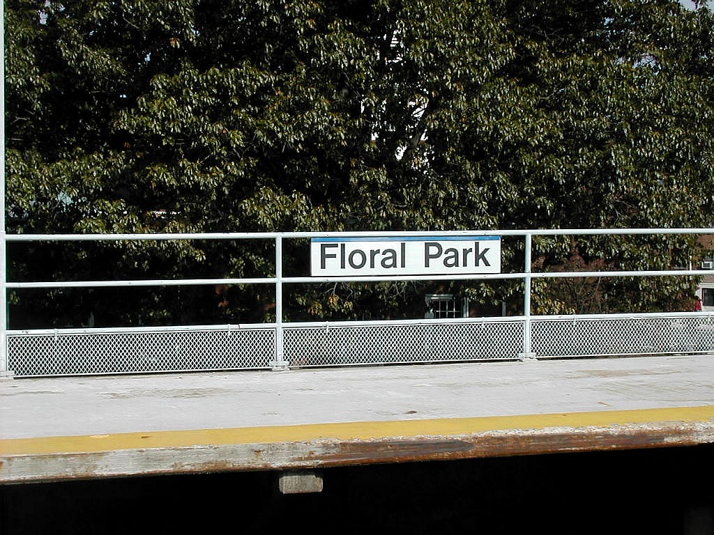 Waiting for the train at Floral Park |
We bought our tickets, the
train came exactly on time and we had about 35 minutes to relax before arriving at
Flatbush Avenue in Brooklyn. We were now three down and two to go, the weather was still great, the schedule was
working flawlessly and we felt just fine.
| T |
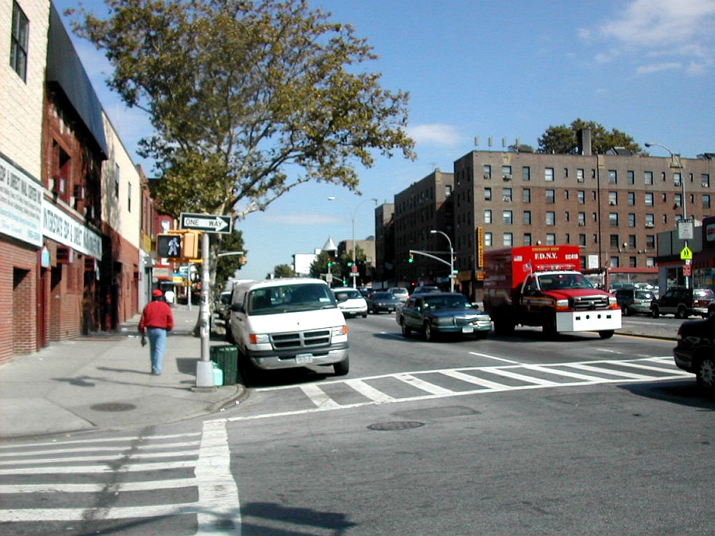 Fourth Avenue and 25th Street, Brooklyn |
We boarded the R Train and in a little over 10 minutes we arrived at the Fourth Avenue and 25th Street station, just a block from Greenwood Cemetery, home of Brooklyn's highest point.
As we climbed the stairs from the subway and arrived in daylight just a few minutes after noon, we were struck once again by the beauty of the day. Behind us down the hill, was the Brooklyn waterfront with warehouses, tankers and container ships. Ahead of us was 25th Street leading up the hill through a manufacturing and warehouse district. Fourth Avenue itself to the left and right showed lots of commercial activity with many small shops and apartments buildings in both directions.
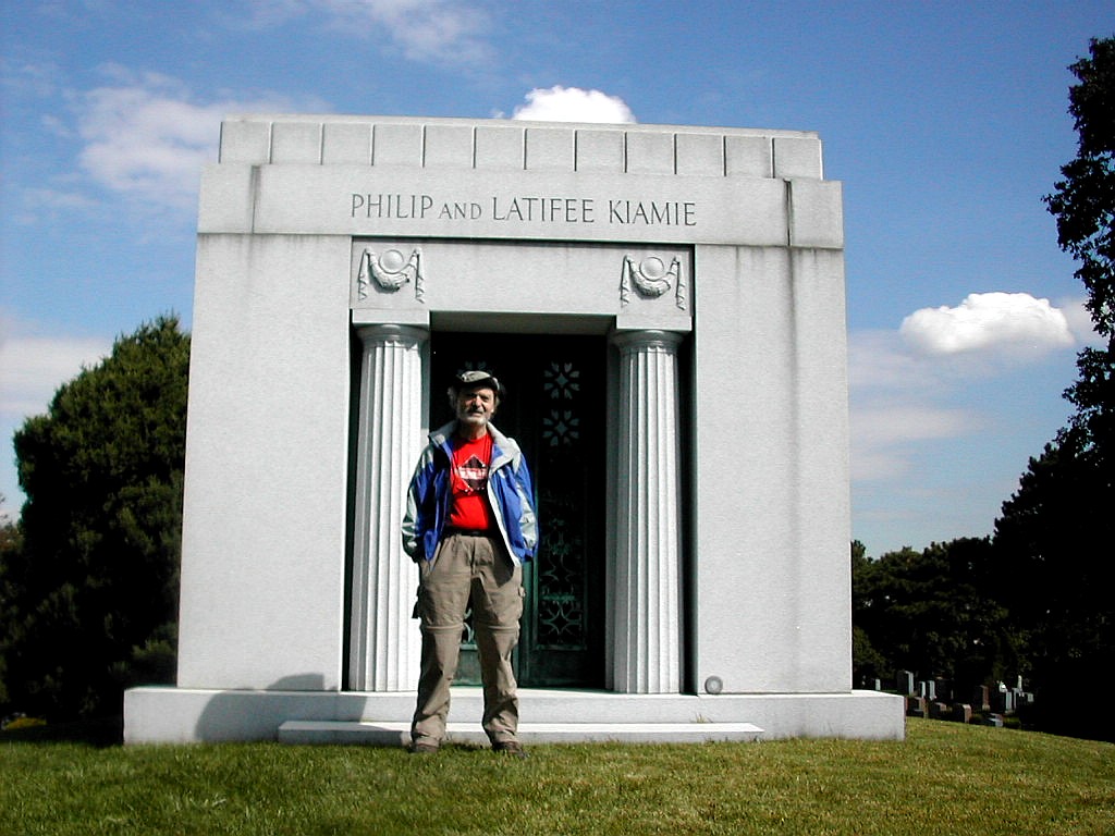
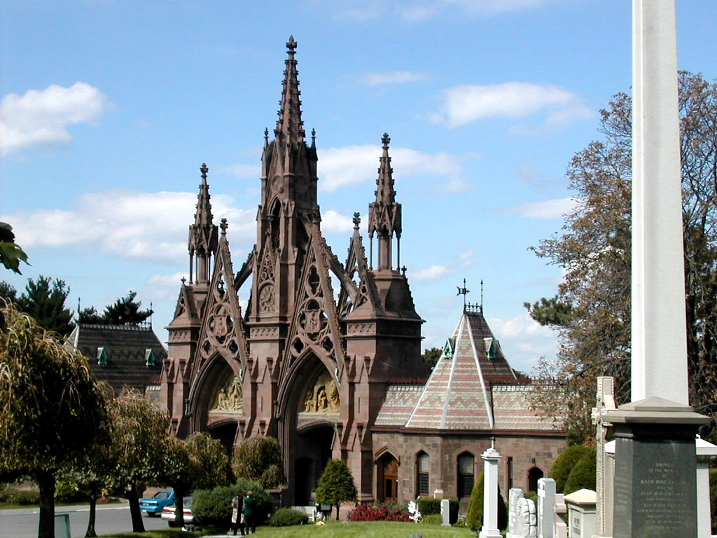 Main Gatehouse, Greenwood Cemetary |
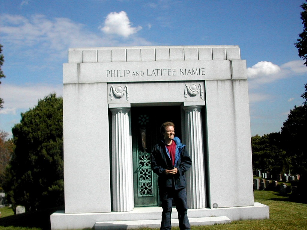
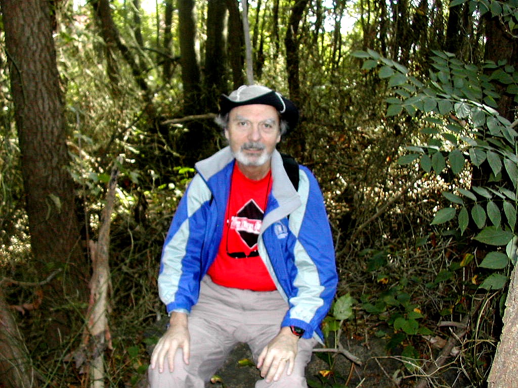
The main part of Battle Hill has a Revolutionary War monument and a Civil War monument. As we made our way higher, we could get views of the Brooklyn waterfront, Manhattan and the statue of Liberty in the distance. Just across a road from the monuments lies the highest peak in the area with a single mausoleum on the top. It belongs to Philip and Latifee Kiamie, who I think are names better known to high pointers than to anyone else. We made our
|
|
| Papa Bear and Fred at the top of Battle Hill, Greenwood Cemetery | |
|
|
| Views from Greenwood: New York Harbor and Lower Manhattan | |
We walked down the hill, past the ornate main gate and down to the 25th Street subway station and waited for the next R Train to take us back to Manhattan. It was now four down and one to go and we were beginning to smell victory!
| W |
|
|
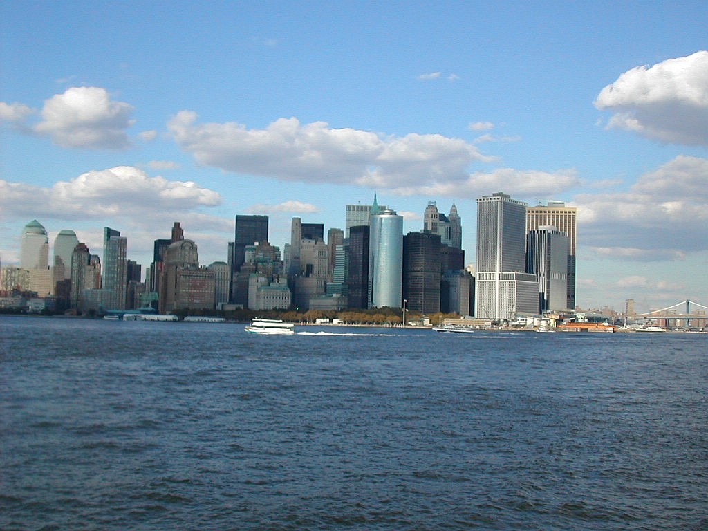
| Views from the ferry terminal: the East River bridges and the downtown buildings | |
terminal offers unique views of these sights. we also check out maps of our proposed route in Staten Island and we picked up a new Staten Island bus map which shows all the bus routes and all the streets. We were planning on taking the S74 bus from the Ferry terminal at St. George and getting off at Doctor's Hospital, a point about a mile west of Todt Hill. After carefully checking this new map we had an "Oops" moment. The streets that we planned to walk to get to Todt Hill shown on my old map were not there! I guess the map maker had consulted the city plans for these streets but they had never been built. There seemed to be a void right across
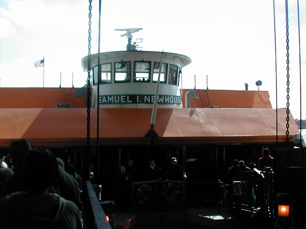 Boarding the Samuel I Newhouse |
So we carefully consulted the bus map to look for alternative routes. We had the whole 25 minute Ferry ride to puzzle out a solution. Fred came up with the idea of taking the S54 over the hill about a half mile east of the peak. I had originally rejected that idea since the S54 didn't go to the Ferry. But we found another bus route along Victory Boulevard where the S61, S62 and S66 all originated at the Ferry, went along Victory Blvd and crossed the route of the S54 before going their own separate ways. Looked like a plan was falling into place! This route, involving a transfer, was actually better than the original. If the time it took to wait for the second bus on Victory Boulevard was not excessive, we would do just fine.
So we enjoyed the rest of the ferry ride and took some pictures of the Statue of Liberty from close range. The ferry is free and gives the best views of the harbor. In fact the best views we had during all this day of high pointing was from the ferry, at elevation 0'. The City has a number of ferries, some build in the 1960s. Of all the transport we had taken all day (except for the elevator at 190th Street), these were the most venerable. But
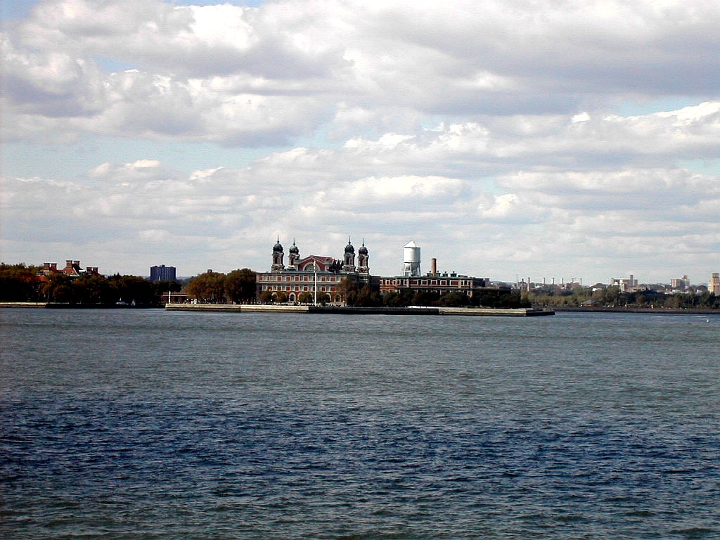 View of Ellis Island |
After a leisurely 25 minutes, we docked at the Saint George ferry terminal and made our way to the busses. About 20 different bus lines originate at the ferry terminal and they fan out all over the island. We found to our great relief that the S61, S62 and S66 all stopped at the same gate, so we went up and waited. Our strategy was to take whichever bus showed up first, since they all went along the same route. About 2:00 PM, the S66 bus showed up, and 10 or 12 people lined up to board. We got on and asked the driver about connecting to the S54, and he said to get off at Manor Road, which would be in about 20 minutes. So we sat back and enjoyed the ride through this, the least populated of New York's 5 borough.
Until the 1960s when the Verrazano Bridge was built, Staten Island was almost rural in character. My wife's family lived there and she remembered exploring through wooded areas in her neighborhood, now long gone, and horse back riding through Clove Lakes Park. The stables disappeared nearly 30
 Transferring to the S54 bus |
We asked the driver how long it was to get to Manor Road and he said "A few more stops". I think everyone on the bus knew where we were headed since two different women volunteered to make sure we got off at Manor Road. We got there about 2:25 PM and only had to wait about 3 minutes for the S54. Once again our schedule was working like clockwork. This route was straight up the side of Todt Hill and we got off about 5 minutes later at Ocean Terrace, across from the CITGO station.
Now we were on the last lap. Just a half mile to the summit and our goal would be met!. We walked up the gently sloping Ocean Terrace and eventually the side walk disappeared. A sign of increasing wilderness? A tall communications tower was visible at the top of the hill and we knew that was near the actual high point. Very near
 Climbing Ocean Terrace to the summit |
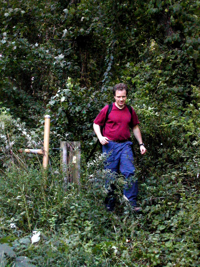
We soon came to a gated gravel road heading in towards the radio tower and the high point. Like the gate in the Bronx, it had funny signs about keeping something out but we figured it didn't really pertain to us. We soon came to the tower which was surrounded by a chain link fence but the actual high point was clearly around to the south, so we circled the tower and headed into the woods. These woods had the same character as the ones we had traversed in the Bronx some 8 hours earlier: thick second growth with brambles underneath. So we were bushwhacking again!
In about 10 or 20 yards we found what looked like the highest point and we took a few pictures. Fred then investigated another spot 20 or so yards further south and went over to it. To me he looked lower, but to him, I looked lower, so I followed him to the other spot to bag that as well. The topo map actually shows two closely located spots both rising above the 410' contour so we had evidently found them both. I crossed an overgrown grassy road (which I later
|
|
| Todt Hill: Fred on the North Peak, Papa Bear on the South Peak | |
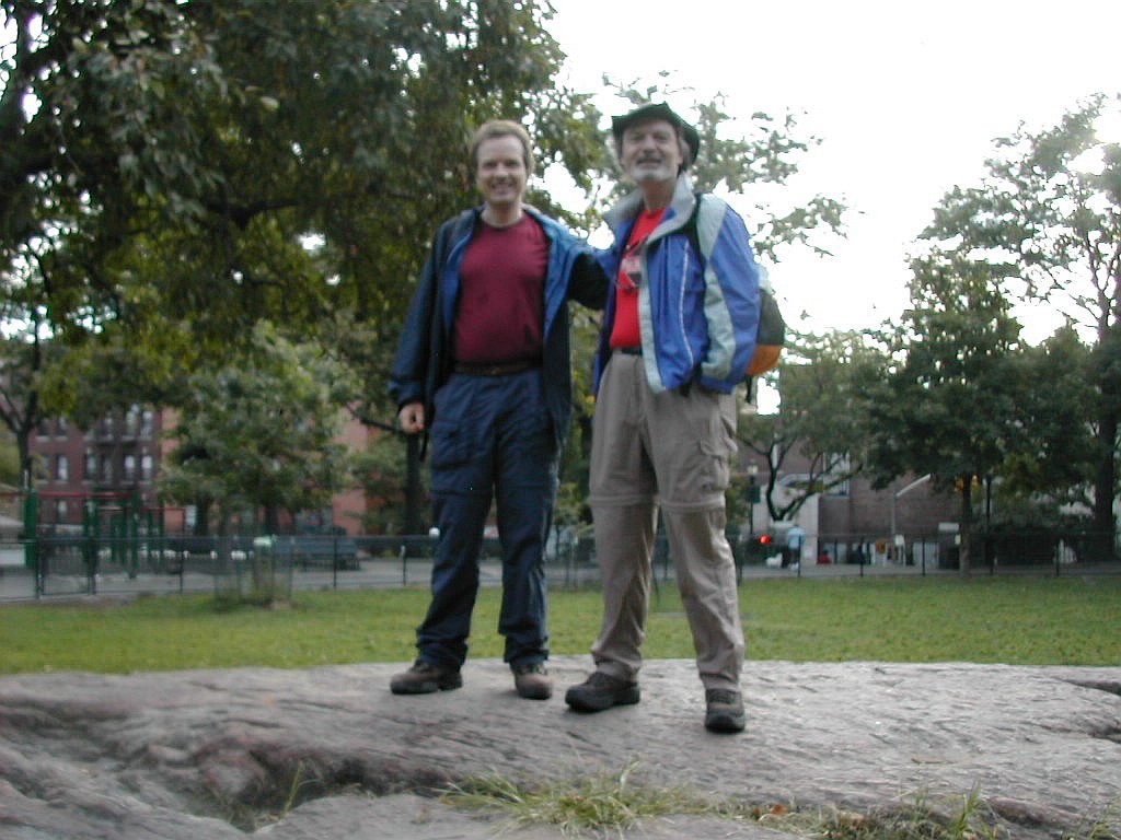
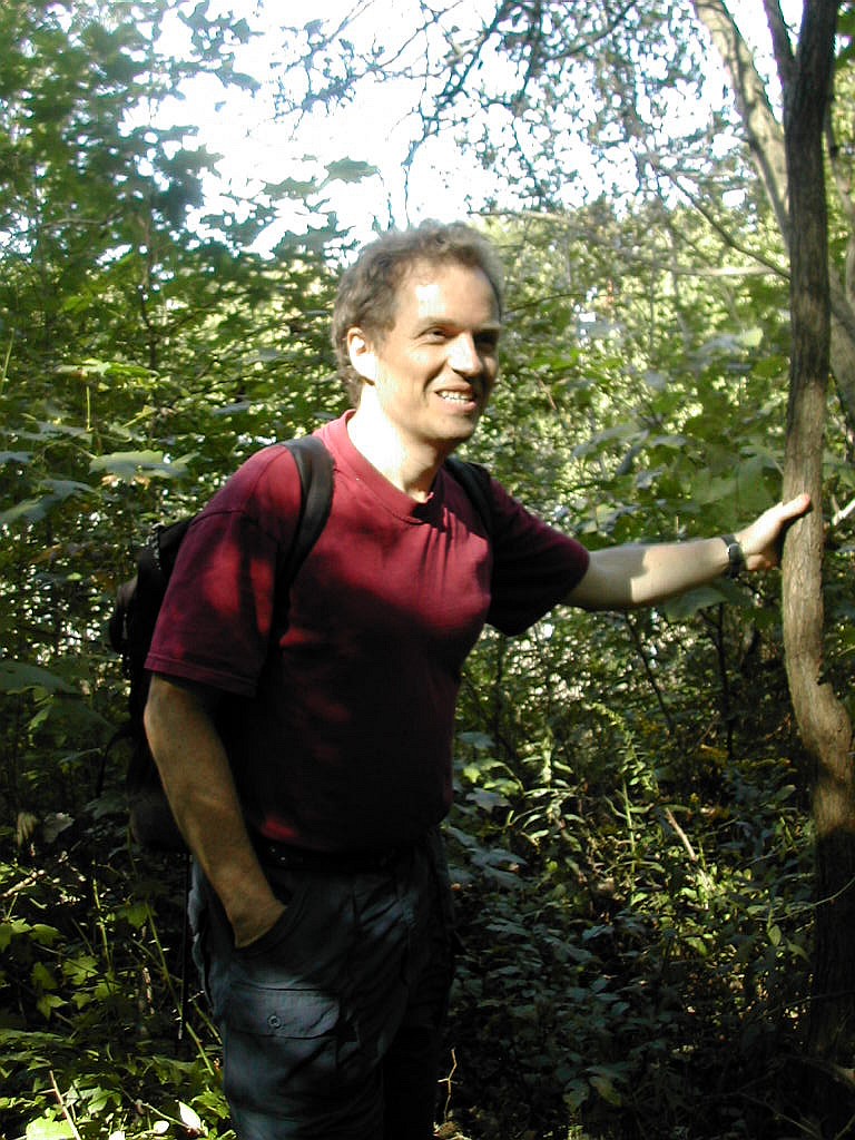
found to be a gas pipeline right-of-way) and realized that this would have been a better route to take getting here than the gravel road that led to the tower. There was even the customary abandoned car (just like in The Bronx) and in about 10 more yards I had joined Fred at the "South Peak" of Todt Hill. Look at the pictures. It's really very, shall we say, "inauspicious". And the symmetry between the summit in The Bronx, our first of the day, and this one, our last was striking. It was 2:56 PM and we had now bagged all the 5 borough high points! Triumph! Euphoria! (But to tell
 Fred, emerging from the woods onto Foster Avenue |
We made our way out along the grassy road towards the west and soon came out at the end of Foster Ave which led in a few short blocks along Bogert Ave to Ocean Terrace. For anyone who cares to try this route, I suggest taking a right on Bogert just before the top of the hill (and just before the wooded area starts) and then a left on Foster to enter the woods, rather than going over the top and entering from the other side as we did.
Well we couldn't stop now, even though we were done, We had to get home, so it was down Ocean terrace to Manor Road and wait for the next S54. The schedule showed the next bus was scheduled for 3:15 PM, about 7 or 8 minutes to wait. To the very end our schedule was playing out perfectly. Then I remembered I had in my pack a cold beer that I had carried all day to surprise Fred, but had forgotten to unveil it on the last peak. So, what the hell, I opened it now, and in the only "screw-up" of the entire trip, I managed to cut myself on the glass of the bottle. Well, whatever. We each had a part of a Sam Adams Boston Ale and the symbolism was there if not the full satisfaction.
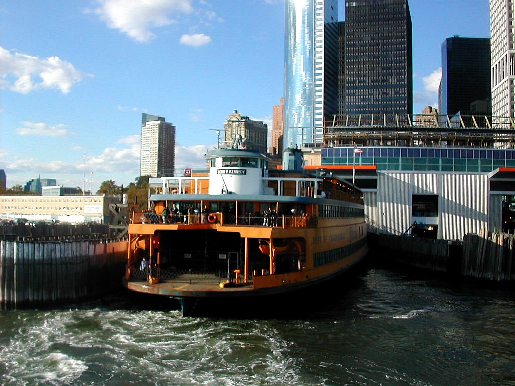
Soon the S54 came and took us to Victory Boulevard, and then after perhaps 10 or 12 minutes and S62 arrived to take us back to the Ferry. We easily made the 3:00 PM boat and took lots of pictures of the harbor, including a view of Battle Hill in Brooklyn, the Statue of Liberty, lower Manhattan, the East River bridges, everything! We were very tourists!
|
|
| Views from the ferry: Lower Manhattan and the ferry John F Kennedy | |
But all good things must come to and end, and Fred an I said goodbye as I got on the Lexington Avenue subway at Bowling Green. He was off to find Faunces' Tavern. Now what would he be doing in a tavern? For myself, it was another half hour or so on the subway and then a short walk home. Just before I got home I spied a Dunkin Donuts, and I figured "What the Hell, might as well complete the symmetry", so I bought a chocolate glazed donut, consumed it with great pleasure and soon thereafter arrived home. It had been one great day!
| F |
 Actually New York's boroughs are contiguous
with the 5 New York City counties but the names (for 3 of the 5) are different. I won't tell you the county
names, you can look them up. I would guess most New Yorkers don't even know the county names anyway. For me it
was about New York City, which I love, and the adventure and pleasure of doing something kooky. I have done
similar adventures in the past, among them running the entire length of the west side of Manhattan and hiking
the 30 or so miles of the Old Croton Aqueduct, (built in 1848 to supply the city with water). A future project
is to walk the complete shore line of Manhattan. Care to join me?
Actually New York's boroughs are contiguous
with the 5 New York City counties but the names (for 3 of the 5) are different. I won't tell you the county
names, you can look them up. I would guess most New Yorkers don't even know the county names anyway. For me it
was about New York City, which I love, and the adventure and pleasure of doing something kooky. I have done
similar adventures in the past, among them running the entire length of the west side of Manhattan and hiking
the 30 or so miles of the Old Croton Aqueduct, (built in 1848 to supply the city with water). A future project
is to walk the complete shore line of Manhattan. Care to join me?
So, you may ask, are any of these places worth visiting? If you are a County High Pointer, I needn't even ask the question. All of these high points are easy to get to and accesible (assuming you get access to the Bronx site). But what if you are not a high pointer? Well starting at the bottom of the list, I would say: Queens - absolutely not; Bronx - nice neighborhod to visit but the high point is a bit of a bust; Staten Island - check it out if you've never visited the island, but it might save time to just turn around and come back once you've made the ferry trip over - that's by far the best part; Brooklyn and Manhattan - absolutely worth a visit, beautiful places.
But I traveled over 100 miles today, including 9.3 miles on foot, and was justly proud. We had even bagged the alternate high point "candidates" in Manhattan and Staten Island and we saw lots of interesting places above and below the streets of the city.
The transit was excellent and our planning, either through luck or expertise, was right on target. We never got lost (well, hardly ever) and like the saying goes "There were no surprises".
|
Click here for a complete album of photos from this hike Return to Papa Bear Home Page |