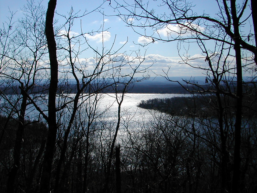
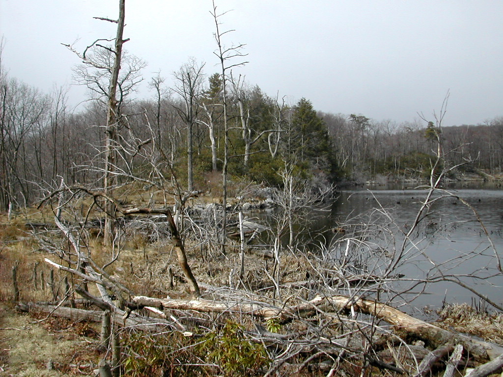
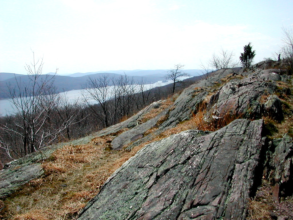
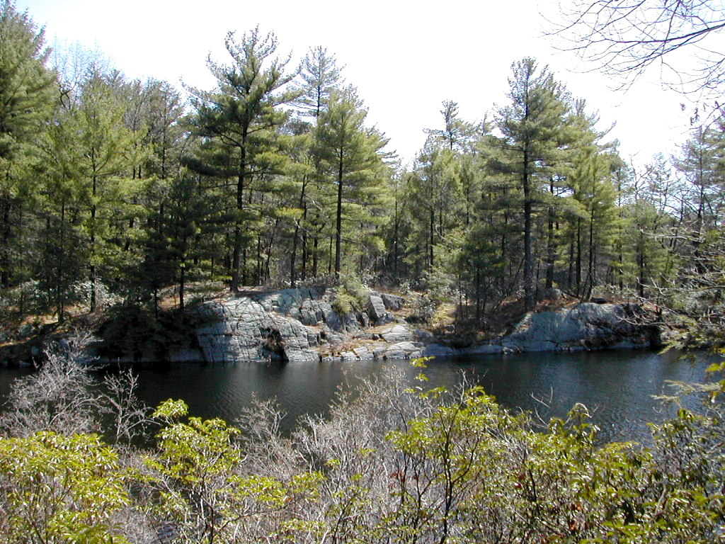
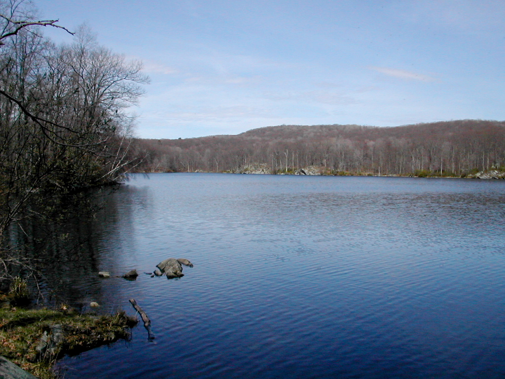
Culver Lake from the Kittatinny Ridge
|
Culver Lake from the Kittatinny Ridge |
|
Click here for a complete album of photos from this hike Click for Papa Bear's Home Page Click for the Backpacking Page |
got back Wednesday morning, April 17th, from phase I of my Appalachian adventure. Bill (my running friend and hiking partner) and I trekked from the Delaware Water Gap to Kent Connecticut a total of 171.8 Trail Miles. I say "Trail Miles" because that's the official distance if you follow the prescribed route exactly (and assuming they have it mapped accurately). We probably hiked over 180 miles, counting going into and out of camps, getting lost a few times, etc. So let's just call it "more than 170" miles on the trail. For those with access to the official AT Data Book, we started just one mile past the official start of the New Jersey section (which is actually on the Pennsylvania side of the bridge), so our cumulative miles will always be one mile shy of what the book shows for this section.
We started out on Thursday April 4th from the parking lot of the Delaware Water Gap National Recreational Area on the New Jersey side of the Delaware River Bridge (Route I-80), and ended up on Tuesday April 16th where the trail crosses Route 341 in Kent Ct. We gave ourselves 2 weeks, but made it in 13 days. So that's a bit over 13 miles a day, pretty good for 2 old guys with full packs. We stayed one night off the trail, in a motel in Fort Montgomery (near the Bear Mountain Bridge), partly because it was too far to the next camp site, and partly because we needed a little break from the trail.
The big picture is we will be hiking all the way to Mount Katahdin in Maine in 2 week sections by September. That's 6 segments of about 150 miles each (900 miles total to Maine). We need to be ahead of that average since 1) we will slow down when we get to the real mountains in NH, and 2) I want to make the last segment (in northern Maine in September) just 120 miles so my daughter can join me, in from Oregon. So I guess we are on track at this point. Our next section, north through Connecticut and Massachusetts to southern Vermont, will take place in May.
We decided not to stop in a lot of towns to replenish supplies, so we brought enough food to get us near the Taconic State Parkway (In Duchess County, NY) where a friend brought us supplies for the remaining 4 days. We met her on Saturday the 13th. So the first part of the hike we actually carried 9 days worth of food. That's a lot of food and my pack weighed in at just over 40 lbs. at the start (including the first day's drinking water). Ugggh!. I weighed the pack at the end (just about all the food used up and no water on board) and it weighed just 25 lb. so you can see what food and drink does to your load. Not only did my pack lose weight, but so did I - 8 lbs! But I would guess a good chunk of that is water loss (dehydration) which I will gain back quickly. Maybe 3 lbs. is real weight loss. That probably won't happen so much next time since I will (hopefully) reach an equilibrium weight when I'm finally in hiking fitness.
My general impressions:
Getting Started
I got my stuff ready and did a final check in the late afternoon, kissed my wife goodbye, and headed by cab over to the Port Authority Bus Terminal about 6:00 PM in the rain. The traffic crossing 42nd Street was so bad I jumped out a block early with my heavy pack, since the cab was going slower than I could walk. I took the 7:00 PM #88 bus to Bloomfield and about 35 minutes later I got out at Bill's stop and we walked in the light rain through the school yard to his house. We put my pack where his cat couldn't attack it and chatted a bit until his wife got home. We looked over the pictures from their Grand Teton trip of last summer and then got an early bed.
ill's friend Andy met us about 7:00 AM to drive us down to the Delaware. He is also a runner and planned to hike the first 5 or so miles with us. We stopped at a diner for pancakes and then we were off for Route 80 and the Delaware Water Gap. We took the last exit before the bridge, get momentarily lost, and finally got to the Delaware Water Gap National Recreation Area parking lot and the trail head. We were officially off (with the requisite photos) at 9:35 AM.
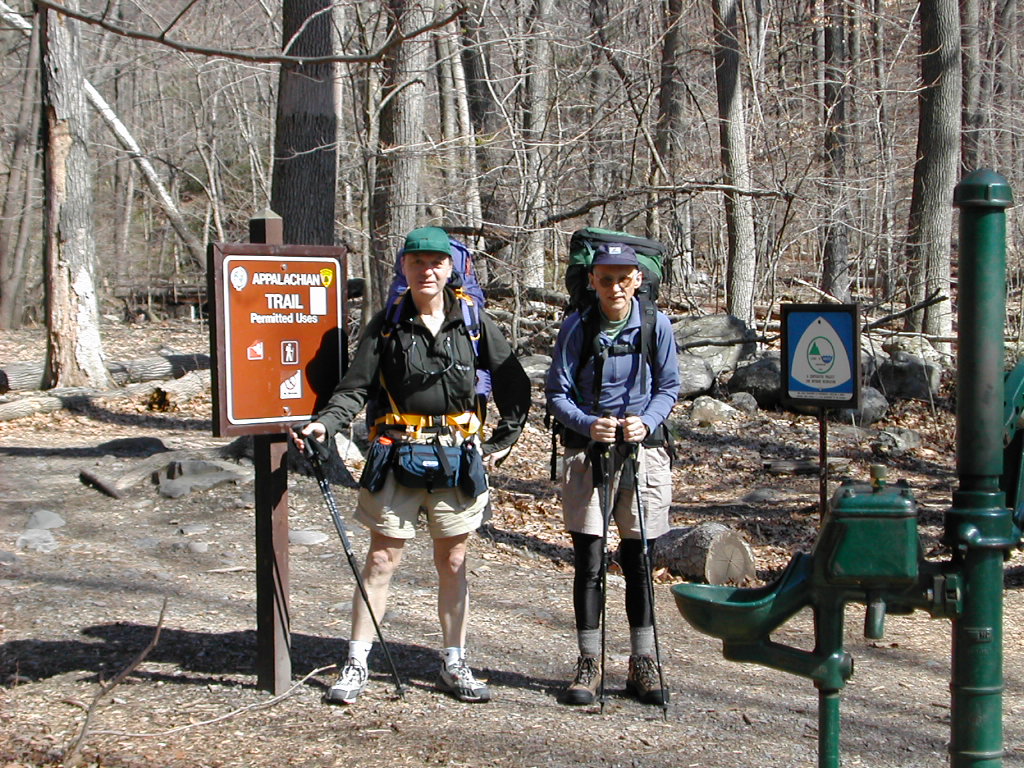 Papa Bear and Bill at the Delaware Water Gap Trailhead |
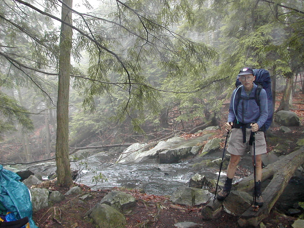
My pack was heavy. H-e-a-v-y. But we started slowly up the ridge. There were nice views back to the right of the Kitatinny Ridge as it extends into Pennsylvania on the far side of the Delaware. There is a lovely stream down to the right which we slowly rose above until we parted ways and turned up the ridge. We saw several Blue Birds, which I thought was unusual since they are usually most often seen along the margins of meadows, not in the forest.
We reached Sunfish Pond for lunch. This has the distinction of being the southern most glacial lake along the trail. It is quite lovely. At this point I noticed the banana I had put in my pants pocket while in the car was still there and was now a gooey mess. I cleaned up as best I could and hoped this would be the worst "disaster" I would encounter this week. Andy left us at this point and planned to return back to the parking lot via a side trail.
After lunch the trail followed the shore of the lake over a very rough rocky trail. Having finally passing this, we got into the woods and, passing a bog, heard a chorus of spring peepers, the first this season for me.
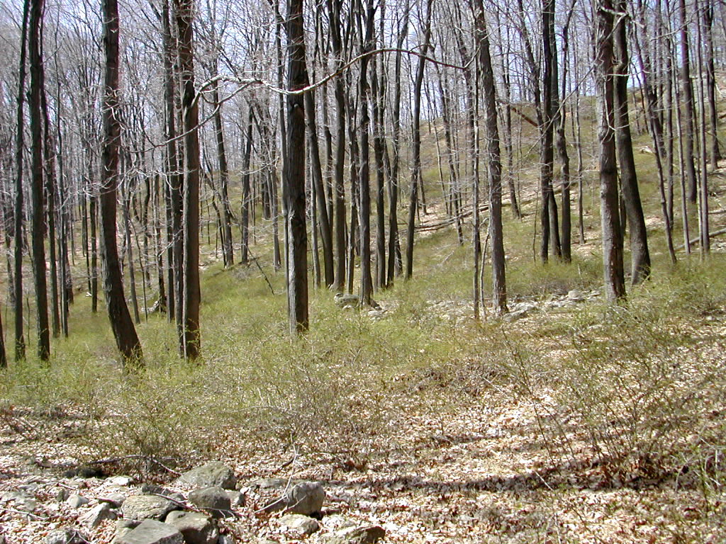
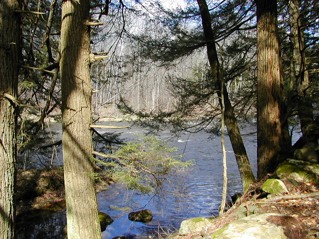
 Moving along the Kitatinny Ridge |
I got started in my Sci Fi book Dragonflight by Anne McCaffrey which was to be my trail book for this section. (Since it's the first of a series, I figured I could read one book each section of our hike.) The cabin was actually too nice. It had a kitchen, flush toilets and heat. I guess the "real" camping would start tomorrow. After supper we took a walk a short distance to Catfish Pond, which was lovely in the fading light.
Day 1 trail miles: 9.3. Other miles: .5
e cooked in the kitchen and packed up and didn't realize how cold it was till we stepped outside. We trekked the half mile or so back to the trail and we were off on day 2. I would recommend this AMC site (either the cabin or the cheaper tent-site) as a good spot for your first night after the DWG.
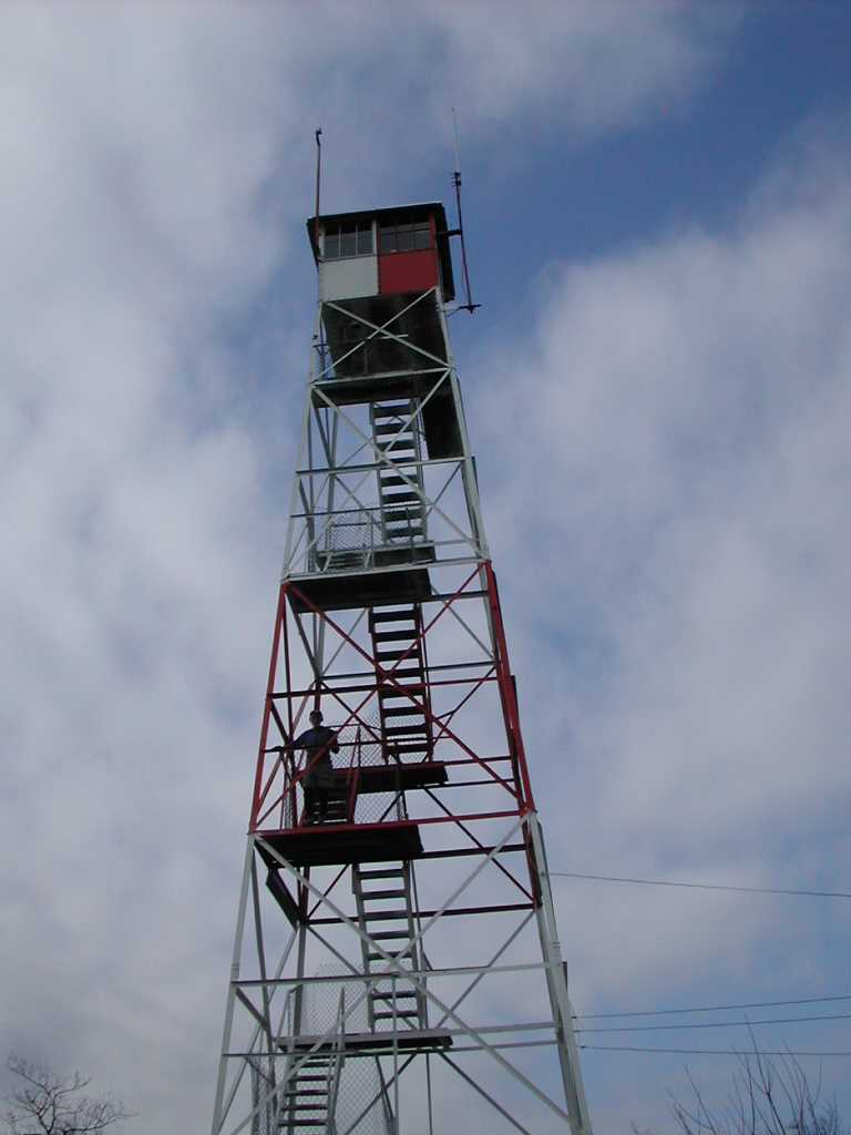 The Catfish FireTower |
I dressed in long pants for the day and took some Ibuprofen (Vitamin I) since I had a little back pain (which had actually started at home before the hike started). We crossed a couple of roads but saw no road traffic on them. A couple of backpackers were heading south and said they had spent the night at Brink Road Shelter (our target for today) and had a very cold night.
We got to the Catfish Fire Tower mid morning. I got a little acrophobia and could only make it up 2 or 3 flights of stairs. The top was locked anyway. Even from where I had gotten there were impressive views, particularly to the west, towards the Delaware valley. We saw some more Blue Birds, and actually saw 2 Wild Turkeys, walking not 10 yards from us.
We passed a beaver pond and it was amazing what destruction these animals are capable of. Every tree up to a width of about 5 inches in diameter seemed to have been felled. The pond had a wild beauty in spite of the beaver "clear cutting" around the shore.
 A Beaver Pond |
There was one area along the ridge which looked like an area of old house lots. The book says when the government bought up the area for the National Recreation Area in the 1970s, there were some developments on the ridge top here that were taken and "given back to nature". I would bet that wouldn't happen today!
We saw a number of signs of both coyotes and bear (scat). Curiously they seem to like leaving their
mark on top of rocks right along the ridge line where we were hiking, sometimes multiple times.
Perhaps it's a way of marking their territory (or maybe they hope we might step in it). The coyote scat
looks like dog doo except it tends to have a lot of hair in it (from all those cute kitty cats they snatch!
 )
The bear scat tends to be larger and black.
)
The bear scat tends to be larger and black.
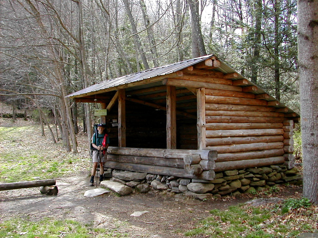
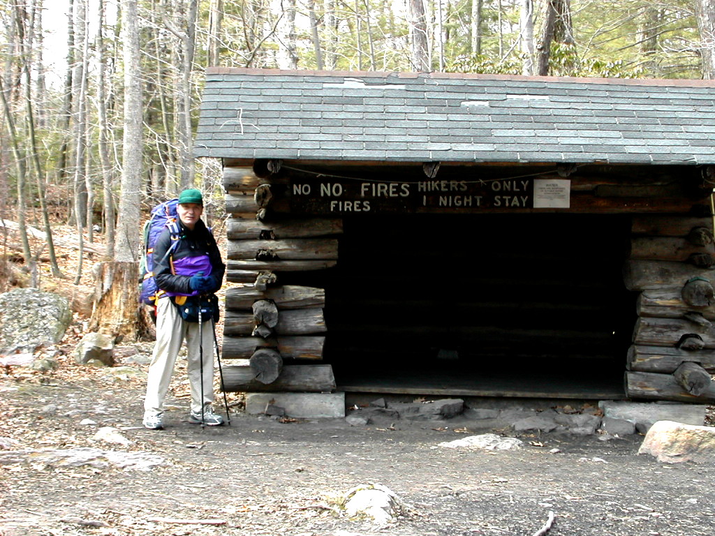 Brink Road Shelter |
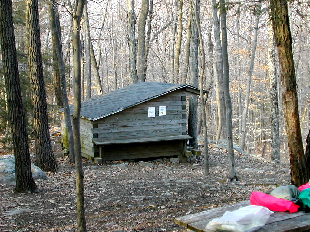
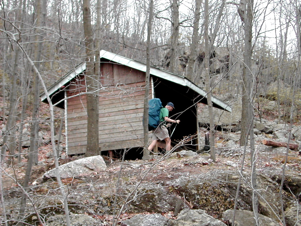
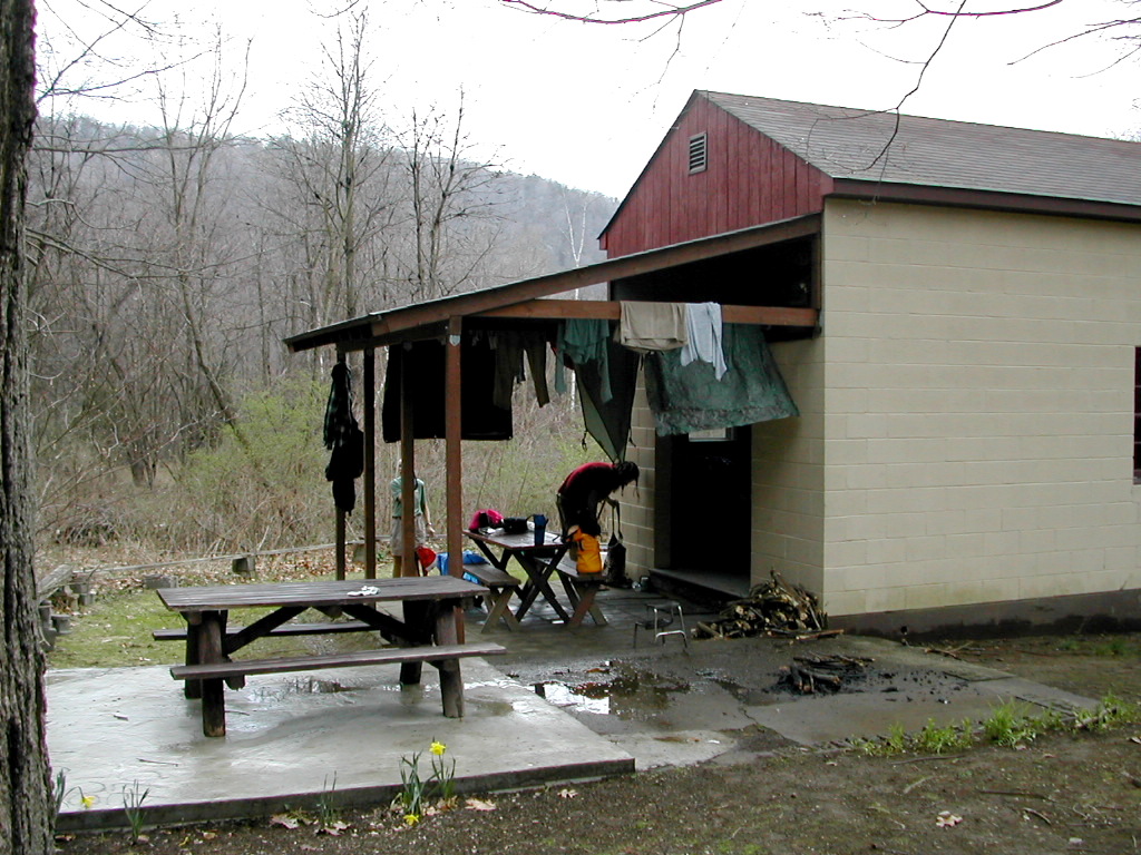
A word on shelters to my non-backpacking friends: all along the trail there are a series of structures spaced at varying distances from perhaps 5 to 20 miles. Some of these were built over 50 years ago when the trail first began to be used heavily, some are quite new. They generally consists of a 3 sided building with the front (open side) facing across a valley. The best ones face east so you can catch the rays of the rising sun in the morning. The have a low back wall and a long pitched roof which overhangs the front to prevent rain and wind from entering. The have (generally) wood floors although I'm told some have dirt floors. The walls are of logs, or sometimes of rough cut timber. In New York several had walls of rock. They are great to have when it rains and in the busy season it's where you meet many a fellow hiker. Often times there are areas nearby to pitch a tent, and usually there is a source of water nearby. The theory is these places will concentrate the camping activities and spare the rest of the trail from overuse from camping. Some will debate this but I think it's a sound theory.
Late in the afternoon, a 50ish man walked into the shelter with a can of Coleman fuel and a plastic trash bag. I thought this was a novel form of ultra lightweight backpacking, but it turned out he was a volunteer named "Desperado" who was coming by to keep the shelter in tip-top shape. He was a true angel, and the Coleman fuel and a few goodies were left (in the bear box) for needy backpackers. He checked the register at the shelter and noted a few bear observations over the winter. This was his first visit since November and he and his colleagues would visit all the Jersey shelters in the next day or so. He said during the peak summer season he comes nearly every day, and has been doing this for 30 years! Thanks for your work Desperado! And he loved to chat. He probably stayed a good 30 minutes after doing his chores and just talked up a storm.
I read a bit more of Dragonflight and got an early bed. (Matter of fact, we always got an early bed - once the sun sets, there's not much else to do.) On the trail, you need all the rest you can get.
Day 2 trail miles: 14.3. Other miles: .75
Total trail miles: 23.6, total other miles: 1.25
t was a very cold night. The temperature fell quite a bit during the night. Sleeping in the shelter with extra clothes on (socks, fleece shirt, gloves and balaclava) was fitful. We would have been warmer if we had set up our tents. I had put all my cooking stuff in the bear box, and this turned out to be a mistake as the propane wouldn't ignite due to the cold. This was the Achilles heel of my marvelous little stove. I borrowed some stove time from Bill's Wisperlight and had a good hot breakfast.
|
Culver Lake, near Culvers Gap |
Then there it was: Worthington's Bakery. The non-hiker may think backpackers are obsessed with food: YES WE ARE! We talked to the owner and he said the place has been in the family for 75 years and that Grandma Gatewood had actually stayed there when she did her thru-hike in the early 1950s. They had a picture of Grandma and the owner's mother (which they have managed to lose, then find, then lose again). This place had history. I had a scrumptious apple turnover. While we were paying the man, he had to run off to the back to take something out of the oven. Raspberry tarts! Drat, we should have waited. Each delectable was better than the last. The owner said they were now just open on weekends since he couldn't get help till school gets out. He hoped to be open on Fridays in a few weeks and full time after Memorial Day. He said since the place had no heat he was not open through the winter. We were lucky to get to this place at the right time.
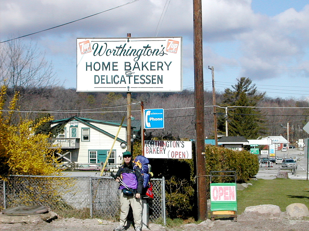 Worthington's Bakery at Culvers Gap |
We were off again and took our next break at the Gren Anderson Shelter. This seemed nice - a bit larger than Brink Road. There were signs that Desperado had also been by on his rounds.
We passed a group of older Boy Scouts and leaders. The leader said they were from Schiff Scout Reservation in Mendham NJ. I told him I had taken a scout training course there in the 1950s and he said the place is still the same (an exaggeration I would say), still doing fine.
We had lunch on Sunrise Mountain. There was chill wind and we were getting some snow flurries. We hunkered down beside an old stone shelter built in the 1930s by the CCC. Monumental but a bit useless. Perhaps in the summer it attracts day hikers and picnickers. The weather was variable: when the sun was out we were warm, otherwise it was rather chilly.
This was a long day for us. We were headed for Rutherford Shelter, over 15 miles. We decided we would take a side trail to the shelter called the Iris Trail. This would allow us to avoid a steep downhill from the regular trail down to the shelter and of course up again the next morning. We found the red-blazed Iris Trail with no problems. The map showed the shelter near the Iris Trail just past the inlet to Rutherford Lake. Well, we got to the lake, and passed the inlet and saw no shelter. We kept going and finally after about a half mile (starting up a hill no less) we found another couple of hikers sitting on a rock. We asked them about the shelter and they said we had come too far. It was back by the lake but the guy wasn't sure how to find it. We drudged back to the inlet stream and scouted around and found no shelter. We saw there was a large bog between where we were and the base of the ridge (where the shelter must be) so we figured "You can't get there from here!". (Maybe the extra mile we hiked was punishment from the purist-gods for trying to get to the shelter by the easier route!)
We found a very nice tent site on a little bluff just past the stream and set up camp. This was to be our
first night in our tents. It turned out we would be warmer tonight in our tents than we were in the shelter
last night. There was an old foundation there and it looked like an old shelter had been there once upon a time
(definitely the foundation had 3 sides with the front facing the lake.). Maybe we had gone through a time warp
to the future and we had actually found the Rutherford Shelter after it had disappeared in the far future!
The temperature was dropping and we figured it would be a cold night. We filtered water from the stream down below our site. Even through the filter, it came out a bit brownish. Bill said it was tannin from the bog. It tasted fine, so we cooked and enjoyed our supper. We had to hang our food and trash from nearby trees since there were no bear boxes here. We went to bed early; it was the longest and most tiring day yet!
Day 3 trail miles: 15.4. Other miles: 1.25
Total trail miles: 39.0, total other miles: 2.5
his was the coldest morning yet. The tent worked well: I was warm in my (30 degree) bag and dry. The water in our water containers had about 1/4 inch of ice on the top. When I shook out my tent fly to pack it up, instead of the usual droplets of moisture, there were crystals of ice. I watched the sunrise across the valley in the cold dry air. Yes, life is truly good!
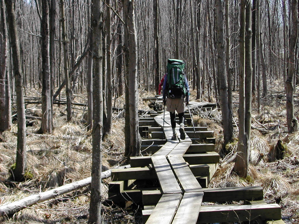 Trekking along the Puncheon |
The day's hiking started easy. First along the Iris trail back to the AT and then on to Route 23. We had some beautiful walking through bogs on board walks or "puncheon".
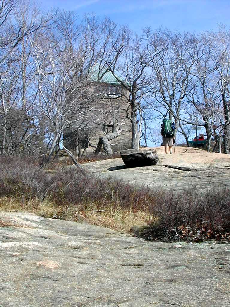
We ascended the ridge towards High Point (the highest point in New Jersey) and the trail got rocky again. Desperado had said (promised, actually) that the rocks would be gone after High Point. I hope he was right. Rocks make for slow, tiring hiking, especially with a full pack. If I were packless I'm sure I could dance over the rocks!
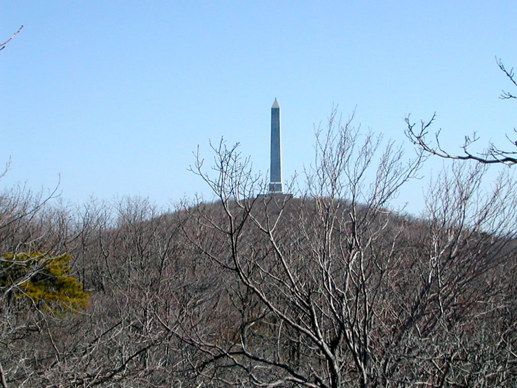 High Point Monument |
In the afternoon things got tiring. My right foot hurt and my back was killing me from my pack. We went around a sod field on a long series of dirt roads. It was better than a road walk, but not much better. We saw some Harriers and crossed another board walk, very nice.
In the late afternoon we reached Liberty Corners Road where there used to be a pump. The pump got polluted and was removed and a sign directed us to a house across the street which had a water spigot around back that we could use. Bill walked up the steep driveway and got water for both of us. It turns out we could have got there via a side trail from the AT which went up the hill to the right of the house. Now with about 4 pounds extra weight in our packs we started up the steep climb to reach Pochuck Shelter, about 2/3 of the way up Pochuck Mountain.
 "Who Cooks for You?" at Pochunk Mountain Shelter |
Bill and I set up our tents in lieu of sleeping in the shelter since the weather was fair but the temperature was dropping. We cooked and ate and
cleaned up, stashed our stuff in the bear box and I got a little reading in before bed time.
Day 4 trail miles: 16.7. Other miles: .25.
Total trail miles: 55.7, total other miles: 2.75
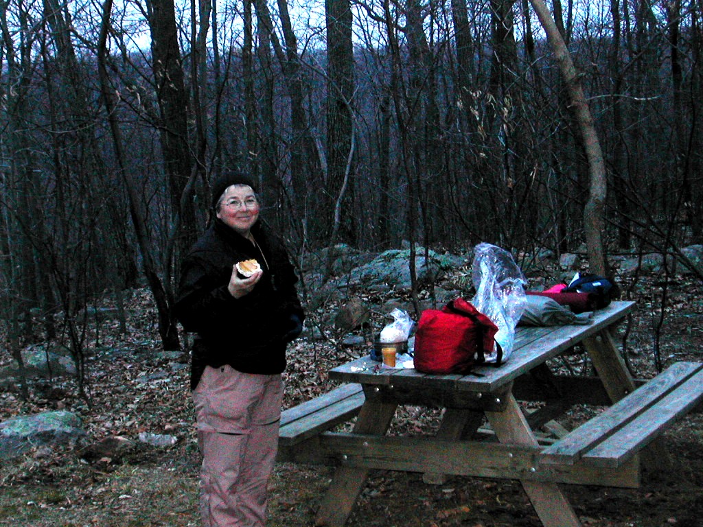
heard the pitter-patter of rain on my tent fly during the night. I was also very proud to work out a way to answer the call of nature from within the tent. The tent is barely tall enough to sit up in, but by assuming a careful kneeling position and using an old Gatorade bottle, the deed was done with no "accidents". We were up at 5:30 and Who Cooks for You? was already up working over her Esbit stove. For once the ground had no frost. Who Cooks for You? got off before us around 7:00, but I was delayed by putting some duck tape on a hot spot on the ball of my right foot to try and stop an incipient blister from forming. I also used lightweight running socks in place of the Thorlos, thinking they were a bit to thick and hot which would possibly cause the problem. After this treatment, my foot felt "OK". We shall see how it goes. I also carefully adjusted the pack, making sure the hip belt was symmetric. I think this may have led to yesterday's problem. The pack felt pretty good as well. We got off around 7:30.
We finished the tough climb up Pochuck Mountain where the trail missed the actual summit (which we didn't much miss). Then we descended into the Pochuck Creek Valley and crossed some open farm meadows. Those steep climbs through open meadows kill you. Here we're supposed to be off the mountain and the grade up is still a killer! We passed Who Cooks for You? about 9:20 but she passed us back a little later while we took a break. She may be slow but she just keeps on going!
When we got to Route 517, we had a choice: ahead of us was the trail relocation through the wet lands surrounding Pochuck Creek. The map showed it as a "Pending Relocation" whereas the Databook had it as official. The old route turned right at this point onto 517 and involved about a mile and a half of road walking. We obviously would prefer a trail to roads but we didn't know if the relo was actually passable. The road crossing was prominently marked as was a new cut in the guard rail on the opposite side and there were no blazes in site along the old road route. This indicated to us that the new route was open.
 The Bridge over Pochunk Creek |
The grass and bull rushes from last year were all burned in the wetland and at first we though it was a controlled burn. We crossed the first section and then came to a marvelous suspension bridge which Bill said was designed by a friend of his in the Trail Conference. All the while there were no blazes on the board walk or the bridge and maybe one or 2 in other places. After the bridge there was more board walk and then we entered an beautiful little wooded upland - which was blazed perfectly! We met a couple who told us the trail had been completed last fall and they had discovered it New Years Eve and first hiked it on New Year's Day. Now it was one of their favorite walks. They also told us the fire was no controlled burn, but a real fire that burned the previous Tuesday and had actually threatened some of the surrounding houses before it was contained.
A little bit later it started sprinkling lightly so I put the pack cover on my pack but the rain was too light and it was too warm to wear my rain jacket. We left the woods, went down along an overgrown meadow and crossed a little bridge (no blazes) and came out to a dirt road. Here we should have checked the map but we were so delighted to finally see blazes along this road that we just set out. After about a half mile we came to a turn to another road and saw we had been on Canal Road and had come to Maple Grange Road. So we checked the map and suddenly realized we had taken the old route along Canal Road and had gone about a half mile back in the wrong direction! So we had to backtrack all the way on the dirt road to where we had come out and, sure enough, there was the correct northbound trail right across the road from where we had come out of the meadow. So we saved about .6 miles by hiking the relocation, but lost a full mile but being too dumb to check the map at a critical point.
We had wondered why we didn't pass Who Cooks for You? again but we figured she was smarter than we were and had not backtracked on Canal Road and had gone on to Vernon NJ, where she had intended to resupply and spend the night. We later found from the ranger in Wawayanda State Park that the fire had actually damaged the boardwalk we just crossed and the maintenance crew had just fixed it on Saturday, two days previous. This probably explains why the blazes weren't fixed and only makes me marvel at the NYNJTC for moving so quickly in getting this section quickly back into shape. A few missing blazes - I'll live with that!
We crossed through some active pastureland where there was a small herd of Black Angus cattle, and then crossed a rail road and came out onto Route 94. According to the Companion, there was a place called Heaven Hill Nursery a short distance up to the left which served goodies, so we took the turn and found the place. Heaven Hill it was indeed. The chocolate mud pie was awesome and I also got coffee and a pecan Danish (for a later snack). We munched and rested on the porch. It was still raining lightly but we were in a very happy mood. Yes, life was good!
 Bill on Wawayanda Mountain |
I would also say that this little piece of Vernon NJ we passed though seemed lovely and everyone we met (admittedly only about 5 people) were all very nice to us.
Refreshed and rested, we now had to attack the climb of the day (perhaps the climb of the section): the ascent of Wawayanda Mountain. This was truly awesome. The trail climbed very steeply over rock ledge after rock ledge and there were rock steps practically the whole way up. And these were no pebbles, these were multi-hundred pound boulders. Bill mentioned that this had been constructed only recently (last 10 years?) by volunteers from the NYNJTC working only with hand tools - picks, crowbars, shovels, etc. When you get here you will find it hard to believe as I did. It's probably one of the seven wonders of the AT trail maintenance world.
After the top was reached, with a beautiful vista, we followed an easy trail through lovely woods to the shelter. The water source was a spigot at a ranger station about a quarter of a mile away. While I was there fetching water, I talked to the ranger who told me the puncheon at the Pochuck Creek
 Wawayanda Shelter |
We stated getting organized at the shelter about 5:35 (now on DST). Supper was great, my feet and pack had behaved, and we had had one of the best hiking days yet, and got ready for a well deserved sleep. At this point I heard my first possible mosquito. No bite, just a buzz (Its buzz was worse than its bite!)
Day 5 trail miles: 11.9. Other miles: 1.5.
Total trail miles: 67.6, total other miles: 3.75
oday was Bill's birthday. At breakfast he announced he had decided to take a trail name: Fresh Air. He chose this for two reasons: he had worked for over 30 years for the Fresh Air Fund in NYC before retirement (the Fresh Air Fund is a non-profit organization that takes needy children from the city and gives them a camp experience), and 2) his enduring love of the outdoors and fresh air. Happy Birthday Fresh Air!
 Greenwood Lake from the Bellville Mountain Ridge |
As we entered NY, Bear Crest Ridge became Bellville Mountain Ridge. There were some scenic vistas along this ridge, particularly as we got close to Greenwood Lake. The hiking was tiring along what seemed like never ending ridges due to the rough rocky ups and downs. Some of the rock scrambles were near to dangerous (especially with a heavy pack to throw off your balance). We got a few sprinkles around Route 17A. After 17A the going got easier except for two little items: Two huge rock formations called the Eastern Pinnacles and Cat Rocks. I made it over the Pinnacles OK, but when I got to Cat Rocks I dropped my pack and went over without it and then retrieved it. Discretion was the better part of valor (you might say I blue-blazed my pack around and slack-packed over this obstacle.)
We made it to the shelter and I started filtering water for dinner, breakfast and the next day's hiking. Suddenly the filter "blew a gasket"!. This got me worried, but I saw that the top screw on the MSR filter was just loose, and after tightening it, it worked fine again. It was sprinkling again so I had to find a tree to hang the food (for bear protection) and get dinner ready without getting wet. It was more annoying that anything more. After dinner, Fresh Air enjoyed a Cliff Bar with a birthday candle his wife had gift wrapped for him. Great birthday party!
The shelter was a dump! Compared to the New Jersey shelters, this was a mess. It was smoky smelling and there was trash, melted wax and other grunge around everywhere. I didn't even want to put down my ground cloth on the shelter floor - I didn't want it to get dirty!
 Wildcat Shelter |
I tended to my foot (the blister didn't happen, thank goodness) and a slightly sore right ankle. A little vitimin-I helped. I also realized I was quite dehydrated - my urine was very dark and sparse. I must make myself drink more water even though I was getting tired of the taste. But overall I felt not bad. This may have been one of the roughest days under foot, though not the longest by far. Sleep will help. To bed by 8:00.
Day 6 trail miles: 12.0. Other miles: .5
Total trail miles: 79.6, total other miles: 4.25
e woke to a nice morning. After the usual we were off by 8:00. Both my foot and ankle seemed fine and I took another dose of vitamin-I and crossed my fingers.
This was to be a fairly tough day: 3 good sized mountains in the morning: Mombasha, Buchanan and Arden, and 3 smaller ones in the afternoon: Green Pond, Island Pond and Surebridge/Fingerboard. Of course in our tired condition late in the day, the 3 smaller ones would be just as bad as the 3 larger ones!
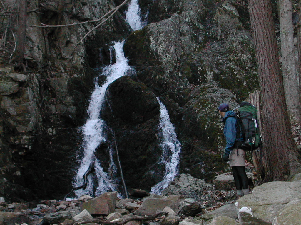 Fitzgerald Falls |
We had easy walking for about an hour. We reached Fitzgerald Falls which was beautiful. We made the climb after falls - it was a nice hiking morning. This was Mombasha - a nice climb. From the top we had views of NYC in the distance (somewhat hazy). At this point I put on sun lotion. Last night's rain had given way to a warm sunny day.
We climbed down then up Buchanan Mountain. It was a steep rock climb to the 1st summit. We met a trail blazer, a middle aged guy, working the other direction. He proudly said he took care of 3 miles of trail in this section. Soon afterards, we stopped by the plaque for Peter Brusk. He was a moving force in the area and died on the trail in 1968. We then mounted Buchanan's 2nd summit - another steep rock climb worse than the 1st. Here we got a view of Little Dam Pond a gem in the valley below. It was slow going today but we had beautiful hiking weather - dryer than yesterday.
We stopped by Little Dam Pond for lunch. This is such a beautiful spot, a hemlock grove, pristine pond, geese honking (mating?). My notes say "This is so freaking great here!"
 Little Dam Lake |
After lunch we went up Arden Mountain, another tough rock haul. We meet "Brooklyn" at the summit. He says he was going to Albany. I said he was heading the wrong way!. He said he was on an alternate route of the Long Path which crosses along the AT to High Point and then goes north through the Gunks. [We were doubtful of this since Bill didn't think the High Point - Gunk trail was complete yet. The next day in Harriman we did see a sign saying this alternate LP route was open.] He said it will be a 3 week trek. When he first saw me he said he liked my pack. This seemed a bit strange at the time, but Fresh Air later said that he had the same model.
After another rock climb to a ridge we saw guy who had just come up Agony Grind (the aptly named ascent on the other side of Arden Mountain) who was quite breathless. He said he had taken the bus up Route 17 and was out to wander around for 4 days. He looked a bit out of shape. We speculated climbing up Agony Grind to Arden Mountain was not the easiest way to start a 4 day trek! Thankfully, unlike "Breathless", we made our way down this steep section and finally crossed Route 17 and the NY State Thruway and entered Harriman State Park. My back was killing me again so we took a break and I readjusted the pack.
 Bill checking out the Lemon Squeezer |
Each climb got more tiring than the last: Green Pond Mountain was followed by Island Pond Mountain. At this point we got to the the "Lemon Squeezer". This was very neat formation: a narrow fissure between two large rock slabs. Naturally the trail went through this fissure rather than around. I was proud to make it up through with pack. The toughest spot was about 10 feet in where there was a rock about 18 inches high on the left side of the crevice. It was just too high to step up onto given the narrow passage and heavy pack (just wide enough for a person with a pack). I got to this obstruction and moved my right foot up beside it, put my Lekis up in front, and put my left knee up on the rock. Somehow I stood up (actually I "kneeled" up, trashing my left knee somewhat in the process) and then inched forward, leaning to the left. Just after emerging from the Lemon Squeezer there was a rather large rock with a blaze on it that was just a bit too dangerous to climb. There were white blazes that went around this and so we did too. More climbs followed up Surebridge/Fingerboard Mountain.
At last the we came to Fingerboard Shelter - a beautiful rock walled structure - but smoky. In spite being notated "no water" in the Databook and Trail Guide, a sign said "seasonal spring" and we figured
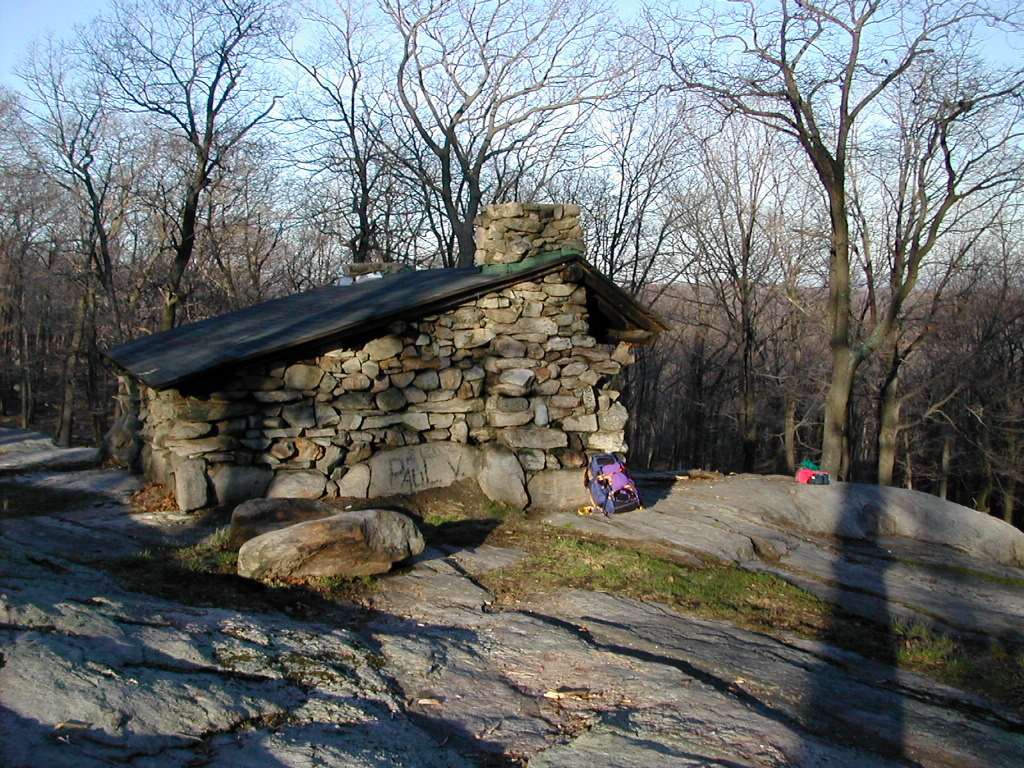 Fingerboard Shelter |
It was late so I started supper. This was one of the toughest days (I know, I keep saying that!) Tired. Tired. We went to sleep with the lights of Ossining New York, on the east side of the Hudson visible and the rumble of freight trains moving up and down the west shore of the Hudson audible in the distance.
Day 7 trail miles: 14.3. Other miles: .5
Total trail miles: 93.9, total other miles: 4.75
e woke to a beautiful dawn with rosy pink sky visible from the shelter. The sky was clear and we watched the sun rise over the mountains to the east. It was a chill but beautiful start to the day.
One problem with the shelters in Harriman is there are no privies at the shelters! Since this is a heavy use area, this leads to the potential of large areas near each shelter pock-marked with "cat holes". I found a spot that seemed unused and did my duty.
We had the potential of a 16.5 mile hike to the campground across the Hudson so I suggested we hit a motel in Fort Montgomery (near the Bear Mountain Bridge), about 2 miles closer. We needed some real rest, so Fresh Air was agreeable to this idea.
 View of Silvermine Lake |
The first 2 hours were not bad. We made the 4.5 miles to Goshen Mountain by 10:00 AM. Today's toughest climbs will be Black Mountain and Bear Mountain. The weather couldn't be better. We had sun and very thin clouds, a breeze and temperatures in the 50°s. We passed the lovely Silvermine Lake and William Brien Shelter on Letterrock Mountain and took a rest at a fire road before ascending Black Mountain. The pack seemed OK as long as I made sure to adjust it carefully. It was hurting my left shoulder a bit this morning but was OK now.
Black Mountain was not so bad. There were great views of Haverstraw Bay and the NYC skyline far beyond. We crossed the Palisades Parkway. I noticed in the registers that we were slowly gaining on "Tenderfoot" a hiker from Indianapolis who was hiking from the DWG to the Bear Mountain Inn. We never quite caught up with her.
 Barberry, an invasive shrub, the first green of Spring |
We had lunch before the ascent of West Mountain (which we thought would be easier than Black). This was in fact probably the longest most relentless climb we did. Not steep but never ending! We passed beautiful ridges and views. We saw one older walker and a young (30ish) day hiker who was doing a tough 4 peak circuit from Popolopen Torn to Tipp Torn. We saw more people on the trail this than on any other day we were out.
The AT from Bear Mountain to Greenwood Lake, which we had been hiking yesterday and today was the first part of the AT to be laid out back in the early 1920s. Now the trail at this point actually follows the road for about a half mile up Bear Mountain and you might ask why follow the road? If you look at this Mountain you would see why. The whole south-west side of the mountain is practically a sheer rock face and for a relatively "small" mountain (by AT standards) it is quite impressive.
 Approaching the Bear Mountain summit |
We got to the bottom and after a little (unnecessary) detour around an old defunct ski jump, reached the Bear Mountain Inn. This is quite an impressive and beautiful structure, but the only food we found was in vending machines so we pushed on. We walked through the zoo which was still open (it was 4:30). The most interesting animal was a "Silver Fox" which was a real pretty silver-black. Unfortunately the bears were sleeping so we never saw a live bear. At the end of the zoo we exited at the Bear Mountain Bridge - the end of the official trail for the day, but not the end of our trek.
We headed towards Fort Montgomery (the Companion said .7 miles. Hah! more like a mile!). First we came to the "Trading Post Bar and Motel - vacancy". The people in the bar said "Oh, they tore the Motel down a while ago". Not a good start. Next we came to the "Old Oak Inn Hotel". We asked in that bar and the bar lady said you have to talk to Chuck. Well she could not get a hold of Chuck, and the bar was filling up with construction worker / truck driver type guys who were kind of looking at us sideways so we decided to trek on.
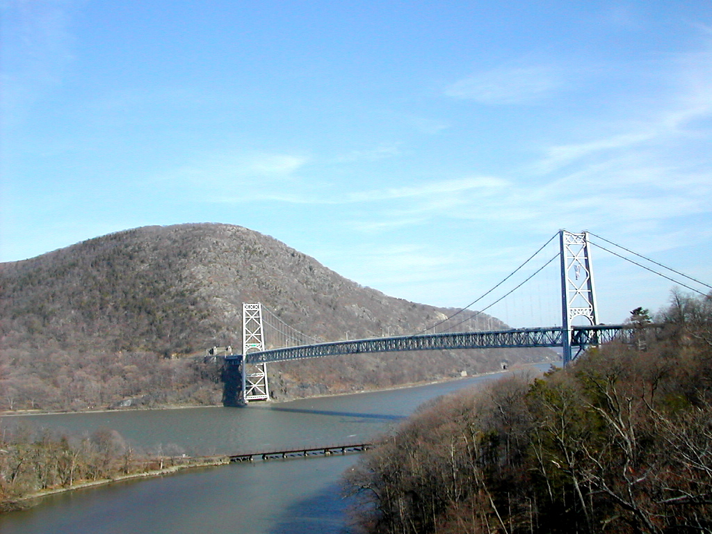 The Bear Mountain Bridge from Fort Montgomery |
We cleaned up and had a great meal across the street at the Pineapple Steak House (though a bit pricey) and then a good night's sleep. We told Ingrid we would get going around 8:00 AM so everything was fine.
Day 8 trail miles: 14.3. Other miles: 1.5
Total trail miles: 108.2, total other miles: 6.25
e got up early and packed up at the motel. Then we headed for the bagel shop across the highway. This was a great little place with a grill and a variety of foods besides bagels: fresh muffins, eggs, sandwiches, coffee, etc. I had a toasted cinnamon raisin bagel, a large coffee and juice. We took the food back to our room and eat while we finished packing up our stuff. The stuff I had washed out the night before was nearly, but not quite dry. Fresh Air settled the bill and Ingrid's Husband Doug helped us load our stuff into his car. I almost, but not quite, forget my Lekis in the room. Doug let us off at a little stop right near the bridge toll booth marked "No Entry". He said this was his regular drop off spot and the sign applied to everyone but him.
We were off again over the bridge. It was just a few minutes after 8:00. The Hudson valley was misty and chill and we felt great. The fog on the river made an eerie but nice scene. The trail followed the road for a short distance and then turned onto a path up the side of Anthony's Nose. This was a tough climb for a while but then got rather easy. We were hoping the countryside east of the Hudson would be easier going then the west side we had just traversed.
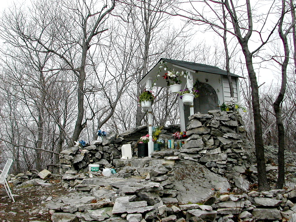 Shrine near the Graymoor Priary |
I changed to a lighter pair of socks at South Mountain Pass and we took a break when we got to Route 9. The day stayed cool and misty. The mornings sun had disappeared behind a gray sky except for an occasional bright spot where the sun might be. We got close to the Graymoor Priary, which I had never visited in all the years I had hiked in this area, but passed on by since it was a half mile of so off the trail. Today we were headed to the Dennytown Road Campsite in Fahnstock State Park and had a good distance to cover. We saw a sign a few miles past Graymoor marked "Shrine" which pointing up a side trail to a small hill. We dropped our packs and climbed up and found a small shrine with votive candles and a picnic table and two chairs on top of a little rocky outcrop, This was strange but beautiful in this setting. It was easy going past Little Fort Hill and Denning Hill. We took our lunch break and the weather was holding at cold and gray. Actually fairly good hiking weather. I would hazard no sunburn today.
It started to sprinkle at Canopus Hill Road and this rain would ultimately last through the night. I put on the pack cover but skipped the rain gear for now since
 Crossing a Stream in the Mist |
When we got to Dennytown Road, we found the stone building with the pump, but the pump was dry. This was a problem. Fresh Air fiddled with the pump, as I called the number for the Park Headquarters which was posted. We were VERY lucky that the guy who answered was 1) the water safety officer for the park and 2) an angel. He said the pump wasn't turned on yet since regular camping season wouldn't start for another week or so and besides they had had problems with that pump. Since he was about to quit for the day he volunteered to scrounge up some containers and bring us water from the HQ on his way home. By this time I had put on my Frogg Toggs to keep a little warmer and dryer. After about 30 minutes he drove up and gave us a gallon jug plus a 20 oz. bottle of water, and we were extremely grateful. We probably could have found some stream somewhere to filter, but this was a real favor and a godsend. We had come over 14 miles that day and we really didn't feel like exploring.
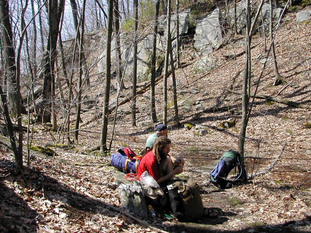
He pointed us to the camp ground across the road and we said good bye and thanks. The camp ground was a large field and looked like in the summer it could accommodate dozens if not more car camping groups. I'm suspicious that this site might not be too inviting in the summer, especially on weekends, due to its ready access and likely crowds. There was hemlock grove up to the side and since it was still raining we headed there instead of the field. As we stepped into the grove, we saw a guy, perhaps in his 30s, with long beard and dreadlocks sitting under a large tree under a tarp, carving something with a huge knife. Thus did we meet Cherokee Tears. He had stayed the previous night at the Graymoor Friary and we had finally caught up with him. Like ourselves, he was sectioning from the DWG to Kent and we had followed his register entries for over a week. He was a bit of a minimalist camper with a wood staff, homemade pack, Tevas for footwear and cooked with what looked like an old Boy Scout mess kit top over wood fires. He said "make yourself at home" and we found some space for our tents a short ways up the hill from him.
We set up the tents and were cooking when he dropped by and chatted briefly. He seemed very shy and laid back, but showed a good deal of knowledge and sensitivity to nature. The rain was still rather light so the hemlock canopy kept us nearly dry. As I hit the john before bed, I saw Cherokee Tears was settled under the tree under a plastic tarp staked out with stakes he had made on the spot from bits of wood. As we crawled into the tents for the night, we could hear the rain on the tent fly off and on through the night.
Day 9 trail miles: 14.5 Other miles: .5
Total trail miles: 122.7, total other miles: 6.75
reakfast was a bit wet. It was hard to tell if it was raining or if it was just the thick fog dripping from the trees overhead. Things got packed up damp and we made off. As we passed Cherokee Tears, he was just rousing so we said good bye.
We were headed for the RPH Cabin, Only a bit over 10 miles distant. This would a short day. But the trail and the rocks were wet and I managed to fall and scrape my right arm going over one ledge (the scrapes are sill there as I write this). We passed through a curious area: the trees were sparse and very mature, such as you would see in old growth, but the understory had lots of barberry, an invasive shrub used by farmers for field margins a and hedges. This indicated this was an agricultural field (perhaps a pasture) not the long ago. We could only speculate that the farmer had left a good many old trees when he cleared his pasture.
When we were nearly out of Fahnstock, the trail joined an old rail right of way for a mining railroad. It was narrow but well graded and banked with rocks along the side of the hills and was quite nice to walk on and rather picturesque. The scene was marred by two mountain bikers riding the other way. Not only were they not supposed to be on the AT, but they followed the rail bed into an area which was closed entirely due to some conservation restoration. Fresh Air said he had heard that NY Governor George Pataki actually had gone birding in the area and had found some relatively rare warbler species nesting, and so the park had closed the area (this did not affect the AT which skirted this area).
We arrived at the RPH Cabin around 2:30, shortly after the rain started up again. We luckily made it in before getting wet. I was to meet De, my Trail Angel, at the Taconic Parkway (just a quarter mile away) at 3:00 so I gave her a buzz and she was on time with our supplies for the rest of our hike. As I started off to meet her at the Taconic, Cherokee Tears showed up, also escaping the rain.
 Hanging out the laundry at the RPH Cabin |
I decided to walk to up the Taconic along the country road that went there rather than the trail since the road was likely to be easier. Well after a minute or two of walking, the road took a turn and then went up an incredibly steep hill to meet the highway. I was exhausted and breathless, but there was De, just having taken the exit off the Taconic. Since the Shelter was actually on a road, we hopped in the car and drove back. I took the bag of stuff and she came in to see where we were staying.
A word on the RPH Shelter, or "Cabin" as the sign on it says. Of all the places we stayed it was quite unique. First of all it used to be a finished enclosed cabin. It had plaster walls, a ceiling, glass windows and 3 bunk beds. Because of some regulation, the front wall had been removed, but there was a porch with a picnic table covered by a roof. Not only was this unusual but it was in the middle of a rural neighborhood with a couple of houses not 50 yards away on one side and a farm field on the other (to say nothing that it is practically sitting on a major highway from NYC.). It actually has a street address: 731 Hortontown Road.
Fresh Air and I were going through the stuff deciding what we needed and what we didn't want to carry (we were actually 2 days ahead in terms of meals since we had made up 1 day on our schedule and we had eaten out in Fort Montgomery). Cherokee Tears and my angel were looking on and chatting when suddenly what must be the most bizarre occurrence of our hike and perhaps any hike happened. Up drives a car on Hortontown Road, parks next to my angel's car, and out comes a 50ish woman with a clipboard who walks over to us. She says "Is this 731 Hortontown Road". I said "I guess so". So she says "I'm doing a survey for the Board of Health and you'll receive $30 if you answer the survey." We all look at her kind of suspiciously, like what kind of scam is this. I finally say "I don't think you may know what this property is, it's not a permanent residence." So she says "You mean you won't be living here for at least the next two months?". I said "No, we just showed up an hour ago and we'll be gone tomorrow.". We all tried in various ways to explain to her that this was a trail shelter, what a trail shelter is, etc. etc. Finally she got the idea that this was not the right place for a survey and I walked her back to her car. She wanted to give me some literature on what her agency (she said it was a Federal agency) did, but I politely declined. My only guess is since this shelter is on a tiny sliver of federal land (the AT corridor) it was on some list of residences owned by the government and made it's way to her agency's list of places to "check out". Our government at work for us!
We finished sorting our supplies (Cherokee Tears took the extra mixed nuts and hot chocolate) and I said goodbye to De. So now we settled down, had supper and had a good night's rest, right! WRONG! From the other direction suddenly 3 backpackers (Frank, Jim and Chris) showed up, hiking southbound from Route 52. They had started that day after a long drive from York Pennsylvania, and were hoping to do around 50 miles to Route 17A over the next 4 days. They were early 50s guys who were doing one section hike in the North each spring and one in the South each fall. This year they had worked their way up to Duchess County New York. The rain was getting heavier but they were merely wet, not soaked. They picked out bunks and laid out their gear to dry and now we had a full complement of 6 in the cabin.
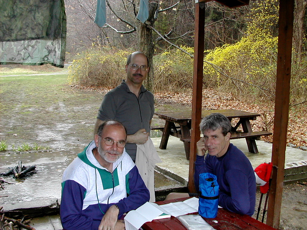 Frank, Jim and Chris at RPH |
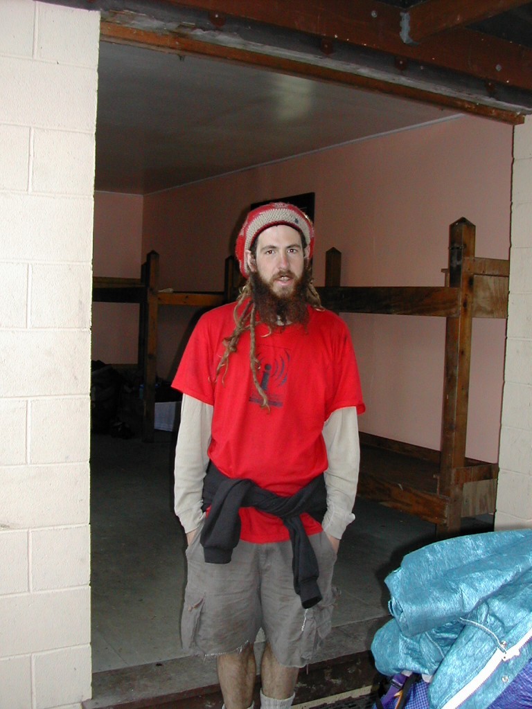 Cherokee Tears at RPH |
About a half hour later it was really raining and two 30ish guys (Haggie and Jay) showed up soaked to the bone. We looked around and didn't say anything like where will these guys fit. Well, there was plenty of room on the floor, so no problem. As they say, when it's raining, there's always room for one more. However these guys had a dog (Nestle) and I believe there is not always room for a dog, especially in the rain.! 15 minutes later, you guessed it, 2 more showed up, these were 30ish women (Cynthia and ?). It took me a while to realize they were actually with the two guys that preceded them. This was getting interesting. It turned out these two couples knew each other from work in NYC, had tents and were just out for the weekend. So two fairly large two-man (or actually one-man plus one-woman) tents got set up, and we no longer had a space problem.
Everyone hung their wet stuff out to dry from the eaves on the front porch and we had some nice conversations.
I started the ball rolling cooking supper, then Fresh Air and then the 3 guys from York (who had lots of gear and cooked with a common stove and common set of cookware). When I started my Pocket Rocket, the guys said "Well, that was fast". They were just getting into equipment and were using a white gas stove which they were not totally comfortable with yet. The 2 girls started an alcohol fire in a tin can stove they had made, and started heating something up - very slowly. They watched us cook and eat and clean up and wash the pot and pack it all away and wash our teeth - all the while their stuff slowly did something or maybe nothing, and I started to think, this doesn't look too good for them (who, you recall, all got soaked). But "The last shall be first" as the Good Book says: finally they produced some very delectable looking stuff that actually made me a little jealous.
After supper, things got cleaned up, the couples (and the dog) disappeared and we chatted with the 3 guys. The had a very uneven schedule. 19 miles tomorrow (to Graymoor) than 3 short legs to get to Route 17A. We were all a bit skeptical that they should be doing 19 miles on the first day out, but hey, what do we know? I definately saw 1 mosquito land on my leg (my first confirmed sighting), but I smacked him (her?) hefore he could bite so I stayed bite-free for this hike.
There was a rumor that a racoon was down in the privy, but I never did find out if that was true or just a joke. Jay had put a long stick down the privy hole reaching up nearly to the seat so the animal could get out, so I guess at least he believed it. At the RPH shelter I guess anything can happen! Next day Cherokee Tears said yes, it was true. Still I don't know ...
I called Ed that night who was thinking of hiking with us the next day (Sunday) but he had decided he didn't know the area well enough to meet us early on, so he and Jerry and Sandy would probably just do some hiking in Harriman.
Everyone got an early bed and we felt very lucky to have a good dry shelter. It was raining when we went to bed, but when I got up in the middle of the night I saw stars.
Day 10 trail miles: 10.6. Other miles: .5
Total trail miles: 133.4, total other miles: 7.25
e woke early to the sound of birds carrying on vociferously in our "front yard". The weather was thankfully dry but the ground was wet. Fresh Air and I debated whether to make it all the way to the Telephone Shelter (almost 17 miles) or perhaps find a tent site 2 or 3 miles closer. We decided to see how we felt and so we got an early start. The York guys were still cleaning up, and the 2 couples were still in their tents. Cherokee Tears was almost ready to leave as well.
We got on the trail and crossed the Taconic and climbed Hosner Mountain with some beautiful views. Cherokee Tears started with us but soon moved on ahead. We passed over Stormville Mountain which was not bad with a
 Morgan Stewart Shelter |
We had lunch at the shelter and then started up Ebert, which was mostly easy with but a few rock ledges. The day was nice - still in the low 70°s. Showers were forecast for tonight but we weren't sure if that were true since we had our rain the night before. The trail was wet and the streams were full which was a very good sign. We knew at this point we would make it to the Telephone Shelter since we were making good time and feeling good. We passed a lone hiker - a bit overweight, with a yellow shirt and a big pack - who said he was on a shakedown hike.
 Nuclear Lake |
We reached the Nuclear Lake area which was very nice hiking with attractive forest land. The lake was clear and beautiful and Fresh Air saw some fish and we saw geese and ducks. He said he remembers 25 years ago this was a dead lake. For a mile or so we could hear gun shots from across the way, where there was a local gun club operating. The last few hills were easy, with nice valley views (except for one ugly new development). Finally we made it to the Telephone Shelter after one of our longest days, but feeling in good shape.
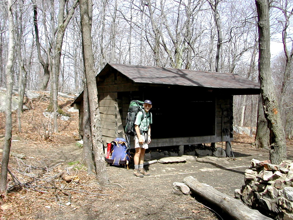
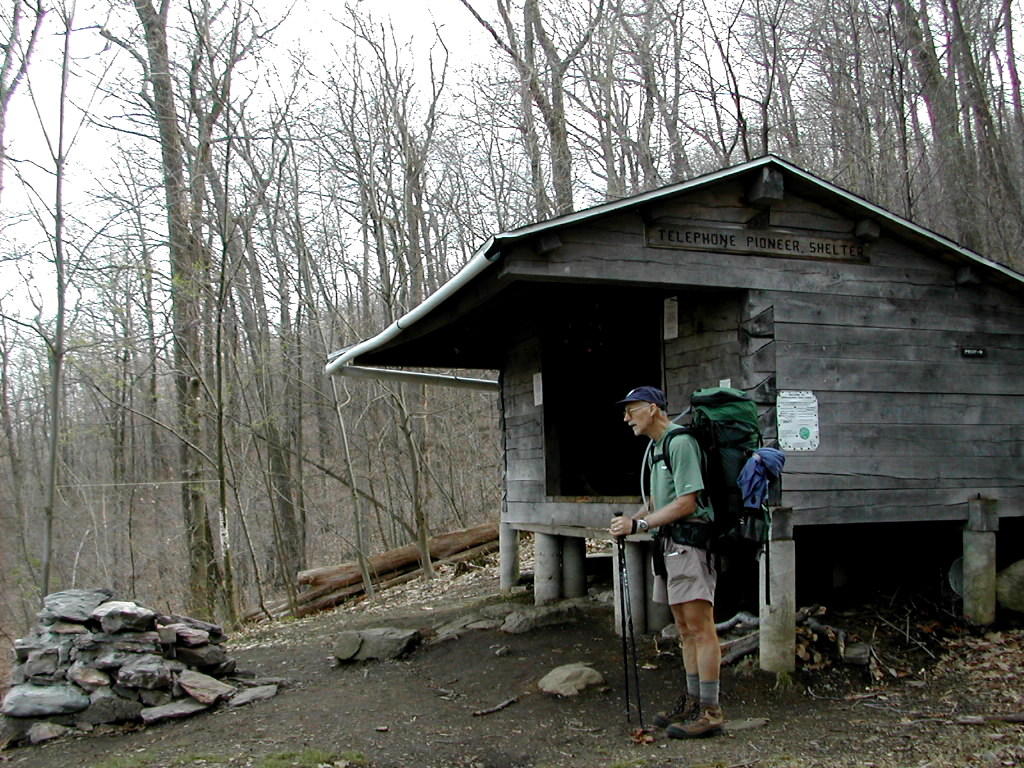 Telephone Pioneers Shelter |
Day 11 trail miles: 16.7. Other miles: .5
Total trail miles: 150.0, total other miles: 7.75
his should be an easier day if not for the weather: humid with rising temperatures. Somewhere we heard record highs (in the 90°s) were expected in the city today.
Things were easy going as we started out. We decended to the valley we had seen from above the afternoon before, crossing farm fields. The streams were full from last night's rain. We then crossed a country road and we saw a White Oak that dwarfed even yesterday's huge specimen. The Companion said this was the largest oak tree on the AT. It was truly It was quite an inspiring tree. We wondered how old it could be. I guessed 400 or 500 years.
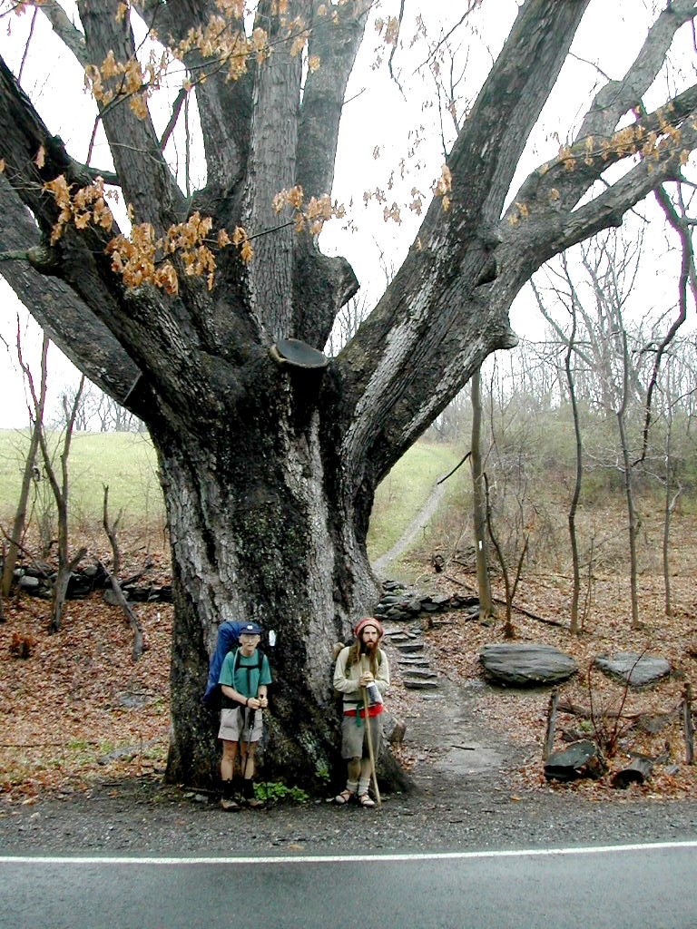 Dover Oak on West Dover Road, Pawling NY Reportedly the Largest Oak Tree on the AT |
After passing through a bog on a very nice board walk we reached the Metro North Railroad and took a little break at the Appalachian Trail train station (weekend service only). I'm guessing this is the only "Appalachian Trail" train station in the world. I called my friend in Kent and said we would probably make it there tomorrow and so we were on target.
Next we crossed Route 22 and found a hot dog stand that was not in the book. This made up for the one that was missing on Route 55 the day before. Yes, of course I had a hot dog - with relish and a Mountain Dew. It was getting a bit hot and humid and at times and this was sapping our strength as much as the hiking. We crossed through the Pawling Nature Preserve, a lovely area with miles of woods roads and bog trails. Some with plank boardwalks,
 Ten Mile River |
We passed Hoyt Road and entered Connecticut. That's two states down! We climbed the last hill of the day: Ten Mile Hill. This was long and gradual with only a few steep places. No Rock ledges. The air was a bit dryer at this point but the sun was still a burden and my ears felt sunburned.
We got down off the hill to the Ten Mile River. This was just amazing! This was the nicest place we found the whole trip! Wild river, hemlock covered shoreline, perfect setting for a shelter. The best had been saved for last.
 Ten Mile River Lean-to |
We set up camp for the night at the Ten Mile River Lean-to and Cherokee Tears decided to move a quarter mile further on where there was a tentsite. I checked it out and it was equally beautiful. Let me tell you all, even in Connecticut, the mostly densely populated state in the Union, there are some hidden gems!.
I felt tired today, more I think from exposure to the sun that from the hiking.
Day 12 trail miles: 13.0 Other miles: .5
Total trail miles: 163.0, total other miles: 8.25
ur last morning on the trail was beautiful one. The sun and sky matched the beauty of the river and forest.
My back was bothering me a bit, probably as much from having trouble sleeping as from carrying the pack. I took some vitamin-I. At the shelter there was a sign that said due to a fire on Schaghticoke Mountain (the fire was last Fall), the trail over the mountain was closed. We didn't like the idea of a road walk around Schaghticoke so we decided to see how it looked and perhaps do the trail anyway. Several register entries indicated some folks had done the trail over the mountain in the last few weeks with no problems. One entry by a trail maintainer said the trail ws only "technically" closed.
 The Housatonic River from the Trail |
The first part of today's hike was along the Housatonic. Ten Mile River joins the Housatonic just past the shelter and this river walk was quite beautiful. I guess it was the only time on our hike when we were going along a river, rather than across one.
We crossed a road and went by a lovely pond and finally got to the place where the trail started up the mountain and there was another sign saying the trail was closed. At the end it said "Please use the temporary relocation of the AT". We figured the word "Please" was conditional so we went ahead. The trail was actually fine.
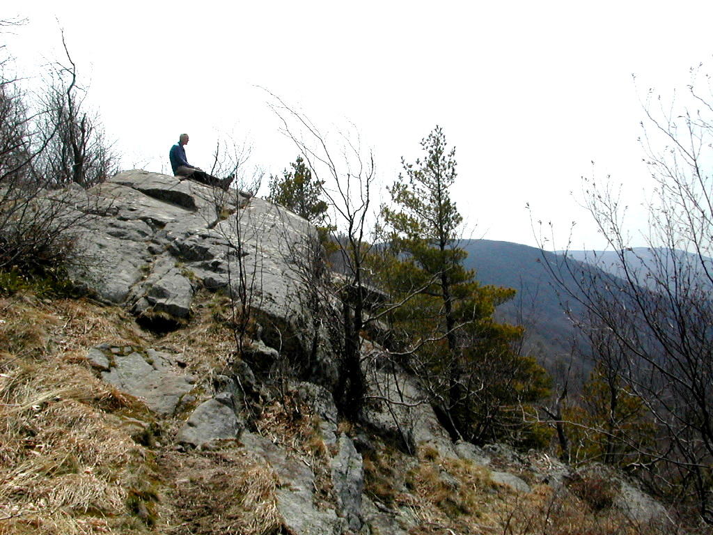
 Taking a Break in Dry Gulch on Schaghticoke |
The ascent was long and gradual but tiring. The sun on the open slopes with no tree cover was beginning to get daunting. I was getting worn out from the heat and from dehydration. I started with 2 liters in my Platypus, but that had run out by the top of the mountain and I had to pump another liter from a stream to drink. Once past the first ridge, we were out of the fire area and there were a number of great views of the Housatonic Valley since the trail generally followed the eastern side of the ridge line.
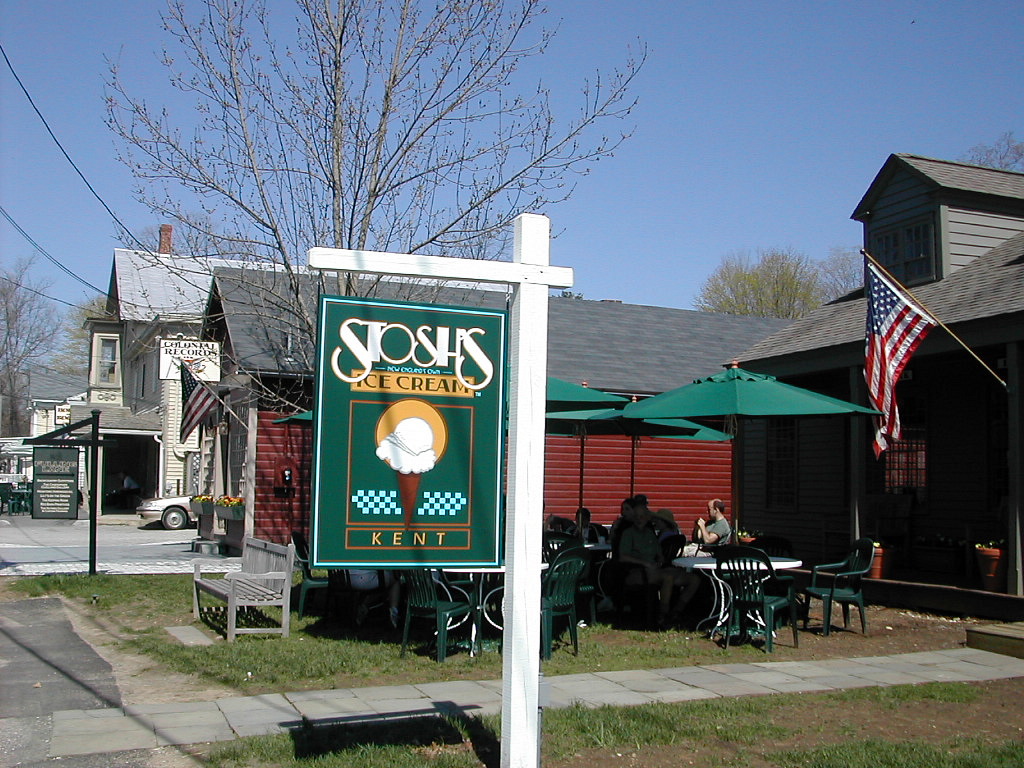 Stosh's Ice Cream Parlor, Kent Connecticut |
But we weren't really done. We walked the .7 miles down the road into Kent, passing the gorgeous grounds of the Kent School as we crossed the Housatonic. The first thing we saw as we entered the village was Stosh's Ice Cream Parlor. A fitting end to our Journey!
Day 13 trail miles: 9.8. Other miles: 1.5
Total trail miles: 171.8, total other miles: 9.75.
Grand Total Miles: 181.55
his being the first of several AT section hikes of the season, I want to give a quick evaluation of gear, food, supplies, etc. before I forget. This will help us (and maybe others) in getting ready for the next big section we plan on doing in about 3 weeks.
Pack: Kelty Flight 4500. Mixed review, it was light (3 lb 2 oz.) and generally comfortable but tended to shift on my back to the left side after a long day which hurt my left shoulder. I'm going to see the Campmor "pack guy" next week to get some hints on adjusting and balancing it.
Tent: Sierra Designs CD Ultra Light-year. Excellent. Light (3 lb. 2 oz.), easy to set up, warm and dry (we had several 30 and 20 degree nights). Slight problem: the tip to one of the poles came off. The SD guy I called said he will send a replacement right away.
Stove: MSR Pocket Rocket. Excellent. Fast to start, fast to boil. Light weight (3 oz.) with fuel in 12 oz. canisters which was good for 20 meals (10 days Breakfasts & Dinners). Downside - keep it warm - it won't start when the temperature of the cannister is below freeezing, definately not a winter stove. But with it's light weight, fast action and long fuel capacity, I consider this a top choice for a stove.
Bag: Marmot Arroyo (30 degree). Good. Light (1 lb. 14 oz.). Used inside the tent, I was fine to well below freezing. I used a silk bag liner which helped keep it clean and made things warmer.
Pad: Thermarest 3/4 ultralight. I was a bit uncomfortable, especially on the hard shelter floors. Oh well, I guess I'll get used to the feeling.
Filter: MSR Miniworks. Good. But Bill's PUR was a bit lighter and pumped a little faster. So I was a tinny bit jealous.
Hydration: Platypus Hoser. No problems. The MSR filter could connect directly to the Platy's tube. This system, which I've just started using, is far superior to the old canteen / Nalgene bottle, etc. way of doing things!
Belt pack (tummy pack): Having the tummy pack was a good idea. I kept camera, maps, first aid and odds and ends in it. Easy access while walking was great. The model (mine was the Outdoor Products "Roadrunner") was just about the right size. (300 cu in., 7 oz.). The price was right too: $9.95 at Campmor.
Camera: Nikon Coolpix 775. Excellent. Over 140 pictures, very good quality. 1 battery lasted the entire 13 days (I also carried an extra). Only 6.5 oz. This and the stove were the real winners of the trip!
Binocs: Brunton Lite-tech 8x22. Perfectly adequate but I didn't use them enough to justify. Next time I think I'll leave them home.
Shoes: New Balance 904 Trail Running Shoes. Mixed review. The first 3 days I was ready to throw them out. The very rocky ground made them uncomfortable and I nearly got some blisters. By the end they were actually much better. Partly adaptation, partly less rocky ground. The down hills were always tough - the shoes would crunch into the toes. Next time I may go with more and less. Some lightweight flexible boots (maybe EMS) and some sandals. See how hiking in sandals really works.
Clothes: The Paramo Mountain Shirt was a great all around hiking shirt. From about 40 degrees to the 60s it was good. It was both warm enough and cool enough. When it got hotter I used a coolmax T shirt. RailRider pants and shorts were OK - maybe not worth the $$$.
Rain gear: Frogg Toggs were fine. We used them on cold mornings and evenings to stay warm. We were warm and dry the few times it rained . One problem: slight rips at each pants pocket opening. I sent them back and they promised a replacement.
Food: We went Freeze Dried which was an excellent choice for us. Fast to cook, more variety than I could do myself, more tasty. Cost more, yes I know. This is the ideal solution for someone who wants good tasting variety with no work (sounds like a guy thing, no?). We took 4 brands. Favorites: Mountain House and Backpacker Pantry. Beef Stroganoff, Lasagna and Chicken w. Rice stand out. Other food favorite: Swiss cheese. Good when warm and a few days old (seriously - really flavorful and not "green" yet). Bagels didn't work out: too chewy, stale tasting.
Maps & guides: we took Maps and a one page-per-section combination Trail Guide / Databook / Companion which I had put together. No actual books. This worked really well for us. Each day the requisite Map and combo pages went into the tummy pack for easy access. I actually like the extended trail descriptions from the Trail Guides - the Databook stuff is a little too sparse for me, but I combined both of these and the Companion pages so I had everything. (Except the Handbook! Did I miss much?).
|
Click here for a complete album of photos from this hike Click for Papa Bear's Home Page Click for the Backpacking Page |