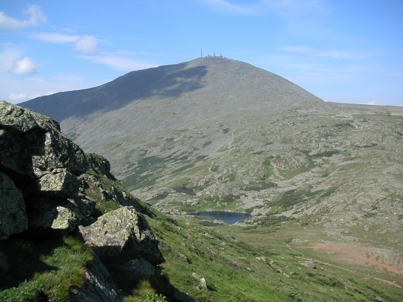
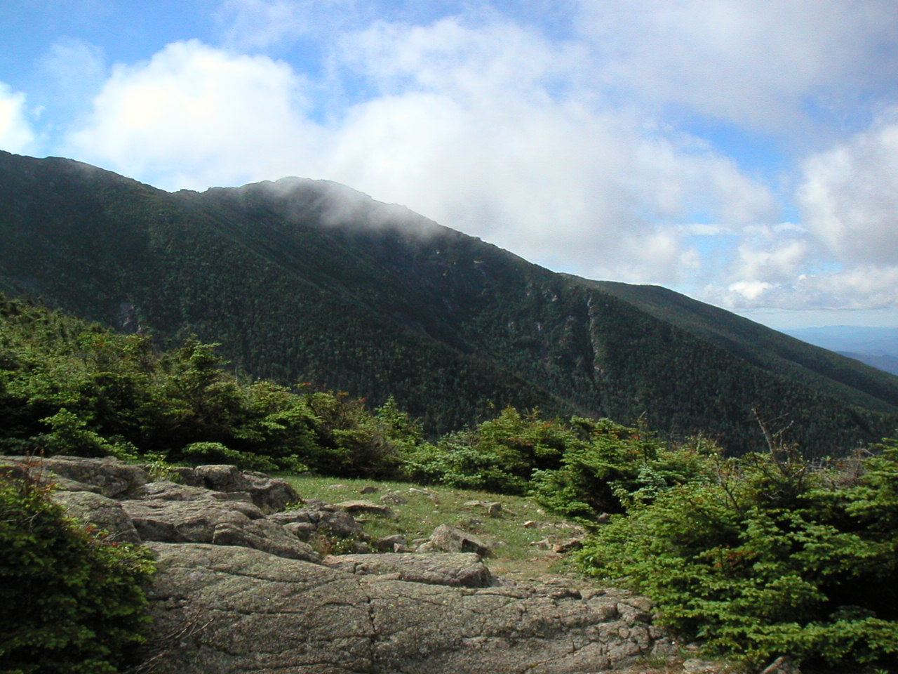
Mount Washington from Mount Monroe
The Lakes of the Clouds visible in the col
|
Mount Washington from Mount Monroe The Lakes of the Clouds visible in the col |
|
Click here for a complete album of photos from this hike Click for Papa Bear's Home Page Click for the Backpacking Page |
y partner and I have set out to do a series of section hikes this season starting at the Delaware Water Gap in April and ending at Katahdin in the early Fall, doing one hike of up to two weeks each month. This was our fourth of these section hikes, a little over 90 miles from Kinsman Notch to Gorham New Hampshire. We stayed at AMC Huts the whole way through the White Mountains. We were out 8 days from July 8th till July 15th.
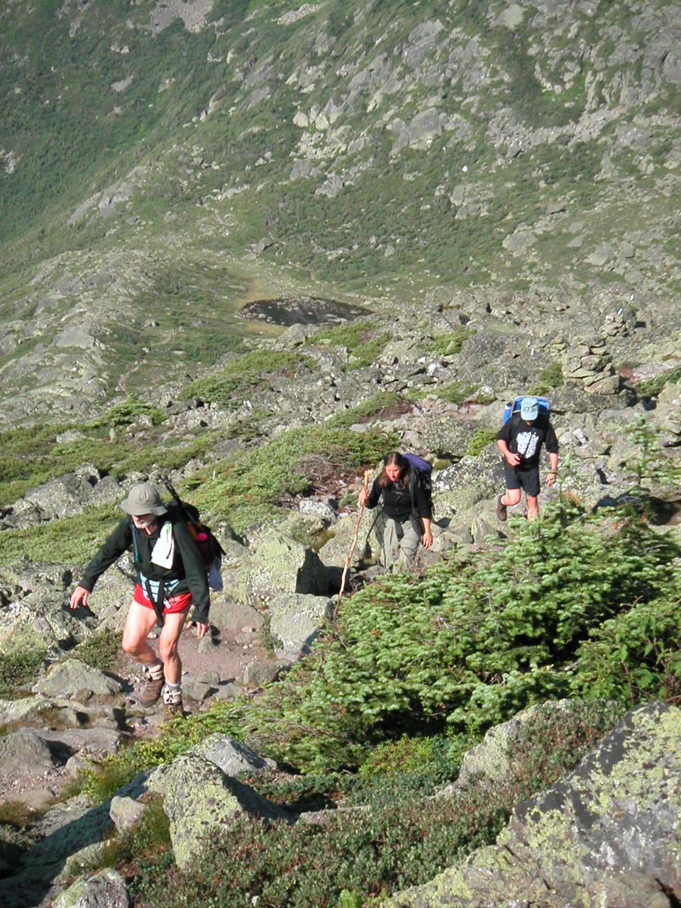 Climbing Mount Madison |
The AMC
The AMC was founded in 1876 and built it's first hut in 1888 (at Madison Spring in the col between
Mount Adams and Mount Madison). So they have been around at least 50 years before the Appalachian Trail
was in existence and their back yard, so to speak is the White Mountains. We decided to do the Whites
by hut-hopping this section. This way we would carry no food, no shelter, no sleeping bag, no stove etc.
For all practical purposes we were slack packing. But due to the unpredictable weather I actually took
extra clothes. But I did the whole section using a 13 lb day pack. Mountaineering and conservation practices
have varied over the more-than-a-century the AMC has been in business. At the start of the 20th century
there was actually a hotel on the top of Mount Washington. I can't speak of the earlier era, but I know
that for the last 20 years or so there has been a serious effort on the part of the AMC and the U.S.
Forest Service to practice good conservation and to protect the fragile areas of the White Mountains from
overuse, especially in the alpine regions. My opinion, and that of many others, is that the state of the
trails and of the surrounding forest and tundra has actually improved in the last several decades, in spite
of an ever increasing amount of use. I've heard that over a million people visit the Whites each year.
I can't verify that number, but I know it is a lot. I have heard the AMC criticized for it's fee structure
and the rules it imposes on camping in the region. But I know that without some rules this place could
turn into a garbage dump, so on the whole I respect their approach.
The Huts
I think the huts are terrific. I am so glad we decided to do the hike this way. They concentrate usage in
a few easily controlled areas, they provide a great educational component (they give hands on nature walks,
etc.), especially for families with children, and they are very serious about conservation practices. And
the huts themselve are
esthetically attractive
and fit well into the natural environment. The staff (mostly
college age kids, called the "croo") is enthusiastic, hard working and fun to be around. They provide free
food and lodging for a limited number of thru-hikers (called "work for stay") which they seemed to dole out
quite liberally. The thru-hikers loved the huts: they connected very much with the croo. Several retirees who
were thru-hiking were using the huts for pay and were happy to have them available. I was especially impressed
by the families who brought young kids (like 3 and 4 year olds) up to experience this. Those kids had to hike
several miles at least to get here and they were learning the beauty and wonder of the out-of-doors (and the
fact that it's so much better when you have to work for it) where the average kid would be home sitting playing
video games. The cost: for an individual it was $49/night including 2 huge meals (for a minimum of 3 nights).
Certainly cheaper than lodging and restaurants down in the valleys. I realize this may be expensive for many,
but I am so happy that we could squeeze this into our budget. It was a great experience. Interestingly, this
type of lodging with the strong educational and conservation component, is close to Benton MacKey's
original vision of the AT (before thru-hiking was "discovered").
The Trails
The state of the trails was unbelievable. There were exactly NO BLOWDOWNS blocking the trail all the way
from Kinsman to Gorham. In no other section of the trail was that record even remotely approached. In fact
in some areas in the mid Atlantic there seemed to be several blowdowns per mile. The stone work was awesome
and the miles of board walk in sensitive boggy areas was equally awesome. One might criticize the roughness of the
trail (what trail?) over some peaks above treeline (Washington, Munroe, Jefferson, Madison, Adams), but to
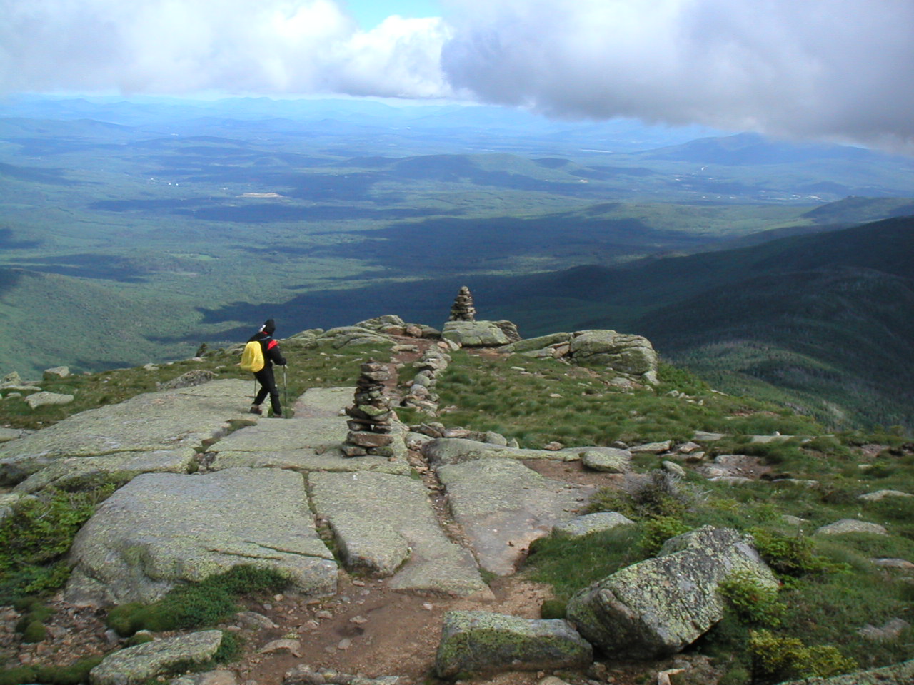
me that just added to the wonder of the trail. Yes, sometimes you just had to scramble from cairn to cairn
over huge boulders. But Mother Nature provided that environment. I certainly would not like to see this
terrain flattened for the convenience of hikers.
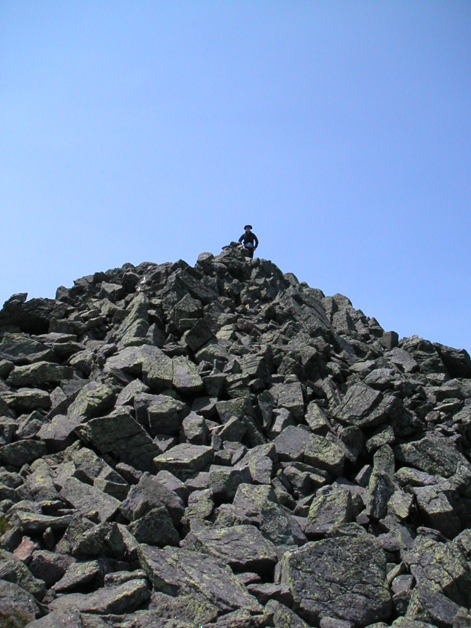 Mount Jefferson |
Peak Bagging
We decided to do all the peaks we could manage, even though some of these were on side loops (blue blazed).
Thus we blue-blazed over the peaks of Eisenhower, Monroe, Clay and Jefferson and were very proud of it.
Sorry to say we missed Adams since rain was
threatening at the time. Next year we'll get it. For peak bagging we managed no less than 20 peaks above 4000'
and all the New Hampshire peaks above 5000' - except Adams (as well as a number of peaks that "don't count"
since they don't drop down far enough from their neighbors. These would add 10 more 4000s.). Ironically the
toughest climbs were on either side of the alpine peaks. South Kinsman to the south and Wildcat to the north
were the toughest peaks we had yet to climb. Basically they went straight up over rock ledges for ever. If
Maine is tougher than this, then bring it on!
The Weather
Statistics say that on 86% of the days, the White Mountain peaks (especially Washington) are cloud covered.
That leaves 3 of 4 days a month on average for clear skies up there. It seems the mounains create their own weather.
Even with a clear blue sky below in the valley, you will often see
clouds just at the peak of the mountains
. Well I consider myself extremely lucky on this hike weather-wise. We had the fun and excitement of
fog and wind
while crossing the Franconia Ridge, but after moving on to Mount Garfield, the skies had cleared
and we got a
great view
of where we had been. Then while crossing the Presidential Range we were blessed with three
days of
clear weather.
We had the best of both worlds!
e had stayed the night in the Woodstock Inn in North Woodstock NH. For the price ($89 for a double room) I would not recommend this place. The Cascade Lodge next door (although a tad run down) at $19.50 was a much better bargain! We got the local taxi/shuttle after breakfast and headed up Route 112 to the trailhead in Kinsman Notch.
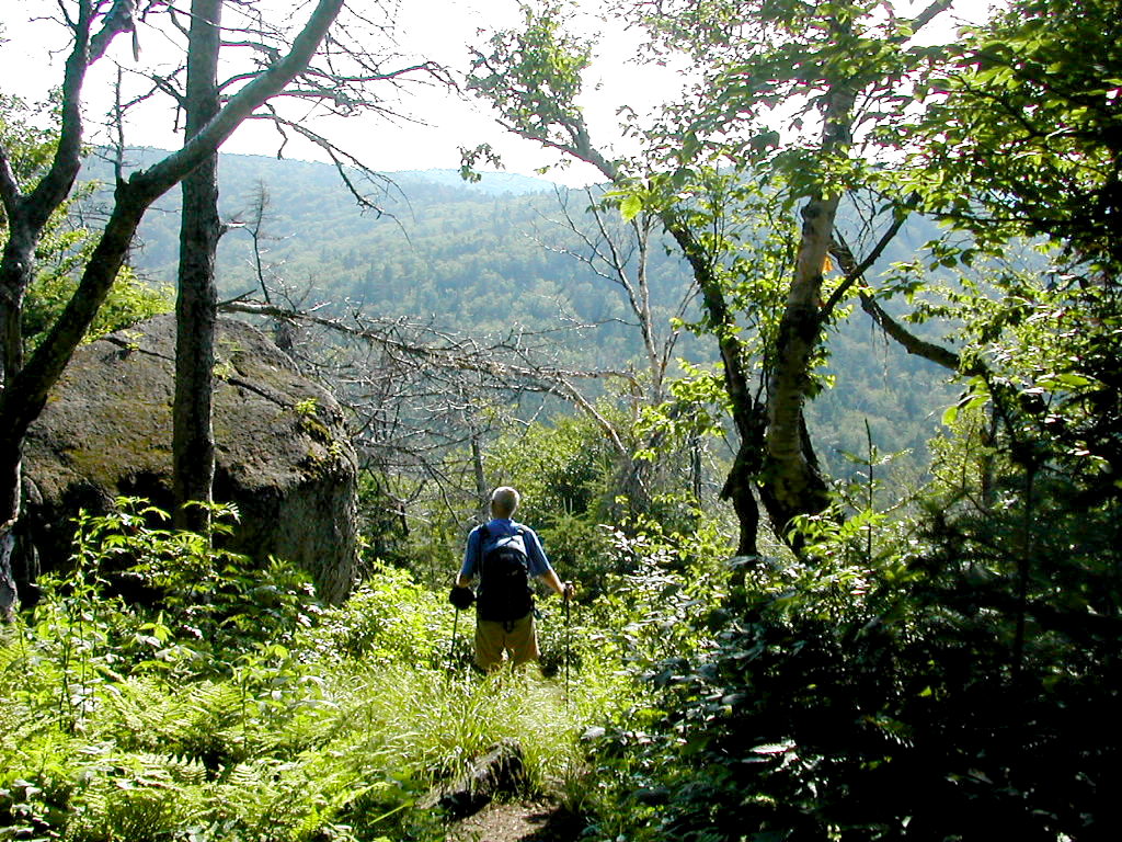 Starting up the trail from Kinsman Notch |
We got going at 7:46 AM. It was so great to be hiking with just day packs, but in spite of that we had a long day ahead of us. The trail started up a steep rocky slope. It was well built and we passed over a nice ridge to a view of Gordon Pond and onto the Gordon Pond trail. In this section, the trail is often not labeled as the "AT" - it goes by numerous local names. Remember these trails were here before there was an AT and have been maintained for over a century in some instances. We met a SOBO thru-hiker named Bill and chatted for a while. He had met Turbo and Sassafras in Andover Maine. We speculated that those two were probably done by now. We suggested he check out the Hostel in Glencliff when he made it over Moosilauke that day, and he thanked us for the advice. The day was humid and we had a few deer flies harassing us (I prefer them over black flies any time!).
We made it up and over Wolf Mountain , a fairly easy climb. The only annoyance was the humidity and the bugs. We passed 2 beat looking day hikers coming south. The second one (about 5 minutes behind the first) asked if his partner was "waiting for him". We said no. Sigh! We stopped briefly for lunch at the Eliza Brook Shelter and checked the register. The shelter is located on a pretty forest stream. There was evidence of a conservation effort to prevent erosion and over use by some signage and small fences.
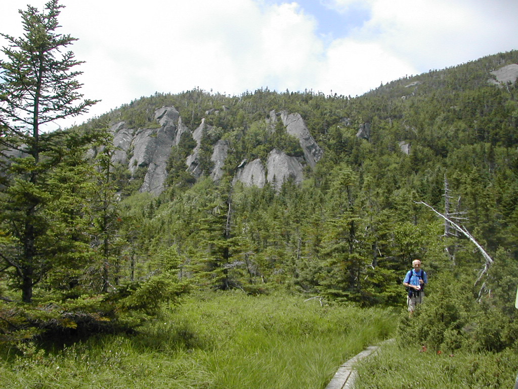 South Kinsman Rampart over the marsh at Harrington Pond |
By the time we got to North Kinsman, the black flies started attacking us. On the down slope (also very steep), I had to put on my bug net. I was afraid I would lose my step (or lose my mind!) while climbing down with the bugs in my eyes and ears and nose!. This was a double attack of rough climbing and black flies. Misery likes company. Struggling down North Kinsman, we met Rocky and Moose (a trail dog) who were thru-hiking, going north like ourselves. We chatted briefly but moved on. Rocky had to move slowly since he was very careful that Moose could manage the steep ledges without injury.
Finally we got to Lonesome Lake Hut. I had thought the day would never end. It was a combination of first day exhaustion, and some truly rough terrain.
This was my first hut. Fresh Air had stayed in huts several times over the years but I had not. It was a great place. Lonesome Lake nearby was great for a cooling and refreshing dip and the other guests included a wide variety including families with young children. Some as young as 4 or 5. Until this point I had considered the huts a convenient way to avoid a heavy pack, but I quickly saw their true value was in education the public, especially the younger segment. These people (with a few exceptions) were not backpackers, but the experience they got here was wonderful. And they had to work to get here. These were not the "fat-people" we see getting out of their cars at the top of Bear Mountain in New York, or getting out of the ski gondola at the top of Killington. These people, like ourselves, had worked to get here. Even the smallest child was learning the value of hard work and the wonder of the out-of-doors. The "croo" had special nature programs for the kids as well as for the adults. And they were fun! This educational value of the huts, which we would see over and over again, gave me a very good feeling about this (admittedly small) segment of tomorrow's outdoor enthusiasts.
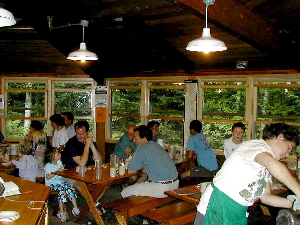 Lonesome Lake Hut at Dinner Time |
Rocky and Moose showed up and the croo offered Rocky "work for stay"; he only asked if he could buy dinner - he hadn't even known "work for stay" was available. Moose had to stay outside (with lots of attention from the kids) but Rocky was very happy to have a nice lodging and meals for a few hours washing dishes.
We bunked out with a couple of college age guys in bunkroom #7. They were having a great time rafting on the rivers, hiking and hutting (is that the word?) I rained on and off during the night but we slept very well. With a mattress and wool blankets no less!
fter a nice breakfast the "croo" gave a skit which was to be repeated in different forms at every hut. The lesson was 1) fold your blankets, 2) pack out your trash and 3) tip the croo. After seeing versions of this skit at the first couple of huts, I looked forward to what funny and ingenious variation I would see at the next hut.
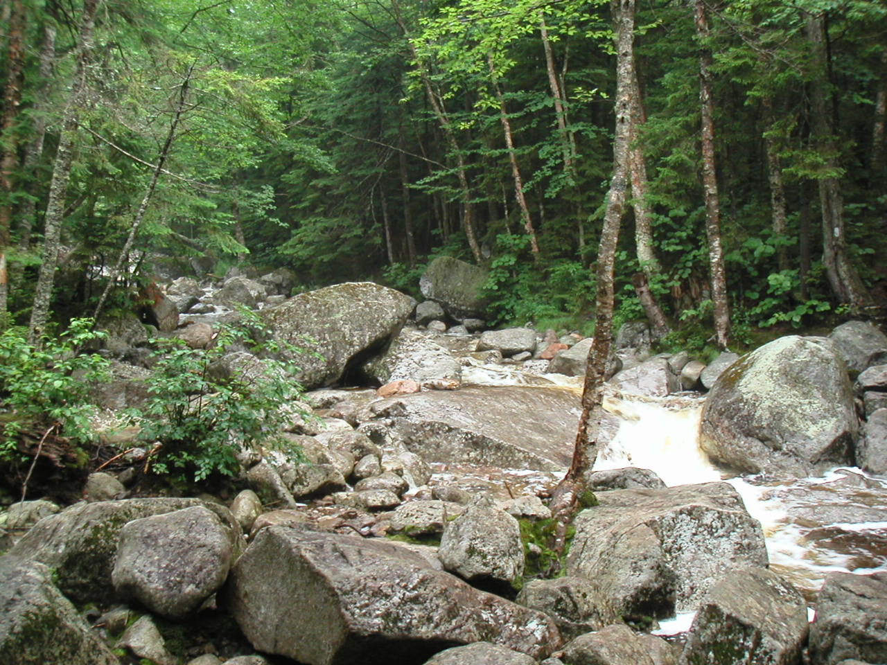 Cascade Brook - tough to cross |
We took a short break by the bridge that crossed the stream, just past (east) of I-93. This was the trailhead of the Liberty Spring Trail which would take us up the side of the Franconia Ridge to join the Franconia Ridge Trail just north of Mount Liberty. The weather seemed to indicate rain - I thought I felt a few drops - so I put my pack cover onto my pack. I did not put on my rain gear however since it was rather warm (mid to upper 60s) and it wasn't really raining as of yet.
The trail was very easy at first, following an old logging road. It soon got very steep and rocky as it started up the side of the ridge. The were many stone steps but not real rock scrambles. I would say it was rather steep and rather long but not as bad as South Kinsman by far (thank goodness). In this region steep long ascents were getting to be the norm.
Just before we reached the top of the ridge, we arrived at the Liberty Spring Tentsite which was directly on the trail. There was a huge wall tent adjacent to the trail and a young woman stepped out of it just as we came by. I said how the heck did you ever pack that tent up to this spot. She laughed and explained she was the caretaker and the tent and her supplies for the summer were actually air lifted in by helicopter at the start of the season. The effort at conservation was very evident here with little fences along the trails to the tent sites and to the spring as well as some signage. The result was also evident: the area surrounding the trail was very well kept - not the usual barren wasteland you so often see around your average camp site. My opinion of the use of AMC caretakers and the rules and fees imposed was rising after seeing the results in places such as this and around the huts. As we went up we passed a group of boyscouts coming down. Just seeing them and knowing how things usually go, I was doubly glad that this area had someone looking after it.
As we got to the top of the ridge the wind picked up considerably, but the slope eased off. To the right a short distance was Mount Liberty. We would not "bag" that particular peak since we were a little concerned with the hike along the ridge before us in the wind and fog. The AT turned to the left and proceeded along the top of the ridge. In a short while we reached a very brief but very steep rock climb just before the summit of Little Haystack. Little Haystack was the start of the Alping area - at 4760' it just rose above treeline. Since technically it was but a shoulder of Mount Liberty (which we didn't do) it "didn't count" as a 4000 footer. But we counted it. We were taking a break when a group of 3 men passed, moving along the ridge in the other direction. They were actually doing a day hike over to Mount Liberty from Greenleaf Hut, and we would see them again that evening. We were sitting down taking a break and as they went on by and got to the very steep rocks, they came back and asked does the trail really go that way? We said yes, pretty steep, isn't it? About 5 minutes later we got to the Little Haystack summit and we would stay above treeline for the rest of our trek today. The fog was thick and I estimated the wind at 30 - 40 MPH along the ridge. Luckily the temperature stayed at around 60, so we had no real problems with cold.
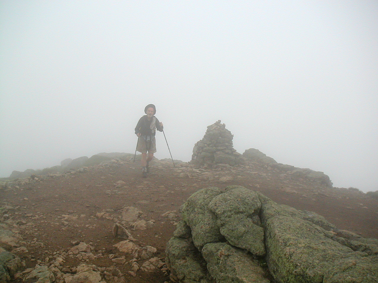 Papa Bear atop Mount Lincoln in the Fog |
We moved on and approached our last and highest peak of the day, Mount Lafayette. Although higher (5249') it is actually much wider and rounder than Lincoln, so it was not quite as imposing. But the wind was rising and the summit was a rather steep cone of rocks so this was no easy peak. Just before we got to the summit, in a little protected depression, we suddenly came upon a group of 8 or 10 teenaged girls with a couple of leaders. The leaders were yelling at them to put on their rain gear and some of them looked like they weren't having a lot of fun. We didn't quite hear where they were headed, maybe Garfield or Galehead, but at least it wasn't Greenleaf (what do I have against big groups of kids anyway?) Since it was already about 1:00 PM, we worried a little that they wouldn't have the time and energy to make their destination in this weather. 2 days later we would hear the happy ending to that story. We climbed the last few rocks to the summit and met a couple who were coming from Galehead (where we were headed tomorrow) and going to Greenleaf tonight, as we were.
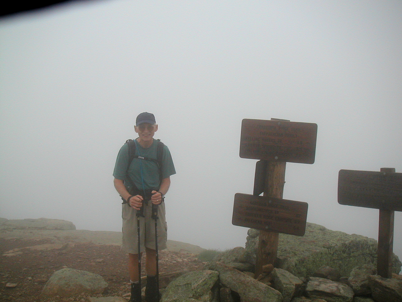 Fresh Air atop Mount Lafayette |
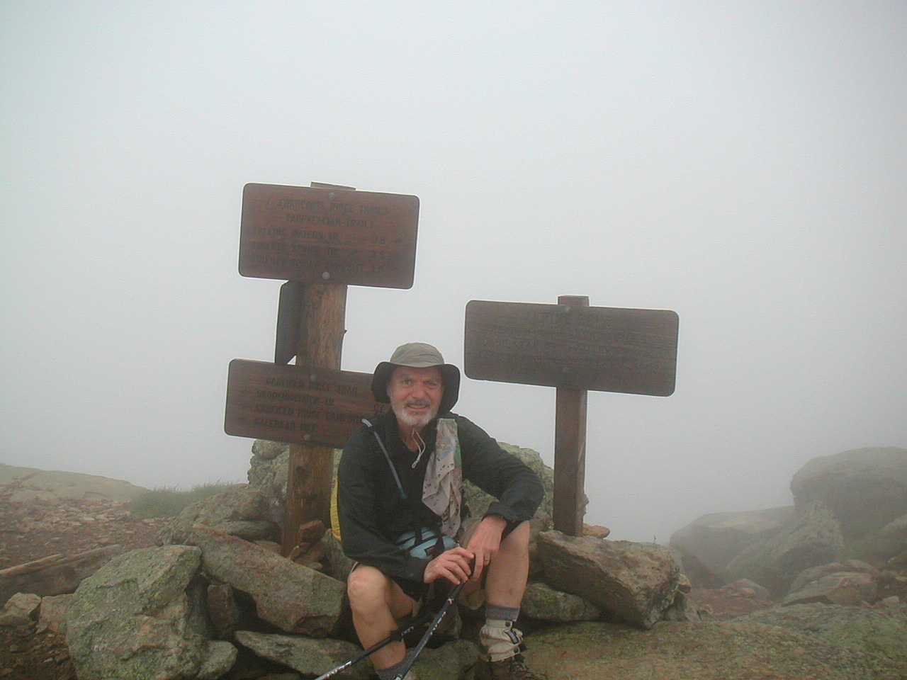 Papa Bear atop Mount Lafayette |
We chatted briefly, but since the weather was rather forbidding where we were standing we moved on down the side trail towards the hut. Of all the AMC huts, this is the only one well off the trail (1.1 miles down the shoulder of Lafayette). But this slope was supposed to be pretty easy and we had budgeted the time and the mileage so down we went.
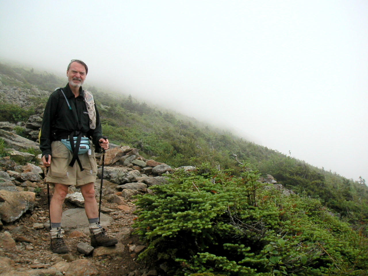 Dropping down below the fog |
Eventually we reached the level of krumholtz trees where there was a bog and a sizable pond just before the hut. The hut was on a little rise beyond the pond so looking back from the hut there was a lovely little alpine vale with the massive shoulder of Lafayette rising beyond. The sky was beginning to clear above us and the peaks were alternately covered with clouds and blue sky. A beautiful sight.
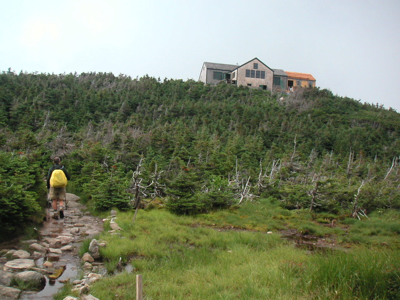 Greenleaf Hut |
We found our places in the bunkrooms. The bunks here were 4 high!. Yikes! getting up there was like climbing Mount Lincoln. The group was as congenial and family oriented as at Lonesome Lake. However since getting here was harder, the children tended to be older, but equally enthusiastic and noisy!.
Around supper time, the 3 guys we had met on Little Haystack showed up. It turns out that the youngest of the 3 was actually an AMC guide who was available to guide small groups of less experienced folks over the mountain trails. After supper he was teaching them map reading and mountaineering skills. I never knew these private guides were available. I guess if you've got the $$, you can get anything you want, even above treeline.
The hut was laid out with a central dining room facing the mountain, and two bunkrooms going off to the rear. A construction project was underway: a new wing was being added with a completely new composting system for the privies and the kitchen compost. The construction workers were a group of 7 young (30s to 40s) men and women who worked for the AMC and who lived at the hut all week. They were roughing it like us: no showers, no ice cream no beer; not you average construction workers. I was glad to see how some of the money raised by the AMC was being returned to help this segment of the hiking public and which had a strong conservation component.
Just before the fog rolled in, we saw a beautiful sunset. Or rather we saw the sun on Mount Lafayette as it set behind us. The whole top of the mountain and the cloud above it turned a rosy red as the sun went down, in a phenomenon called Alpenglow. As the night came on, so did the fog. The temperatures dropped into the 50s. I slept well that night. It had been another great day to be alive.
hen we awoke the next morning the outside had disappeared. It was a cold 50° with fog so thick you could hardly see the trees standing near the hut. The hut croo give the 7:00 AM weather broadcast each day from Mount Washington: temperature 35°; wind 44 MPH out of the northwest gusting to 61 MPH; wind chill 19; fog. Brrr!
After breakfast the croo gave a little skit to reinforce the responsibilities of the campers: 3 mountain climbers struggle to the top of a peak. When they get there, rejoicing, one of them throws an empty maple syrup bottle away saying "well I won't need this anymore". The other 2 are aghast and convince him to go pick it up. When he goes to get it, he falls and breaks his leg. They try to splint it with a blanket but it only works if they fold the blanket properly. Then they discover his pack is too heavy: he's carrying too much money - don't need that up here. They agree they'll tip the croo and reduce the pack weight!
With such high drama so begins another day in the high mountains!
We had a relatively short day ahead of us - just over 7 miles along the ridge over to Galehead Hut, so we waited to see if the fog would lift. By 9:00 AM we got impatient. The fog was slowly clearing and it had warmed up a little around the hut. I decided to wear my full foul-weather gear with the temperatures expected to be low and the wind speed high.
As we started up we had some sun, but looking up there were clouds hovering over the mountain tops. We moved up the ridge line and as we passed above treeline into the alpine zone we took one last look back down at the hut. It was sitting in sunlight but there were swirling clouds all around. We climbed up higher and approached the fog. It was like going into an unknown abyss. When we got into the fog near the peak, wham! the wind hit us hard. The temperature was about 40 and so was the wind speed. I was glad I had warm waterproof clothes and a hood.
 Climbing up into the fog |
The Lafayette summit has 5 smaller crags stretching along the ridge line towards the north. As we crossed each one the wind seemed to increase. It was out of the northwest and so it was practically in our face. As we took each step the wind would literally blow our feet slightly to the right when we would put them down. We really had to be careful, but luckily the treadway was rather easy going here.
 Coming down off Lafayette back into the sun |
As we dropped down along the ridge to the low area between Lafayette and
Garfield, we passed below treeline. With the sun now solidly out, and the
wind blocked by the trees, we found ourselves rather hot. I stripped off my
rain gear and was much more comfortable in shorts and a fleece shirt. We
met a few SOBO thru-hikers: Bagels and Buns and Papa Huskers (from Oklahoma - of
course). We inquired of Rocky and Moose who we had last seen at Lonesome
Lake. They said they were a few hours ahead of us and had camped with them
the previous night at the Garfield Ridge Campsite. Since we were getting
close to that and it was well after 10:00 AM, we figured everyone had gotten
a late start today.
 On the Mount Garfield summit |
We moved down off of Garfield and the descent was also quite steep. At one
point the trail went along in a stream bed. There were numerous ups and
downs but like the ascent, the descent was short. The silhouette of this
peak shown on the map was a sharp little peak like a sharp pyramid sitting
on the ridge line. We met another SOBO named Playdough. He said there were
a couple of his hiking friend who should be along shortly. It turns out
that he was the first of 5 SOBOs we would meet who had been together off and
on since their start at Katahdin. They called themselves the Switchback
Gang and they had earned some notoriety on the trail. He said the Whites
were easy compared to Maine, which surprised us. We figured he said this
because 1) it was true, or 2) he had got into much better conditioning since
he started out in Maine, or 3) he was just showing off with some
SOBO-superiority ("Oh we've done much tougher things than you have").
Whatever the case, we would find out.
 Galehead hut from the Garfield Ridge Trail |
We arrived at Galehead Hut around 2:55 PM. It had been a rather short and easy hiking day, but with the wind and fog, one of the more exciting ones. The hut was beautiful inside and out. It had been rebuilt just a few years before and the inside was paneled in beautiful knotty pine. It was also in a great setting: in the col on the ridge between Garfield and South Twin and looking out over the vast Pemigawasset Wilderness to the south. I made note of the wildflowers I had seen today: Bunchberry, Wood Sorrel, Diapensia, Goldenthread, Clintonia, Sandwort, Labrador Tea, Dwarf Birch and Spruce. We finally figured out what Diapensia looked like - at first we had it confused with Mountain Sandwort (which in actuality it doesn't resemble at all). There is a great little book published by the AMC called Field Guide to the New England Alpine Summits, which is great. I bought a copy at the hut and it had just about everything you ever wanted to know about alpine wildflowers, geology, climate etc. I highly recommend it. And at 5.2 oz. it's light enough to carry!
I was feeling a little bit chilled so I changed into my camp clothes and managed a short nap and caught up a little on my reading and my journal. Late in the afternoon a couple of thru-hikers showed up and arranged work-for-stay with the croo. We chatted a while with them and it turns out they were 2 of Playdough's friends: Dr. Feelgood and Firefly, part of the Switchback Gang.
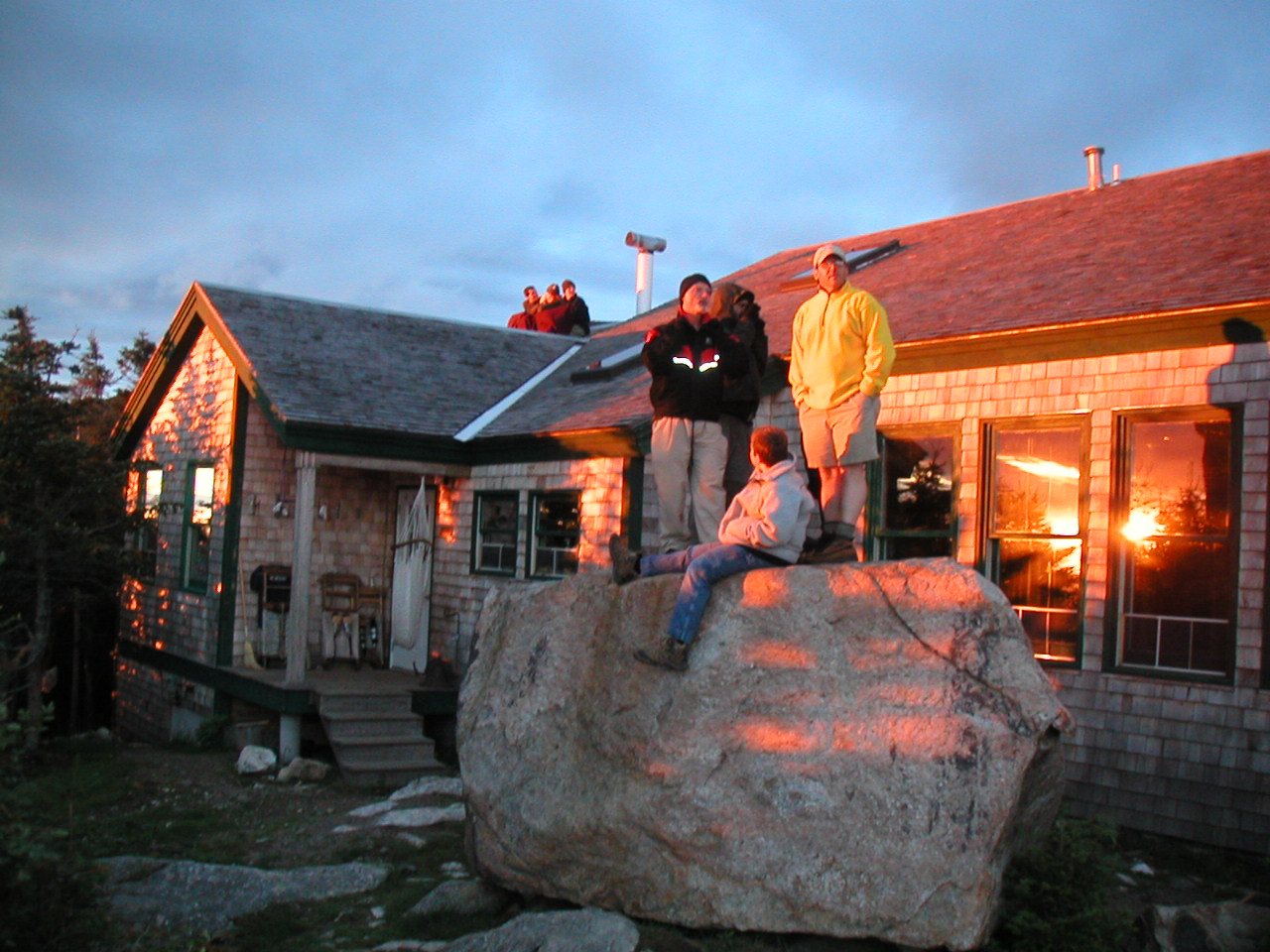 Waiting for Sunset |
After supper we experienced one of the most beautiful sights of our entire trek. Sunset over the mountains. Everyone got outside, bundled up and watched. The croo were huddled on the hut roof wrapped in a blanket and most of the rest of us were standing on a large erratic outside the hut.
Just as the sun went below the mountains, the clouds overhead lit up with a bright pink glow, illuminated by the setting sun from below.
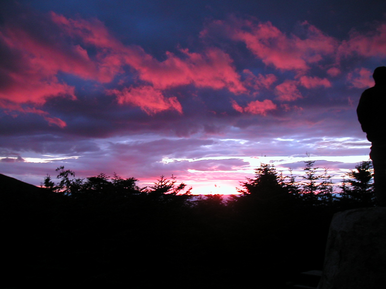 Sunset from Galehead Hut |
A great end to another great day!
t was a chilly night, I'm glad they had given us 3 wool blankets. The weather from Mount Washington was: temperature 29°; wind 47 MPH out of the NW gusting to 62 MPH; wind chill 19°; visibility 200'; freezing fog. Thus the weather on the peaks was getting serious!
During the night I noticed a whirring sound coming from the hut, somewhere near the roof. One of the croo explained that it was the wind generator (it looked like a little propeller about a foot long, end to end). He explained that the hut was self sufficient in power: energy from the wind generator and from solar cells on the roof charged up storage batteries in the attic. They supplied enough power for the water pump, the refrigerator, the 2-way radio and the lights (which were used for a few hours a day). This seemed rather cool and altogether admirable!
Today's hiking was long on paper - nearly 15 miles - but the last 3 or 4 miles of the route looked to be very easy, so we were not too concerned. We had arranged to meet my friend Susan from North Conway at 4:00 PM at Crawford Notch and there was no way to confirm since we were told there was no cell phones signal in that area. One of the hut croo assured us that we would have no problem making it there by 4:00, but I was a little skeptical knowing how those guys move along. We managed to get off around 7:35, early for us. We had packed everything up before breakfast and with such a small crowd being served, we ate and got away early.
South Twin (4902') was our first, and the day's major obstacle. Guess what: it went straight up, steep and rocky. Why was I not surprised? The trail was called The Twinway which I thought was a cool name. We made it up in fairly good shape and found the ridge to be a nice even pathway leading over to Mount Guyot to the east. We could see the alpine ridge of Mount Bond which jutted off to the south from Mount Guyot. Ironically the Bond-Bondcliff ridge was above treeline although it lay lower than the Twins where we were standing. Clearly the direction of the ridge had a lot to do with it. The Bond-Bondcliff ridge was oriented approximately north-south (like the Franconia Ridge) whereas the Twins-Guyot ridge was oriented more east-west.
 Mount Bond and the Bondcliff Trail from Mount Guyot |
Next we met an interesting looking thru-hiker in a kilt with a set of fancy wooden staffs. These were the Moses-parting-the-Red-Sea variety so I said those look like impressive staffs you got there. He said yes they've served me well. Later we learned this was Strider, the last of the Switchback Gang. He was making for Greenleaf Hut. He asked was it far down off the trail and I said yes, over a mile but it was worth it (at least if he could get work-for-stay).
We started moving down off Zealand but it was still windy well off the ridge. My left hamstring under the knee was bothering me a bit, but we managed to keep up a good pace nevertheless. The downhill from Zealand was a moderate slope (for once!) and we had some great views. We were then surprised to meet the group of girls we had seen the day before yesterday at the top of Mount Lafayette. I had a little time to talk to one of the counselors. They were from the "Farm & Wilderness Camp" and she said they experienced both "Farm" and "Wilderness" in their program. Part of their camp experience was to do a 5 day backpacking trip, in which they were now on the fourth day. They had started at The Flume and we had first seen them (on the Lafayette summit) on their second day. She said, yes it was a long haul that day and there were "some tears" from the girls getting to the Garfield Ridge Campsite that night. She then warned us to avoid the Zeacliff Trail (which we weren't planning on doing anyway) - she said it was "straight down". It was nice to see them again and to know they made it safely off of Mount Lafayette.
Finally we made it to the Zealand Falls Hut. This hut was the only one we couldn't get a reservation at. It is situated an easy walk from the road (not the route we were taking) and was in a very lovely setting where a stream flowed over a rock ledge. Apparently it is popular with families and camp groups, so it was booked solid. We spent a nice half hour or so and partook of some lemonade and bread (AYCE) which they sold fairly cheaply to people passing through. It seemed like a nice hut and I'd like to stay there some time.
The trail to Crawford Notch bore to the right here onto the Ethan Pond Trail and actually went down through Zealand Notch. Thank goodness they didn't decide to take the "short cut" and go straight up the other side of the notch. This area had been heavily logged in the 19th and early 20th century and the trail actually followed the path of an old railroad bed which had been used for logging. It was very flat and level but was periodically interrupted by massive rock slides from the slope of Mount Whitewall which formed the left hand side of the notch at this point. We realized these slides, which we saw in numerous places, have not been here for eternity but that the mountains can change their face quite markedly on the order of decades or centuries.
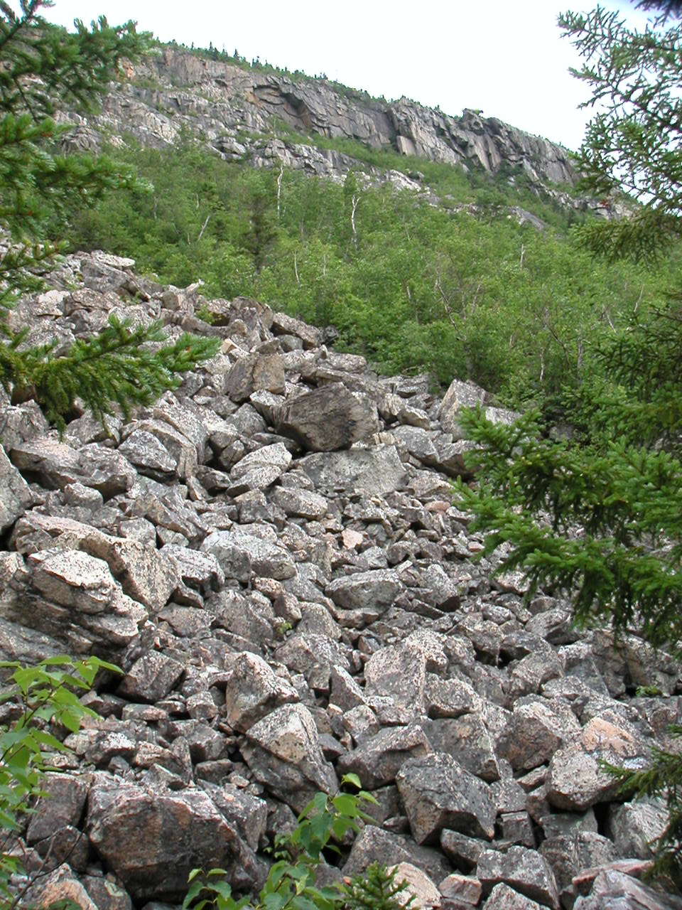 Rock Slides from Mount Whitewall in Zealand Notch |
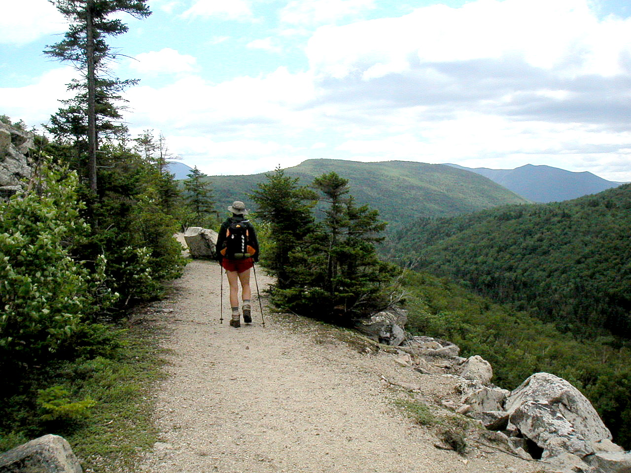 Much of the Ethan Pond Trail follows an old logging railroad rite-of-way |
As we moved further down the notch we moved to the right side of the valley and entered a lovely area of forests and bogs. There were many board walks here and we passed another campsite on a pretty lake (the Ethan Pond Campsite). We met a SOBO moving up this last slope we were coming down. His name was Moose and he looked a bit beat. He asked how far to the campsite which we told him was just a few minutes more. It was he that told us that the guy with the fancy wooden staffs was Strider, the last of the Switchback Gang. We made our way around Mount Willey, down the moderate descent over its shoulder and out to Route 302 - Crawford Notch. We were done hiking for the day and it was only 3:40 PM! We had made very good time, especially once we got off the South Twin-Guyot ridge
While we waited for our pickup, I wrote down the wildflowers (and wildlife) we had seen today: Mountain Cranberry, Bunchberry, Clintonia, Mountain Sandwort, Wood Sorrel, Goldenthread, Star Flower, Labrador Tea and a Red Eft (Red Spotted Newt). I finally found out from my AMC book that what I simply called a "Red Salamander" and which we had seen by the dozens in our section hikes, was a "Red Eft", the land stage of the aquatic "Red Spotted Newt".
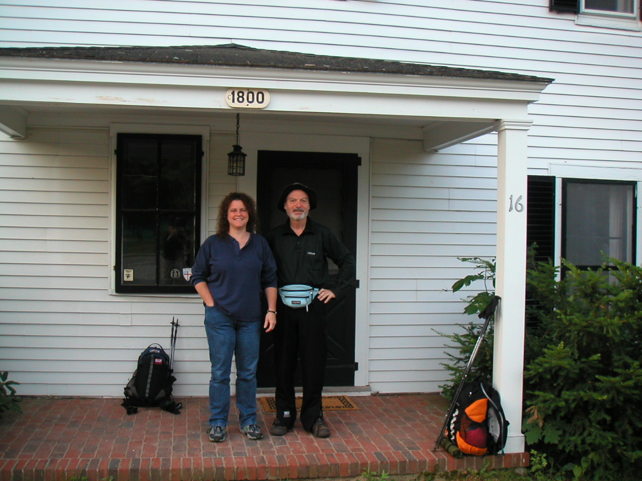 Papa Bear with Susan, our Trail Angel |
We had a luscious dinner at Hooligans in North Conway, and Gary and his daughter Beth showed up and joined us. As usual, another great day! Of course, what else?
e got up around 6:00 AM and Susan drove Fresh Air and myself the 10 miles or so from North Conway to Bartlett to meet Gary and Beth for breakfast. We all met at the Chippanock Inn where they were staying and had a scrumptious breakfast served by the proprietor of this lovely B&B. After breakfast Susan reluctantly went back to North Conway since this was a work day for her. The rest of us packed our stuff into Gary's car and headed up to the trailhead at Crawford Notch.
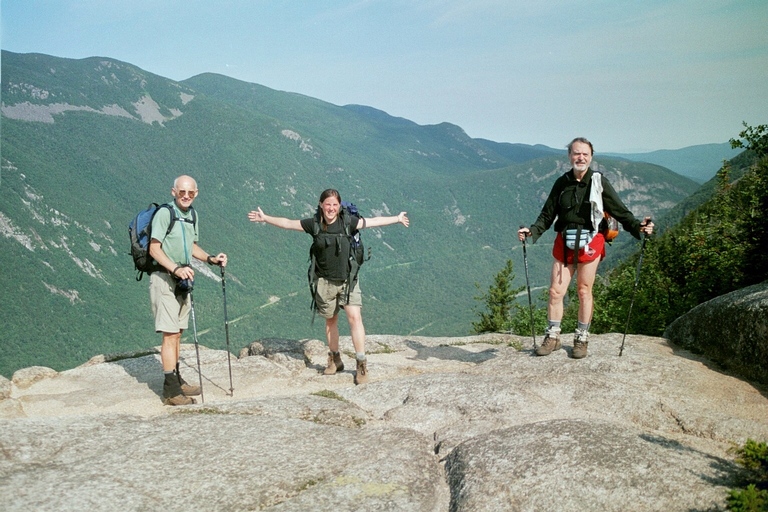 One of the ledges on the Webster Cliff Trail - View of Mount Willey across Crawford Notch |
Now the elevation gain was mostly behind us as we moved along the ridge
towards
Mount Jackson. We crossed a number of boreal bogs and the trail had
extensive board walks along these sections. Gary could not believe how the
trail maintainers managed to get all that lumber up here and he swore it
must have been air-lifted in. He may be right about that. Your AMC fees at
work for you
We arrived at the Mizpah Spring Hut and were served up with some hot
split-pea soup, which made a great lunch break. We discovered to our
delight that
Rocky and Moose were there. Rocky had done work-for-stay the
night before and was taking a zero day since Moose had hurt one of his paws.
We later found that one of the hut croo from Mizpah took them down to visit
a vet the next day. I hope they are all right. I expect they are well on
the way to Katahdin by now.
At this point we had joined the
Crawford Path, the trail that would take us
all the way to Lakes of the Clouds Hut and to the summit of Mount Washington
beyond. It was originally cut in 1819 and has the distinction of being then
oldest forest trail in continuous use in this country. Imagine: it predates
the Appalachian Trail by over a century! At one point it was graded for
horses, but for over a hundred years now (after the hotel on the Washington
summit burned down) it has been used only for foot travel.
It was our intention to follow the side trails to the peaks, so we took the
blue-blazed Eisenhower Loop Trail when we got to it. This was a relatively
easy climb which brought us about 200' above the Crawford Path (the AT) and
added about .2 miles. We were amply rewarded by truly breathtaking views
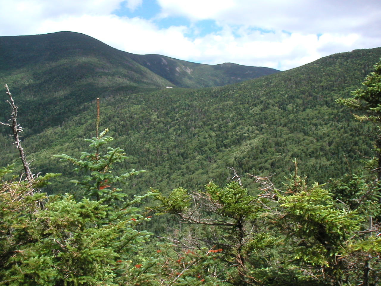
down into
Oake's Gulf
and of Mount Monroe and Washington ahead along the ridge.
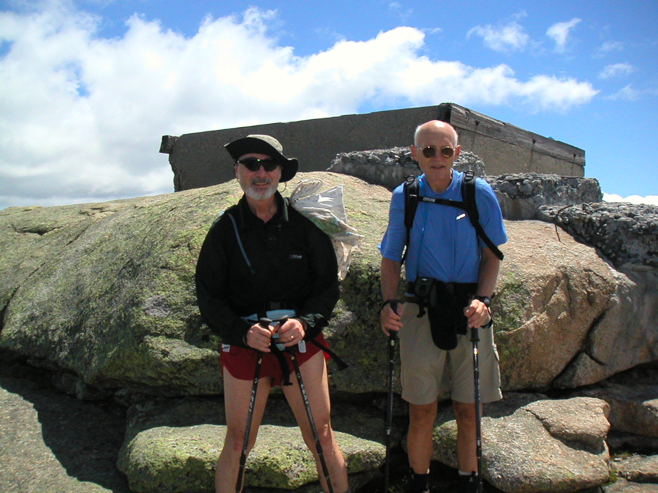
We met Amtrak, a thru-hiker there and he took our picture. He was so
disappointed to discover that this was not the "official" AT. He asked
plaintively: "but why doesn't the AT go up here? It's so much better?" We
couldn't give him an answer and he reluctantly climbed back down the way he
came up so as not to miss any of the Official AT. Ah, poor purist! Having
no such purity ourselves, we proceeded ahead down the loop and gained a
small advantage over poor Amtrak (which he would soon make up - he moved
fast, as did most NOBOs we saw). We warned Amtrak about the loop trail over
Mount Monroe which was ahead so he wouldn't make the same "mistake" a second
time.
These peaks also illustrated the first real example of what I would call the
"rock zone" which rises above the alpine zone. The peak is one huge pile of
rocks. And the trail (what trail?) is just a series of small piles of rocks
(the cairns) on top of the huge pile - which is the mountain.
Although the mountain was certainly a sheer block of granite after the last
ice age scrapped it clean, the thousands of years of freezing and thawing
since that time has split the surface rock into a myriad of small and large
jagged boulders. The only vegetation is some moss and lichen on the boulders
and an occasional hardy plant down in some crack between the rocks. The
name for this is "felsenmeer", which means literally "sea of rocks". This
is a unique and beautiful area. In a way, its sheer inhospitability is the
only protection the mountain has against the intrusion of too many trampling
foot steps. You really have to want to get up here to make the required
effort. As one trail guide put it, in a bit of an understatement: "Trails
across felsenmeer slopes can be difficult to negotiate with a big pack,
especially in a high wind". We found that Mount Jefferson, Adams and
Madison all had this characteristic pile-of-rocks peak. And of course Mount
Washington is the biggest pile of rocks of all. (A common nickname for
Washington is "The Rock Pile"). It's a little hard to visualize these raw
peaks until you've climbed them yourself. So what are you waiting for?
I was a little apprehensive about this hut. You'll recall that at Galehead
Hut where we stayed the night before last, there were only eight of us
staying that night.
Lakes of the Clouds Hut (elevation 5050', well above
tree line, "Lakes" for short) has a capacity of 90 and I was worried about
the crowds. But I needn't have worried about overcrowding in the high
mountains: somehow the construction of the hut and the magnificent views
made all of us seem so insignificant that the number of guests hardly was an
issue. There were about 65 guests that night, and of all the huts this one
took the most work, over very rugged trails, to get to, so it was in fact a
very good crowd. There was the retired thru-hiker couple Red Oak and Jam,
there was big Pete (who complained he was getting too old for this sort of
thing), his son little Pete (who was actually bigger) and his friend Eric,
and lots of others. But once you moved away from the hut along the trails
in any direction you were alone with yourself and the mountains as if the
crowds were not there. The croo was also a super group, and the largest
croo of any of the huts. I think there were seven of them (plus one on a
day off) plus 4 thru-hikers helping with the work and as usual they were
terrific.
Of all the huts, I learned the most about the alpine environment here from
the presentations the naturalist gave. On a little pre-dinner hike that
Beth and I took, we spotted Indian Poke, Mountain Sandwort, Mountain Avens,
Bunchberry, Star Flower, Labrador Tea, Mountain Cranberry, Dwarf Birch and
Canada Mayflower plus a Raven, a Dark-eyed Junco and a Gray Jay (a Canada
Jay to older birders like myself). The Dwarf Birch in particular was
incrdible: ths alpine variant of a Birch Tree was all of 2" high! We
learned that Mountain Sandwort is perhaps the hardiest of the hardy alpine
flowers. It colonizes eroded areas such as trail beds. One saying is that
if you're hiking from "Lakes" to the summit of Washington and it's hard to
see the blazes in the dark of fog or evening, just follow the white flowers
of the Mountain Sandwort!
As always, the supper was enormous and wonderful and we slept well that
night.
he Mount Washington weather report was 43°, winds 23 MPH with fog
clearing. From the hut we could see that the summit would soon clear. Two
days in a row; this was amazing and wonderful.
We took a pre-breakfast wildflower walk with the Hut naturalist and we
learned a few new varieties: Diapensia, alpine Bluet, Three-toothed
Cinquefoil, Rose Twisted-stalk, Bilberry, Blueberry, Bog Laurel and Map
lichen, as well as the more familiar Bunchberry, Krumholtz Fir, Star Flower,
Clintonia, Mountain Avens and of course Mountain Sandwort
Breakfast was the usual great feast and the skit of the day was a musical
using Broadway tunes to make sure we 1) folded our blankets, 2) packed out
our trash and 3) tipped the croo. I never tired of these corny but
ingenious creations.
Today's trek was a comparatively short one: the 7 miles over the
Presidential Ridge to Madison Spring Hut. But since we would stay a while
at the Mount Washington summit, and wanted to do all the side trails to go
over the peaks of Clay, Jefferson and Adams, we got started as soon as we
finished breakfast. By now the peak had cleared of fog and we left with
high spirits. However we were impressed that the first thing we saw as we
started up the slope from the Hut was a
huge STOP sign
. It read "The area
ahead has the worst weather in America. Many have died there from exposure,
even in the summer. Turn back now if the weather is bad." It was easy on a
clear day like today to take this warning lightly, but in my heart it was a
sobering thought. We had some great
views back down to the Lakes of the Clouds and the hut,
but then we managed to take a wrong turn amid the confusing trails
that seemed to go every which-a-way on the shoulder between he Hut and
Tuckerman's Ravine below the cone of Washington. I think we got onto the
Crossover Trail and then took a left on the Davis Path to get back to the
Crawford Path, but I'm not sure. In any case we soon saw the familiar white
blazes. Interestingly, although white blazes were painted on various rocks
and some of the cairns, the tops of the cairns tended to be either painted
orange (I'm told it's more visible in the fog) or the top rock would be a
white chunk of crystalline quartz.
We started up the cone of the mountain, which was the biggest pile of rocks
of all. The temperature was around 40 and the wind was picking up as we
rose towards the top, probably to between 25 and 35 MPH. I managed to fall
on the rough felsenmeer about 100' from the top. I swear my Leki pole did
more harm than good, and I managed to bang my elbow. Luckily it was not
serious, although it showed me that one has to be doubly careful in this
environment. The mountain is just there. It really doesn't care if you
fall and break something! As we reached the top, it was an awesome
experience with views in all directions.
This elation was soon jarred as we
passed over the last of the rocks to see for the first time the road, the
cars, the parking lot, the cog railroad station, the whole reminder of what
we had left behind at the bottom. I took some solace in the fact that all
the development on these peaks was concentrated in this one small spot: the
rest of the peaks were close to their pristine state and (except for the
summits of the ski mountains) you had to work your butt off to get up to
them. Plus there was that little surge of pride and superiority when we
looked at these fat-people. We knew when they looked at us that they knew
we weren't like them.
I must say about
the cog railway,
that it is so
historic and charming (it was first opened in 1869)
that I didn't mind it being here at all. With a
real (smelly) steam engine and a whistle you could hear across the ridge
practically to Mount Madison, it - like some headless horseman riding out of
a Washington Irving story from another, earlier time - had it's place on the
mountain top. After the requisite pictures we spent about a hour in the
snack bar among the fat-people. I felt a strong since of guilt and
embarrassment when I washed my hands in the restroom, used a paper towel and
threw it in the trash. I had been conditioned by nearly a week in the huts
to be aware of even throwing away an unnecessary piece of paper. Getting
back to New York City will be quite jarring and I am not looking forward to
that thought.
We arrived at the top of Mount Jefferson and found a surprising crowd of
hikers in the little protected area below the peak. There was a colossal
cairn here, about 8' - 10' high, and impressive views back to Washington
and onward towards Adams. Everyone seemed to be taking a break here and so
did we. I climbed the final rocky pile and bagged this peak (at 5715', the
3rd highest in NH).
The hike down from
Mount Jefferson back to the Gulfside Trail was fairly typical, moving over
rocky ledges and sometimes just expanses of rocks. The vegetation was
naturally more prolific down from the peak and the trail meandered through
areas of krumholtz and sedge and was in general more sheltered. The sky was
getting a bit cloudier and we saw what might have been some rain clouds to
the northwest. In the broad flat area between
Jefferson and Mount Adams
is a spot known as Edmands Col. Several trails come together here and being
relatively protected from the wind the vegetation was particularly
noteworthy. There was a memorial
plaque honoring J. Rayner Edmands, an
early trail builder and a member of the AMC from it's founding in 1876 till
his death in 1910. It gave me a sense of how long a history these trails
had to see this memorial, itself almost a century old. How many thousands
have hiked here in all that time? How many tried to hide here from terrific
storms coming over the peaks? How many perished on this spot?
Not wanting to be one of them, and seeing the possible onset of rain, we
moved along the trail and decided to forgo the blue-blaze trail over Mount
Adams and instead stay below on the Gulfside Trail and get to Madison
Spring Hut. A short distance from Edmands Col is a trail junction with a
large cairn (although not as large as the one on Mount Jefferson) called
Thunderstorm Junction. Somehow, I didn't like that name so we didn't tarry.
For some reason we will never know, the short section of the trail from
Thunderstorm Junction, around the north side of Mount Adams to Madison Spring Hut
was much better graded than the rest. Somehow, someone had flattened those
sharp rocks or did some monumental trail construction here. It was an
unexpected but welcome respite from the usual trail over this area. We got
to the hut around 3:30 PM, just before a few sprinkles arrived. No - there
was no horrific thunderstorm, but we were glad we came here directly and
skipped Mount Adams. After all we must leave some goals for next year.
My notes show the wildflowers we spotted today, mostly between Washington
and Jefferson:
Mountain Sandwort,
Bunchberry
, Bilberry, Blueberry, Clintonia, Indian
Poke, Canada Mayflower, Three-toothed Cinquefoil,
Mountain Avens,
Starflower, alpine Bluet, krumholtz fir and spruce, Dwarf Birch, Labrador
Tea, Mountain Cranberry, Diapensia,
various alpine sedges
and Map Lichen.
Inside
Madison Spring Hut
at last, we found Red Oak and Jam had also made the trek across from
Lakes. We talked to them a bit and found they had started near their farm
in Virginia and were planning a flip-flop thru-hike so they would jump from
Katahdin to Springer and then hike north, ending at their farm in Virginia.
They were the only thru-hikers we met who were paying guests at the huts
like us, but then again they were more our age then most of the other
thru-hikers we met. Most of the others were about the age of the average
croo member. They also, like ourselves, considered South Kinsman to be the
toughest peak we had done yet.
We made ourselves at home and found that Pete, Pete and Eric had also
arrived just before us. They had done Washington the day before however, so
today they skipped the peak and took the Westside Cutoff Trail to avoid
that. With about 45 other guests we had the usual
huge and yummy supper
and an early bed.
ount Washington weather report: 51°, clear, wind 10 MPH, gusting to
41. It looked like another fine day and Gary and Beth were leaving the
trail at Pinkham Notch so we got off soon after breakfast, shortly before
8:00 AM. Red Oak and Jam were trying to make the AMC shuttle at noon at
Pinkham Notch so they had taken off earlier and were taking the trail which
bypassed the Madison summit. They needed to go back to retrieve their packs
at Franconia Notch. Gary and Beth also needed the shuttle to get back to
their car but they figured if the missed it they would just hitch hike.
Fresh Air and myself we continuing on to Carter Notch Hut so we were not
particularly concerned about the schedule.
Mount Madison, like the other Presidents we climbed the day before, had a
steep rocky felsenmeer cone that was difficult climbing. After a glimpse
back down to the hut
, we started up. As in a few other
cases, there really was no trail at all. Just a route to follow from cairn
to cairn. Little piles of rocks on a big pile of rocks. But it was not
overly long
climbing to the top
and we had good views in all directions, especially
back at Mount Adams, across the vale from the Hut. Three consecutive days
of clear weather on the peaks was almost too much to ask for.
Then we met Red Oak and
Jam coming around the trail from Madison Hut at the base of the peak.
Although they were looking for a short cut, they told us it was the worst
trail they had encountered yet. So rocky as to be almost impassable. They
were worried about the shuttle. I pointed out that the trailhead at Pinkham
Notch was actually close to Gorham via the road, and they could probably get
a pick up from the Hostel there. They had planned to look for some place to
stay in North Conway (and not stay in Gorham till they had hiked through the
Carter Range) but this new plan appealed to them a lot, so they stopped
worrying about the shuttle. We later learned they indeed had gone to the
Hiker's Paradise Hostel that night and had managed to get their back packs
back. Just as we were parting, I noticed Red Oak's day pack. It looked
just like the one I had borrowed last month at the Welcome Hikers Hostel in
Glencliff from Packrat when I slack-packed Moosilauke! I asked Red Oak, and
sure enough it was that same pack. Cool coincidence!
As we moved below treeline, it became rather warm and we changed into
lighter clothing. At a certain point the trail takes a sharp right turn
onto the Osgood Cutoff Trail. At that point we heard a man screaming and
cursing as we approached. When we got there we found a man sitting on a
sleeping bag with all his pack's contents spread out on the ground around
him. Most of the stuff seemed to be canned food: soup, raviolis,
you-name-it. He was yelling at a young teenager, perhaps his son.
Something about how he had to carry all the food and his pack weighed 70 lb
and the rest of the group must come back and on and on. He seemed a very
unhappy camper - to the point of derangement. We could only imagine what
frustration and conflict we had happened upon. Lucky for him the weather
had been so temperate. I would guess he could sit there for a good part of
a week before starving. Assuming he had a can opener! The young kid took
off into the woods, who-knows-where. Never did find out how that tale
ended.
We eventually came upon sure
signs that we were near the road: a number of fat day-walkers. Not even day-hikers,
just walkers, you have all seen them - not more than a half mile
from their cars. We reached the visitors center in
Pinkham Notch
around 12:30. Too late for
Gary to get the shuttle, but no one was worried. It had been a pleasant and
easy morning of hiking, and Gary and Beth had had a rewarding 2 1/2 days of
hiking. We all agreed we would do the huts again next summer and get more
of our friends to join us.
Carter Notch Hut, tonight's goal, differed from the other huts in that it
was a "self service" hut. This basically meant we had to bring our own food
and sleeping bags. The hut provides a kitchen and bunks (but no blankets).
To plan for this, we put together a day's worth of food for each of us and
planned to mail it to the AMC Pinkham Notch visitor's center to pick
up when we got here. Fresh Air however decided to do some vacationing in
the area prior to our hike, so he simply dropped by and arranged to leave
the stuff the week before. We didn't want to hike the whole week with
sleeping bags either, and we really didn't even want to drag them over the Wildcats
and Carters if we didn't have to, so we each picked up a lightweight (6 oz.)
bivy bag at one of the huts. Given the temperate weather and the fact that
Carter Notch Hut was not in the high mountains (its elevation was "only"
3288') we reckoned this would solve our problem. So when we got to the
visitors center, Fresh Air retrieved the food from the staff and we packed
it into our day packs.
The first mile or so from the road was along the Lost Pond Trail, an easy trail that led along a
brook and to a pretty little pond called Lost Pond. For awhile we found
ourselves among some day hikers and fat-people but soon left them behind. A
few rambunctious kids showed us how fast they were by surging ahead of us,
but they too soon tired and we were by ourselves beyond the range of the
walkers and into hiker territory. The AT then turned left on the Wildcat
Ridge Trail and we soon started to climb.
At this point the trail guide then used a term
I have not seen before: "an exceptionally steep ascent". We chuckled and
figured the guy who wrote that probably had never hiked the trails we had
been on for the last week. After what we had finished, what could be so
bad? Well, I soon wrote in my log book a term I never have used before
either: "Zounds!" Yes, it was very long and very steep. Maybe even very
very long and very very steep! I wondered what came after "exceptionally
steep"? Perhaps "incredibly steep"? or maybe "unbelievably steep"? Well
exceptionally steep was enough for today. As I said in the introduction to
this trip report, the two places that were the toughest climbs were not in
the Franconia Range or the Presidential Range, but South Kinsman to the
south, and Wildcat, right here, exceptionally steep Wildcat, to the north.
But what can you do, just climb climb climb. Mostly rock steps and ledges
where you had to scramble up hand over foot. But exceptionally steep or
not, we eventually reached the top of the ridge and the first of the five
Wildcat peaks known as Wildcat E.
Wildcat D had a viewing platform where a few folks who had come up via the
ski gondola were checking out the view, but since we had so recently been
there, where they were looking, we just went on by. It's not that we don't
appreciate a nice view but we were a bit worn down and wanted to move along.
There were great view from Wildcat A: a steep gorge down to Carter Notch and
the Carter Lakes and the rock face of Carter Dome across the Notch, one of
tomorrow's big climbs. Brrr! Looks impressive. The trail down to the
notch was gentler than I expected: it was well built and actually had
switchbacks! However the easy trail was interrupted at one point by what looked like
a
very recent slide. Glad we weren't here then! Near the bottom of the climb we had a nice view north through
Carter Notch. The U-shape of the Notch is a classic example of a valley gouged out by glacial action.
I thought how fortunate we are that some of these notches such as Zealand, and Carter
did not succumb to the fate of others like Franconia and Crawford and have highways built through them.
The bunkhouse was up the hill and we had a room to ourselves. We got
situated and then went down to the
main building
and cooked supper. Gosh, I
miss someone else making super large meals! Oh well, I'm supposed to be a
camper, so I just did it. What does it take to boil water over a gas stove
anyway? As we were eating, Sion, a thru-hiker (NOBO) showed up and they
gave him work-for-stay. There was practically nothing to do, and
furthermore Lydia gave him a huge amount of food that was stashed away here
(possibly left by others). The hut croos have great respect for the thrus.
Eventually two more thrus showed up, and 2 other hikers (after 10 PM) and
they all got fitted in, but only Sion got the free stay. Still it was only $19
per night here so it wasn't too bad for the others and it was a great little
place. Remember the regular campsites in this section are $8 per night
anyway, so $19 for a real hut, with kitchen and bunks was not too bad. We
asked Sion what his name meant. He said it was his real name. Now there's
an idea! It turns out Sion did work-for-stay at Madison Hut last night but
we never met him there. He went on at great length about how great the
croos were and how much fun it would be to be on a croo next year. He was
thinking he would apply to the AMC for a croo job: apparently being a
thru-hiker is a big plus.
Coming down to Pinkham Notch today he told us he had taken wrong turn: he had failed to
take the right turn at the Osgood Cutoff Trail (where we saw the "screaming man") and went all the way out to
Route 16 - way to the north of Pinkham Notch. He did perhaps an extra 5 miles
getting back to the trail (a total of 19 miles for the day - and unlike
ourselves, he carried a full pack - minus food he didn't need since he was
"working" the huts). As has been mentioned, the AT often does not appear on
trail signs, just the local trail names do. But there are always white blazes
if you are careful to find them. Don't get lost on this section! And yes,
Sion had also seen the "screaming man" sitting by the side of the trail
amidst his vast collection of canned food!
I read a bit and then got to bed around 9:00 PM. Need I say it was another
great day?
n the morning it looked and felt like a weather front was moving in. We
were up early and cooked breakfast and were off by 6:45 AM before anyone
else had stirred.
We descended steeply to Zeta Pass, a very pretty glen where there was
actually a bench to sit on at a trail junction where we took a break. For
most of the day we were hiking along the Carter Moriah Trail. We then
climbed South Carter, the first of the Carters (not counting Carter Dome). This had a tree covered
summit and it was hard to tell when we actually got to the top, but we found
a sign indicating "South Carter" (4458') so that was it. There followed an
easy walk along the ridge with numerous boreal bogs with board walks. We
got to Middle Carter (4600') and met Rawhide, going south. He was actually a
NOBO but had just taken some time off the trail in Gorham to get something
fixed, and he was hiking back to Crawford Notch where he had left the trail.
We passed over Mount Lethe (4570'), really just an exposed ledge which was a
shoulder of Middle Carter. At this point it started to rain lightly. We
hiked over to North Carter (4530') (another sign) and as we started down, the
rain increased so I had to put on the pack cover and my rain top. The rain
seemed to intensify on the down slopes, making the tiresome downward
climbing slippery and dangerous. We passed a father and daughter going up
the mountain and they seemed pretty wet and not altogether having a great
time. At the bottom of North Carter the trail got easier and the rain let
up as we passed over a number of board walks. These were a relief from the
usual rocky terrain since they were so easy to walk on.
We got going again, climbing back to the trail, and passed another area of
boardwalks. We were approaching Mount Moriah, the last major climb of the
day. We met Crater (or maybe it was "Critter") who was a section hiker
moving south that day. He said he was jumping around the different sections
of the Whites. Just before we got onto the trail up Mount Moriah, at the
point where the Stony Brook Trail intersects with our trail (the Carter
Moriah Trail) at a three way board walk intersection, we ran into a large
group (maybe 12 or 15) of boys from a camp. I thought the leader said Camp
Brooklyn (could that be right?) on Lake Winnapisauke. They were hiking up
Mount Moriah today as well, and as we climbed slightly ahead of them we
could hear the boys exclaiming at the wonder of each new view they came to.
We soon came to the place where a short side trail led to Moriah's summit.
It started out with a steep rock scramble and I headed up to "bag" the peak
solo, since Fresh Air had bagged this one some years ago. The trail was
steep but thankfully short, and another trail from the north joined just
before the top. Having bagged the peak, I quickly rejoined Fresh Air and we
started down. The AT turns right onto the Kenduskeag Trail at this point
and we descended over long tiring steps interspersed with board walks.
Naturally since we were on a tiring down slope, it started raining again and
the rain became quite heavy at times. Finally the trail leveled off and we
crossed and recrossed the Rattle River (where the AT joined the Rattle River
Trail) three times as it flowed down the mountain. We arrived at the Rattle
River Shelter about 3:15 and since the rain had abated, we got out of our
sweaty gain gear.
There was an older camper there who had pitched his tent inside the shelter
and he went on a bit about his liver transplant and his hiking. Since the
mosquitoes were starting to get ferocious, we left as soon as we could break
away, and did the last very easy two miles rather quickly. We made it out
to Route 2 at 4:35, not bad for the 16 or so miles we had done today.
I called Hikers Paradise on my cell phone and the guy said he'd be right
over. Well, a half hour passed and he didn't show up and just then Sion showed
up off the trail. He was glad to see us and was tired like ourselves after
this long day (which he had done much quicker since I'm sure he didn't get
going till after 9:00). He wanted to go to the Hostel too, so I called
again and the guy double checked where we were. Seems before he had gone to
the other trail head (about .2 miles up the road) where the trail comes in
from the north, rather than where we were at the
Rattle River Trailhead.
This time he really did show up right away and we got the cook's tour of
Gorham. He had been in this business for years and showed us every
restaurant, which ones were too expensive, which ones were good, all the food stores, the
bus stop, everything we needed to know.
After checking into the Hostel (only $14 including the free pickup) we went
upstairs to the bunkroom ("Leave you boots on the porch under penalty of
death") and met a whole bunch of other hikers. NOBOs, SOBOs, Sectioners,
those off the trail with sore ankles, lots of them. Sion met an old friend
and they all had a grand time talking trail talk.
After cleaning ourselves up a bit, we walked into town and had a nice dinner at the
Pizza Restaurant. Sion came by on a bicycle (he "bought" it from the Hostel
for $1) and we all unwound a bit. We were done hiking for now, but he was heading further
tomorrow on up to Maine and ultimately Katahdin. Gorham was a huge
milestone for all of us. We had finished (most of ) New Hampshire, one of
the toughest but most rewarding sections of the entire trail and this was
one big accomplishment. Everyone felt really high.
The next morning we would get the 6:55 AM bus to Boston and ultimately back
to NYC. This section was done and we were very happy indeed.
Day 8 Trail Miles: 15.0, Extra miles: 1.1, Total: 16.1
here was less equipment to evaluate since we just used day packs for this section. But there were still aspects
that deserve some comments.
The Huts:
Conditioning, bodily complaints:
My left ankle bone on the outside got sore somehow about midway through. It wasn't a muscle soreness, more a bruise.
I must have hit it on a rock but I don't remember when. It hurt like hell when my boot was tight against
it, so I left my left boot rather loose, ordinarily not a good idea.
I was also probably taking too much vitamin-I (Advil). My urine got very dark the last day (which was scary)
but when I stopped the Advil it cleared up after a day. Just don't overmedicate!
Camera:
All those peaks:
Moosilauke (4802), South Kinsman (4358'), North Kinsman (4293'), [Little Haystack (4760')], Lincoln (5089'),
Lafayette (5249'), Garfield (4488'), South Twin (4902'), [Guyot (4560')], Jackson (4052'),
Pierce (Clinton) (4310'), Eisenhower (4761'), [Franklin (5004')], Monroe (5385'), Washington (6288'),
[Clay (5532')], Jefferson (5715'), Madison (5363'), [Wildcat E (4041')], Wildcat D (4063'),
[Wildcat C (4270')], [Wildcat B (4270')], Wildcat (4380'), Carter Dome (4832'), [Hight (4675')],
South Carter (4458'), Middle Carter (4600'), [Lethe (4570')], [North Carter (4530')], Moriah (4049').
That's 20 official 4000 footer peaks out of 48, plus 10 that "don't count". Not bad, if I do
say so. By the way, my legs think they all count.
We left the hut to resume our trek about 1:15 PM. The initial climb up
Mount Pierce (Clinton) had some tough rock steps but soon the going got easy
with some board walks interspersed with a relatively easy grade. Mount
Pierce is the point at which (as they say in that ad): "Now it gets
interesting". We suddenly found ourselves above tree line. The trail is
relatively easy and the views towards Mount Washington are awesome. The
vegetation consists of krumholtz, sedges and a variety of wildflowers. I
noted in my log: Mountain Sandwort, Mountain Cranberry, Labrador Tea,
Bunchberry, and Hawk Weed. We also spotted a Black-backed Woodpecker, a
relatively rare (for a city bird watcher like myself) boreal species. To
those of you who may have wondered how Bill Clinton, our last president,
might have a gotten a peak named for himself in the Presidential Range: it's
not him, it's the New York Governor Clinton, a renowned conservationist of
the 19th century who shares the honors with Pierce for this peak.
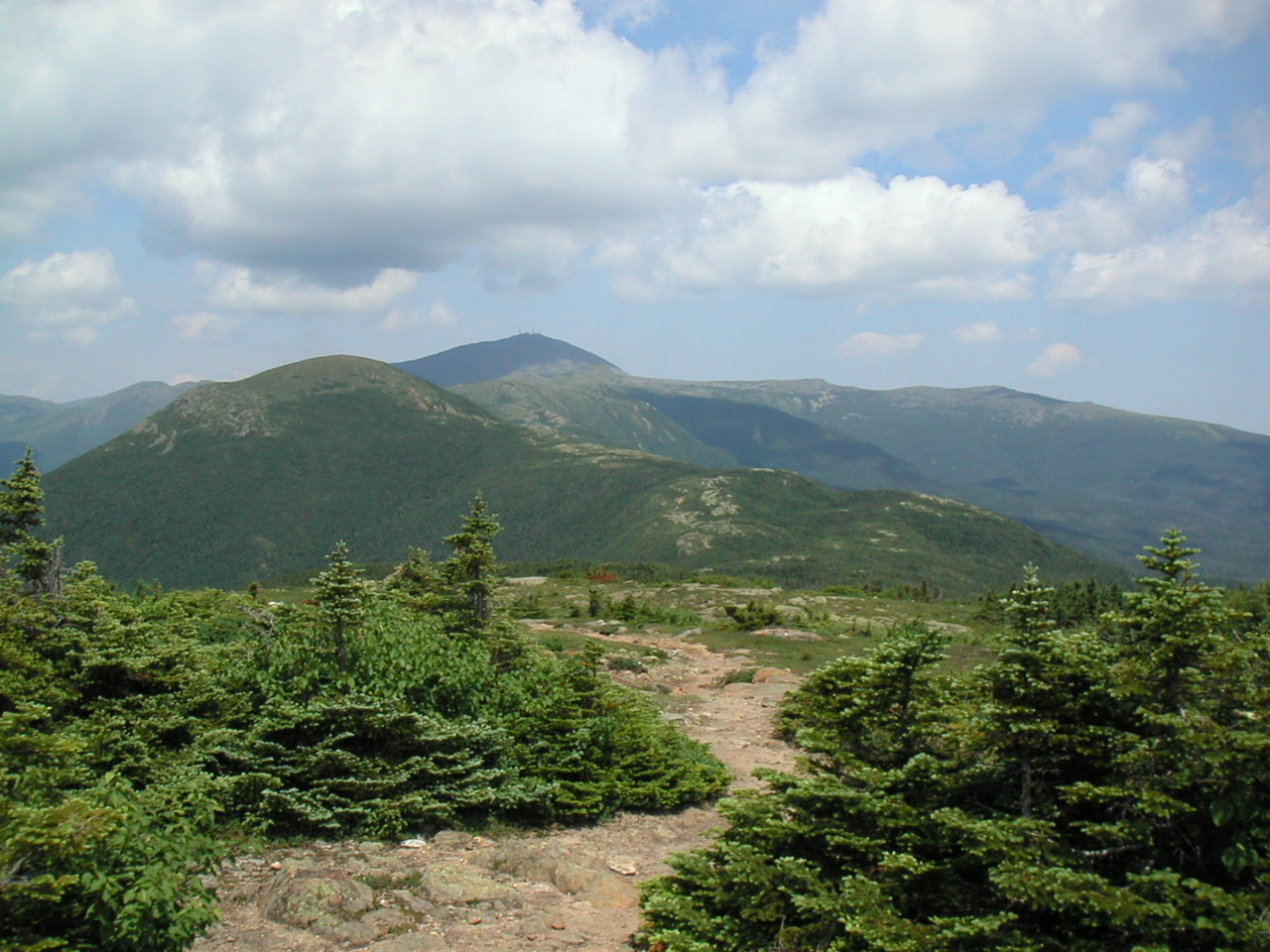
Mount Pierce, where we move
above treeline
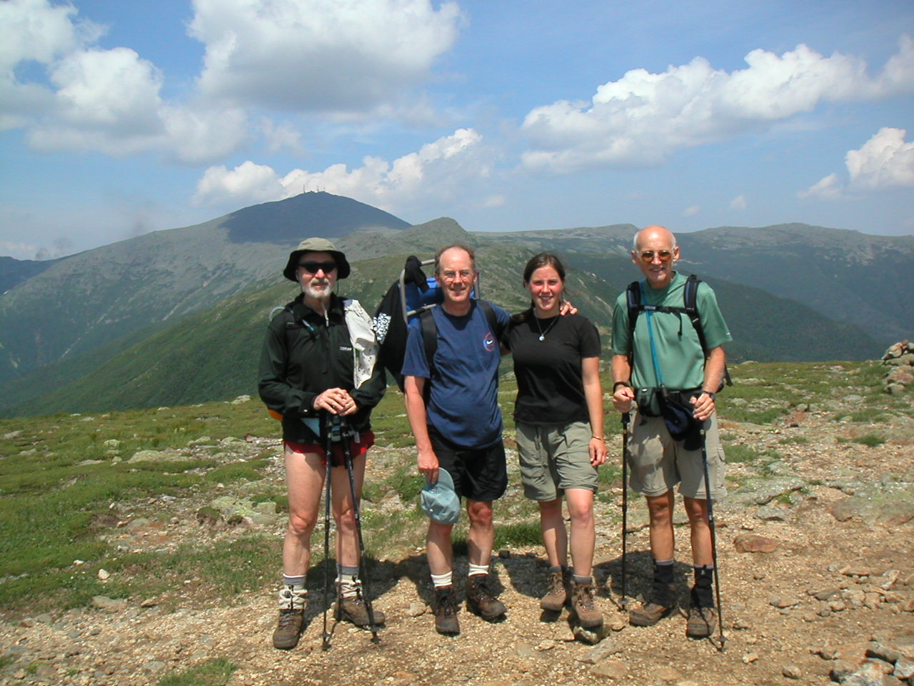
Mount Eisenhower
Mount Washington beyond
Meanwhile we quickly passed the non-descript summit of Mount Franklin
(5004'), which in reality is just a shoulder of Mount Monroe, and took the
blue-blazed side loop to that summit.
Mount Monroe actually consists of two
rock crags with a slight separation. The second one is the higher (5398')
and affords magnificent views of
Mount Washington
and the col in between
where the Lakes of the Clouds are located; to the right is the steep
chasm of
Oake's Gulf, and to the left is the more gentle but broad valley
leading northwest to the Mount Washington Hotel at Breton Woods, with
glimpses of the old cog railway. It just doesn't get any better than this.
If the peaks are not shrouded in clouds, this would be the perfect way to
approach this hut. The sheer enormity of the mountains and the beauty of
the rock face and the green of the alpine vegetation is just a picture of a
lifetime.
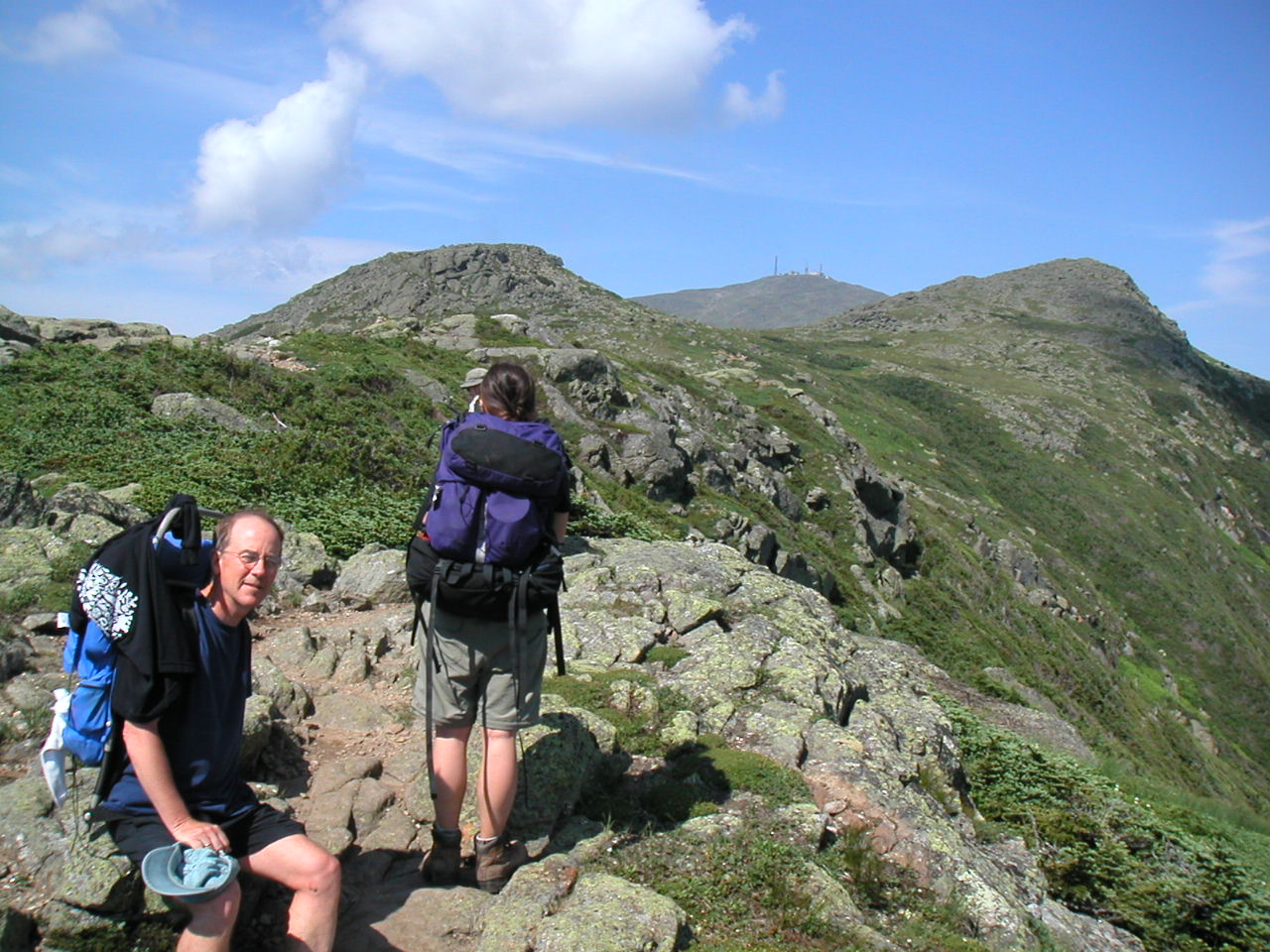
The climb up Mount Monroe
We were getting tired from a long day and the sight of the hut, our
destination for the day, gave us that needed extra little push, so down the
rock pile we made our way, soon passing back down into the zone of alpine
vegetation. The col between Washington and Monroe gives an extra measure of
shelter and the vegetation was a bit more prolific here than along the
ridge.

Hiking down Mount Monroe
to Lakes of the Clouds Hut
Day 5 Trail Miles: 11.2, Extra miles: 0.2, Total: 11.4
Aggregate Trail Miles: 55.2, Aggregate Total: 57.6
Peaks: Webster (3910'), Jackson (4052'), Pierce (Clinton) (4310'), Eisenhower (4761'), Franklin (5004'), Monroe (5385')
Day 6: July 13, 2002
Lakes of the Clouds Hut to Madison Spring Hut
Weather: 50°, clear sky, sun.Mount Washington and Mount Jefferson
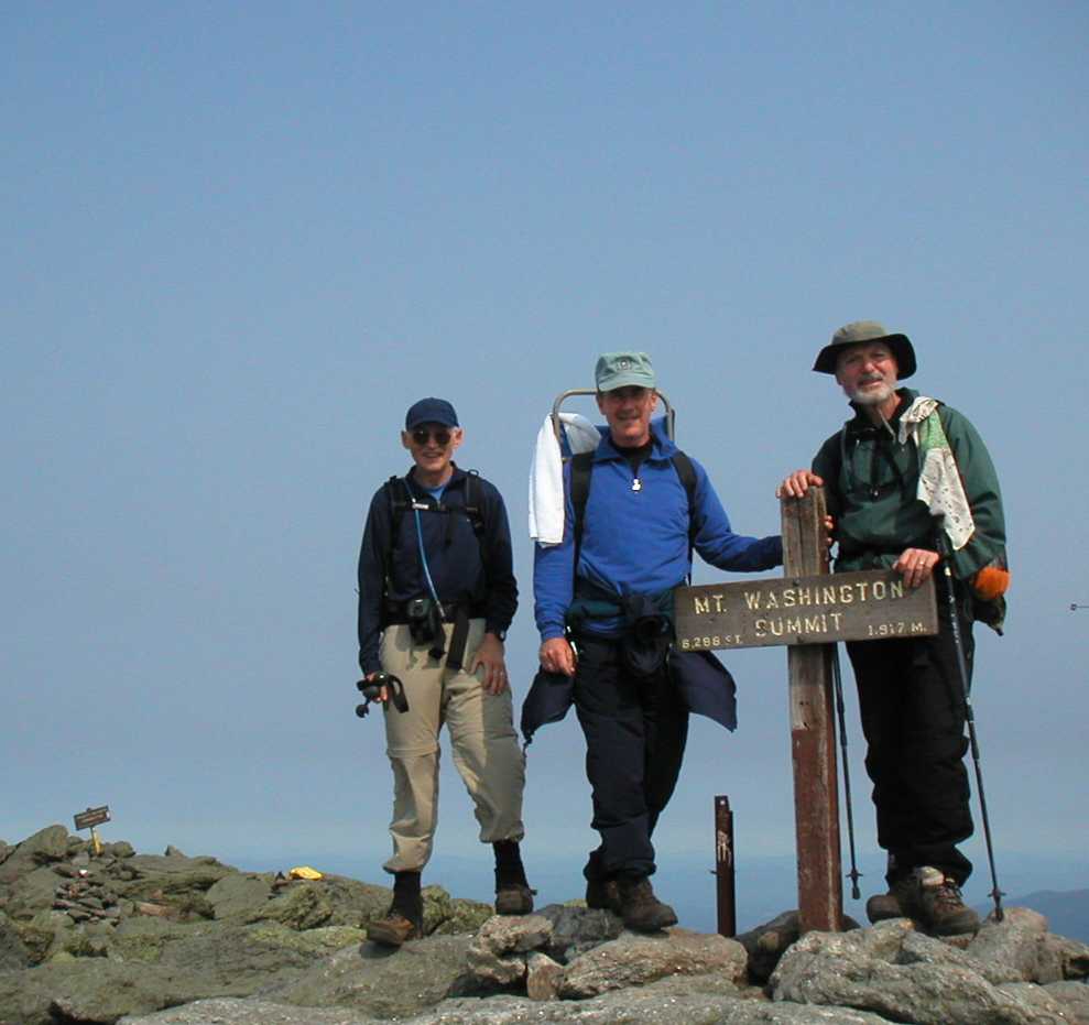
The summit of Mount Washington
When we left to continue our trek, the wind had picked up considerably to I
would estimate 40 - 50 MPH. This would buffet us most of the day depending
on where we were at a particular moment. It was generally out of the
northwest. Ahead of us we could see the peaks of Mount Clay, Mount Jefferson
Mount Adams and Mount Madison strung out along the ridge to the north. With
the alpine meadow below Washington's cone in the foreground, and the cog
railway, which in the distance looked like a tiny toy train belching it's
steam and blowing it's whistle, it was a truly impressive scene. I had
decided to collapse my trekking poles and trust the additional balance I
would get from just my hands over this rough area. We made our way down the
steep rocky cone
and across the
meadow
which was especially rich in wildflowers.
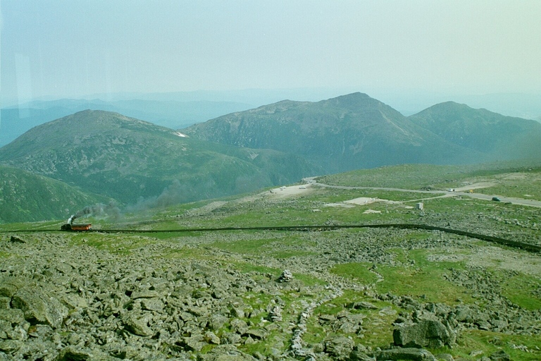
Cog Railway with (the flank of) Clay, Jefferson, Adams and Madison
We got onto the Gulfside trail which generally followed the
rim of the Great Gulf, an impressive glacial cirque on the east side of the
ridge. No - we didn't "moon" the train when we crossed the tracks. First
off, the train was not in sight and secondly it was rather windy. The hike
over
Mount Clay
(5532'), although a blue-blaze, was rather easy. The views down into
the Great Gulf was especially grand from Mount Clay, although many spots
along the Gulfside Trail also had excellent views of this glacial valley.
The wind picked up between Clay and Jefferson. It was steady at about 40
MPH, enough to make it hard to place your feet casually. But we knew it
could have been much worse than this on a bad day.
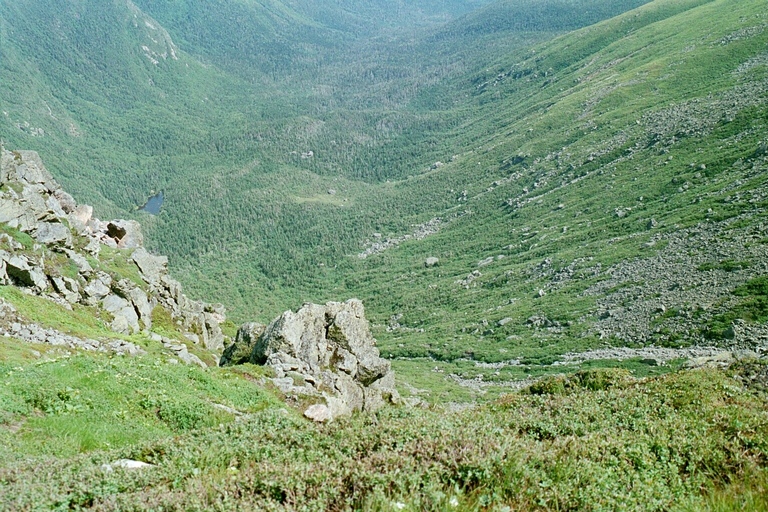
Looking down into the Great Gulf
Mount Jefferson:
one huge pile of rocks
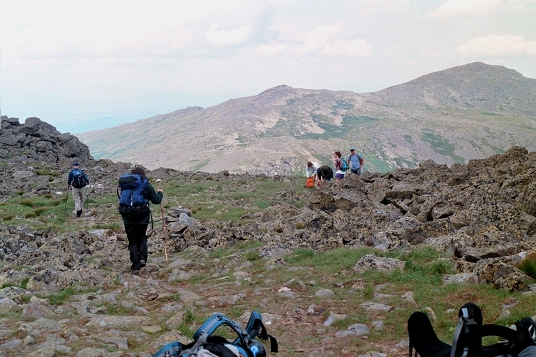
Mount Jefferson looking towards
Mount Sam Adams and Mount Adams
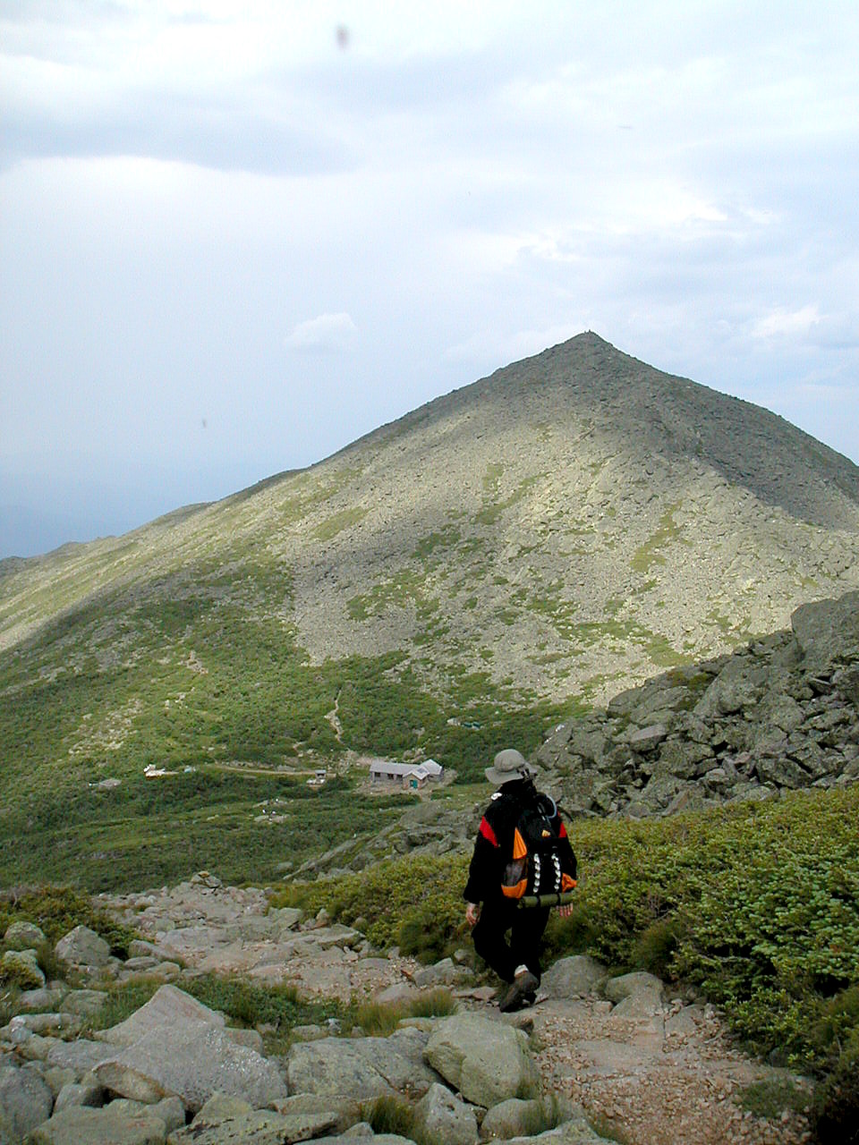
Rounding Mount Adams to Madison Spring Hut, Mount Madison beyond
Day 6 Trail Miles: 7.0
Aggregate Trail Miles: 62.2, Aggregate Total: 64.6
Peaks: Washington (6288'), Clay (5532'), Jefferson (5715')
Day 7: July 14, 2002
Madison Spring Hut to Carter Notch Hut
Weather: Temperature 55°, clear sunny skies
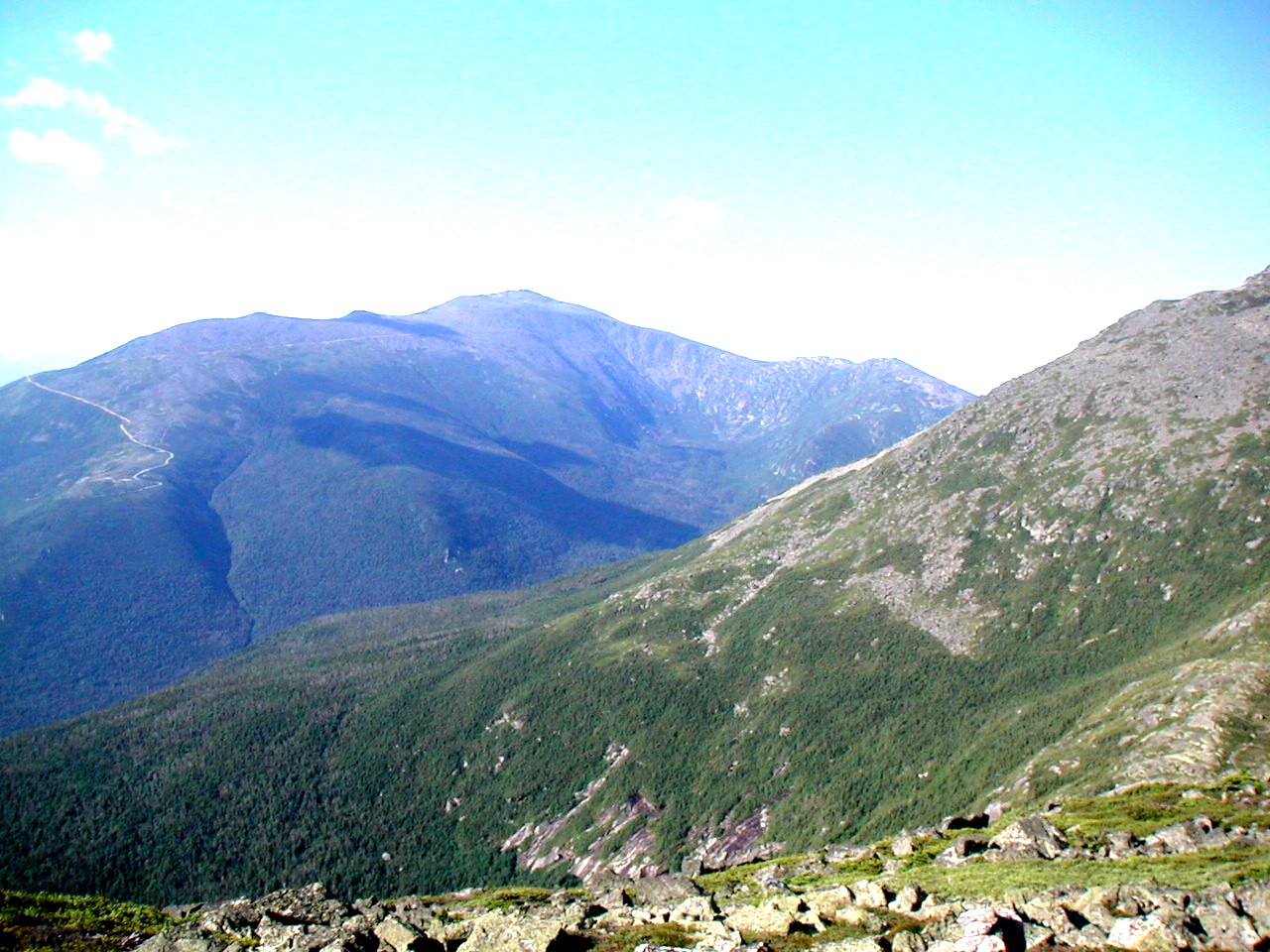
Mount Washington across the shoulder
of Mount Adams
We made our way down the Osgood Ridge and slowly worked our way down through
the alpine zone to the treeline. Of course it's not a line. The trees
start out as krumholtz dwarf specimens, then they are up to your knees or
waist and finally they are up to the level of your head. The ridge line
itself, where the trail was, and which is most exposed to the elements was
the last to fall below the trees. On the way down the ridge we met two SOBO
thru-hikers moving up: Gentle Bear and Care Bear.
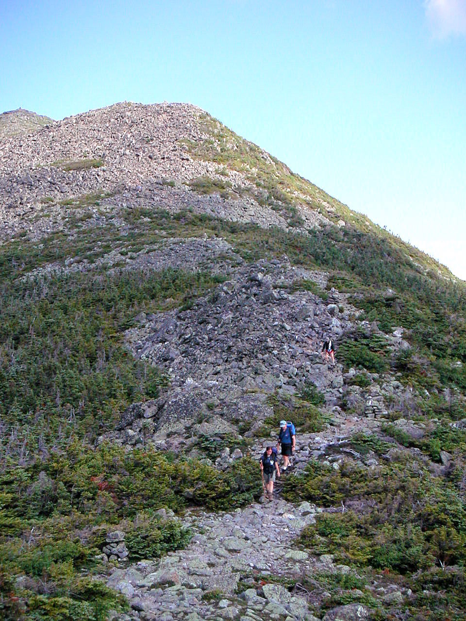
Working our way down the Osgood Ridge from Mount Madison
We were now moving through a lush forest.
Many streams
were running out of
the Great Gulf and Madison Gulf and the biggest, the Peabody River had a
neat suspension bridge we crossed over. We then climbed one more scenic
rock ledge (although a scenic rock ledge down here in the forest hardly
compares to the magnificent views we had for the last several days above
tree line) and crossed the summit road. The last few miles past the road
were very easy, almost flat down what was called the Old Jackson Road.
Since Mount Jackson was way on the other side of the mountain range, I don't
know how it got it's name, but we didn't care.
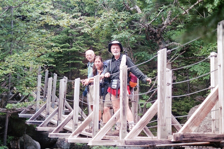
The Bridge over the Peabody River
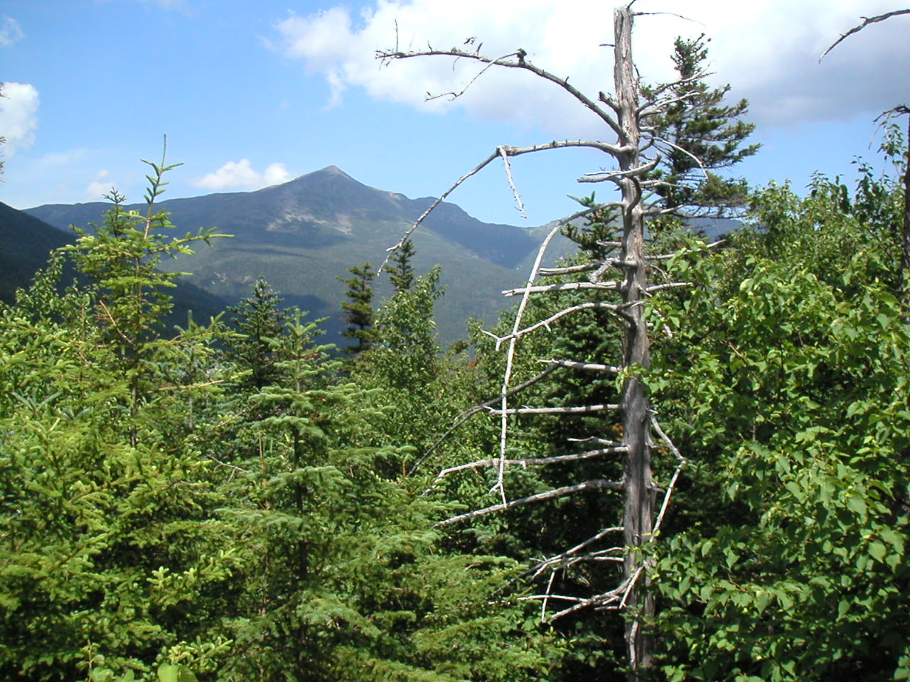
A last look at Mount Washington from
near Pinkham Notch
When we finished eating lunch and said goodbye to Gary and Beth, we walked
across Route 16 to continue our trek. The time was about 1:20 PM.
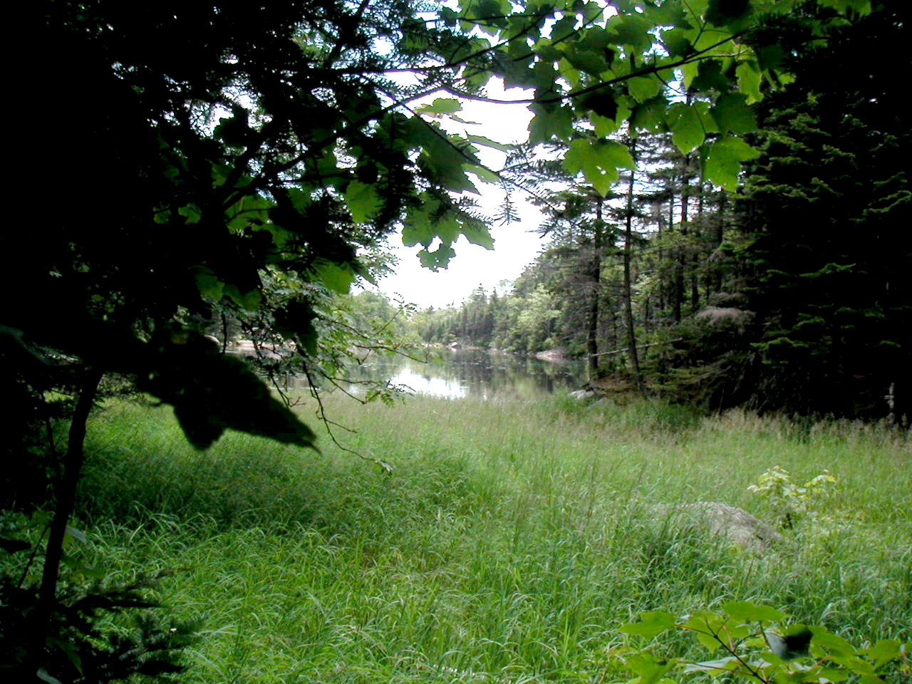
Lost Pond from the Lost Pond Trail
We descended easily and just before the next peak, came to the top of the
ski gondola, which was operating. Thus once again the fat-people had an
easy way up, but for some reason there were only a very few of them. They
eyed us and probably wondered "how did they get up here?". As we hiked past
the gondola building back up into the woods towards Wildcat D, we met two
SOBOs (Popeye and Monster) coming down. With a smile in her voice Popeye
asked "Did you take the easy way up?" I answered in the same tone "No, are
you taking the easy way down?" We knew who we were, just on sight. No
fat-people us!
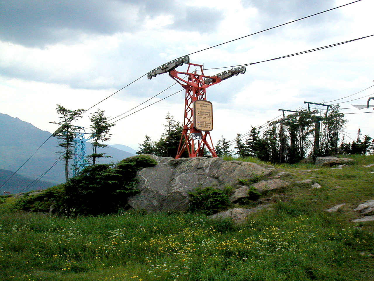
Wildcat Ski gondola
near Wildcat D summit
We descended easily to Wildcat Col, a low area between E, and D to the
south and
C, B and A
up ahead to the north. The official 4000 footers are
peaks A (or just "Wildcat" at 4380') and Wildcat D (4063'). The others don't drop
down sufficiently from their taller brothers. Some rock climbs and a fair
amount of board walks brought us across this col and then it was up to C, then
quickly down and up at last to B and A which were rather close together.
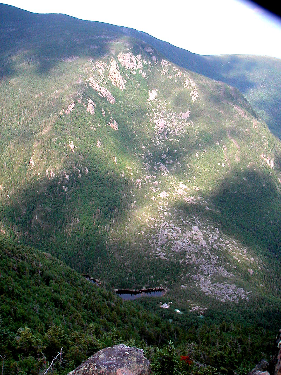
Across Carter Notch to Carter Dome (Lower Carter Lake and the Hut in the Notch)
At the bottom of the descent, in Carter Notch, we passed by first the upper and
then the lower of the lovely Carter Lakes, and just a little beyond, the
Hut. We met the caretaker Lydia who checked us in. There was a woman with
her kids there and otherwise we had the place to ourselves. There was a big
kitchen and lots of plates and utensils and everything you could possibly
need. From the looks of it, I would guess this was originally built as a full service
hut.
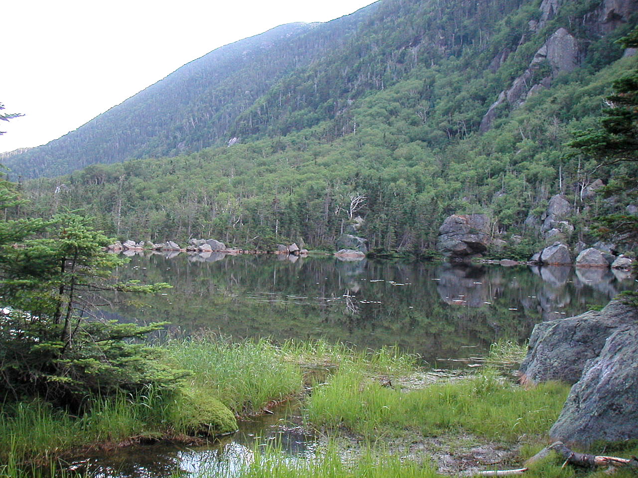
Upper Carter Lake near the Hut
Day 7 Trail Miles: 13.7, Extra miles: 0.1, Total: 13.8
Aggregate Trail Miles: 75.9, Aggregate Total: 78.4
Peaks: Madison (5363'), Wildcat E (4041'), D (4063'), C (4270'), B (4270'), A (4380')
Day 8: July 15, 2002
Carter Notch Hut to U.S. Route 2 (Gorham)
Weather: 60°s, warm and breezy, blue sky and cloudsCarter Dome, Hight, South Carter, Middle Carter, Lethe, North Carter, and Moriah
We had a fair number of peaks to climb today, Carter Dome, all the Carter
Ridge and lastly Mount Moriah. Carter Dome (4832') was the first and
highest of the peaks. It proved to be a steep exhausting climb. Luckily we
were doing it first off as opposed to late in the day. It was 1 hour to the
summit . At this point we had an easy traverse along the ridge to Mount
Hight (4675'), a secondary peak. The vegetation was definitely alpine with
Mountain Sandwort, Canada Mayflower and Bilberry, although we were
technically not above treeline. We got some good shots of both
Balsam Fir and
Black Spruce, showing the greyish Fir cones growing up, and the redish Spruce cones growing down.
The views were very nice, mostly towards
the northeast along the Carter Range, and back to the southwest to the
Presidentials.
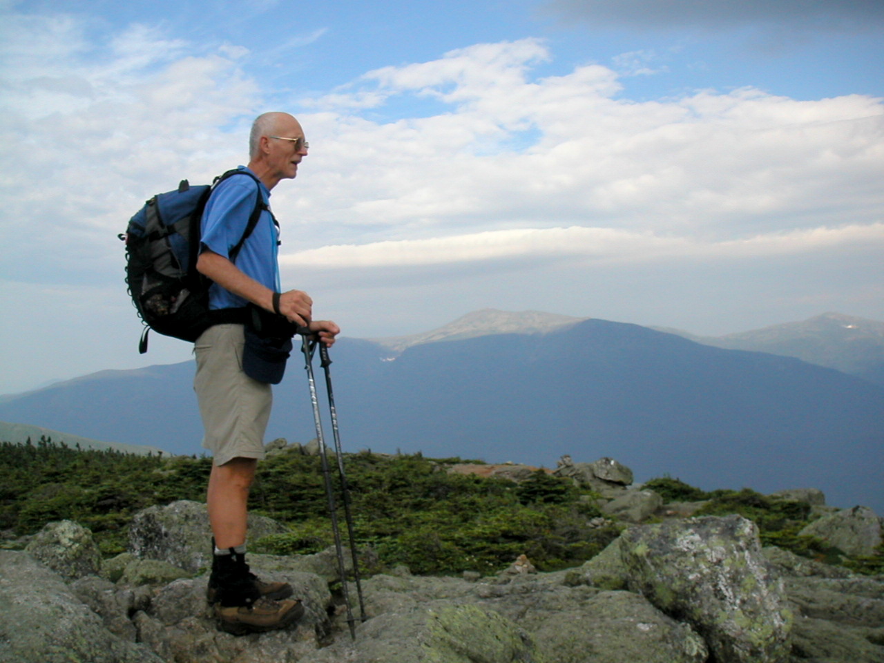
The summit of Carter Dome,
Carter Range extends behind
We decided to take a lunch break at the Imp Shelter, even though at .5 miles
off the trail it was rather out of the way. The trail down to the shelter
was actually rather nice through some lush woods and the shelter itself was
right up slope from a good north facing view over a steep cliff. There was
actually a bench and a fence at the viewing spot, and the shelter, facing
the same way, had a chair built in right in the middle facing outward. It
resembled nothing more than a rustic throne. We checked through the
register and saw many many familiar names, both NOBOs and SOBOs we had previously met.
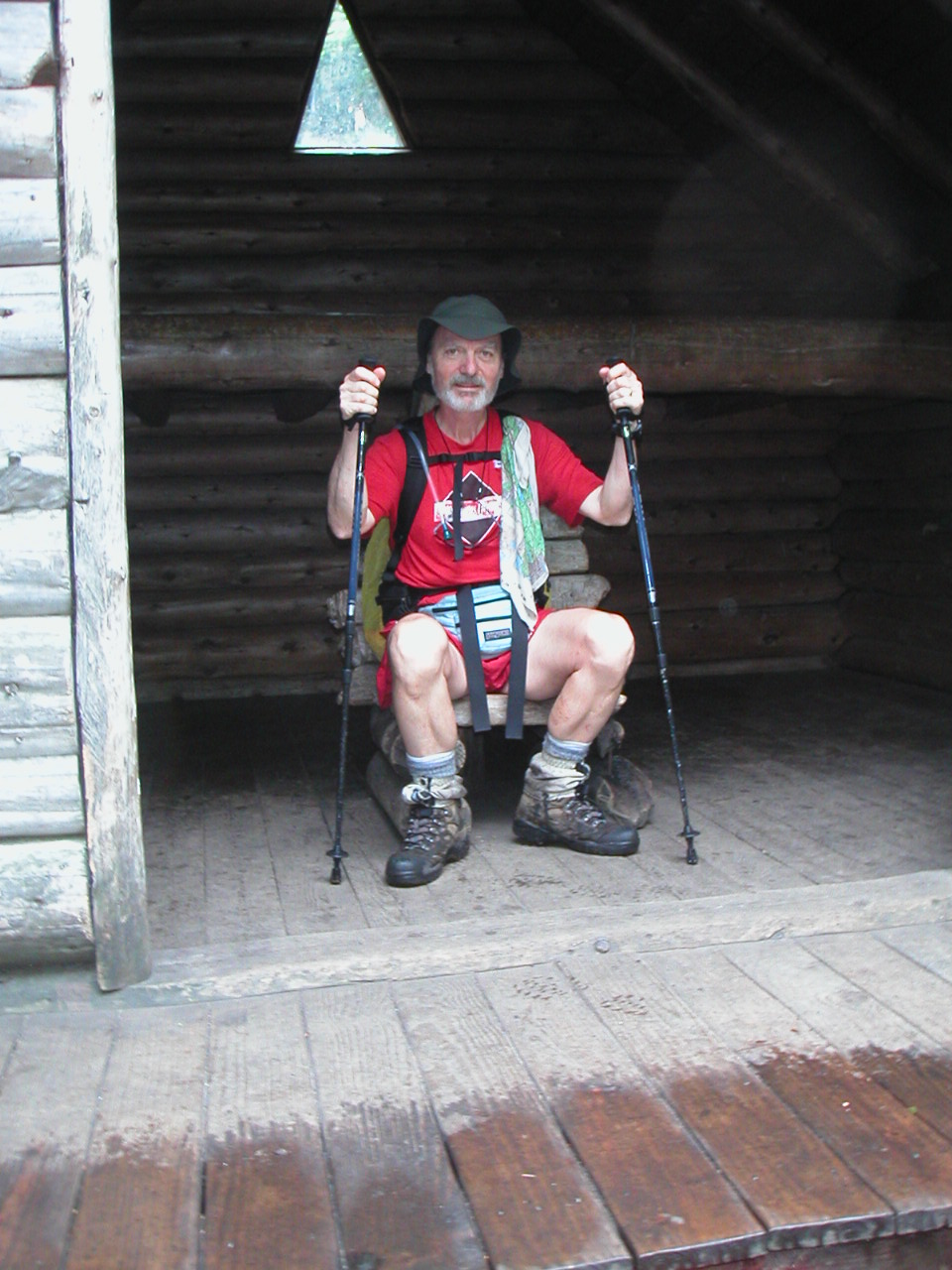
Papa Bear at the Imp Shelter
Unlike the Carters, Moriah was a series of long sloping smooth rock faces.
This climb was more like what we had seen in Vermont than the more recent
climbs through the Whites. Shortly before the summit, on one particular
sunny rock, we saw three snakes sunning themselves. One was a small garter
snake and the others were a large brown and a large gray specimen. We later
found that they were all color forms of the Eastern Garter, but it was
wonderful to see such variety all on a single slab of rock.
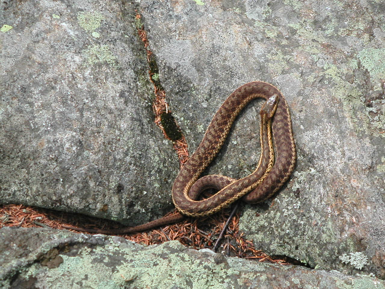
Eastern Garter Snake on Mount Moriah, showing unusual coloration
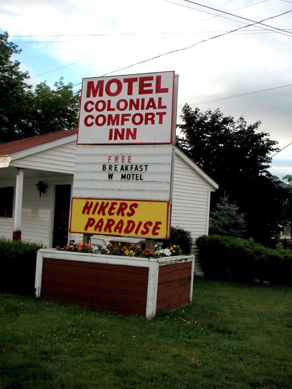
Hikers Paradise in Gorham
Aggregate Trail Miles: 90.9, Aggregate Total: 92.5
Peaks: Carter Dome (4832'), Hight (4675'), South Carter (4458'), Middle Carter (4600'), Lethe (4570'), North Carter (4530'), Moriah (4049')
An Evaluation:
By now you know my opinion if you've read this far. The huts are great! If you can afford to cross the Whites this way,
I highly recommend you do so. Not only will you be free of the burden of heavy pack, making and breaking camp, and cooking,
but you will learn a lot and see young members of families being exposed to the great outdoors in a very positive way. Even
if it's only once, do it. You'll be glad you did.
We were up for the arduous nature of this section, partly due to our having previously hiked the 500 or so miles of the AT
from the DWG this season (although by doing it in sections you lose some of your gains between sections),
and partly due to the fact that we used daypacks.
I love my Nikon digital camera, but alas it stopped working after about a day and a half. The problem seemed to be
mechanical, not electronic: the lens wouldn't open when you turned on the camera. I could still
view the pictures and upload them to my computer. The camera is currently in the shop. Luckily
my partners for this hike took plenty of pictures so there is a good pictorial record
of our adventure.
The AMC gives a certificate to those who have hiked all the 4000 footers in New Hampshire (which number 48 on their
official list). A peak "doesn't count" if it does not drop at least 200' below a higher neighboring peak.
This eliminates a few of the peaks we did such as Franklin and Clay. Here is the list of peaks we bagged
(including Moosilauke from our last section hike). I have listed them in the order we hiked them, south to north.
Those in brackets are the ones that "don't count".
Click here for a complete album of photos from this hike
Click for Papa Bear's Home Page
Click for the Backpacking Page