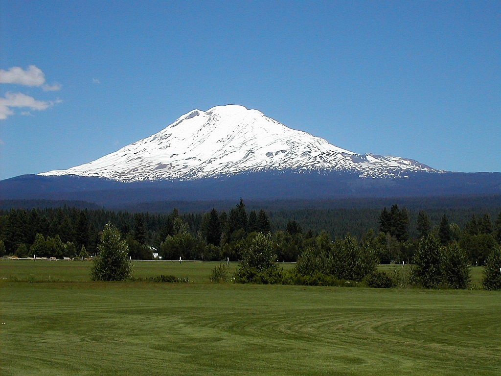
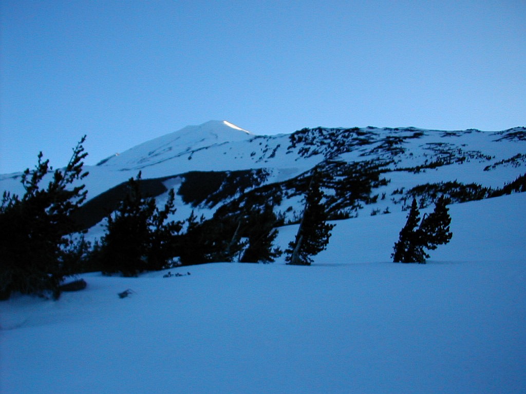
Mount Adams from the South across a Valley
(Click on this or any picture for a larger image)
|
Mount Adams from the South across a Valley (Click on this or any picture for a larger image) |
|
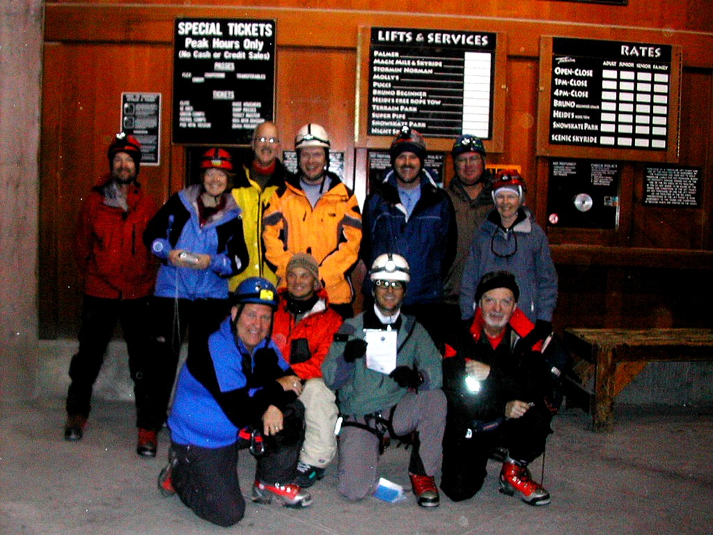
Click here for a complete album of photos from this trip Back to Papa Bear Home Page |
|
Click on an entry to jump to a particular section: |
|
|
A Northwest Adventure Mount Adams: June 15 & 16th Mount Hood: June 18 & 19th Portland Natural Areas: June 20th | |
| L |
For several years I had been thinking of climbing the Cascade Volcanos, or at least the ones near Portland. I had been visiting that city for some years and everytime I flew in, seeing Mount Hood, Mount Adams, and Mount Saint Helens (and on clear days even Mount Rainier) out the plane window has inspired me. Last summer I finally got my feet wet (actually got them dry is more like it) and did Mount Saint Helens (see my Mount Saint Helens Report) so I was ready for more. My daughter had done Mount Hood and convinced me it would be great to do it together, so it was time.
I arrived on Monday and on Tuesday we visited OMC (Oregon Mountain Company?) where we rented some winter mountaineering equipment. My daughter got some crampons and I got Kolfach boots, crampons, ice axe and MSR snow shoes. Then we were off to Mount Adams. This was the first of the two major mountains we were attempting - Mount Hood being the other.
We went east on I-84 to Hood River, crossed the Columbia and had a late lunch In White Salmon, Washington. Then it was an hours drive up to Trout Lake to the ranger's station, pick up the permits and finally onto the forest service road up to the trail head. I'll leave the complete trip details for the section below, but in summary, there was snow cover the entire route (plus on half a mile of the road below the trail head), we camped the first night at about 6800', we attempted the summit the following day but had to turn around at about 11,200', and then hiked out. Although the weather and conditions (except the excess snow, some of which was soft) were almost perfect, we didn't plan the strategy optimally, and I for one, did not have my hiking legs. But summit or no summit, we had a great time and now have an excuse to return.
We took Thursday off and got up early Friday morning and headed for Mount Hood. We had reserved with the Portland Parks and Recreation guides and met Rodney, our guide at 8:00 AM at Timberline Lodge. Friday was spent in "Snow School". We stayed (briefly) at a lovely lodge near the bottom of the road for supper and about 4 hours of sleep. We were back at the mountain at midnight, took the snow cat to 8500' and went up as a team, reaching the snow capped summit (11,239') just after 6:00 AM. We were down by 10:15, exhausted but exhilarated by the climb. The weather had once again been great (except for a cloud just on the summit) and the strategy and pacing was much better than for Mount Adams - hey that's what you pay the guides for!
On Sunday we visited two natural areas in or near Portland. Kelly Point Park is in North Portland at the confluence of the Columbia and Willamette Rivers, and although surrounded by industrial facilities, contains a beautiful wet bottomland ecosystem, primarily of Cottonwood. We then visited Sauvie Island, just downstream on the Columbia River. We visited one of the preserve areas on Oak Island and went through an Oak Savannah ecosystem (a dry bottomland). This was equally marvelous but totally different.
Then it was back to NYC on Monday. It had been an exhausting but marvelous week. I can't wait to get back.
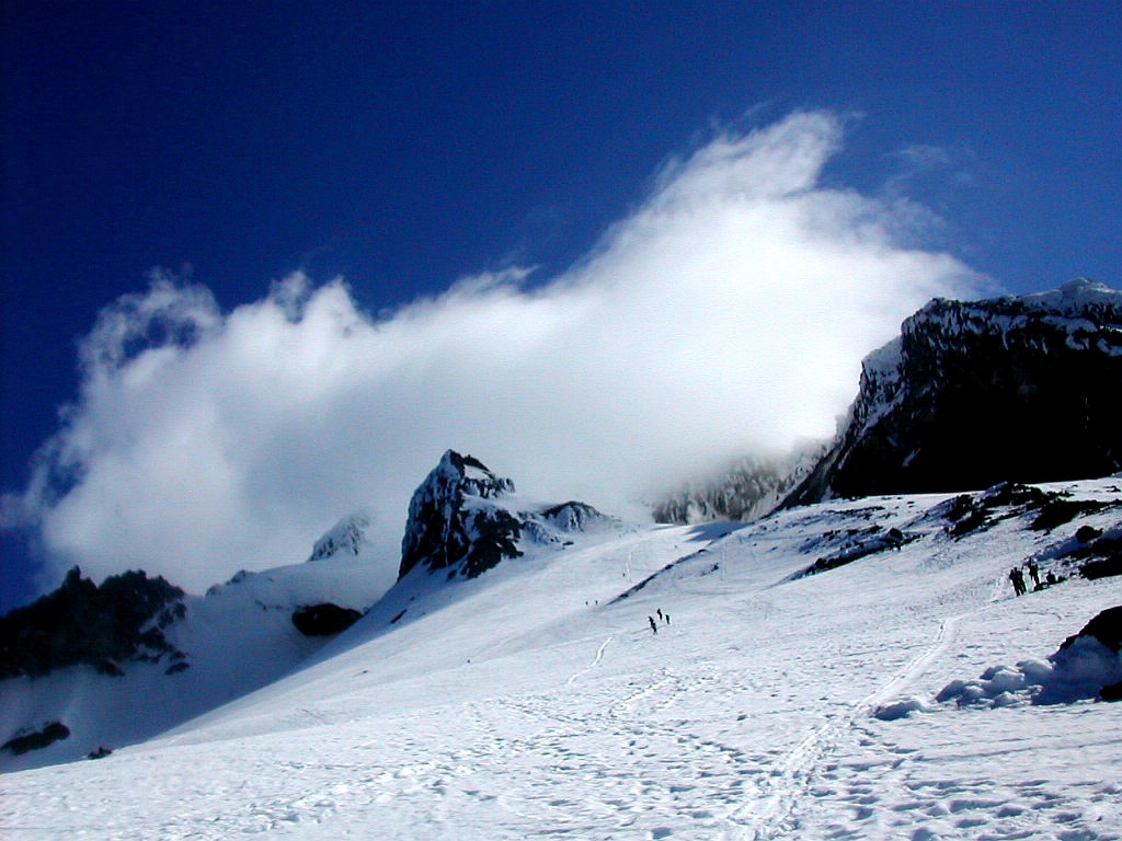
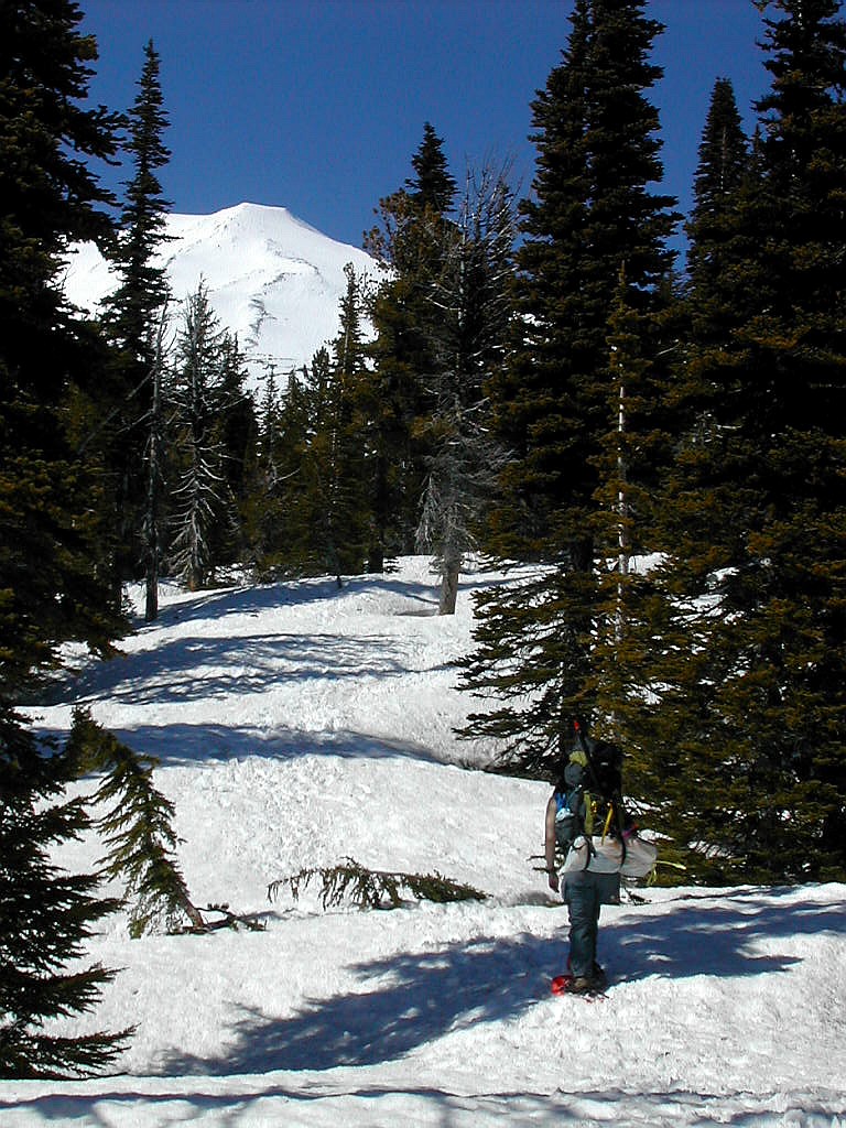 Mount Adams from the approach trail (Click on this or any picture for a larger image) |
Topo Map (Lists of John): Mount Adams
| O |
We had brought overnight packs plus day packs (for the summit climb) and snowshoes. Snowshoes are not normally needed for this climb but they were of great help to us in getting to our camping spot the first day since the snow in the lower part of the trail was rather soft - particularly on a warm sunny afternoon such as this one. So we packed up our stuff but I was faced with a dilemma. I had my big pack and my smaller day pack, but I couldn't figure out how to get the little one inside the big one with all the stuff we had. We carried a fairly substantial winter tent (shared between us) which weighed 12 lbs (ulp!) plus winter clothes, snowshoes, crampons and ice axe,
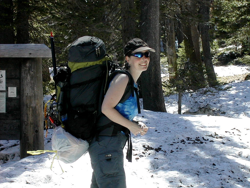 At the South Climb trailhead |
The ranger had said there would be tons of cars and people but we saw only about 8 cars and not very many people on the trail at all. Maybe 10 or 12 going down and no one going up except 3 people we saw going by after we had
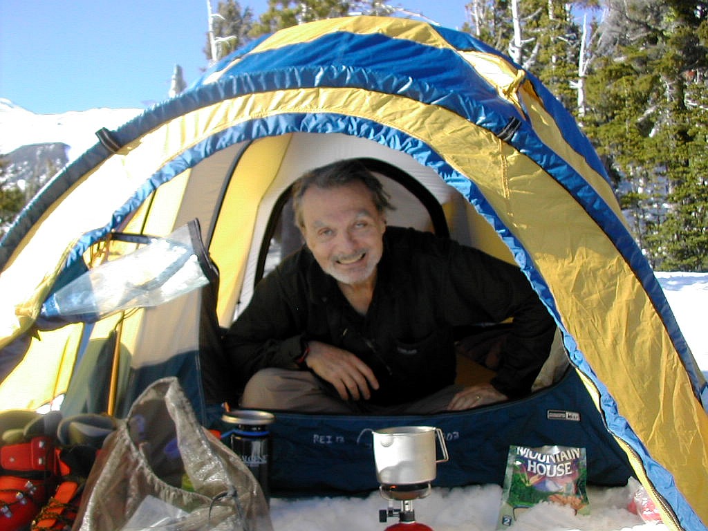 Cooking Dinner |
I answered a call of nature about midnight and saw an awesome star filled sky above with no moon. Stars like you never see them except in places like this. Shortly after I returned to my sack, the wind started and kept howling for the rest of the night.
We dragged ourselves out of bed at 4:00 AM to a pre-dawn clear, but cold and windy day. We got our climbing stuff together and left the rest in the tent where we would return in the afternoon. It was hard to get moving, especially with no hot food since we had decided we didn't have the time to do any cooking. For some reason I will never
 Sunrise hits Mount Adams |
Our climb consisted of two sections: the long ridge line to the saddle below the summit cone - a distance of about 2.5 miles and 2400' of elevation, and the summit cone itself, a much steeper climb of about 1.6 miles and 3100' of elevation. Moving along the ridge was relatively easy and we made it to the saddle by about 7:30 AM (the Lunch Counter was on the south side of this saddle) . Along the way we passed several tents so we knew others had made it up further than we did. For some strange reason, we saw no one camping at the Lunch Counter itself - which was where everyone said they were headed. The uncharacteristic wind direction (from the east) had probably kept most campers away from this exposed area. Meanwhile, I was having problems with my boots, which were evidently a little too big. There was pressure and pain on my heels and I was getting a blister on one side.
We saw several little "dots" of climbers moving up the slope in front of us and we wondered why these people were moving so slowly. We would soon find out. Evidently a number of people had gotten an earlier start than we did since
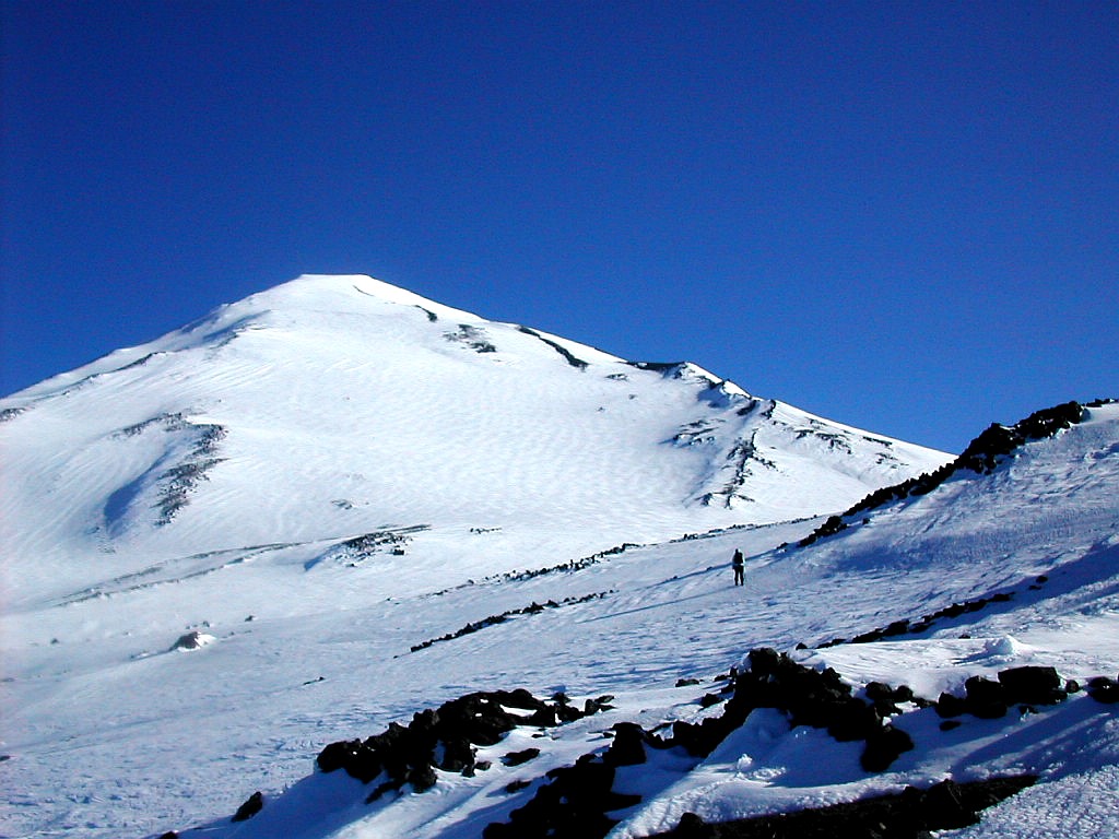 Mount Adams across the saddle |
So we turned around and glissaded down most of the steep slope. It was fun and fast but was actually quite a lot of work. We got to practice our self arrest technique but my pants took a beating on the hard icy surface. I'm told
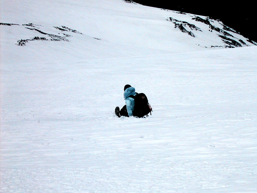 The fast way down |
Once down to the saddle we got back on the ridge and eventually met up with another climber coming back down who had
also camped down near the bottom of the ridge as we had. She was also pretty beat, but had gotten an earlier start
and had made it all the way. She was one of those black dots we had seen who were moving very slowly when we were at
the bottom of the steep slope. We chatted as we moved down and we all were impressed at how much elevation we had
climbed on this ridge. We finally split up and made it back to our camp at about 2:20 and took an hour to get our
stuff packed up. The last mile or so on the ridge was very slow going since the snow cover had softened in the sun
and we were constantly post holing. We were glad our snow shoes were waiting for us at camp.
If anything, my full pack was now even more uncomfortable than when we had hiked up. I managed to get the day pack lashed onto the overnight pack (instead of wearing it on my front) but that made the load very lopsided. The uneven
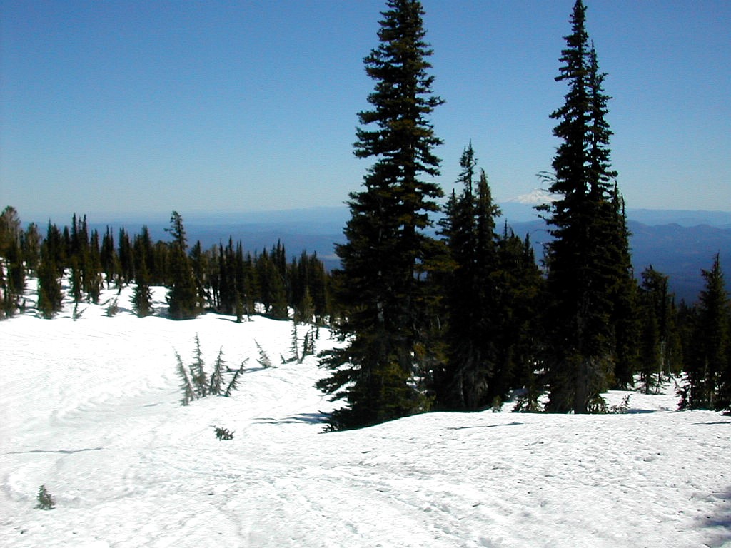 The trail down, Mount Hood peeking from behind the trees |
For a while we were quite disconcerted as we trekked down since there were numerous tracks going in various directions, but we never found what seemed to be the best one. My daughter thought we were lost and I felt uneasy, but since we were following fresh footprints, I said if we are lost, so are 4 or 5 others in front of us. Finally, to our great relief, we crossed two climbers coming up who reassured us that we were on the right path and the trail ahead of us would be easy to follow. Thank goodness they were right, but like (almost) every hike, the last mile to the car seemed to take forever. But we finally made it to the car at 5:20 PM and it felt great changing into clean clothes at last. I hate to think of when we would have got back if we had pushed on to the summit, and what condition we would have been in.
It had been a tiring day but a good one. With picture perfect weather on a beautiful mountain we could not complain. Conditions and strategy had kept us from the summit, but not from having a great day. But being the analytical type that I am, I did think about how we could have done better. Here's some ideas:
1) Better conditioning! This is a tough climb, especially with snow cover all the way from the trailhead. I trained
for months to run a marathon. But the only real mountain training I had done was a few easy hikes in Vermont after
my marathon a week prior to this climb.
2) With late spring snow cover, especially soft snow on the lower part of the trail, we should have allowed more
time the first day and camped higher up. Snow shoes are highly recommended for these conditions.
3) We should have worked on packing lighter. Especially a lighter tent and a way for me to balance my load.
4) Better hiking boots. Heavy rentals that didn't quite fit did not enhance the climbing experience.
5) Better conditioning! Did I mention that?
A summer attempt on Mount Adams, with little or no snow below the summit cone, would be a very different experience, undoubtedly easier. Maybe I'll get to find that out this summer or next.
Now on to Mount Hood ...
 Mount Hood summit in the clouds (Click on this or any picture for a larger image) |
Topo Map (Lists of John): Mount Hood
| I |
I was however a little apprehensive after the Mount Adams experience, but since Mount Hood, although more "technical" than Adams, would entail much less elevation gain (since we would bypass the ski slope - see below), I decided not to worry. One thing I could address however, were the rental boots which had hurt my feet. So we headed to OMC on Thursday to have them checked out. We were temporarily stymied in getting to the place. It seems the Gay Pride Parade was in progress at that hour and many of the streets in the area were closed. After crosing the Willamette unintentionally several times on various bridges, we decided to just park out of the area and walk over. When we finally got to OMC, we were greeted by 6 or 7 sales people who were delighted to see a customer walk in. It seems that no one could get to them! I tried on another couple of pairs of Kolfachs and found one a half size smaller that fit well, so we made an exchange. The new boots never bothered me on Mount Hood for which I was very gtateful!
We used the Portland Parks and Recreation guide service (telephone: 503-823-5132) which is one of several that operates on the mountain. The cost was not cheap ($279 plus a non-resident surcharge) but it included a lot of amenities that I considered important: a full days training in basic mountaineering skills, a nearby lodge where we had a big dinner and a place for 4 or 5 hours of sleep, and perhaps most important - a reservation on the snow cat which took us from Timberline Lodge up to 8500', just above the ski area. This eliminated the long slog up along the ski area with it's soft snow surface and 2500' of elevation gain. We found this service to be highly qualified and we had a fun group of people to climb with. We were all pretty inexperienced in technical climbing but generally a fit group of people. Other services such as Timberline Mountain Guides were also highly recommended. All the guides seem to know each other and were generally young climbing enthusiasts looking for a seasonal work. Rodney, our guide, was a graduate student at PSU.
If you are technically competent to do the climb without a guide service that is fine. But if you skip the option (and expense) of using the snow cat, I suggest you climb the lower section the day before and camp (which is legal above 8500') around 9000' and sleep the early part of the evening before starting the upper climb (probably at 1:00 or 2:00 AM if you are reasonably fast). There are several areas that are reasonably flat around the level of Illumination Rock that you might choose. To slog up all the way from the bottom in one continuous climb would be quite an exhausting undertaking. Believe me, our experience on Mount Adams earlier in the week attests to this. And one other thing: bring snow shoes for the lower section and cache them around 8500' - 9000'. You'll be happy you did and even happier to use them again on the way down.
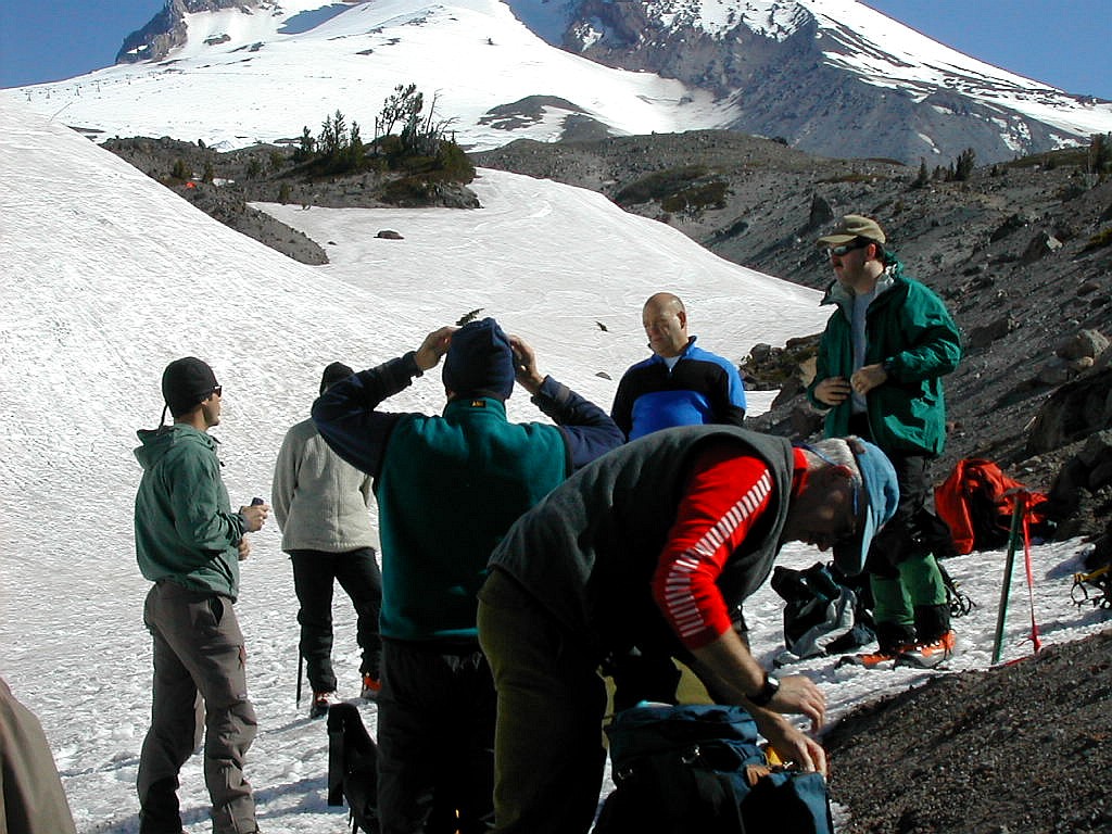 Snow School Rodney on the left |
We "caravaned" to a beautiful A-frame lodge which was actually a condo in the Trillium Lake area, about 2 miles off Route 26 just north of the road up to Timberline Lodge. We spent the afternoon organizing and shmoozing and had an early pasta dinner around 5:30 PM. One guy brought some beer and a surprising number of people decided to imbibe, but I decided to put that pleasure off until after the climb. We got to sleep around 6:30 PM and around 10:30 PM people started moving around and I dragged myself out of bed. My daughter unfortunately had come down with some sort of intestinal problem and decided to take a pass on the climb. I was saddened by that turn of events, but knew that with this type of high exertion / high risk endeavor it was the right decision for her.
 The group ready to go |
Our route was the standard south face route, up across the Palmer Snow field (in our case by snow cat) then up for a rest stop at the Triangle Moraine. Then up onto the Hogback, across the bergschrund, up thought the Pearly Gates and on the summit. Our strategy was to get an early start so as to minimize the congestion with other climbing groups and to get through most of the snow surface when it was still frozen solid. [late in day, late in season. bad snow, rockfalls] For a map of the upper part of the summit click here Mount Hood topo map. Unfortunately this does not show the mountain as we climbed it. The prominent feature know as the Hogback is not labeled and much of the rocky areas shown were actually snow covered at this point in the season.
The first part of the climb was done unroped and without crampons. Most of the group had trekking poles but I had decided not to bring mine. This was a mistake since both for balance and support they would have been helpful in this first part of the climb. The first thing I noticed, even though I had been warned, was the sulfur smell. After a few jokes about who was cutting the cheese and being at the back of the line, we soldiered on. We switch-backed up across the slope over a moderate grade. I felt pretty strong although one of our group was starting to fall behind. We passed over a small rocky outcrop at about 9600 which was the top of the Triangle Moraine, shown on the map by the small red cross marker. Here we took an extended rest of about 15 minutes, put on our crampons and harnesses and roped up. Most groups wait till the bottom of the Hogback, about 800 feet higher, to rope up, but our guides wanted us to get some experience with team climbing before the hard stuff started. They used a short rope technique, with about 12' - 15' of rope between climbers. The guides said long roping would result in much stronger forces in the event we need to team arrest a falling climber due to the speed at which a fall can accelerate to in a few seconds.
The climb up from the Triangle Moraine was steeper and passed up through a funnel between two large rock outcroppings: Crater Rock on the left and Steel Cliff on the right. At this point the climber who was lagging began to get exhausted and he decided he could not go on. Rodney, our guide, secured the team, unroped and went down to the climber and took him back to the Triangle Moraine area where he set up a bivy for the climber and then returned to our team. Meanwhile we were down to 3 climbers and we followed the other team, led by Rance, up through the funnel to the Hogback where Rodney would catch up with us. Once through the funnel we traversed diagonally up to the left to arrive a the top of the lower part of the Hogback. There we took another extended rest before the final climb to the summit. So what is the "Hogback"? It is basically a ridge of snow across the old crater and forms a line up to the last steep part of the climb. It is steep but it offers the best climbing route across this area. As an added "bonus", it is bisected by a crevasse known as the bergshrund about midway up the slope. This is where the glacier underlying the slope pulls away from the steeper part of the mountain above. Later in the season this get wider as the glacier pulls away and climbing this section becomes more difficult. Some years this
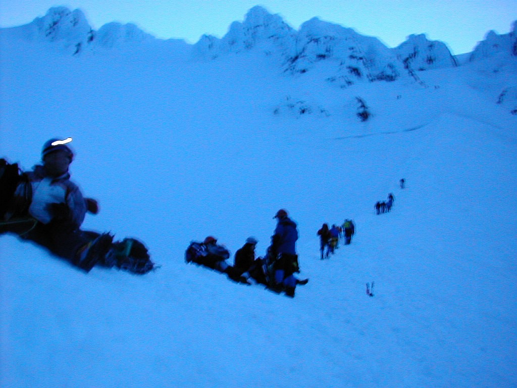 Moving up the Hogback in the pre-dawn |
This part of the climb was the steepest and we were told it was a bit more difficult than usual due to the lack of a good track in several areas. Following pre-existing tracks, consisting of other climbers' frozen foot prints, is a great time and energy saver and where there was a good track we made good progress. Our rope team now was led by Rodney again and consisted of the 3 remaining climbers of our group. Movement along the Hogback was slow but steady. A short distance before the bergschrund we traversed to the left and this was rather easy in comparison. At the point where we crossed the bergschrung it was just a big step but a rather scary one nevertheless. You didn't want to fall in there. The blue glacier ice seemed to glow beneath the white snow covering. I wish I had some pictures of this part of the route, but it was too dark and I was too preoccupied with climbing to fiddle with my camera. At this point the sky was lightening since it was close to 5:00 AM. We could see the top of the mountain was covered by a cloud so we would not see the actual sunrise.
After crossing the bergschrund we climbed up towards a rock outcropping and moved around it to the right and regained the upper part of the Hogback. This section was very difficult since several areas were very icy and were difficult to climb with no appreciable track. The last steep part of the climb goes through another funnel between some icy massifs which is known as the Pearly Gates. It is a treacherous but beautiful section. The beauty was enhanced by the cloud, lit from the top by the newly risen sun, that hung just above the level of the Gates. The last person on our rope, just below me, was starting to tire at this point and she kept asking to stop for a rest. I felt I was pulling her up though this area, although I was no powerhouse myself. But we finally got through the Gates and onto the short easier slope to the top.
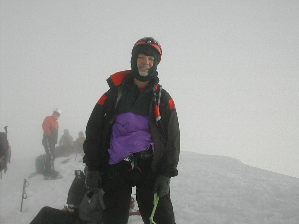 A tired but happy papa Bear at the summit |
We reorganized the rope teams when we started down to even them out and I was switched to Rance's team. Going down was easier on my heart, but not easier on my legs or mind. The top section through the Pearly Gates and down to the bergschrund was very tiring side stepping and belaying with the ice axe. There were traffic jams with up-climbing teams, but lucky for us we seemed to get the right of way by convention. I found the down-climbing much harder than expected, and with my concentration waning, probably more dangerous. When we crossed the bergschrund I stumbled a bit and the rope team leader warned me to watch it. The traverse back to the Hogback was easier but I managed to stumble again. The leader warned me if I lose my feet I need to be sure of my ice axe - which I wasn't. We finally reached the rest spot near the bottom of the Hogback and I tried to recover from my very tiring experience of the last hour and a half.
One thing that was visually impressive, which only our noses had alerted us to on the way up, was the presence of two sulfur fumeroles, one on the west side of Crater Rock, and the other (the Devil's Kitchen), across the funnel at the base of Steel Cliff just opposite where we would soon descend. You wouldn't want to slip into one of these babies! I'm told one can suffocate due to lack of oxygen in these pits.
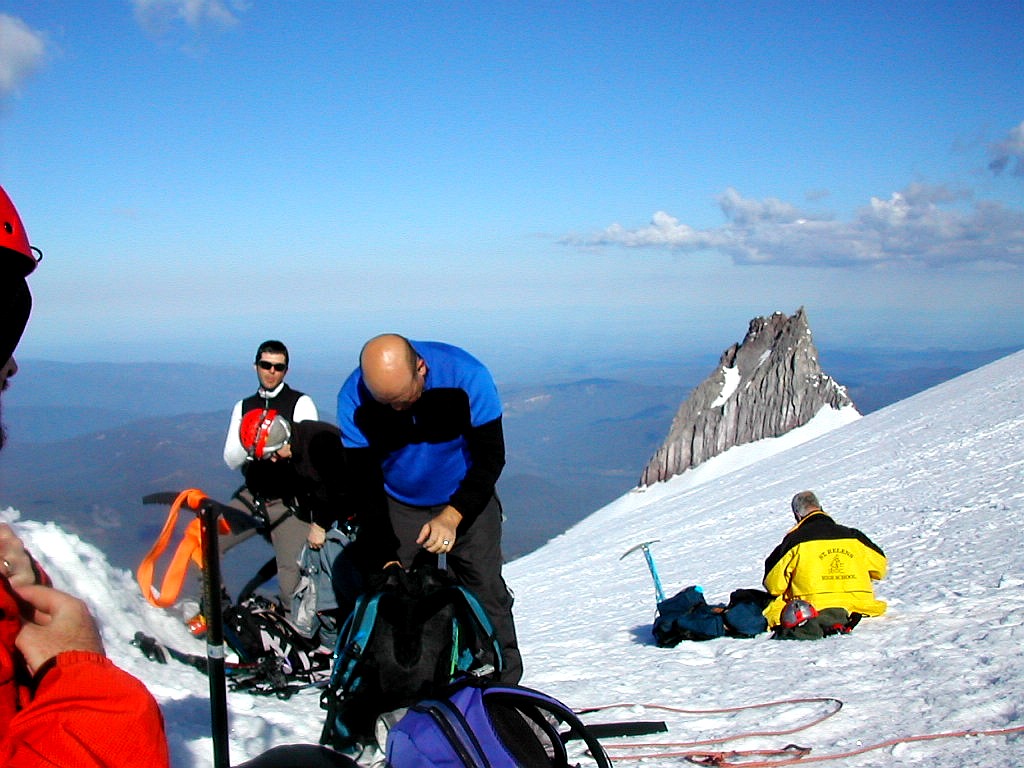 The group at Triangle Moraine Illumination Rock in the background |
From the Moraine to the bottom was easier but it eventually became a long slog through soft snow. As we got close to the top of the ski slopes (around 8500') the snow got softer and softer and we began to post-hole. I missed my trekking poles, as on the way up, but I also wished I had brought snow shoes and stashed them somewhere for going down this section. The worst part was the last couple of miles along the side of the ski slope, where the cat had taken us last night. This seemed interminable with tired muscles and soft snow making it a real chore. But all things come to an end and at around 10:15 AM, my feet finally hit the pavement at Timberline Lodge. I turned in my harness and helmet, said goodbye to everyone and was done with the Glorious but exhausting Mount Hood.
This was not a tourist climb! It was as hard as any marathon I've run (and I've run 15 marathons). If you climb this mountain, prepare well and take it seriously!
But for the record, I think if I had put in as much time training for this mountain as I have for one of my marathons, It would have been a lot easier. That was a big lesson to me. If I hope to do more of this type of thing, I need to get in better climbing shape, which is not the same as running shape (as I learned the hard way).
And I want to share something that I thought was enlightening and not a little ironic. After the climb I happened to chat with both of the Guides (separately) about the fact that I had run a marathon recently and had run a number of them over the years. Both of them (each about 30 years younger than me and perhaps 10 times as fit), using almost the exact same words, said "I could never run a marathon". To each I replied "What if I told you I could never climb this mountain?" They each showed a little embarassment and then said something like "Yeah, I see your point, I guess I could run a marathon if I worked on it". A good point to remember for all of us when we assume we just can't do something.
| I |
Last summer my daughter had worked for the departments of Ports of Portland as a summer intern. She worked on mitigation studies of wetlands that were owned by Portland Ports. Recovering polluted areas, getting rid of invasive plants, etc. Stuff like that. In the course of the summer, she had been to seldom visited areas along the river, some of which were rather attractive natural areas. We decided to check some of these out.
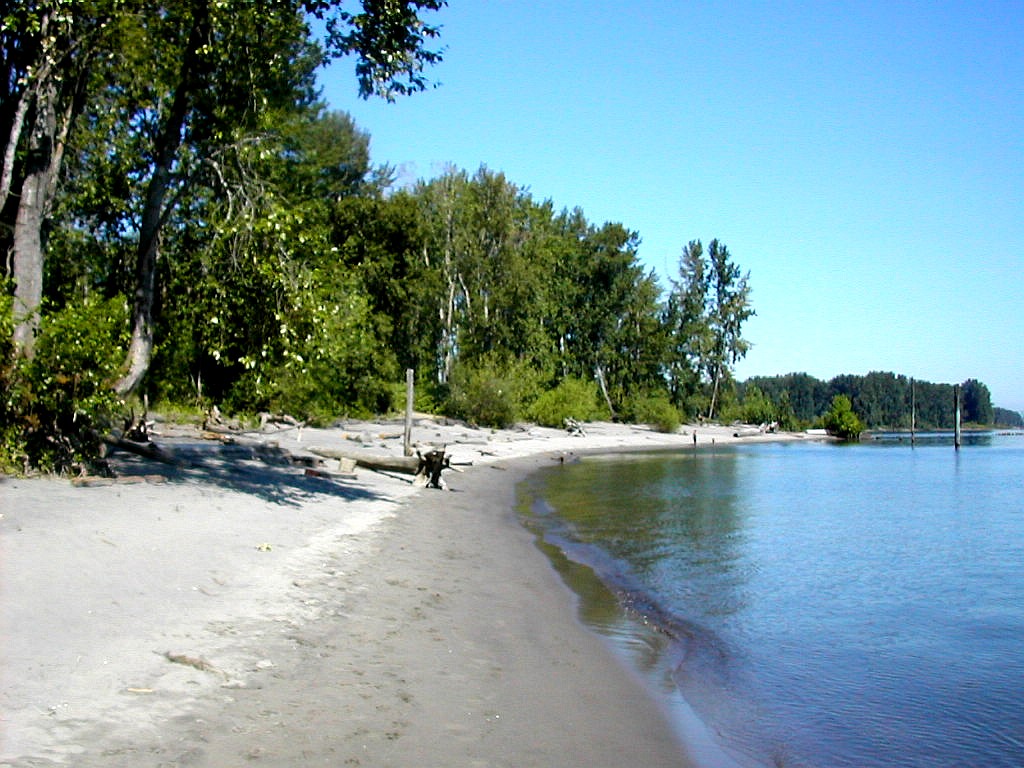 Kelly Point seen from the beach |
We drove up I-5 and exited onto the road that goes by the motor race track and the new convention center. Since it was Sunday, once we passed these areas we had the road almost entirely to ourselves. We drove through freight facilities and over many railroad tracks and finally got to the Park and stopped in a nearly empty parking lot. Just a few walkers and dog owners were around today. I was surprised to see that this wholoe area contains a beautiful wet bottomland ecosystem, primarily of Cottonwood. And the cottonwood was in flower (or maybe going to seed, whatever) and there was "cotton" all over the place. I had never seen this before and it was beautiful. We walked along the beach around the point and then down to the Columbia Slough (pronounced "slew") which is a narrow tributory that originates over near the airport and empties into the confluence of the two rivers at this point. See the map. We got some good views of freight traffic mixed with natural beauty and finished up with a long walk through the cottonwoods.
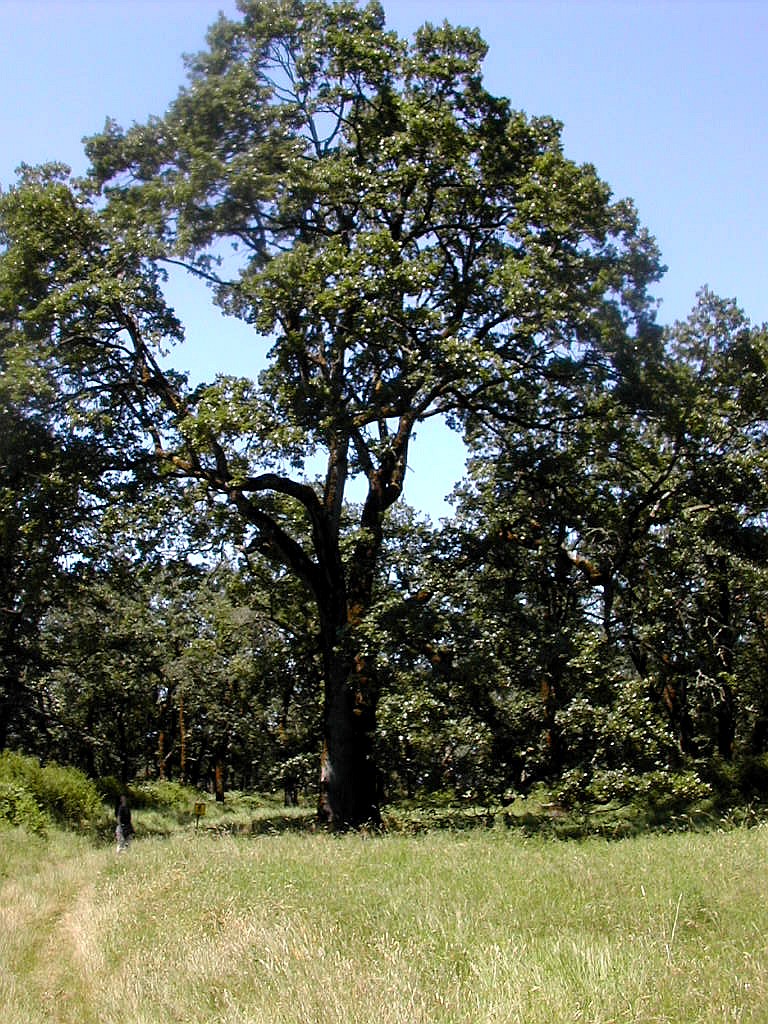 Oak Savannah |
This was an equally marvelous but totally different area from the cottonwood forest we had just seen. My daughter pointed out that this type of ecosystem depended on recurring fires as a precondition, so evidently controlled burns were used here to preserve this unique area. She noted that soil studies of the Willamette Valley had shown that the Native American tribes living there had used fire as a tool in that area for 6000 years before the coming of the Europeans in the 19th Century.
It was a pleasure to find these natural areas so near a large city on a busy river.
|
Click here for a complete album of photos from this hike Return to Papa Bear Home Page |