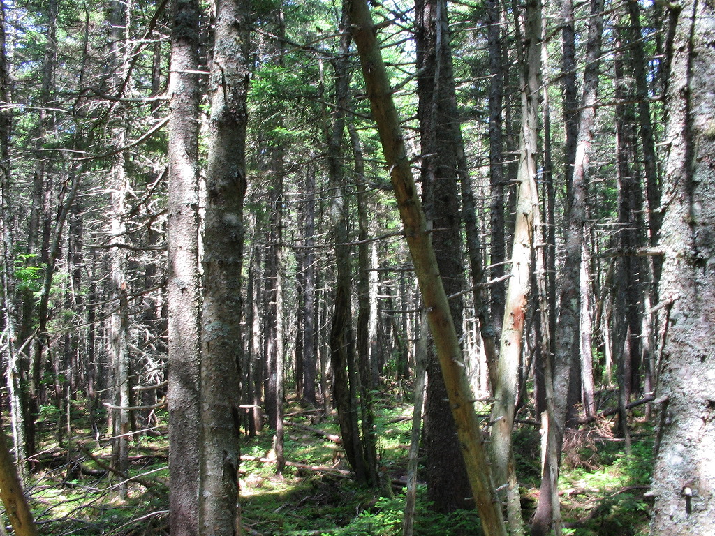
Old Growth Spruce in the Old Blue - Elephant Col
(Click on this or any picture for a larger image)
|
Old Growth Spruce in the Old Blue - Elephant Col (Click on this or any picture for a larger image) |
|
Click here for a complete album of photos from this hike Click for Papa Bear's Home Page Click for the Backpacking Page |
|
Click on an entry to jump to a particular section: |
|
|
The Maine Blitz moves to the AT Tuesday July 12th - South Arm Road to Route 17 | |
| T |
Maine: Hundred Highest - all done, Fifty Finest - 4 to go
Vermont: Hundred Highest - 8 to go, Fifty Finest - 1 to go
New Hampshire (not including Carrigain): Hundred Highest - 14 to go, Fifty Finest - all done
Thanks to all my VFTT friends who hiked me over this blitz. It's always more fun when you do things with friends.
This report is the third of four which cover my hikes and climbs during two weeks in July. The first report covers the peakbagging I did in New Hampshire from July 5 - 10 and the 11 peaks I climbed that busy week. The second recounts some peakbagging I did in Maine and the last covers the the peaks in New Hampshire on the weekend of July 15-17. To go to the other reports, click on the entry below:
|
Blitz part 1: New Hampshire - 11 peaks in a week |
|
Blitz part 2: Peakbagging in Maine |
|
Blitz part 3: An AT Section Hike in Maine (this report) |
|
Blitz part 4: A Long Weekend in the White Mountains |
| Y |
Then in 2003 I had a brilliant idea to combine this section with a bushwhack of Elephant. (2003 Elephant report) With two VFTT friends, I would hike in from South Arm Road, over Old Blue, across to where the trail cuts across Elephant's flank, then bushwhack in first to the east, and then to the west peak. Then we would return to the AT and finish the section. Simple! Stupid is more like it. But by the time we got to the west peak of Elephant and signed the register we were exhausted and it was mid afternoon. So we just went down the clear cuts and skid roads to Elephant Road, called our car shuttle and got back to Andover in a downpour.
Now this time there would be no side trips. I stashed my car on Monday afternoon at the parking lot on Route 17
 View of South Arm Road and Black Brook |
The trail north from South Arm Road is a tough one for the first thing in the morning. Why is it that you always
have to literally "climb out of bed" mornings on the trail? I guess, because most campsites (and of course Hostels
and road crossings) are in valleys. Almost immediately I was confronted by a series of steep rocky ledges. I
noticed on one long difficult ledge,
a series of iron rungs that looked new and which I didn't recall from my 2003 hike here. Sure enough,
later as I neared the top of Old Blue there was a trail crew putting in iron rungs on the face of another steep
ledge. So I used these new rungs the very day they were put in. Perhaps I was the first to use them. I thanked the
crew for their work (I always try to do that unless they're dropping boulders on me
 ). There is one spot on this
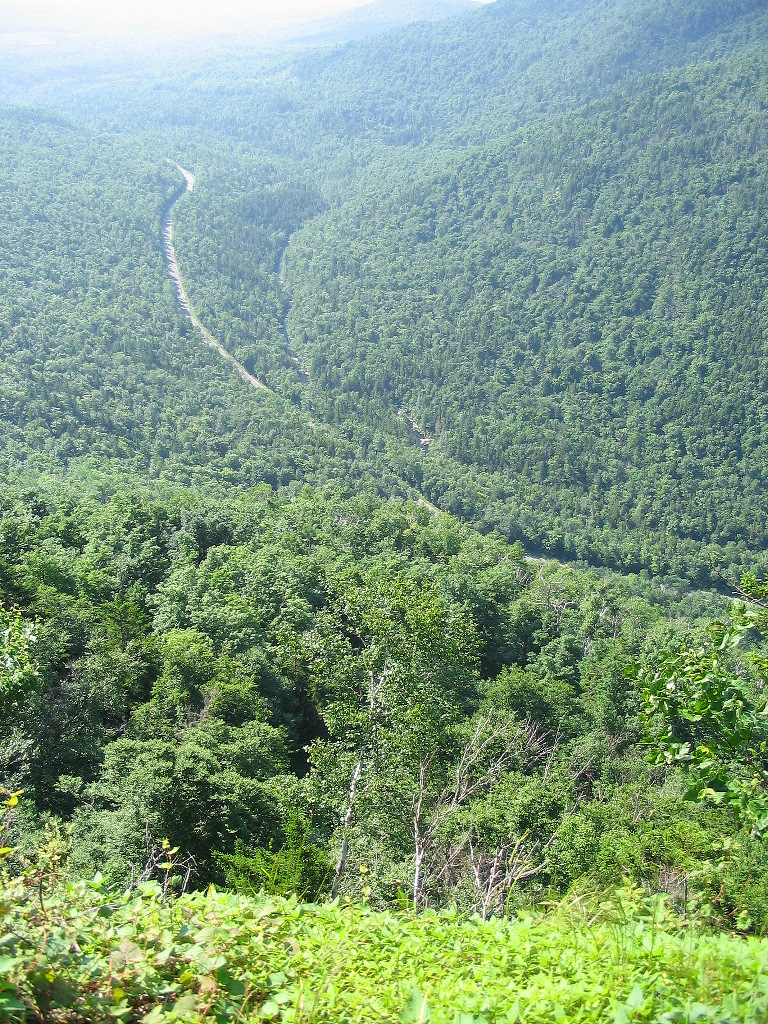
climb that I recall from before, a lookout just off the trail to the right where you can see down the valley to
the south. The winding courses of South Arm Road and of Black Brook down the green valley make for a remarkable
vista.
). There is one spot on this
climb that I recall from before, a lookout just off the trail to the right where you can see down the valley to
the south. The winding courses of South Arm Road and of Black Brook down the green valley make for a remarkable
vista.
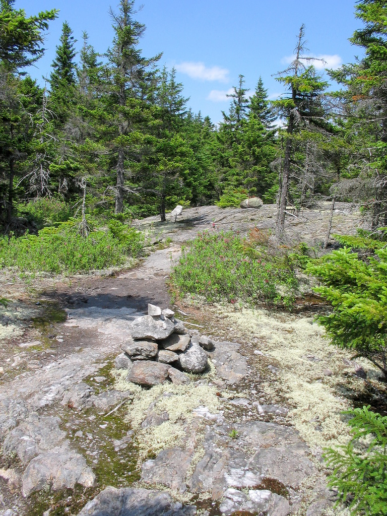
There follows a section of relatively easy grade after the steep initial climb. The trail actually drops a bit into a sort of col before resuming the climb of Old Blue. Then follows once again a fairly steep section with rocks and ledges (and more new iron rungs) until near the top where the peak levels off to a broad dome. It's not exactly above tree line at the summit of this 3600 foot peak, but the trees are all rather short and there are lots of open ledges. There are also what looks like trails going all over the place, so you have to be careful to watch the blazes to stay on track. I reached the summit of Old Blue at 10:42 AM. There are good views of Elephant Mountain to the north with both peaks visible, and of Bemis with its multiple bumps peeking out from behind towards
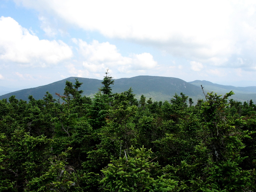 Elephant and Bemis from Old Blue |
Around this time I was passed by another AT hiker who had started from Hall Mountain lean-to, about 4 miles south of the road crossing where I had started. We would play leap frog over the next several hours. I think his name was Klaus.
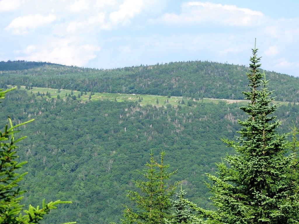
The trail down from Old Blue and up over the flank of Elephant is one of the most beautiful in all of this part of
Maine. As you drop down into the col, you first cross through a boggy area with long sections of puncheon and then
you enter an area of old growth Spruce, one of the few surviving such tracts in all of Maine. I don't know how this
area escaped the loggers axe, but it did. The old trees continue through the col and up on the side of Elephant. I
passed the point where the old Clearwater Brook Trail (now abandoned) used to come up from South Arm Road. At one
time this was the official route of the AT before it was rerouted over Old Blue. Elephant whackers could make their
way about a quarter mile down the remnant of this trail to a logging yard to approach that Hundred Highest peak, or
OTOH, they could just drive up on Elephant Road with their SUV and save a lot of effort
.
Soon I passed the point where in 2003 we started our bushwhack up to the east peak of Elephant. We had followed the Franklin/Oxford county boundary cut for part of that whack, but I didn't notice it today. According to the MATC map the trail never quite crosses that line although it comes very close so the map is probably right. Now I was in new territory.
The trail rises and eventually leaves Elephant behind and crosses the high col and heads over to the multiple bumps of Bemis Mountain. The Bemis Stream Trail drops down to the right from this col as the AT heads up the easy slope (except of course the last few tenths of a mile) of Bemis. The first bump is also the highest and I reached this summit at 1:25 PM. At 3592', this is just 8 feet lower than Old Blue, but of course Elephant, which the AT bypasses, whose two peaks both rise to around 3770', is the highest in the range.
 Endless open ledges |
I reached the Bemis Mountain lean-to and found 4 guys lounging around there. I pumped some water and chatted with them briefly. After I got going again along the ridges I met first a 40ish woman (one of the lean-to lounger's aunt, it turns out) and then a series of groups of young camp kids (about 12 - 14 years old) all heading south and all planning to camp the night at the lean-to. They were looking pretty tuckered out from the heat, as was I, but at least I had the sense to wear a hat and drink plenty of water. Ah youth! After I had passed them all, I estimated there would be something close to 20 campers at that lean-to this night. Sheesh!
Eventually I got below the exhausting open slabs, and descended steeply over rocks and ledges into the Bemis Stream valley. There is a great irony to this section: as you descend off the ridge, you can see the highway way across the valley, up on the side of the hill! The trail drops nearly 1000' off the last bump on the ridge, and
 Route 17 across the valley |
The AT crosses Route 17 near the height of land overlooking Lake Mooselookmeguntick. There is a turn-off here, and it seems that every tourist driving this road, and not a few natives, take the opportunity to stop and take in the vista. If you get here in the early morning, as we did in 2002, there is very often a cloud just sitting on the lake below. A super photo-op if there ever was one! But my car was nearly a mile away down the hill, so I still had the long walk down Route 17. Finally I reached my car around 6:00 PM. It had been a very long and hot day, but I was done.
I drove back up to the high point and stopped briefly. Klaus was there and he managed to convinced some folks who had stopped to ogle, to drive him to Rangeley. I was glad he would get relief from his foot problems. For myself, I was off to Audrey and Pat's. I had more Maine peakbagging to do over the rest of the week.
AT Section: South Arm Road to Route 17, Maine
Distance hiked: 14.3 miles (including Route 17 road walk)
Elevation gained: 4300' (estimate from MATC map)
Time: 9:24
Photos:
AT Section Hike Album
|
Click here for a complete album of photos from this hike Click for Papa Bear's Home Page Click for the Backpacking Page |