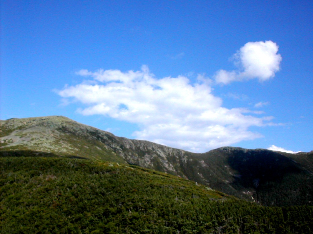
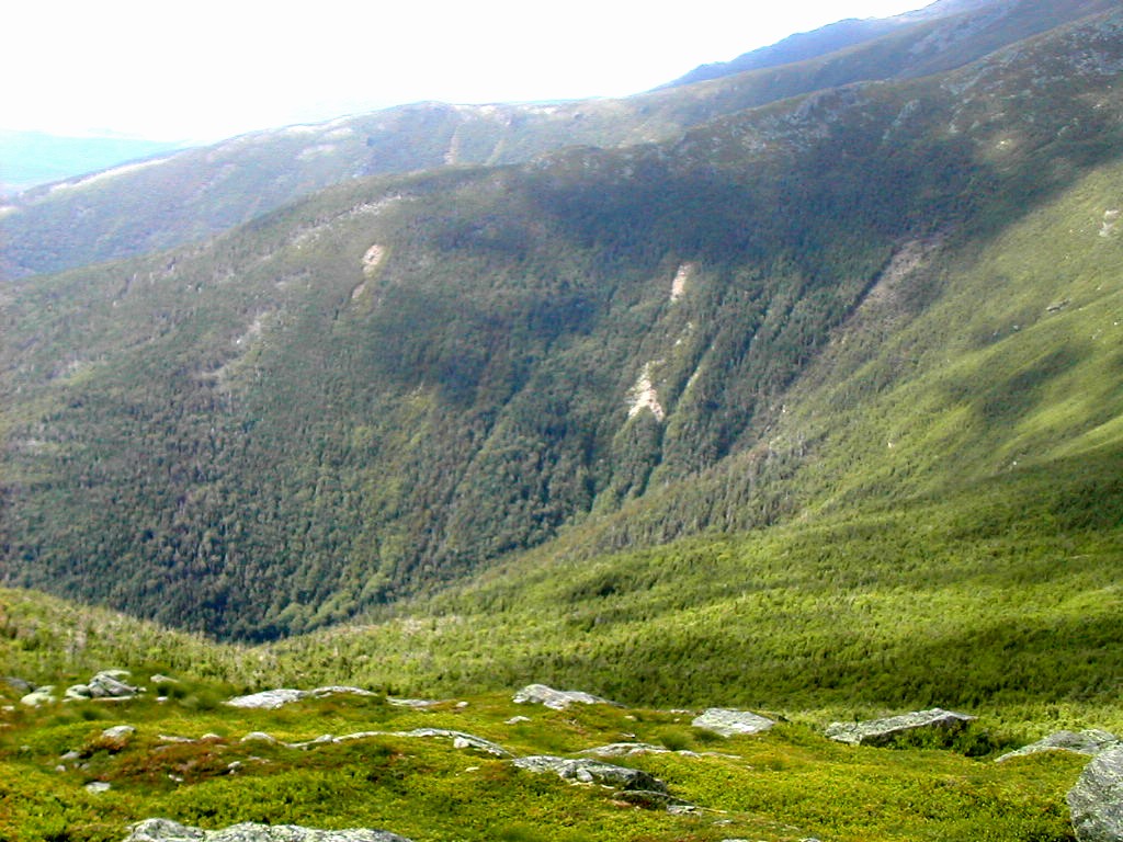
Mount Lafayette from Greenleaf Hut
(Click on this or any picture for a larger image)
|
Mount Lafayette from Greenleaf Hut (Click on this or any picture for a larger image) |
|
Click here for a complete album of photos from this hike Click for Papa Bear's Home Page Click for the Backpacking Page Click for the Hiking/Peakbagging Page |
he idea for this trip was last year's AT section hike through the White Mountains. Fresh Air and I started in Kinsman Notch and hiked hut to hut to Rte 2 in Gorham. Click on this link for the account of that trek. For the "centerpiece" of that trip, the Presidential Range, I invited members of my running club, The New York Flyers, to join us. After a few injuries and cancellations, I was joined by Gary Heard and his daughter Beth. The 4 of us experienced a wonderful 3 day traverse of the AT across the Presidentials with blue sky and sun for all 3 days. Fresh Air and I then went on through the Wildcats and Carters to Gorham.
This year I wanted to repeat the experience, but not as an AT section hike (that section being already finished), but as just a great time in the Whites with some peak bagging thrown in. In the end, 3 Flyers (Ed, Jerry and Jim) came along and in addition, Ed's friend Laura. We spent 4 days crossing the Franconia Range from Franconia Notch to Crawford Notch, and I continued on solo 2 1/2 more days across the Presidentials. We stayed in huts each night.
I had laid out a long hike and a short hike for each day to account for different hiking goals and capabilities, but in the end we stayed together since the group was really too small to split up
On Saturday, we drove up in two cars and stayed the night in Gorham at the Hiker's Paradise Hostel. We stopped for lunch in North Hampton, MA and then proceeded up I-91 all the way to US Route 2 (in Vermont) and then drove across to Gorham. This was a bit longer then some routes but it may have been the fastest given the potential Saturday traffic conditions on the narrow New Hampshire roads. Several of the group thought they would like to move up to "higher class" accommodations, so next time I'll let them make the arrangements. The Hiker's Paradise was fine with me. We had a nice dinner at the Pizza place (which we closed! Boy, now we knew we were not in Kansas, I mean NYC).
e had breakfast at the Hiker's Paradise and got our stuff packed into Ed's and Jerry's cars. It was a cool morning with temperatures in the 50°s
 Cannon Mountain from the Old Bridle Path |
We got going up the "Old Bridle Path" to the hut. This is a fairly steep trail (2500' in about 3 miles) but there were no terribly rough sections, just a few rock ledges near the top that we had to scramble over. It took us about 2 hours to hike up to Greenleaf Hut and practicully the whole way there were beautiful views of
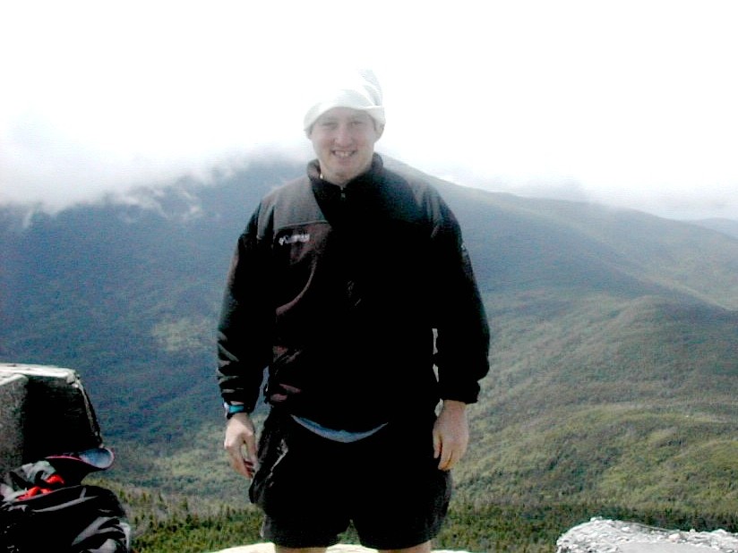
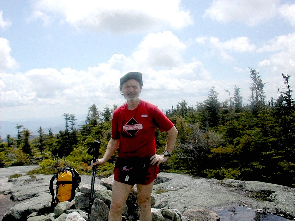
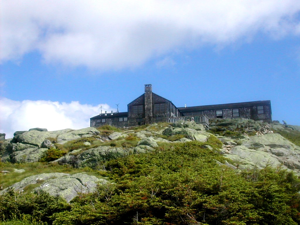
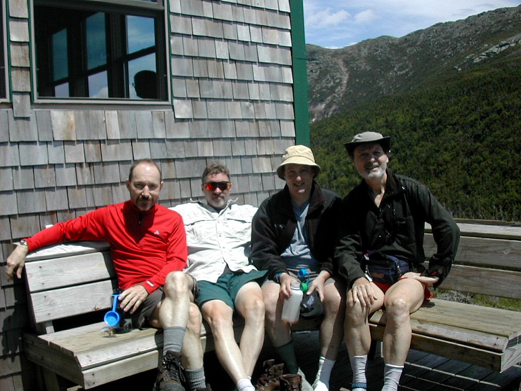 Jerry, Ed, Jim and myself at the hut |
Laura was a little late getting up so we went out to find her and there she was just before the crest of the ridge before the hut comes into sight. She yelled at us for doubting her, but nevertheless it was nice when we were all comfortably ensconced at the hut. After dinner Jim hiked up to the summit of Lafayette, hoping for some sunset views. I stayed behind and took a million more pictures, then hiked up to the first cairn above tree line across the lake. Alas, there was no sunset! A cloud layer obscured the horizon and Jim came back just in time to have some fading daylight.
It was a great first day, but the real work would start tomorrow.
las, the beautiful weather of the day before was not to repeat itself today. It was cloudy with occasional glimpses of sun, with rain and possible thunderstorms forecast for later in the day. At 7:00 AM it was 56°. The weather report from Mt.Washington was for 40 - 60 MPH winds on the high summits.
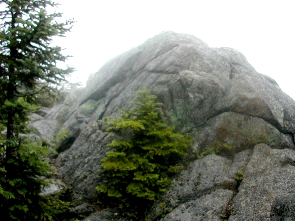
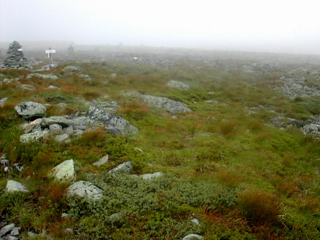
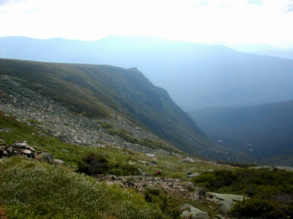
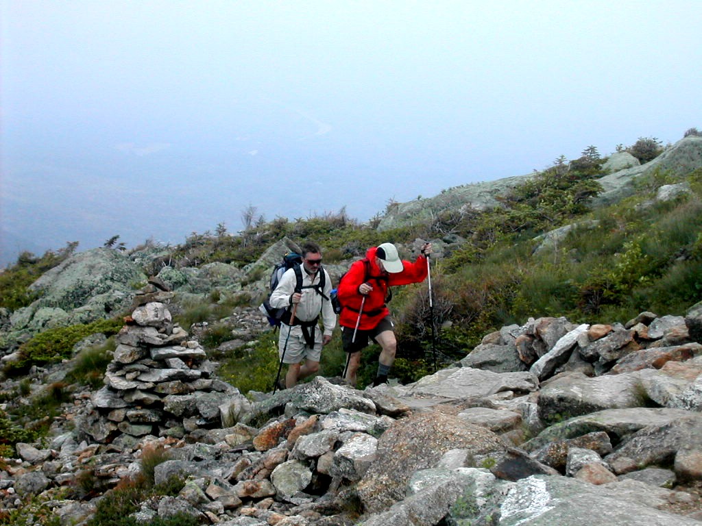 Climbing up to the ridge in the fog |
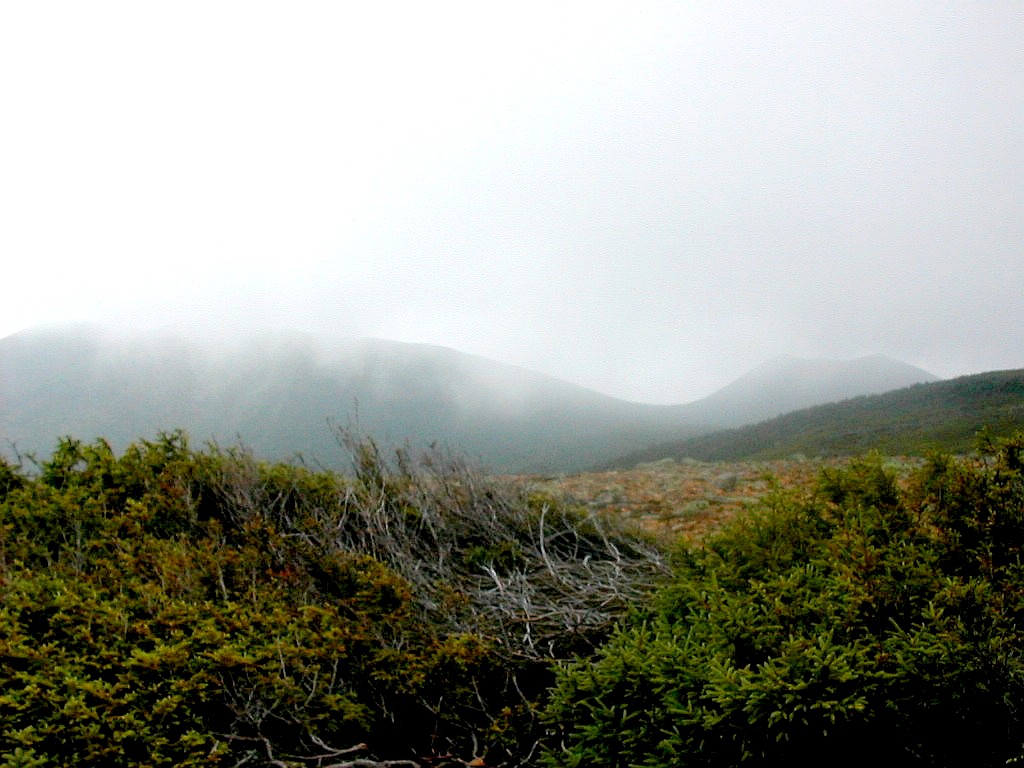
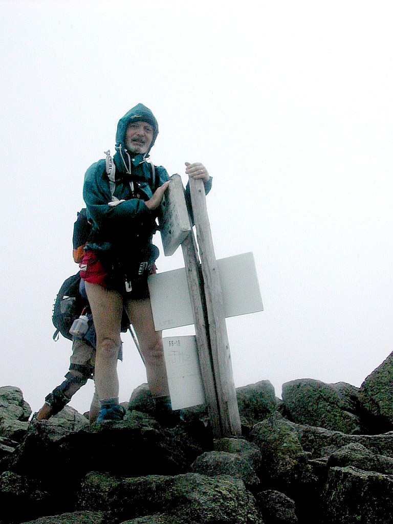
We started up to Lafayette about 8:20 and made it to the top in a little under an hour. I remembered this as an easy climb (although it is 1000' of elevation in a little more than a mile) but it was tougher than I remembered. Why are trails always tougher than you remember? There was fog and wind at the summit so we stopped only very briefly. The winds were probably above 30 MPH. It was fun up there but we missed the views. We hiked along the ridge, pretty much in clouds and fog the whole way, but with the occasional glimpse of a view. I was particularly interested in the approach to the top of the Lincoln Slide from the trail and I thought I saw an easy approach. This was for a planned descent of that slide in the future. The craggy top of Lincoln was ominous and awesome as usual and Little Haystack was also impressive. Jerry had never hiked above treeline before and I think the rocky terrain coupled with the fog and wind, which probably approached 40 MPH on the ridge, suitably impressed him. We made it to Little Haystack by about 10:30 and
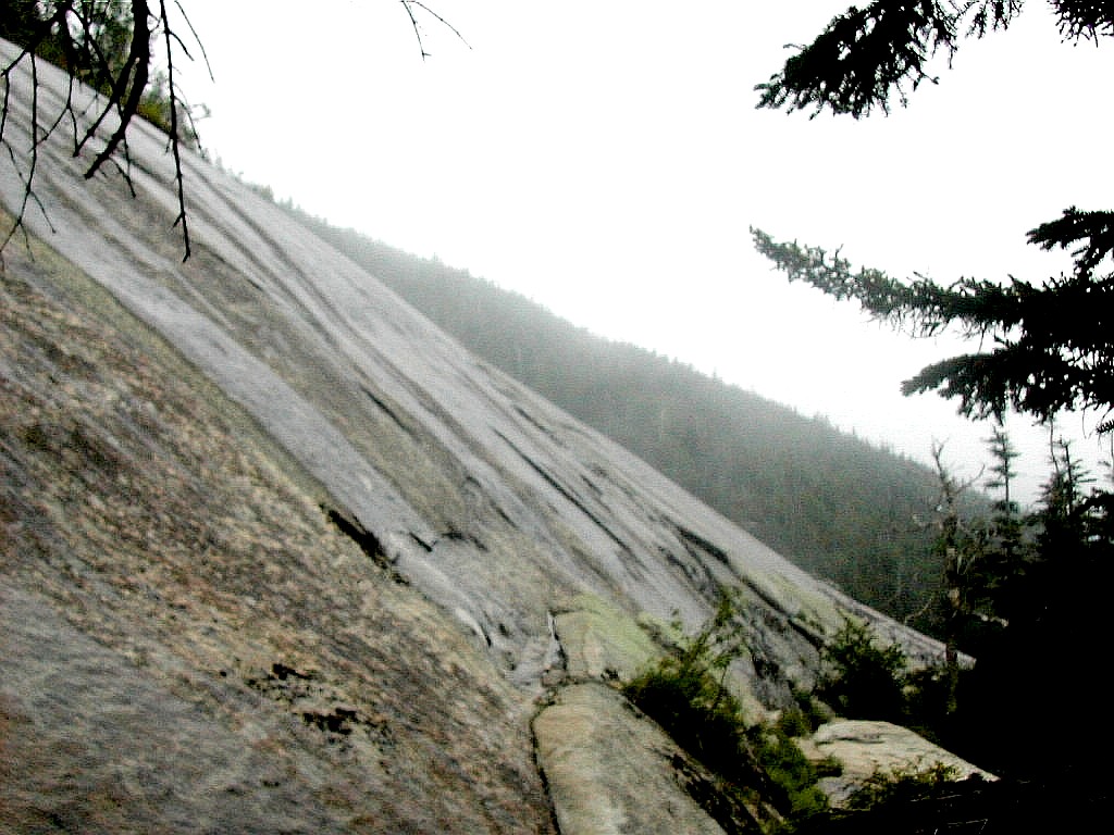 Shining Rock in the rain |
The upper part of the FW Trail is rather steep and rocky (it drops 3000' in 3.2 miles) and a bit slow going, but it was measurably warmer once we hit treeline and escaped the wind. There is a side trail to Shining Rock which I took - I like to take every side trail. My cohorts waited at the intersection to take a break. I got to Shining Rock and found it to be much larger and steeper when you are standing right at it's base than it looks from afar. I would say it is definitely not a slab you could readily scramble up. In fact signs warned of the dangers of doing just that! It is perpetually wet and slippery from springs above, is about 800 feet long and perhaps 200 feet high and seems steeper than 45°. I took a few pictures and then got back to my friends. I'm told the trail used to go right by this point. Too bad more folks don't check it out. It's an impressive sight.
The lower trail is less steep and much prettier. It follows a stream down, crossing and recrossing and passing by a number of impressive waterfalls. One in particular was about 60 feet high and was a wonder to see. Falling Waters: an apt name for the trail. Towards the bottom we passed a small crew doing trail maintenance work. One guy was pitching huge boulders down to his colleague below on a steep section. They seemed to ignore our passage so we got out of there as quickly as we could.
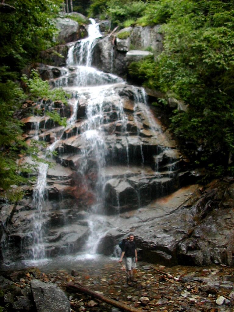 Ed in front of Swiftwater Falls |
Well, we tried for about 20 minutes (actually Ed tried) and finally gave up the idea of hitching. So we got onto the Old Bridle Path and we were back at the hut by 3:40 PM. We were faster today because 1) we had lighter packs and 2) it was cloudy and rainy so we didn't stop to take pictures. On the way up, the rocks were wetter than yesterday due to the drizzle. We met a few hikers, including the man with his son whom we had seen going up the FW Trail. It was like a dance going around a circle and seeing others going the other way and seeing them again on the other side. We also passed 5 women who were headed up to the hut with very heavy packs. They were having a tough time on some of the rock scrambles. But they all eventually made it up to the hut.
I actually had time for a brief nap before dinner, unusual in a busy and noisy hut. Dinner was nice. It started raining in earnest outside and we were glad to be where we were at this late hour. At that point about 10 kids came down off the mountain soaking wet. They were headed down to the road. A bit of poor planning from their leaders, I would say.
Finally just before dark, a SOBO thru-hiker named Goldilocks showed up. Although well prepared for the weather he was really beaten by the wind and rain. He said there were high winds and hail on the ridge and he just couldn't make it across to Liberty Springs Campsite (about 4 miles across the ridge). He described the conditions as "unreal". He was lucky the hut was here and the croo let him stay gratis, even though he was a bit late to do any work for stay. We were very happy that our ridge walk today had been done before the worst of the weather set in.
No white clouds against blue sky or sunsets tonight. It was off to bed, hoping for better weather tomorrow when we would hike over Mount Garfield to Galehead Hut.
.
oday our trek was to Galehead Hut, a "mere" 7.7 miles. I had outlined a "long" hike alternative, which was to go up to the ridge, go down the Lincoln slide, bag Owl's Head, then go all the was up the Lincoln Brook Trail
 Jim on Mount Garfield |
The morning weather was 55° with fog and clouds on the peaks. We packed up before breakfast and got off early. We got to Lafayette's summit around 9:20 and, like the day before, we had high winds (40 MPH) and fog. As we started along the ridge towards the north we got occasional rain, mostly below treeline. I got the impression that we hiked down into the rain.
Hiking up Mount Garfield was slow and treacherous in the rain, but again as we neared the summit the rain abated. We passed Garfield Pond around noon and got to the summit of Mount Garfield at 12:35 and took a short break. Occasionally a view would briefly appear in the swirling fog but basically we saw nothing. I had forgotten how tough this climb was. I had just done it a year ago and didn't remember it as such a much. The book says this section is harder than you might think. Well, it is!
We started down again at 12:45 and soon got into the rain again. As those of you who have done this know, the trail coincides with a stream in the steepest part of this descent. The rain added to the "fun" with very slow going and a few falls between us. Once we were past the steep section, the trail was easier and we got a
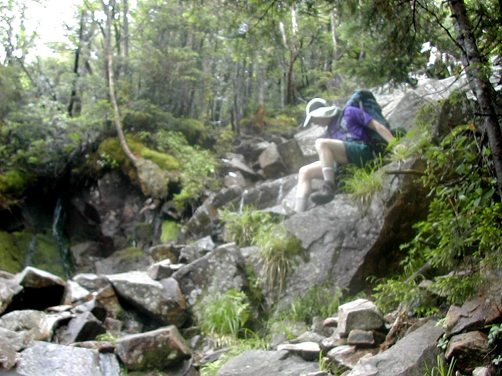 Ed working down a steep, wet section |
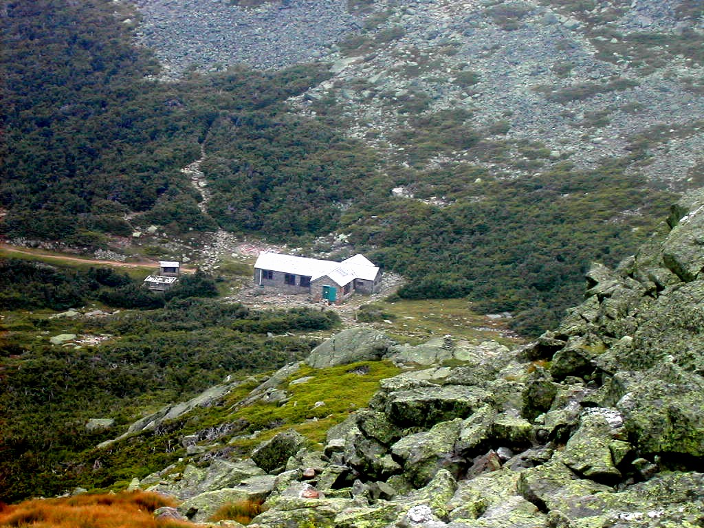
Before I lost my momentum, I dropped my pack and took off up the easy .6 miles to the Mount Galehead summit. This was a fairly non-descript peak but there was a view point about half way up where you could see back to the hut and over towards the Twins, tomorrow's route. This little side trip took just about a half an hour, 15 minutes up and 15 minutes back. I had time to clean up, write a little in my log and actually take a nap..
After supper, the skies cleared and we had a glorious sunset! All was forgiven!
Around 8:45, two NOBO thru-hikers, Stringbean and Cosmo arrived. They arranged for work-for-stay with the croo and mentioned they had passed the 5 women who had left Greenleaf Hut just before us that morning (we had passed them going up Lafayette). They said 3 had decided to stop and stay at the Garfield Ridge campground, and the other two were a short distance from the hut.
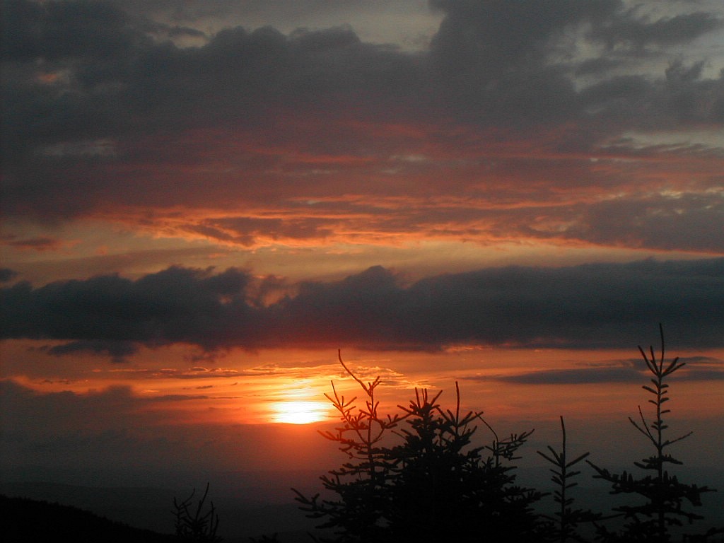 Sunset from galehead |
The croo put on the lights again and gave them some food and slowly they came back to life. Then one of those deja vue moments came. The older women mentioned that her husband was a thru hiker and was expected to summit Katahdin today or tomorrow. I asked what his trail name was. It was "Journeyman". I said "I just saw him a little over a of week ago in Monson". He was with 3 other thru-hikers whom I had actually met in Pennsylvania in May when I was down there sectioning. Well, this made her feel good; I had actually seen him more recently then she had. I said he was looking great and was just anxious to finish. The other woman was their daughter and they said that originally he was going to return after finishing his thru hike and do the huts with them, but his schedule didn't allow it. It's a small world.
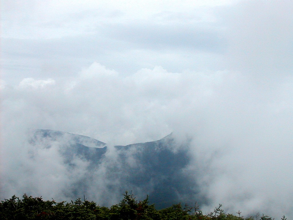 The Franconia Peaks Peeking through the Clouds from South Twin |
South Twin is very steep: 1150' in .8 miles. Luckily it is not tough, there are no rock scrambles at all. It's just one foot in front of the other up, up, and up. We got going at 8:30 AM and reached the summit just after 9:30. This is just about "book" time. The rain had actually stopped and at the summit of South Twin we had only the fog to put up with.
I split off from the others at this point. My plan was to do the side trip to North Twin, returning here (2.6 miles round trip) and then further on take the side trip to the Bonds. The side trail to North Twin was rather easy and scenic, although I had a few doubtful moments getting started since getting off of South Twin was a little tricky. I went through an area of young Spruce and then through a fir wave (Why aren't they ever called "Spruce waves"?). The location of the summit itself was a bit ambiguous. The trail took a left at a cairn near the summit, then rose slightly and got to a view point. The only view was an occasional glimpse of the Franconia peaks peeking though the clouds. This seemed to be the highest point - I'm sure most folks stop here believing it is the summit - but maybe it was back a little on the spur or just around the corner in the bushes. Well, I
 Bond and West Bond |
I followed the ridgeline on the "Twinway" for about an uneventful hour until reaching the Bondcliff Trail which splits off from the Twinway on the open side of Mount Guyote, a little below that summit. The Bondcliff Trail actually goes straight whereas the AT (the Twinway) turns left up Guyote so this can be a turn you might miss, especially since the sign at the trail junction was twisted a little so the direction arrows were not actually pointing the right directions.
I got going and after crossing a minor peak, moved below treeline. I passed the Guyote campground and soon got to the West Bond trail. I left my pack here since it was but a half mile to West Bond and the trail was rather easy. I measured the elevation from the col to the peak as 210'. Some folks have disputed whether this col satisfies the 200' rule. Today according to my Suunto, it did. There was a short steep rise to the peak and then the cairn. The fog prevented any views but this point is supposed to be a favorite sunset watching point.
Then it was back to the trail junction and then on to
Mount Bond. The rain started again but not too hard. Bond
was taller then West Bond but the top, in the fog, looked remarkably similar. Seen one, seen em' all, as they say!

I then turned back and by 2:15 I was back on the Twinway. This side trip, about 3.6 miles round trip, had taken about 1:45 so now I figured I was more than 3 hours behind the others. It was actually rather a nice feeling
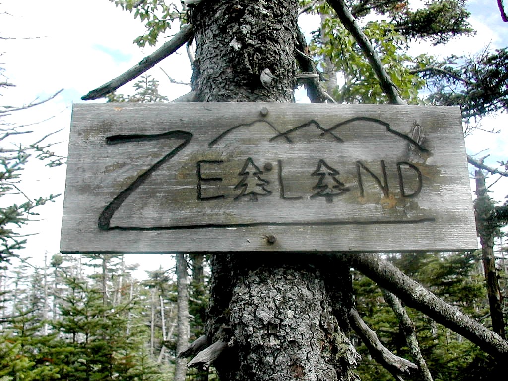 Mount Zealand summit |
After another easy ridge walk, I got to the Zealand Spur, my last side trip of the day. This was a very short .2 miles round trip and Mount Zealand was but a slight rise in a very broad area. There was a nice old fashioned sign there which was nice to see. Not your standard USFS or AMC rendition.
Now it was just on to the hut with a short break on the Zeacliff viewpoint. This was quite spectacular and in fact my fellow hikers told me later they spent nearly an hour relaxing here. Then it was down, down, down. What we had gained in climbing from Galehead up to South Twin this morning, we gave back here. One particularly steep spot had a ladder in place.
Finally I arrived at the hut at around 5:00 PM and found my friends, including Laura, on the porch of the hut waiting for me, arguing with each other over whose fault something was. It seems when they got to the Bondcliff Trial junction, they took the wrong turn and it wasn't till they were past the Guyote campground that they finally turned around and got back to the Twinway. They actually got off the Bondcliff trail a mere 20 minutes before I got there. This fact, and that fact that they spent a long time on the Zeacliff view point meant they had arrived at the hut less than an hour before I did. I asked "How could you take that trail, it clearly had blue blazes, not white?" But they didn't know from blazes, so whatever!
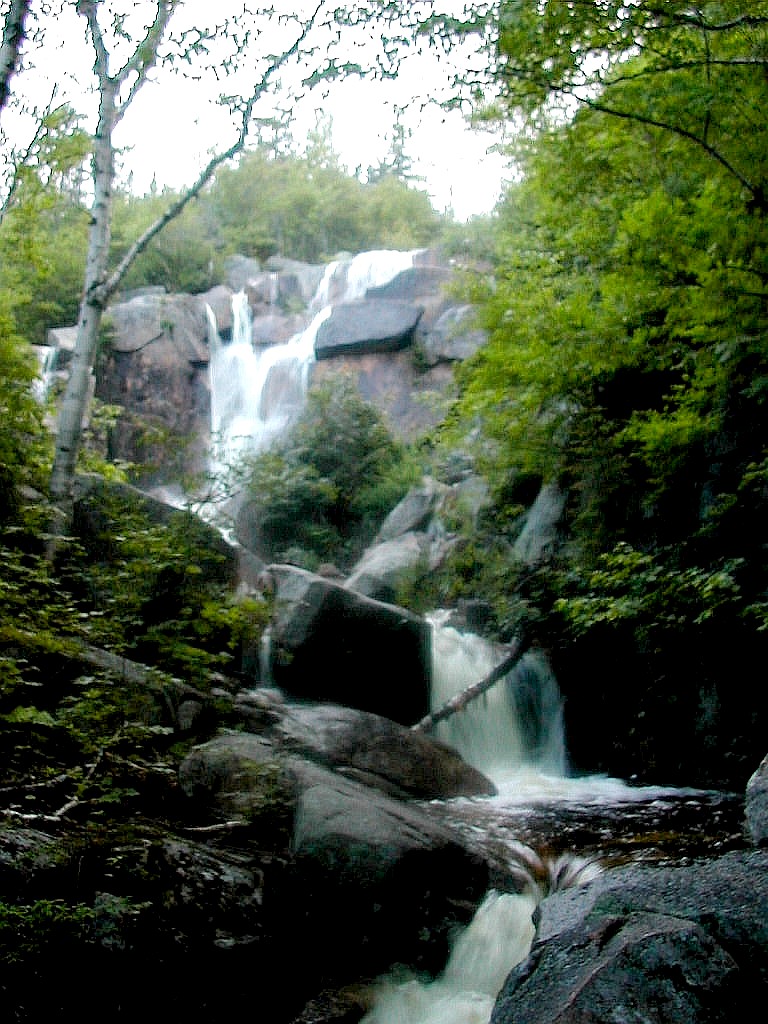 Zealand falls |
3 NOBOs were working here tonight: Mudflat, Fly and Cameleon. One had a hammock which he set up between two poles on the porch. That was neat to see.
After supper, Jim and I went down to check out Zealand Falls, about .1 miles down the hill from the hut. It was quite impressive. This hut actually derives some of it's electrical power from the flow of Zealand Stream. The other huts used wind and solar panels. It was nice to see these clean energy sources in use.
I was hoping to call this day "Two Twins, Three Bonds and Zealand". Well, I had to scale that back, not having the time for Bondcliff, but "Two Twins, Two Bonds and Zealand" isn't too bad!
he morning weather was fog, 62° and a forecast of rain. Today my friends would depart and return to NYC. They would take the short Zealand Trail out and get an early start. Meanwhile I had trails to hike and peaks to climb. Today's trek was to hike to Mizpah Spring Hut via the Willey Ridge where I would bag Mount Tom, Field and Willey. These three 4000 footers form a ridge on the west side of Crawford Notch. I would then descend to the Notch and continue up to the hut via the Crawford Path.
I got going around 7:40 AM. The AMC group (about 25 people all together) were splitting up into groups and some of them would be doing some of the same peaks as I planned for the day, so I got off before things got crowded. I turned down the Zealand trail and was on the watch for the A-Z trail which would go up the ridge to the right. The map seemed to show the intersection just before a Lake. I came to a lake and a bridge across it and so I
 The cairn at the Mount Tom summit |
The hike up to the ridge line was rather easy. The Willey Ridge Trail went off one way, and the spur to Mount
Tom went the other. I dropped my pack and headed up to Mount Tom. This was very easy except the last few hundred
yards which was steep and rocky. This would be typical of all three peaks I would summit today. On the Tom summit
there was a bench to sit on and relax! That was nice. So I sat momentarily and enjoyed the fog and rain.
Then
back down I went to the A-Z Trail intersection. Upon arriving there, I found the first AMC group getting ready
to do the same summit. I said it had taken me about 45 minutes round trip, but they seemed skeptical that they
would finish in that time. One guy said he wished his pack was a small as mine. He had a monstrous external frame
pack that looked like it held enough stuff to cross the Yukon Territories! I just smiled and went on. These folks
were out here having a good time. Far be it for me to lecture them on packing light. They were learning by doing,
that's the best way.
Now it was off to Mount Field. I left the AMC group behind and started along the ridge line on the Willey Ridge Trail. As with Mount Tom this was easy going till the last 50 - 100 yards where the trail got rocky. The trail to Mount Willey continues straight on another 1.4 miles. It seemed steeper down from on the Willey side of Mount Field than up on the Tom side. The trail angles off to the right (west) and at times the spruce has almost overgrown the trail as it traverses the side of the ridge. A good brushing here would help. Since I would have to retrace this portion of the trail after bagging Willey, I dropped my pack at what seemed like the low point.
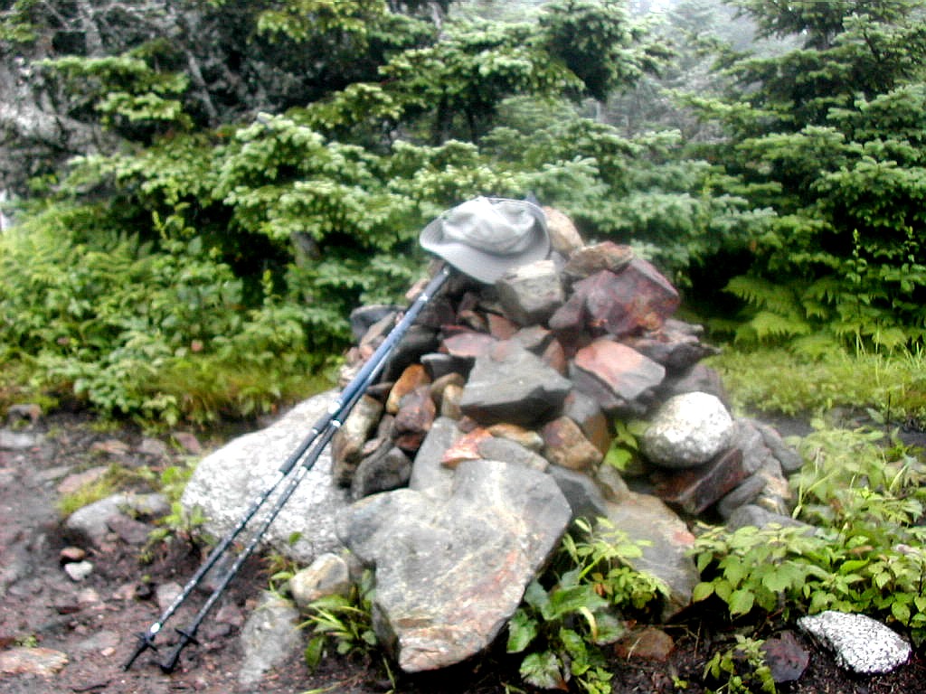
I arrived at the Willey summit (steep and rocky the last few hundred yards - you guessed it!) and guess what? I had a great view of the fog! After the obligatory picture of my hat (when there's no one around to take my
 Mount Avalon |
This was called the Avalon Trail and there were some open sub-alpine meadows with good views down towards the Notch. Eventually after about 35 minutes I reached an intersection of a spur trail which said "Mount Avalon, 100 yds". Mount Avalon? Never even thought about Mount Avalon. I guess there had to be one if there was an Avalon Trail. And "100 yards" - how hard could that be? So off I went and found that 100 yards could be very hard indeed. Mount Avalon is a rocky knob that juts up from the side of Mount Field and it took a good bit of huffing and puffing with hands and feet to climb it. But it offered a nice view when I made it and was a little break on my otherwise very long down hill trek to Crawford Notch. There was a couple with a little dog that was out for a day hike who came up just after me. They seemed familiar with the place but don't ask me how that little dog got up those ledges. Don't get me wrong, this was not the Matahorn, just a big rock coming at an unexpected time and place.
The trail from there on down was very steep and rocky for about another mile. This was a slow section for me and tough on the knees. Finally the A-Z trail, which I had started on this morning, came in from the left and the
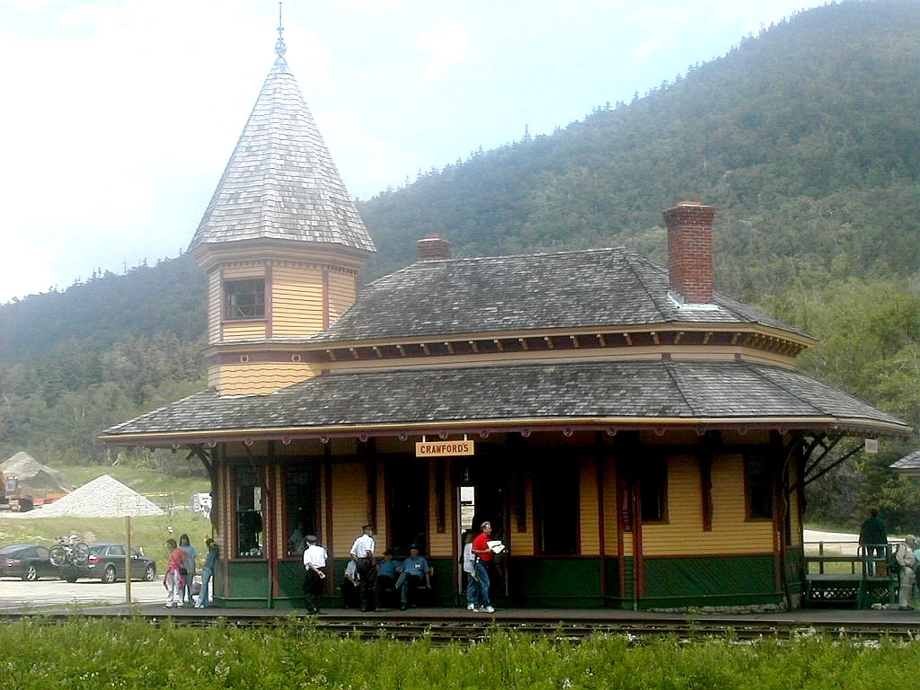 Crawford Notch Railroad Depot |
After my break, I crossed the road and started up the
Crawford Path, originally cut in 1819 and the first route
up Mt. Washington. Like many trails I had hiked this week, this was quite steep, but not too rough. It rises
about 2000' in 2.6 miles (including the .7 miles of the Mizpah Cut-off at the top). As I made my way up this
trail, whom should I see but various members of the AMC group. After their hike over the ridge they had had a
box lunch delivered to them in the Crawford Path parking lot, and were now headed up to the Mizpah Hut, as was
I. As a runner we use a term called "road kill". It's not birds or skunks left on the side of a highway after
an unfortunate encounter with a car, but it is slower folks passed and left behind by faster folks along a course.
Well, I know this was not a race, HYOH, and all that, but we did start together at Zealand Hut this morning, so
I was proud to notch 12 road kills on my way up the Crawford Path and the Mizpah Cut-off. Shame on me for
thinking such thoughts!
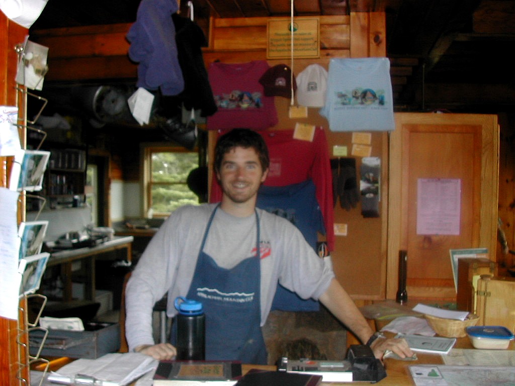 Jon, crooperson at Mispah Hut |
Supper was great as usual. As we were eating the fog suddenly rolled in and outside it got very dark. Very eerie.
oday I planned to go way, way off the beaten path and summit Mt. Isolation. As the name implies, this is a very long way from anywhere, although starting at the hut instead of at a road gave me a good advantage. It lies in the middle of the Dry River Wilderness area south of Mt. Washington, where trails and hikers are few and far between.
I awoke to fog, occasional showers and temperatures in the 50°s. My wet stuff was now but damp and I knew it would be OK since my shirt and shorts were Coolmax and would dry quickly from my warm body. Yuck! My boots however were still rather wet so I put on dry socks and then put on a couple of plastic shopping bags over the socks as a vapor
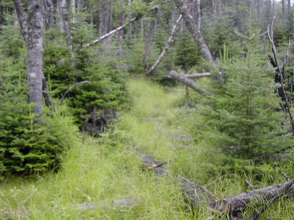 Wet, boggy and overgrown |
The light rain and fog was OK by me, since most of the day would be spent in rather overgrown forest where a little more "atmosphere" would do little damage to my plans. I asked Jon, the hut guy, how the trail would be. He said the Dry River Cutoff and Isolation Trails get very little traffic and would be overgrown. He thought the Dry River crossing would be OK unless I get nervous on rock hops. I said: "do people ever get lost down there". He said "Yeah, it happens". Great reassurance. The AMC people were also thinking of going down to the Dry River (although not to Mt. Isolation) but being more concerned (than I) with issues of crossing the River with a mixed group, they opted to just stick to the Crawford Path to get to Lakes. I told them I would see them at Lakes, and send out a search party if I never showed up. I was only partly kidding.
I got off at 7:45 AM and immediately the trail seemed different, somehow wilder than your usual White Mountains trail. The forest seemed thicker and the blow downs (off the trail) more impressive. This was primarily a mixed hardwood forest not the Spruce/Fir combination found higher up and the trail was very overgrown from the sides
 Dry River Falls |
I crossed two tributaries as I approached the Dry River and then got to that crossing. We had had rain for the several days prior to today, but never any significant accumulation, so the water level was modest. I scouted out the rock hop and although it's always scary to step onto a round boulder which lies a half inch under water, I made it across safe and sound.
This brought me to the Dry River Trail which goes up the east side of the river all the way to Lakes. It was about 9:30 AM so I was making good time. I dropped my pack and hiked up a short distance to check out Dry River Falls. I was told by Jon the hut guy that the short spur is unmarked, but if you listen for the falls you would find the spur. Well I did, and sure enough down a steep but short bank brought me face to face with an awesome waterfall. I would love to see this in Spring under heavy water conditions. Trouble is how would I get in here in the Spring with the crossings next to impassible!
I turned around and got back to my pack and went down the trail a short distance and found the intersection with the Isolation Trail going up to the left. It was just about 10:00 AM.
The sense of wilderness and beauty here was pregnant. I seemed like no one had been here in years. The trail was somewhat overgrown and the forest was filled with very old trees and blowdows. In the higher elevations, walking through the fir waves was humbling. I can't put it adequately in words but it was juts raw, beautiful wildness.
As the trail rose up along Isolation Creek to the Davis Path, it crossed to the right bank and crossed back a short time later. It seemed like this may have been a relocation perhaps due to trail erosion along the left side of the creek. This trail has a lot of elevation gain (1700' in 2.7 miles) but never did it seem steep. It
 On the summit of Mount Isolation |
I arrived at the top of this trail at the Davis Path at 11:24 and took a break. Here I checked my feet and boots and found the inside of the boots was now dry so off came the plastic bags. Experiment in using a vapor barrier successful! The Davis Path is one of the very old trails in the Whites originally laid down by Edmands himself. Usually anything called a "Path" (like the Crawford Path, Edmands Path or the Davis Path) is one of the older trails. It took about 45 minutes to reach Mt. isolation and unfortunately my morning's reverie was broken by first a group of 5 hikers who were hiking up the Path having just summited isolation, and a group of 3 more on the summit. The little spur trail to the summit was steep and rocky as is often the case. I made it to the summit at 12:18. The view was stunning! Not a sign of civilization in any direction. Even the ugly radio towers atop Mt. Washington were mercifully shrouded in clouds. The fog was gone and except for the summit of Washington the surrounding mountains were all visible. One of the 3 hikers on Isolation had just finished his 48, so they were celebrating. I congratulated him on this accomplishment. and one of them took my picture. They intended to hike up the Davis Path to Boott Spur and then down to Pinkham so they got going while I took a break.
I was hardly done: I had another 6 miles or so to get to Lakes of the Clouds Hut, and that by also going over Boott Spur, a shoulder of Mt. Washington. As I made my way up the Davis Path, it rained off and on for an hour or so, and I heard distant thunder, so I was apprehensive. I saw the three I had met on Isolation coming back down the Davis Path. The thunder had caused them to change their plans and go out via Rocky Branch (a trail off the Davis Path to the north). Thunder or no thunder, I couldn't change my plan since I had to get to the hut, but I was hoping that by skirting Washington around the north-west side of the cone I would escape anything really fierce, even though I had a couple of miles above tree line to do.
I got to tree line a little after 2:00 PM and put on my rain gear, more for wind protection than for rain. The
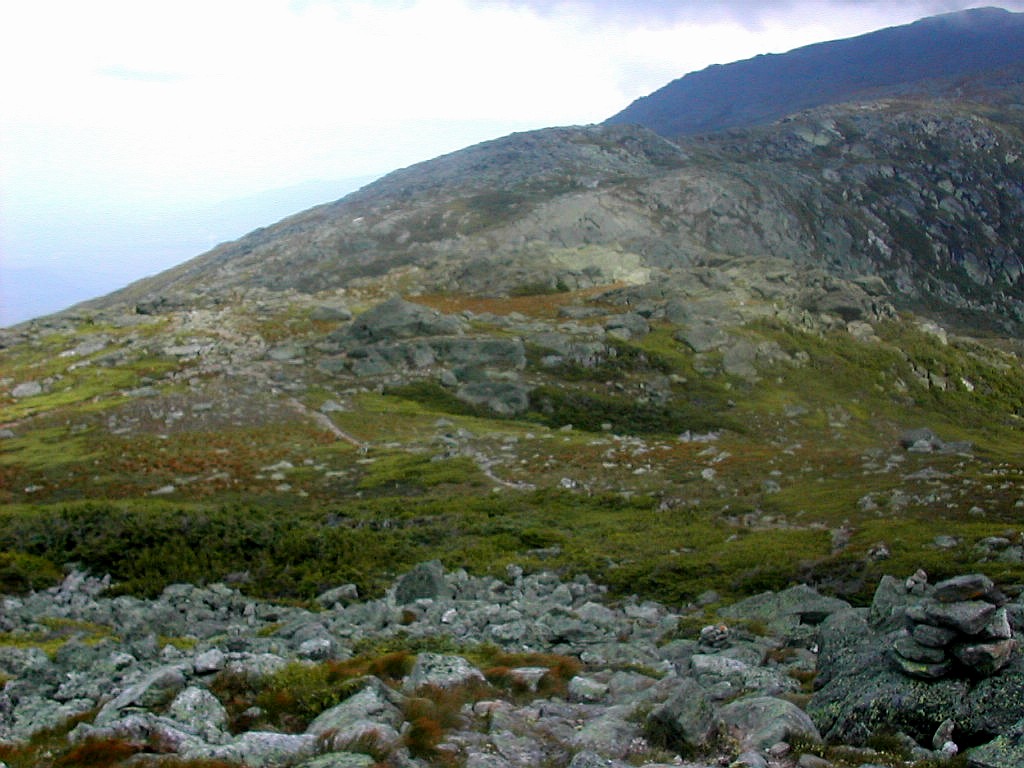
 The cairns receeding into the mist |
Just as I got to the top of the Spur, the clouds started to lift! Wonder of wonders, blue sky to the South and improving by the minute. I took a bunch of pictures and set off across the Felsenmeer towards Lakes where I arrived just before 3:30. I changed, rinsed a few things off and took more pictures. Lo and behold, the clouds covering Washington lifted as well, and people were starting to organize late afternoon hikes to it's summit. It is clear so seldom up here that you take whatever opportunities you can when they suddenly present themselves.
 Mount Monroe |
 The upper Lake of the Clouds |
Between the solitude of the wilderness and the majesty of the peaks it had been an awesome and beautiful day, one I will long remember.
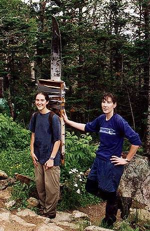
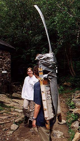
The Story of The Propellernyone who has stayed in any of the White Mountain Huts in the last 30 odd years has probably heard about The Propeller. While never having seen it until this trip, I have heard many times rumors about it. It seems that the croos have a contest to "steal" certain nostalgia items which are displayed in other huts (usually in the
On July 25 of this year, after dinner at Lakes of the Clouds Hut, I finally saw The Propeller and heard the "true story" as told by the hutmaster. [I'm sorry I didn't take a photo of the propeller that evening since photos of it on the net are quite rare. Here's a couple of photos from 1998 I found when 2 members of the Carter Hut croo stole it from Mizpah Hut (from Wildcats/Carters Overnight by David Metsky, July 1998).] The hutmaster told the story as follows: The Propeller you see here is from a Cessna C-130. It weighs 37 lbs. and is about 6 feet long. (Note: the plane was actually a Cessna 172. Here is the accident report: Official NTSB report) The Cesna crashed into the top of Oakes Gulf (between Mount Monroe and Mount Washington) near the Crawford Path on November 29, 1969. The three crewmen aboard were killed. Their bodies were recovered in early December of 1969 and the plane remained where it was. The Federal Aviation Administration planned to return in the Spring to investigate the cause of the crash. In June of 1970, the new croo of Lakes Hut arrived to set up the hut for the 1970 season which was about to begin. Having little better to do, they decided to play a prank on the FAA and remove the propeller from the plane, located close by. And so they did. They then waited and waited but the FAA never showed up. They had either lost the file on the plane crash or decided it did not need to be investigated. After a week of waiting for the Feds, the croo got even bolder and went over and pushed the plane wreck over the edge and down into Oakes Gulf where it settled about 500' down into the Gulf. There it remains today. So goes the "true" story as I heard it. How true is "true"? The events happened over 30 years ago. The story was undoubtedly passed down from croo to croo over the years. The average age of this year's croo is younger than the propeller. Is the propeller really from that Cessna that crashed? Did the croo really pull a prank on the FAA? Did they really push a plane wreck into Oak's Gulf? How true is "true"? You tell me. At Greenleaf Hut this year one of the croo was wearing a T-shirt with the logo "Mount Monroe Demolition Crew". She said it was a spoof on the "Mount Madison Ski Patrol" which is a small group of dedicated individuals with little to do - since there are no ski trails on Mount Madison. She said she and a few others had actually bushwhacked down into Oakes Gulf and found the old Cessna from the 1969 crash. Such fun the hut croos have! |
After supper I watched the sunset and took a few more pictures. I got to sleep but woke a few times. The wind was howling all night and one glimpse outside showed the stars looking down! Tomorrow I must cross the Presidentials to finish my trek.
 Ammonoosuc Ravine |
 Lakes of the Clouds Hut from the Ammonoosuc Trail |
he primary goal today was to summit Mt. Adams, the one Presidential peak I had missed last year. But since the weather looked favorable with the lower areas partly sunny and only the tops of the peaks in clouds, I decide to go for a northern Presidential traverse (minus Mt. Madison). I also decided to hike up to the Washington summit via the Tuckerman Ravine trail, which I had never done. This was a bit rougher, but would be in the lea of the summit till the very top. The forecast was for 55 - 75 MPH winds on the high summits today.
I got started on my day's trek about 7:55 AM. As on other days, the AMC groups were also getting ready to get
 Tuckerman ravine in the morning mist |
I climbed up past the two lakes and took the Tuckerman Crossover to the south side of the cone. Luckily the AMC groups would take the more commonly used Crawford path to the summit. I assumed I would see them there since their route was shorter and a bit easier than mine. When I got to the Tuckerman Ravine Trail to the summit, I got into the clouds and the wind increased. The going over the Felsenmeer was rough but steady and when I finally reached the road, visibility was down to about 10 yards with very high winds. I stood on the peak for a photo op (taken by another brave soul) and the winds felt very strong. The sort of winds where you have to hold on to something every step of the way. After the picture, I went into the visitor's center and the real-time weather readout showed a temperature of 49 with winds of 50, gusting to 57 MPH. That was confirmation - winds over 50 MPH are strong!. Some of the AMC group was there and we chatted a bit and I had a cup of coffee - my first for a week.
After a short break I tried to go down the Crawford Path, but I just couldn't find it! Visibility was about
 The Clay Jefferson Col |
I was just below the clouds now and the wind was less at this slightly lower elevation, so I was off to summit first Clay, then Jefferson and finally Adams. Clay had three peaks, not quite the way I remembered it, and to tell the truth I'm not sure which was the highest. It's actually considered a sub-peak of Washington, so it really didn't matter at all. At one of the Clay summits I met 3 hikers coming south. I asked where they had started the day, assuming it was Madison Hut, or perhaps the Perch Campsite. "Appalachia" they said, "We started at 4:30 AM". 4:30 AM! Well, this sounded like a full Presidential Traverse. At the rate they were going they would make it to Washington by 11:00 AM and I would bet they would be out of the woods in Crawford Notch by dark. A Presidential Traverse is an extremely taxing one day endeavor of nearly 20 miles (depending
 High Winds atop Mount Adams |
Now it was Jefferson next. Jefferson has a very pointy top which is extremely rocky. The Gulfside Trail (which is the AT along this section) skirts around Clay, Jefferson and Adams but each has a summit trail straight over the tops which I would be doing. The Jefferson Summit was also in the clouds and had fierce winds as Washington. I made it to the Jefferson summit just by noon and took a short break.
The hike to Adams crosses Edmands Col (named after the renowned early trail builder from the early 20th century) It took about an hour and a half to get to Mount Adams,which like the others was in the clouds. When I final arrived at the summit of Adams I had just caught up with the vanguard of the AMC group. here the winds were even stronger, probably at least 60 MPH. It was very hard to stand up and great care needed to be taken moving from rock to rock. I took the Air Line down (not "Air Line Trail", just "Air Line") and admittedly I was a little careless. I moved a bit faster than I should across the steep rocks, in part to get to Madison Hut before the AMC people. I left about a half dozen of them on Mount Adams as "road kill".
I was planning on going all the way down to the road today since I had no further hut reservations, but I did stop for about 30 minutes at Madison Hut for some soup and baked goods. These are AYCE daytime goodies available
 Madison Spring Hut from Mount Adams |
The Air Line follows the Durand Ridge from the top of Mount Adams all the way to Route 2, a distance of about 4.5 miles with an elevation drop of nearly 5000'. The upper section, over 2 miles is totally exposed and offers magnificent views down into Kings Ravine of one side and into the wooded valley on the other side. The ridge walk is rather narrow and is sometimes referred to as a knife edge, but to tell the truth it's not scary at all (unlike the real knife edge on Katahdin, which can be quite scary). The sun was out and the sky was beautiful and my trek was slowed by the need to take many many pictures. You just don't get to experience a ridge line like this one very often.
 King Ravine from the Air Line |
 The Air Line along the Durand Ridgeline |
I got to tree line about 3:45 and took out my hiking poles which I had stowed away while I was on the rocks above and made my way down to the Trailhead at Appalachia. On the way down I met a man and his daughter moving down and chatted briefly. I was also intrigued to note that in the lower section of the route, there were hoses connecting a number of trees for the collection of maple Syrup. I know the Nation Forest is a multi use area, but I had never before considered Maple Sugar farming on Mount Adams as a use.
Where the upper part of the Air Line was steep rocks, the lower part was steep and rocky!
All things, good or bad, come to an end and after my longest day, nearly 10 hours of hiking, I reached Appalachia. After a hitch into Gorham, I was back at Hiker's Paradise. The next evening I would be home with many a happy memory.
eak bagging: one of my goals is to hike all of the New England 100 highest peaks which include 67 over 4000'. During this trek I summited (or "bagged") 10 new peaks from this list, and revisited 6 more "old friends", as well as several interesting sub-peaks.
Peaks (in order of climbing): Lafayette (5249'), Lincoln (5089'), [Little Haystack (4760')], Garfield (4488'), Galehead* (4024'), South Twin (4902'), North Twin* (4761'), West Bond* (4540'), Bond* (4698'), [Guyote (4580')], Zealand* (4260'), Tom* (4051'), Field* (4330'), Willey* (4285'), [Avalon (3442')], Isolation* (4003'), Washington (6288'), [Clay (5533')], Jefferson (5712'), Adams* (5774').
* - new 4000' peaks
Peaks in [brackets] are not on the list since they are considered sub-peaks of nearby higher peaks.
Note on the photos: We had a few nice days and a lot of rainy or foggy days. The photos therefore are very uneven in coverage. Some days I would just take a few. Other nice sunny days (or parts of days) I would take a zillion. And the pictures taken in the fog came out, well ... foggy. You get the idea. Nevertheless there are lots of good photos, so enjoy.
|
Click here for a complete album of photos from this hike Click for Papa Bear's Home Page Click for the Backpacking Page Click for the Hiking/Peakbagging Page |