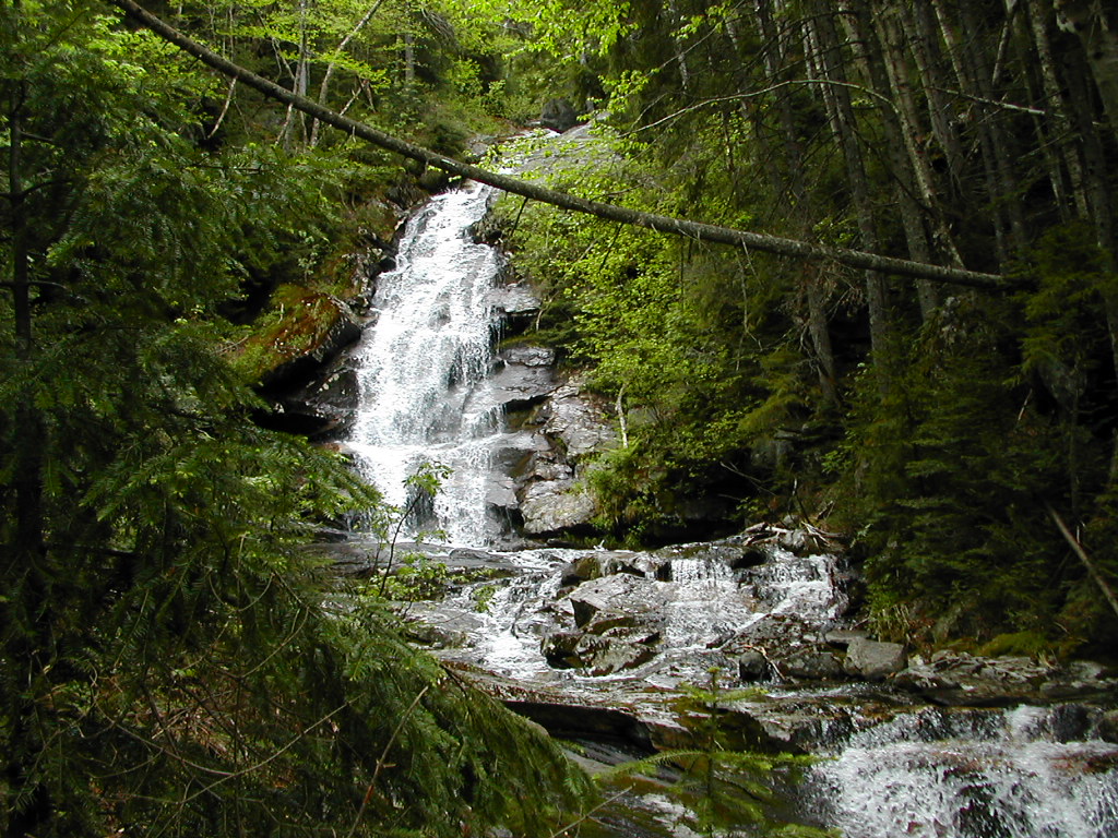
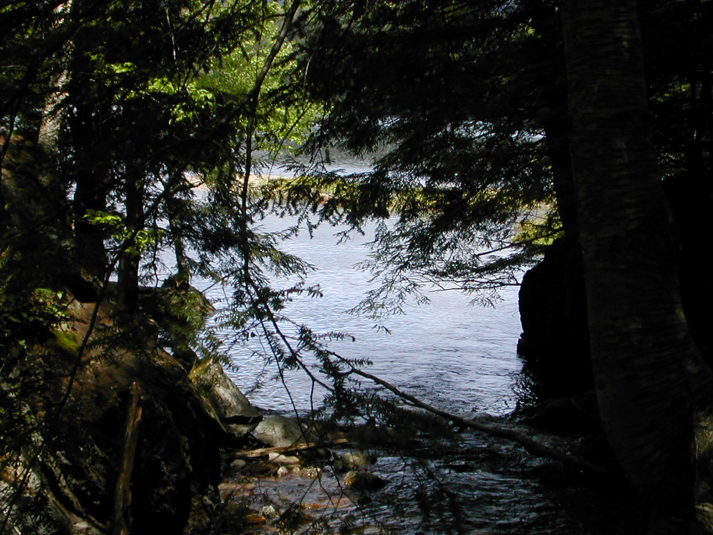
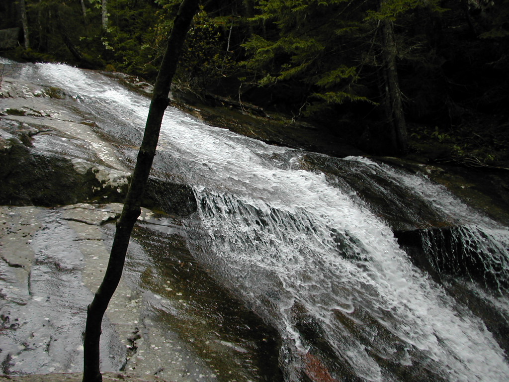
A cascade coming down off Moosilauke,
beside the Beaver Brook Trail
|
A cascade coming down off Moosilauke, beside the Beaver Brook Trail |
|
Click here for a complete album of photos from this hike Click here for an album of wild flowers seen along the trail Click for Papa Bear's Home Page Click for the Backpacking Page |
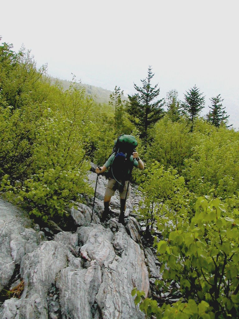
retired a little over a year ago and one of the things I had "always" wanted to do was hike the Appalachian Trail. Last year I spent considerable time training for a marathon, which I did last October in Dublin Ireland, so this year I decided to devote my time to hiking. I had hiked and backpacked a considerable amount in the 60s and 70s, but since then I had done very little. I did some research, got some new gear and got myself into shape. I decided a thru-hike was not for me, but I wanted an exhaustive, if not continuous experience. So I choose a 2 weeks on, 2 weeks off schedule. This would keep the momentum going, allow me to stay pretty fit between hikes, but allow me to participate a reasonable amount in "normal" life.
I found a hiking partner who was quite interested in following much the same schedule, so in April we did the first of our sections: from the Delaware Water Gap to Kent Connecticut. Part 2 followed in May where we made our way from Kent to Manchester Vermont, and this, the third section, took us to Kinsman Notch, New Hampshire. Ultimately we hope to reach Katahdin this September. We seem to get a little better each time: a little fitter, a better senses of what to bring (and what to leave home) and a more at-one-ness with the trail. It's working out rather well.
Folks ask me if I intend to do more next year and eventually hike the whole trail? The answer is "lets see how it goes". So far this has been lots of fun (except when it sucks) and I'll keep it that way, without (I hope) becoming obsessive. Although being a marathon runner, many people would say I'm already obsessive.
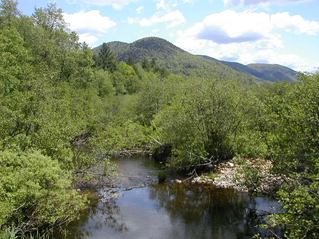
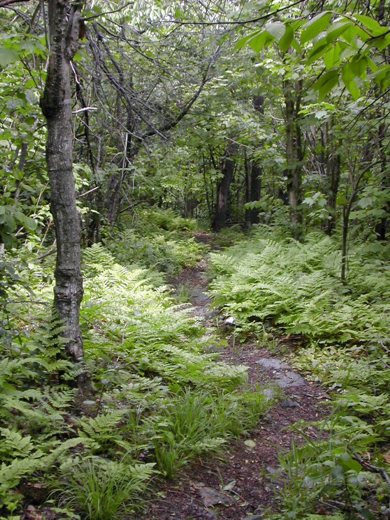
 The Trail can be very wild |
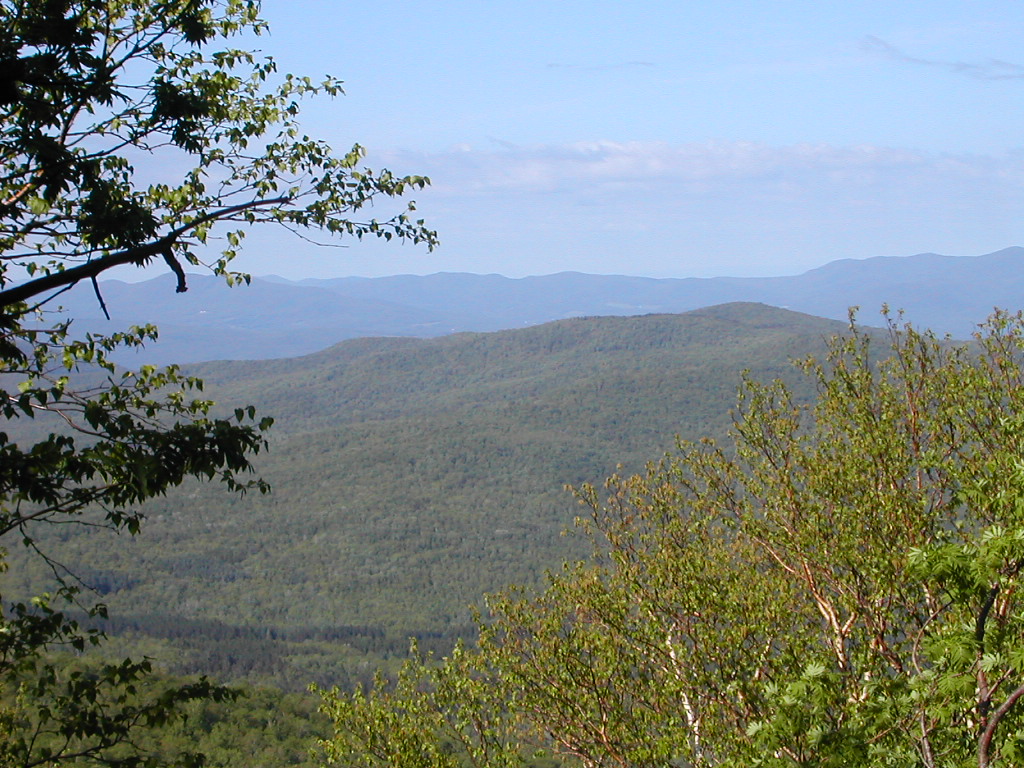
This section of the route is largely through the Green Mountain National Forest and is the most "wild". Yes it crosses Stratton, Bromley, Killington and Pico Peak, but those ski areas are mostly hidden from view. And yes, the forest is used for logging, but the trail itself avoids any active logging sites. Still it is wild in the sense that you seldom see a town or a farm unless you look carefully from the mountain tops into the valleys.
It is also very wet, especially at this time of year. The trail maintenance for this section must be
a nightmare. In the early Spring the trail turns to mud and there is a constant battle to keep the
treadway from eroding. Maintenance and trail building is among the best I have seen, and the local volunteers
have done an admirable job in fighting the battle with mud and water. Of course the real battle is with us,
the hikers. If we stayed off the trail in this season it would survive much better, but I guess we all
insist on "loving it to death". But by June, things had dried out substantially, so it was the black flies
and mosquitoes rather than the mud we had to battle.
he day actually started in New York City. I was to meet my partner Fresh Air at the bus terminal and we would take the 7:00 AM Greyhound to Manchester Vermont. There were two mini-SNAFUs which luckily did not portend any further problems. First I almost forgot my lunch and Fresh Air's trail guide pages which I had printed for him. Since these were not part of my gear, they were not on my comprehensive check list. I was actually in the cab, heading for the bus terminal when I remembered. Luckily my wife saw the bag of stuff and brought it down to the street so there was only a momentary delay. Then when I got to the terminal, I went straight to the gate since I had picked up my ticket the day before to save time. Unfortunately Fresh Air was waiting for me at the ticket counter and if it weren't for a cell phone conservation we would have both missed the bus. But we got going just at 7:00 AM and that was the last of the SNAFUs.
We arrived on time in Manchester Vermont a few minutes past noon and I asked the bus lady to call a taxi for us. Taxis up here are few and far between, but she managed to get Bill, who was actually on his way to Williamstown Massachusetts to redeem a lottery ticket, on his cell phone. We got a bite to eat and Bill showed up about 20 minutes later. He had an old wagon which was falling apart. The back door would only open from the outside, and the windows would not work at all. There were bits and pieces of assorted mechanical equipment on the floor, trunk, etc. Bill also matched the state of his car, but he was quite talkative and said he took hikers up to the trail all the time.
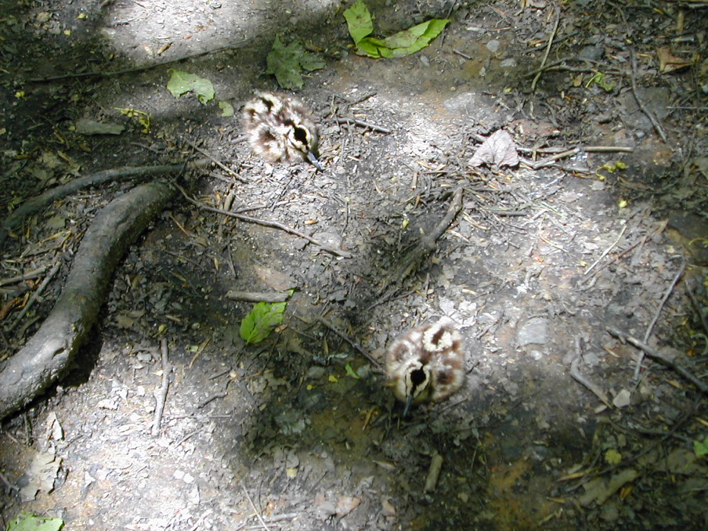 Woodcock Chicks on the Trail |
Just as we started up the trail, I was startled by the sound of a bird taking off right at my feet. I saw the distinctive shape of a Woodcock fly off to the right. That was cool, since I don't see that species very often, but just as we were about to go on, I noticed 2 little spots on the trail, just where I was about to step. There were two Woodcock chicks, motionless and quiet right on the trail. The oversized beak was evident even in these miniature specimens.
 The Trail down off Bromley |
The views
and esthetics improved as soon as we were off the summit and we started down to Mad Tom Road. A Forest
service employee was painting a road sign there and we chatted with her for a few minutes. I tried out
the big green water pump: a trickle came out but it was hard to use it the way they had laid out the pipes.
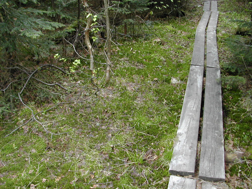 The Bog-logs are to protect the trail, not your feet. This shots shows the untouched green around the bog-logs. |
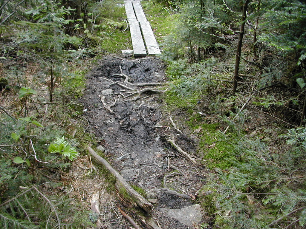 This shot is litterally next to the other. Without bog-logs there is massive mud and erosion. |
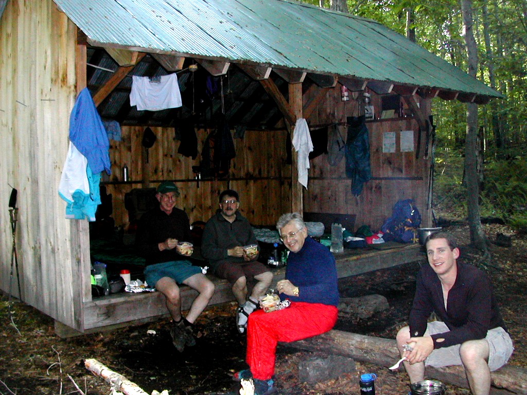
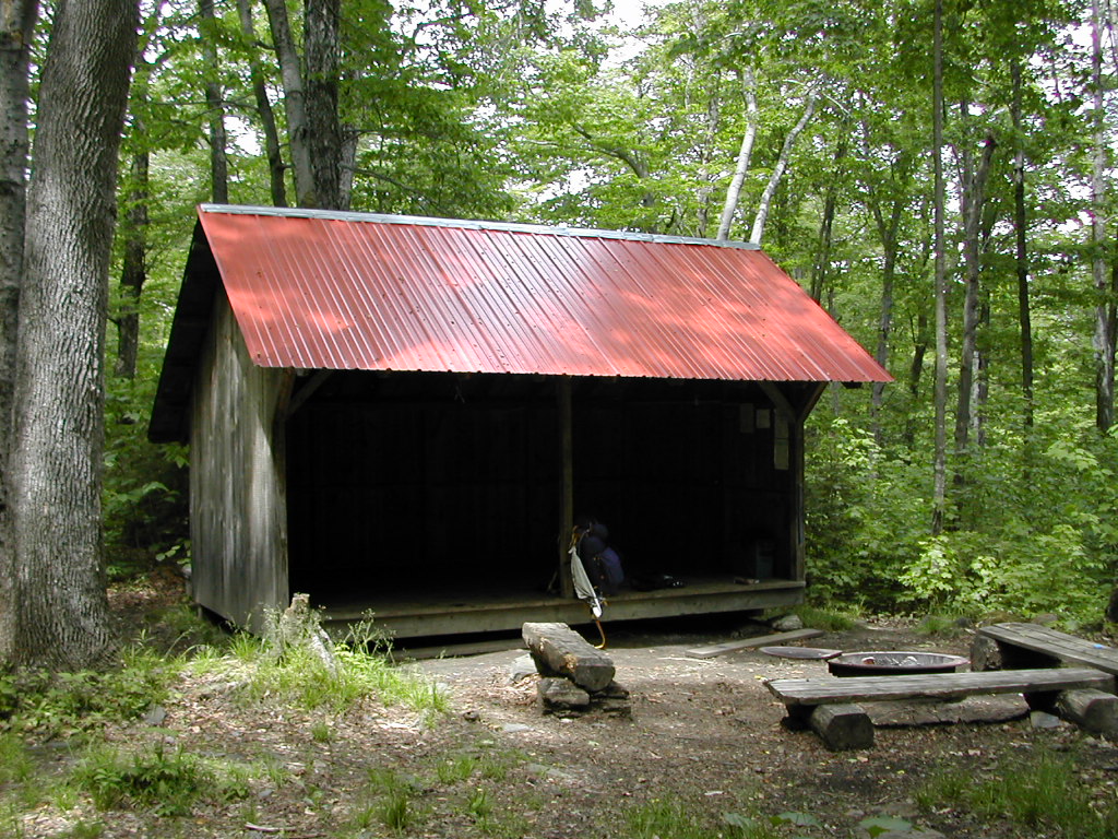
We passed several bogs, with bog-logs and several steep climbs before arriving at Peru Peak. In spite of the short mileage today, I was rather tired when we got to the shelter. At the shelter we met Roland, an amiable fellow in his 60s who was from Bennington. He was taking it easy and said he was trying out an Esbit stove as something new to try. We got in relatively late (around 6:30 PM) so there was not a lot of time to read or anything. After we got off to bed, it rained, rather heavily at times. We hoped it would be over by morning.
 Peru Peak Shelter |
oday was to be our longest day ever - 19.4 miles. We needed to get to the Minerva Hinchley Shelter so we would be in a position to get to the Cooper Lodge on Killington the next day. We wanted to bypass the Governor Clement Shelter which has a bad reputation of hikers being harassed by locals.
 Griffith Lake in the Morning Mist |
Bakers Peak was a series of steep ridges. The trail guide describes it as the "final rocky scramble" to the top. Rocky scramble it was, but also rewarding. We then decided to go down and look at the Lost Pond Shelter, which had burned down last year. It was a complete wreck. I hope no one was caught in that fire. We took a break here and I explored the creek down below which was rather lovely.
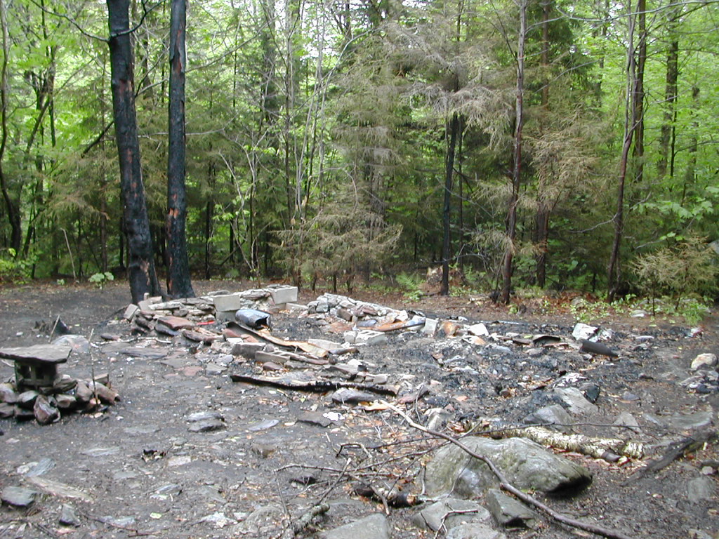 The Remains of the Lost Pond Shelter |
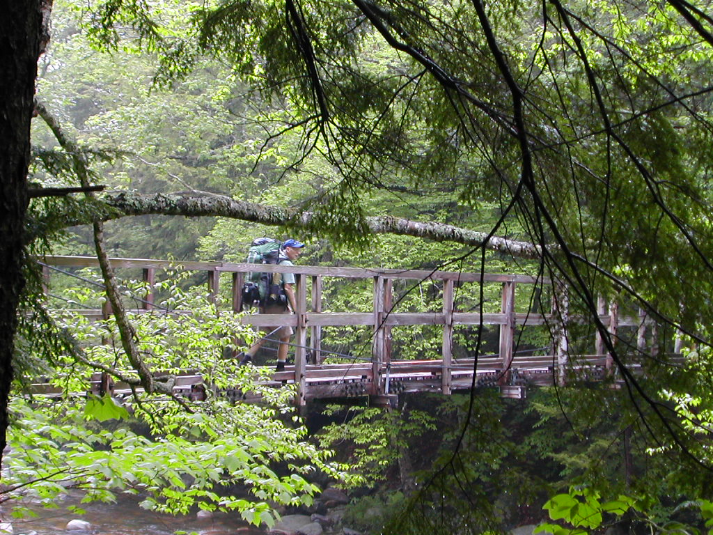 The Bridge over Big Branch River |
 Big Branch Shelter with the late rising gang |
We moved on, since everyone seemed to be going to Minerva Shelter tonight (our destination) and we wanted to beat the crown to get a good spot on the floor.
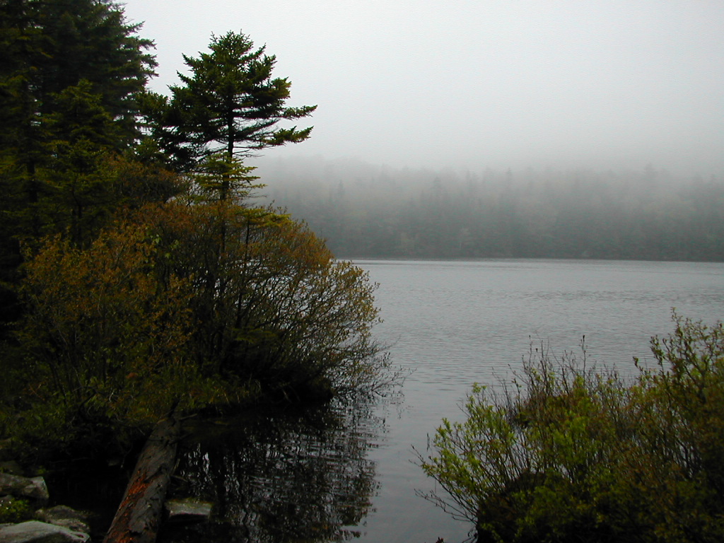
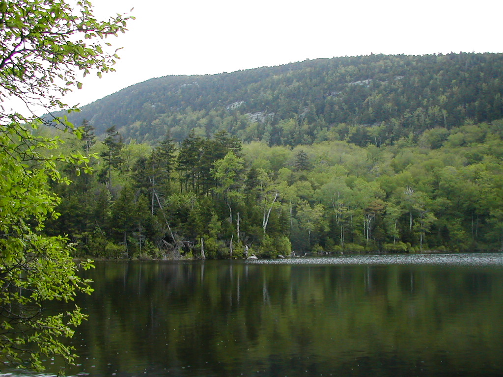 Little Rock Pond |
On the next climb we passed the two Canadian women we had been told had left Big Branch earlier, and just then the young guy caught up with us as well. But fast as he was he was more interested in hanging out with them then moving on, since he never did go ahead of us.
We passed over a recent relocation and then climbed a very tough slope with switchback after switchback up Bear Mountain. (No, not the New York Bear Mt, not the Connecticut Bear Mt, this was the Vermont Bear Mt.).
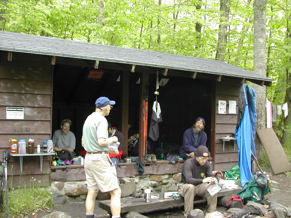
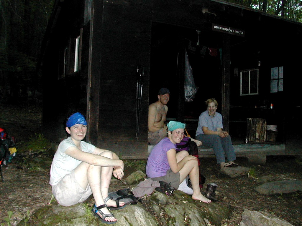 Minerva Hinchley Shelter That's Sarah, Amber, Matt and Puddles |
We were told there was a nice diner a few tenths of a mile on the road we would cross in the morning, so we looked forward to a real breakfast and enjoyed the rest of the day. It was the longest day but rewarding nevertheless.
oday we were to climb Killington, our first 4000 footer. But first we were going to breakfast at that diner, so we got up, packed up without cooking breakfast and were off. The rain dampened our spirits, but ever the optimists, we hoped that it wouldn't last long. We got going around 7:30 while the rest of the crew at Minerva slept on.
 The Wistlestop Restaurant |
 Sadie at Governor Clement |
We got to Governor Clement Shelter and finally met up with the guy with the dog. I don't know the guy's name, but the dog was Sadie and she was a sweet trail dog if ever there was one. They had stayed the night at this shelter (no locals problem: perhaps the rain helped) and they were just starting up Killington, heading for Pico Camp. We were aiming for Cooper Lodge, a few miles closer, so we said so long to them.
 Blowdowns on Killington |
We saw some packs there - evidently some others had dropped their packs and gone to the summit. So we dropped our packs in the lodge and proceeded up. Immediately a large family (3 boys, a girl and the parents) came down off the summit trail as we proceeded up. Well, this was by far the steepest trail we had hit anywhere from New Jersey north, it was hand over foot climbing. At least 45 degrees. The climb was something like 500 ft. in .2 miles so you can figure that one.
 Killington Summit |
When we got back down to the trail, we introduced ourselves to the family we had seen. They had hiked up from Route 4 and had plenty of good camping gear. The mother and daughter were dressed in long skirts and it turns out they were Mennonites from Lancaster Pennsylvania. Since Fresh Air came from a Mennonite background, it was a bit of a reunion. It seems all Mennonites know, or at least know the family names of, all other Mennonites.
The shelter appeared to be an old ski lodge of some sort. It was a stone building, rather dirty and
the roof leaked. Luckily it rained the night before, but was not to rain tonight. Much of my stuff was
damp, but it would be a cold night and not much would dry out.
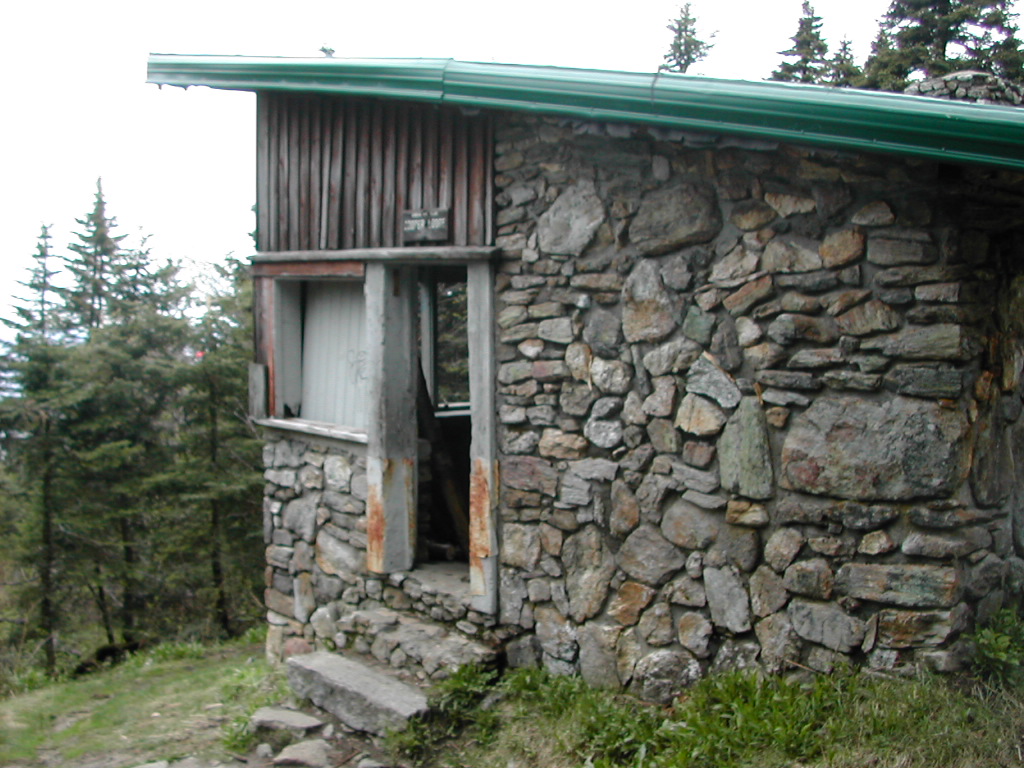 Cooper Lodge |
oday was a pivotal day. We would finish the part of the AT that follows the Long Trail and turn east towards New Hampshire and Maine. I expected that the number of fellow hikers I would see would drop since most of those we me lately had been LT thru- or section hikers. Furthermore, I would be on my own from here on. Fresh Air had got a call last night and would have to leave the trail at Route 4 to go home to attend a funeral of an elderly aunt. This year all of our hikes had been together, so it was a little bit funny to think of hiking alone. But soon the thought passed since the trail was the trail and when you're walking it, you are basically alone anyway, whoever else may be nearby.
 Pico Peak from Killington |
The trail down was a beautiful walk through dense Balsam along the ridge west of Pico Peak. It soon became a Spruce and then a Birch forest with a lovely understory of ferns. Hiking was easy for this descent. We soon met a day hiker who said his name was "Geezer Hiker". He was in his late 60s and we had seen him yesterday on the other side of the mountain. He said he was gradually day hiking the entire trail, up and back every peak. That way he pointed out he actually did everything twice - both up and down directions. When we talked yesterday we were a little skeptical, but upon seeing him again doing this side of Killington, we were convinced he really was serious about doing it his way.
 A Beautiful Green Glade |
I passed through a beautiful green glade and soon came to Maine Junction. A recent relocation had moved the AT about a mile east, so the trail I now entered was actually the old route before the relocation. Looking back to the south I could see the north side of Pico Peak with all the ski trails in evidence, a view that I did not get from the trail itself (which skirted this peak to the west). The tread on the trail showed the difference in usage. After moving away from the LT and the rest of the relocation the trail passed through a campground in a state park. The trail was hardly blazed at all here, but by simply staying on the road, I soon got to the next highway and was back in the woods.
 The input Stream to Kent Pond |
I crossed River Road and then climbed the toughest climb of the day. One of those steep switchbacked
dirt hills that wear you down. Give me rocks anytime. I proceeded to climb no less than 3 unnamed 2600'
hills. Where I come from, 2600 ft is a real mountain. Up here they don't even give them
names!  I
crossed a dirt road and chatted briefly with a guy on a 4 wheeler ATV. He said the next 15 miles was
easy going. Had he walked it or ridden over it? Well, I took his word for it anyway.
I
crossed a dirt road and chatted briefly with a guy on a 4 wheeler ATV. He said the next 15 miles was
easy going. Had he walked it or ridden over it? Well, I took his word for it anyway.
 The Placid Ottauquechee |
I arrived at the shelter and met a group of 5 guys: Rod, Jim, Ed, Scott and Shawn. The first 3 were in their 50s and were doing one of their twice yearly long-weekend hikes. They were nice guys with lots of good food which you can take when you do short hikes. Their rituals included cigars for the campfire and a Gatorade bottle of very good scotch. I passed when offered to partake. They were tired and complained about the hills, their packs, all the usual stuff but you could see they enjoyed each other's company and getting out there.
I had had a good workout the last few days. I took some Vitamin I for my right calf and hit the sack early.
 Story Brook Shelter with Ed, Rod, Jim and Scott |
hen the AT turns east at Maine Junction, leaving the Long Trail and wending it's way over towards New Hampshire, it's character changes quite noticeably. Whereas I would call the first section as "wild" I would say this section is "pastoral".
Another difference is that the trail maintenance is taken over by the Dartmouth Outing Club. The trail in Vermont along the Long Trail is maintained by the Green Mountain Club. The most noticeable difference is DOC's bright orange signage. I prefer GMC's natural wood signs with the letters carved into the wood. As for trail quality, I'd say GMC has a much harder section (more mountainous, wetter) and does a great job. DOC's job is good, but sections here and there could definitely use work.
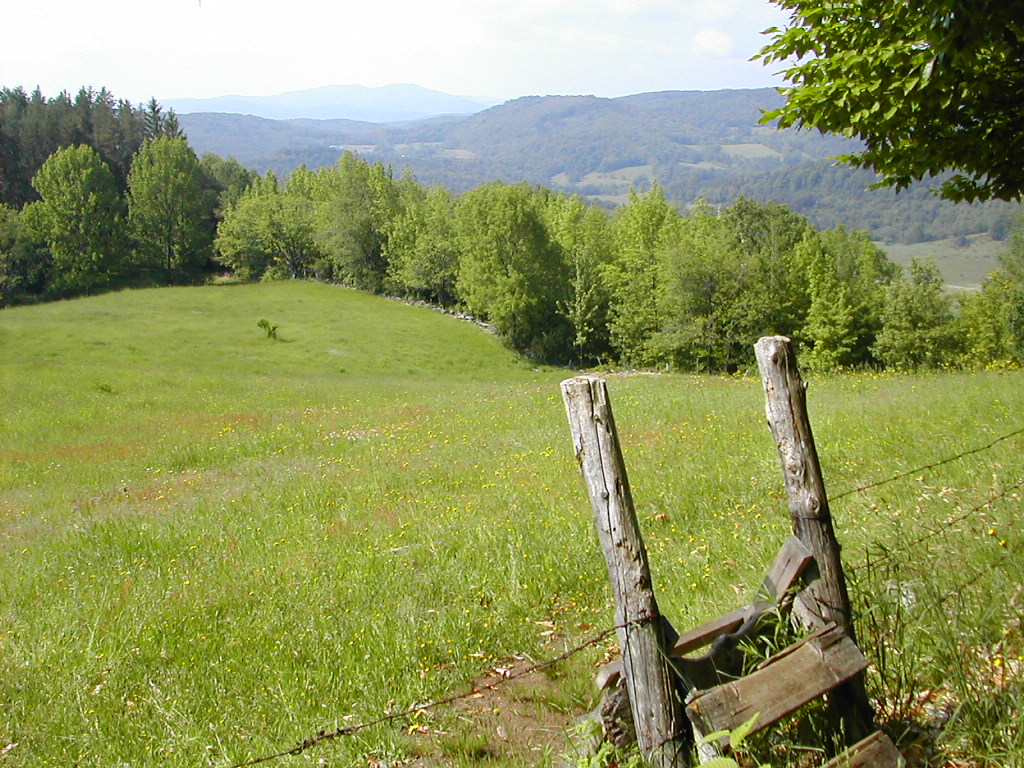 The "Pastoral" Trail in Eastern Vermont |
Another difference, and this is major, is that the trail is much dryer in this section. Perhaps it's the lower elevation, or the type of soil or underlying rocks (and of course it was a bit later into the Spring season), but the steep rock climbs to high elevation bogs with so much water and mud, were replaced by hill climbs over dry hill tops, often old pastureland. The one area where you would be likely get your boots wet were occasional boggy meadows.
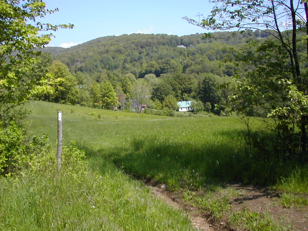
I consider this the "picture-postcard" Vermont, and I love it's beauty. Alas, the day may come when these old farms and small towns are turned into new developments, and that will be a shame. But for now, this is the Vermont I have known and loved for years. So get up here, look around and enjoy the trail. The countryside is probably much as it was in the late 19th and early 20th century (actually there were likely more active farms then but the character was much the same).
saw the sunrise from the shelter. It was a nice morning. My leg wasn't hurting so I'm hoping my "favoring" of it and the Advil I took, had done the trick. I was dreading waking up to a stiff sore calf muscle. This was to be a short day - just under 10 miles, so that boded well for my rest and recovery.
 Over a Little Knoll |
I climbed a hill to a hemlock covered ridge. So far my right calf was acting OK, but the day was young. Jim caught up with me while I was taking a break and moved ahead for a while. He said he had to get a head start since his friends would eventually overtake him. His feet were bothering him yesterday, but he said they were better today. My own pack, which I had adjusted the other day, seemed to stay in better balance today.
 A Stand of White Birch |
I stopped briefly at the Lakota Lake Lookout, but it was too buggy to stay. So I pressed on and a couple of miles later I followed the short side trail to "The Lookout". This was great. An enclosed cabin with a lookout platform on the roof. And the sign "Hikers Welcome" on the door. I had a bit to eat and chatted with 3 college age girls who had 3 dogs. They said they had hiked up here in 15 minutes from somewhere. And to think I've been hiking over 400 miles to get to this place! I got a picture of myself with their puppy and eventually got back down to the trail.
 Me and friends at "The Lookout" |
There were several more bumps and a long descent to the Shelter. I had time to rinse some of my clothes before the others trickled in and by 4:00 they had all arrived. Ed decided to tent out - in spite of the threat of rain. Then another couple, Ed and Shelly, showed up around 6:00 and they too intended to tent. They were new to backpacking and she had a 50 lb. pack and said his was heavier! Yikes! So there were 8 of us in or around the shelter and got a fire going which needed to be continually fed. I'm no big fan of fires, with the smoke and constant maintenance needed, but they have their good points on a cold night. As usual the guys had their scotch and cigars, and we all turned in.
 The Wintturi Shelter |
he guys were joking that it always had to rain on one of their camping trips, so on cue, we had some morning sprinkles. Luckily these did not last too long. I said goodbye to the gang (who would finish off today) and got an early start at 7:15.
The trail was pretty in this section, a few ups and downs, a vista and Hemlocks, Ferns, Pine and Maple to go through. It was sunny but a bit humid. My right leg was still OK, so I could almost consider that recovered.
 Ferns under Pines |
I took another break at Stage Road. There was a bridge over a stream here. It was funny, as I came out to this road I looked at my Trail Guide page, and a couple of men came across the road from the other direction. I said out loud, "I'm trying to figure out what road this is". They said "It's Stage Road, we just figured that out ourselves". So this was a bit of helpful information from the only souls I had seen all morning on the trail.
 Open Meadows - Beautiful but Hot |
I met a woman moving south up from Rt. 38. She introduced herself as Mrs. Gorp. I said "I know who you are, you resupplied Flyin' Brian last year when Greyhound lost his pack". She said "Yes, that's me, in fact these are the trekking poles he used". She wanted to know if there was any water at "The Lookout" (no), and we chatted about various things. She had been hiking in the south this year but had to break it off and now she was just getting out there. It was nice to meet someone I only knew from reading stuff on the internet.
 Mrs. Gorp Photo by Chase, used with permision |
The water was a good ways distant. First you pass a dry stream and you think "Oh sh*t, there's no water", then you go another 50 yards or so and there is a wet stream which is OK. But it was buggy pumping the filter. It was pump - pump - smack. I'm sure I killed 45 mosquitoes while pumping 3 liters. My right calf was also not feeling too terrific, but it was not worse. I rinsed a few things and hung them out to dry and took a little time to relax. I also separated out some stuff I could send back when I got to Hanover tomorrow afternoon. The tent, some extra clothes, various other stuff. I wanted to make my load as light as possible for the last trek through New Hampshire. My right calf (and my back!) would be thankful.
 Turbo, Bruno and Sassafras |
It was a warm buggy night, I would put the bug net over my head, but the mosquitoes would still do their annoying buzz. Then I would put in my ear plugs so I wouldn't hear the buzz. Then it would be too hot and claustrophobic, so off would come the net and out would come the earplugs. So went the night. It was actually my worst bug night yet, and the girls said the same thing.
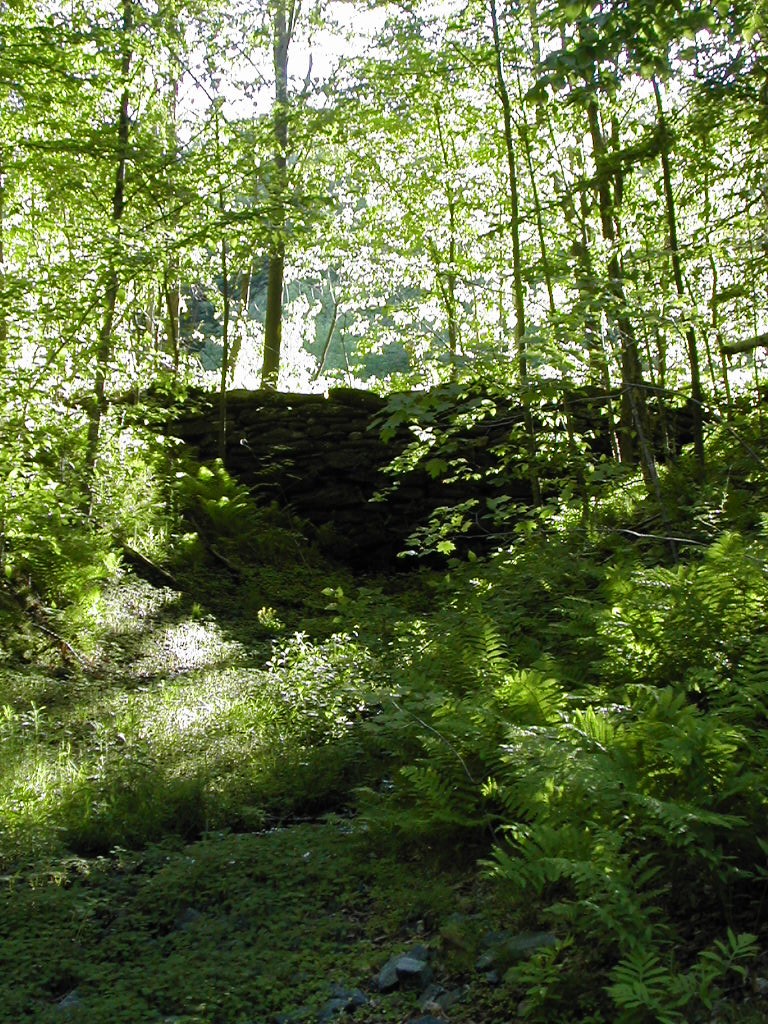 An old rock dam by the trail |
The terrain was getting more rural, less forests and more open space as I approached the Connecticut Valley. The ups and downs were not bad and to be honest the meadows and pastures I went through were actually quite lovely. My leg was OK as I was favoring it strongly and really trying to relieve any excess stress on it.
I passed a small pond and looking closely, I realized it was an old farm pond with a rock dam (with no mortar) at the outlet. Both dam and pond (and farm) were obscured by many years of overgrowth.
I passed a Red Pine plantation and came out to a meadow with a view to the south-east of
the Connecticut River, about 8 or 10 miles away. This was a great morale booster since
crossing this river was my goal for today and it would be a milestone to cross into a new state.
 Red Pine Plantation |
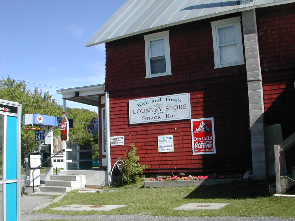 The Country Store in West Hartford |
It was still only mid-morning when I crossed the old iron bridge over the White River and through the lovely town of West Hartford. I stopped for coffee and a snack at the country store. The man said the two woman hikers had just left. That would be Turbo and Sassafras.
 Happy Hill Shelter |
Unfortunately I didn't realize the extent of the road walks through this section. It seemed to be at least a mile in Norwich on the Vermont side and probably at least as much in Hanover on the New Hampshire side. And of course there was about a mile of road in West Hartford I had walked in the morning. Ironically, although the roads are esthetically unpleasant , and hard on your feet, you actually make better time moving along them.
 The Bridge over the Connecticut into New Hampshire |
Bah!. At least the pizza place would know how to help me.
So I went to the Post Office, picked up my food for the next 4 days, mailed back my excess stuff and headed out to eat. I had a very nice couple of slices and a couple of pints in the Brick and Brew and then headed up to Velvet Rocks Shelter. Like it says in the Gospel "And in those towns where you are not welcome, shake the dust off your sandals and leave", or something like that.
I passed through the outskirts of Hanover and found the trail which climbed a steep but short trail to the shelter. It seemed to be graduation weekend (it was actually a Monday) and all sorts of young and old college types were hiking up the trail. There is a nice rocky ridge with good views near the shelter and I saw probably 8 or 10 hikers going by - first up and then back.
 Me and Bruno at Velvet Rocks Shelter |
I got to the shelter and there was Turbo and Sassafras (and of course Bruno). They had come to the same conclusion as I did and decided the trail and the shelter was a better place to spend the night. I cooked supper (didn't I just have pizza and beer and hour or two ago?) and got my stuff into the shelter. It was VERY small. It was supposed to sleep 4, but the 3 of us practically filled it to capacity.
New Hampshire: Approaching the Whites
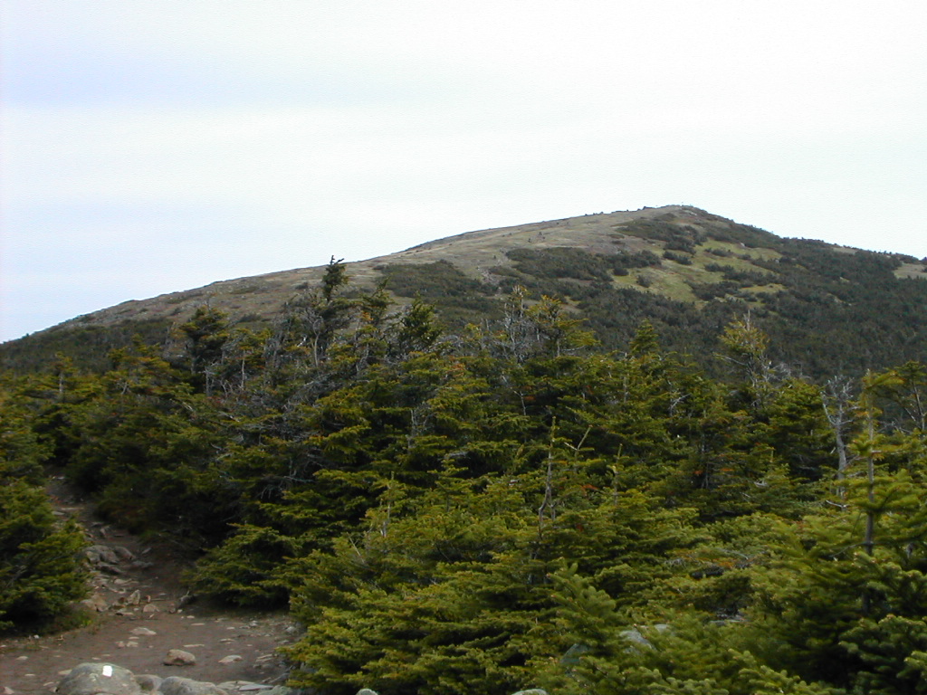
 Franconia Ridge and the Presidentials from Moosilauke |
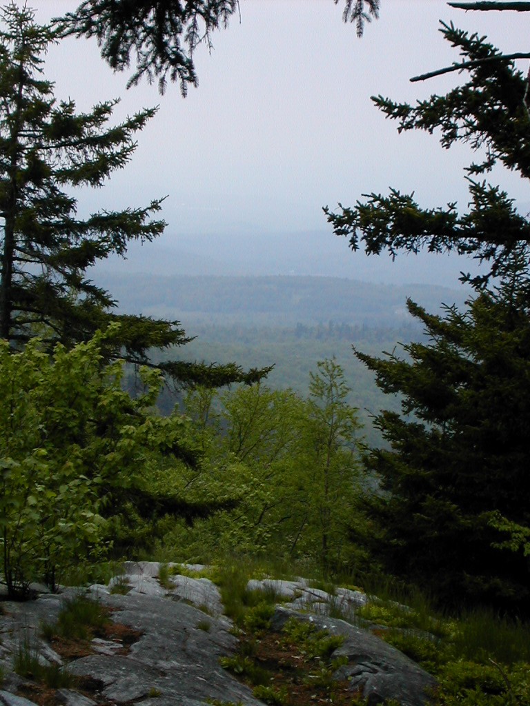
Finally you reach Mt. Moosilauke, the first of what I would call the real mountains, the first on the entire trail for a northbounder to rise above treeline, and incidentally the last place where the trail passes through a farm field (at least that's what the Companion has to say). From here on in you are in the mountains, no two ways about it.
Logistics get trickier as well. Bus service is hard to find in many places and one has to plan carefully to lay out a section hike and find access to both start and finish. Of course worse logistics are to come. There are some places in Maine (so I've heard) you just can't get to! (or from!)
t started out looking like another nice day. The two girls were going farther than I was (they were headed for the "Firewarden's Cabin" on Smart's Mountain, nearly 22 miles) and were up and out early. They had talked me into aiming for Glencliff, which had a hostel near the trail, rather than aiming for a shelter (Ore Hill or Jeffers Brook) on my third night. They planned to take a zero day in Glencliff, so although I would take 3 days to get there (vs. two for them) I would likely see them again when I got there. This also made my last day, hiking over Moosilauke, shorter and easier to plan. Moosilauke was on my mind both because I was worried about my right calf (which fortunately felt fine this morning) and just the fact that it was the most significant peak I would get to in all my hiking this season.
 Trail in the morning rain |
I was shooting for Trapper John Shelter today, slightly over 15 miles, and got started at 6:50 AM. It's always nice when I manage to get going before 7:00. The bugs were already starting to be bothersome so it was good to get moving.
As it turned out, it got more cloudy as I went along, not less. It looked like prospects for a nice day would not happen. The forest was dark with the clouds and the trees. The Pine and Hemlock groves were almost forbidding - but in an intriguing, not a malevolent way. The silence and shadows made for a particularly introspective hike. The rain started by about 9:00 AM and continued on without really stopping till well into the afternoon.
I had to climb Moose Mountain, which has two peaks separated by a long relatively flat saddle between.
 Moose Mountain, South Peak |
The undergrowth was extremely thick on the flat saddle between the Moose Mountain peaks and I got
wetter there than from the earlier rain. After passing by the north peak, I started down towards
Goose Pond Road. I was concentrating on my footing, and suddenly my head slammed into an overhanging
tree across the trail. Wham! I hit it so hard it knocked me down and bloodied my scalp! Boy,
why don't they put warning signs down by your feet for hazards ahead?
I got going again and
got down to the road.
After crossing Goose Pond Road, the trail skirted a pretty bog area with some nice wild flowers. However, the mosquitoes were getting so bad I could hardly stop long enough to snap a picture before being bitten, so I moved along. Now came the climb up Holt's Ledge. The rain had stopped and it was very hot and humid. The temperature was in the high 70s.
 Holt's Ledge |
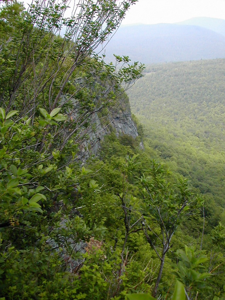
There was an area which was off bounds, where Peregrine Falcons were nesting, but I did nevertheless get a good view of the ledge and valley below. This is where the Dartmouth College has it's ski area, although I never did see any of that from the trail.
To add insult to injury, by the top of the ledge, my water had run out. Instead of pumping more, I figured I would just trudge on to the shelter which at this point was only a mile or so further.
I finally made it down to Trapper John Shelter, which was in a nice cool glen with a very good stream just yards away for water. There I met Maine Billy, who was taking a zero day here.
Billy was one of the more interesting chaps I met. He was from Maine, from a small costal town. He was about 18, and had quit high school a few years before to become a lobsterman. He made good money during the lobster season and intended to go back and enter college to study philosophy. He had read many of the great philosophers (from Aristotle all the way to Spinoza) and would wax eloquent on many topics, especially nature and the forest. He was marking time since he was going to meet his high school sweetheart in Glencliff over the next weekend. They planned to do some of the trail together heading north into Maine.
His stove had conked out a while back, so he cooked his meals on wood fires (and skipped breakfast). Even while gathering wood and cooking (he always lit his fires with just one match, no matter the rain) he would expound on the need to leave the dead twigs and wood for the forest. It was food for the forest life, as he would say. He hoped to get his stove fixed when he got to Glencliff.
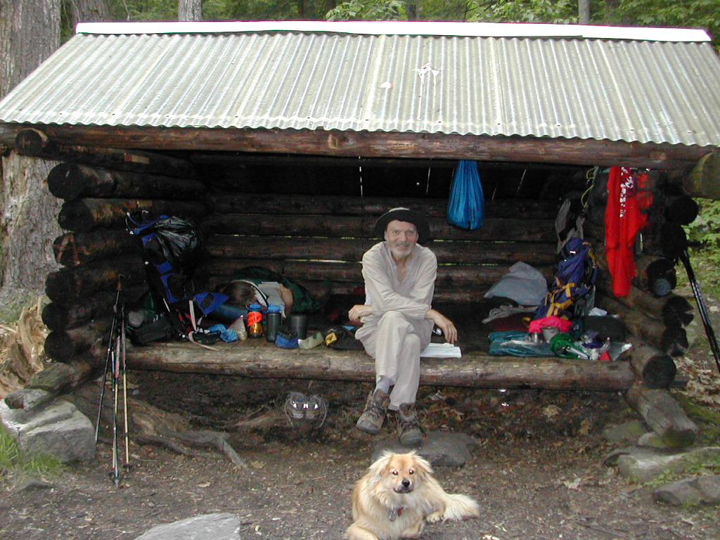
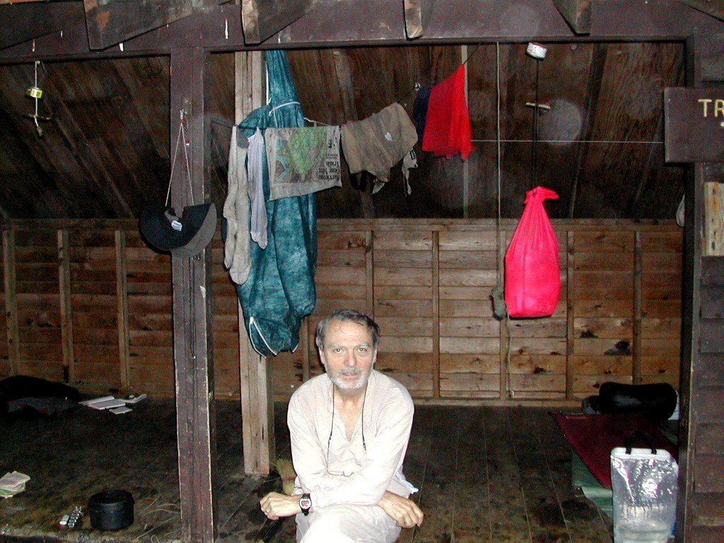 Papa Bear at Trapper John Shelter |
The rain started again in the afternoon, fortunately after I had made it to Trapper John. I had made a strategic error however by rinsing out most of my sweaty clothes. In this weather they would never dry. But I felt clean and happy to be here and my leg felt OK.
The rain continued off and on during the night. It's always hard to tell rain from water dripping from the trees, but it was wet in either case, that's for sure.
he clothes I had rinsed yesterday afternoon were not-unexpectedly still quite damp. This fact underscored another strategic error I had made: I had sent a bunch of unnecessary stuff back home when I went through Hanover. Among these were a set of "night clothes" which consisted of a long sleeve coolmax shirt, long johns and a pair of coolmax socks. I also sent back my camp shoes - a pair of K-mart aqua-mocs. Now the long johns and shirt will not be missed, but with a chilly, rainy day in the offing, and no dry socks or camp shoes (just two damp pairs of Smartwools), I would have no warm dry feet when I got to camp. Not to cry over spilled milk, and in the knowledge that damp or even wet Smartwool socks can still be warm, I got my stuff together and got going.
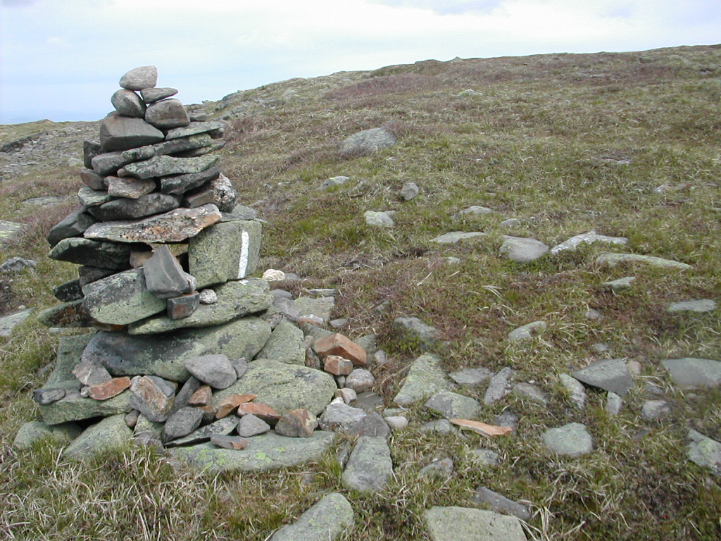
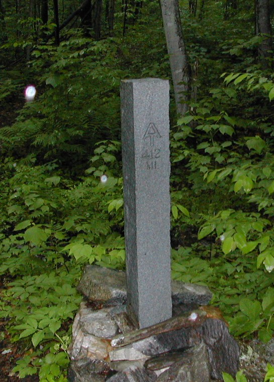 Granite Trail Marker |
The first section, down to the road was fine. Rain and Solitude ... rain drop noise on the forest cover. I passed that immensely incongruous granite trail marker. New Hampshire - the Granite State. Wouldn't you know. When you get there and see it you can give a chuckle.
Then up the Lambert Ridge, a series of steep rock ledges. This proved to be a bit exciting in the wind and rain. Almost dangerous where the strong wind on the exposed ledges buffeted you. The rain and wind was tiring and when I got to the Firewarden's cabin at the top of Smart's Mountain I needed a rest. The crew there of 5 lay-a-beds let me in and watched me from their sleeping bags, trying to get warm. Finally I scrounged some water and cooked a pot of oat meal and that did the trick. But for that, I was just shivering in wet socks and wet clothes in the chill air. I got going again and apparently inspired the others there to get moving a bit. Ed and Emily started getting dressed and got their packs together as I was leaving. They would pass me shortly going down the north side of Smart's Mountain. The 3 other girls (one of whom had given me water to make the oatmeal) would be moving soon as well.
 The gang at the Firewarden's cabin |
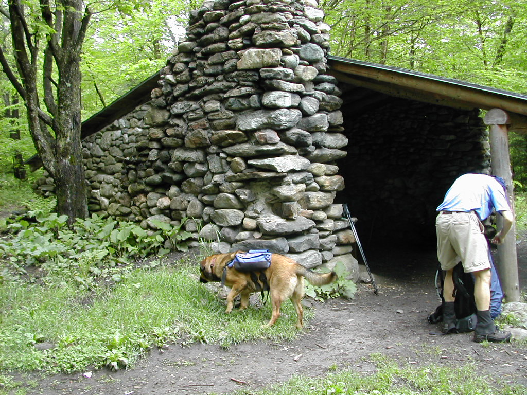
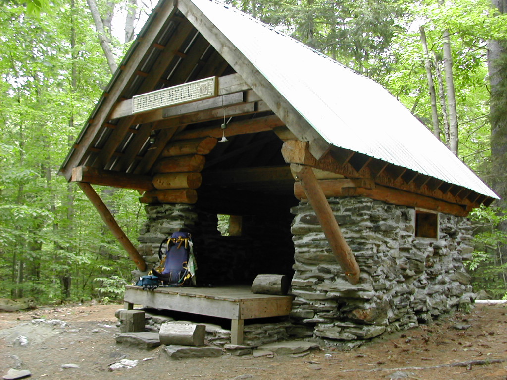
"Hexacuba"? What kind of name is that? I thought maybe it was named after someone, or had something to do with Cube Mountain, where it is located. Well, when I saw it I knew: it was shaped like a hexagon!. Six sides with the front two sides open. This gives somewhat more protected wall space then the usual rectangular shelter. The only problem was deciding how to fit ourselves in. We debated doing it radially or circumferentially and eventually settled on the former. A visit to the privy made the geometric joke even better: it had 5 sides and was labeled the Penta Privy! You gotta see it!
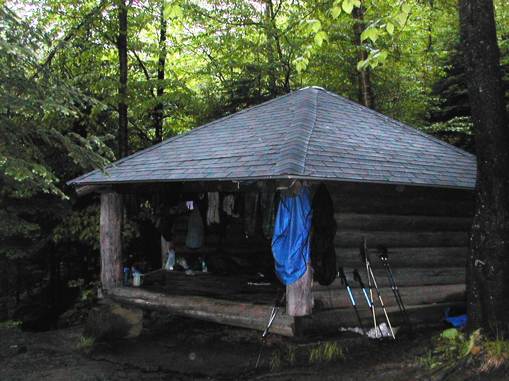 The Hexacuba Shelter ... |
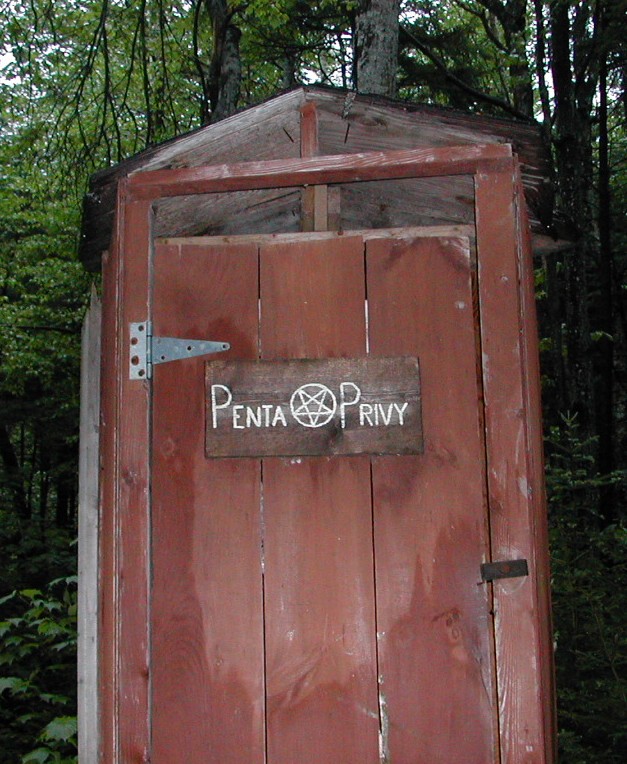 And the Penta Privy |
Everyone who showed up had tons of clothes to hang up to dry ... not that we expected anything to actually dry. My main problem was my cold, wet feet. The simplest solution was to hang up the Smartwools, go bare foot, and stay on my thermarest for insulation. I made sure the wet stuff didn't get the dry stuff wet and once I got into the sleeping bag I was fine. It finally stopped raining and got colder. There was a pitter-patter all night - hopefully just the trees dripping.
was up early today. I intended to get to Glencliff (just under 15 miles) and stay at the Hostel. Turbo and Sassafras had suggested this to me and it was a good plan. Alternatives would have been to stay at Ore Hill Shelter (too close) or Jeffers Brook Shelter (a little too far). The shower, washing machine and restaurant would make up for the town stop I missed in Hanover. Who Cooks for You? was also up early; the rest of the gang was sleeping late as I made breakfast and got ready to go.
 Mount Cube |
The peak was nice and the descent down was easy. I got rolling and soon reached the road (NH 25A). There I changed into lighter clothes and had a bite to eat. The sun was just breaking through so it was going to be a nice day - after 2 days of rain I deserved that!
After my little rest I crossed the road and discovered a large wetland to the left and the trail entered the woods a little to the right. But whoaa! There was no trail! The water from the marsh extended along the road and was about 10 feet wide and at least a foot deep! Either temporary flooding from 2 days of rain, or maybe that's just the way it was. There seemed no way around, so I either had to go through or end my hike prematurely right here. Off came gaiters, boots and socks and I trudged through barefoot. This was no big deal but it was time consuming to take off all my footwear, go through, and then dry my feet and put everything back on again. I'll have to work out a better system for when I get to Maine.
 A little pond near Ore Hill |
The hike down to Route 25C and up the other side was easy. I took another break about 2:00 PM and suddenly noticed I had no gaiters on! Sh*t! I must have left them at the Ore Hill Shelter. I could only hope one of the gang from Hexacuba would stop there and pick them up for me. Perhaps I would get them back in Glencliff (where we were all heading). I could only hope.
The bugs discovered me, so I was off down the easy descent of Mount Mist to Glencliff. The trail was supposed to skirt Wachipauka Lake, according to the Trail Guide, but it didn't! Maybe there had been a recent relocation in this section. I got to the road and a very short (but hot and sunny) walk down the hill brought me to the Hikers Welcome Hostel.
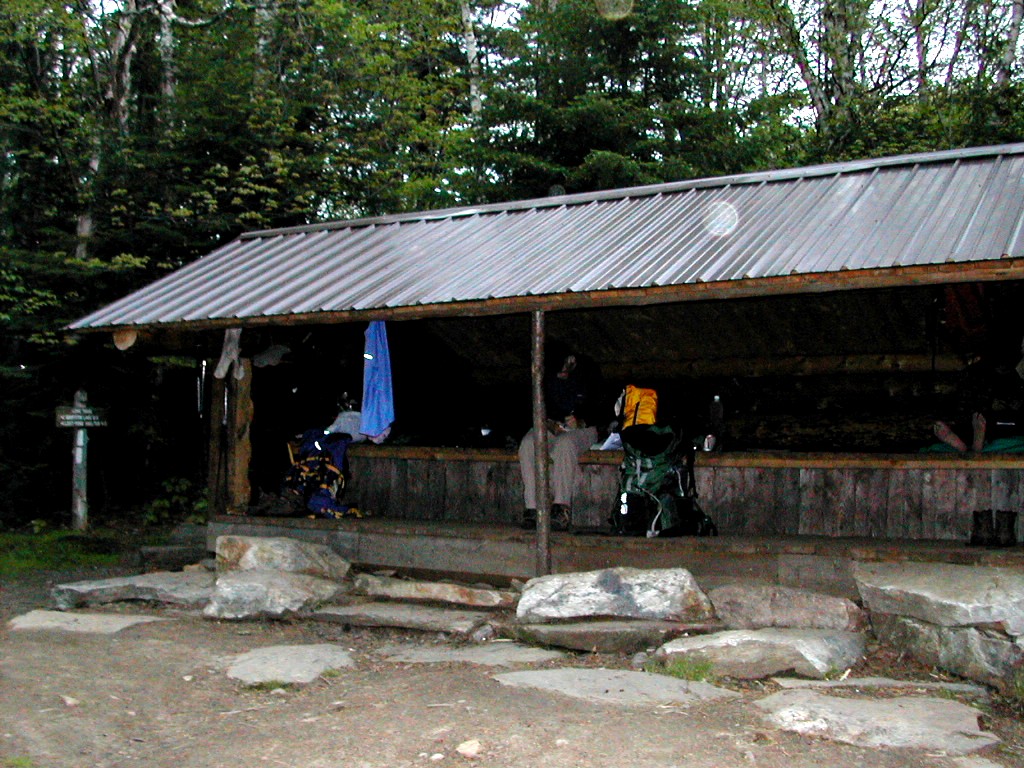
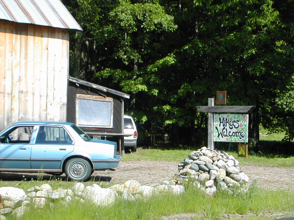 Hikers Welcome Hostel |
I took my shower and washed my stuff (and found a tick on my foot. Where ever did I get that? Barefoot in Hexacuba in yesterday's rain?) Then lo and behold, Ed and Emily walked in and Ed said: "Papa Bear, are these your gaiters?" Yes, yes they were. Thanks. It seems that they and Who Cooks for You were all taking a break at Ore Hill Shelter and saw them drying on a log. Who Cooks thought they were mine ("They matched your tan clothes style" she said later. And I didn't even know I had a clothes style!).
We soon met Packrat (John) who ran the place. He gave us a ride to Warren, the next town (there was nothing in Glencliff but this Hostel, the post office and a few houses). We picked up the Canadian couple down the road hitching, and we got dropped off by the pizza place and grocery store. Packrat was off to pick up Turbo and Sassafras in Franconia Notch. It seems yes, they got here yesterday, but instead of taking a zero today, they decided to do a 26 mile slack! They wanted to take advantage of the nice weather, so they said. We had nice food and brew (I had a bacon cheese burger, medium rare, with French fries and two pints of local microbrew. Great!)
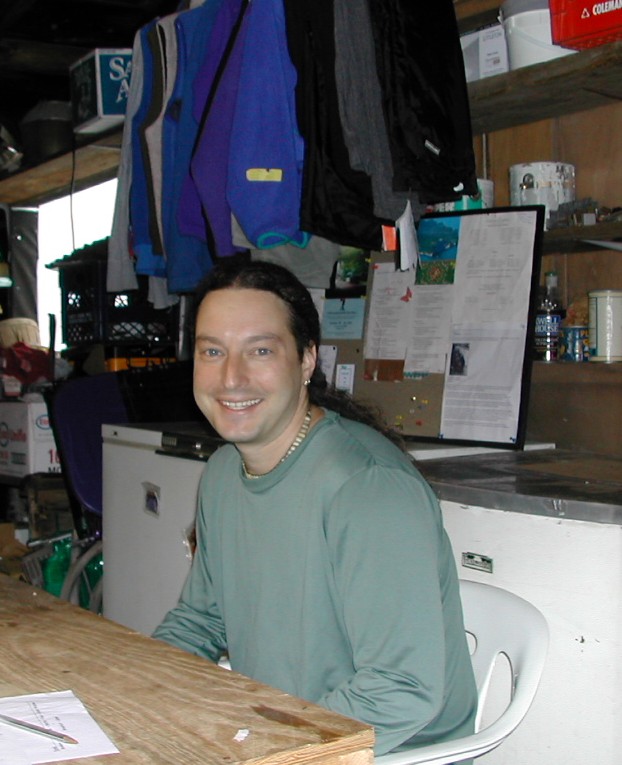 Packrat |
 Turbo |
 Who Cooks for You? and Sassafras |
When we got back, I met with Turbo and Sassafras, back from their slack, and Who Cooks for You? who had also arrived from her day's hike from Hexacuba Shelter. There were 3 or 4 others and it was quite an amiable crowd. Packrat offered to slack my pack to Kinsman Notch tomorrow and after burrowing a day pack I readily agreed. Doing a tough mountain like Moosilauke would be much easier with a light load. The weather forecast was for sun, with rain late in the day tomorrow, so I was hopeful tomorrow would be a great last day of hiking for me over Moosilauke.
oosilauke! For several reasons I was concerned about today's hike. First off was my right calf, which started bothering me way back on the Long Trail after crossing Killington. Luckily this had been "good" for the last few days, and the lighter pack I had carried since Hanover had helped. Second was the fact that it was the first peak to rise above treeline. I know it's just another mountain with no trees at the top, but I had an irrational fear - no, not fear - concern, that somehow when I got above treeline, the wind would start howling at 60 MPH and the snow and sleet would start coming down. In truth the day was sunny with temperatures going up the the 70s and likely to remain that way even at the summit. Third was the trail down the north side. Everyone had told me this was very steep and possibly dangerous - especially in the rain. So with rain forecast for late in the day I had visions of rain coming 4 hours too early and washing me down the north slope of the mountain. Such are our fears. Luckily reality generally is much more mundane, so I got a hold of my self and got going by 7:00 AM. Packrat agreed to drop by the Cascade Lodge in North Woodstock, where I would stay tonight, and get his day pack and bring my pack.
 The last pasture on the trail for northbounders |
Surprisingly, the first mile or two of the trail was very un-wild. I crossed a road and walked about a quarter mile along it. Then I passed a cemetery. Finally I went off into a farm area and slowly got away from civilization. The Companion says the pasture land here is the last that the trail crosses for northbounders. No more meadows and pastures all the way to Katahdin!
 The trail up gets very steep and rocky |
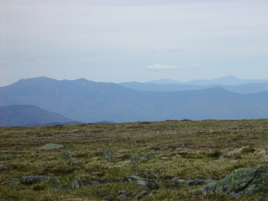
After joining the old carriage road, the trail got easier, and I soon passed above treeline. This was gradual with the trees getting shorter and shorter and then disappearing altogether. The pattern was not neat and even, but rather spotty. It probably depended on wind direction, soil, etc. The trail was now marked by large cairns (8 to 10 ft. high) and had boulders on either side. Signs said to keep to the trail since the alpine environment was very fragile. The view to the summit was very clear, and several other hikers could be seen moving up. The vegetation seemed to be a combination of moss, lichen and some kind of grass.
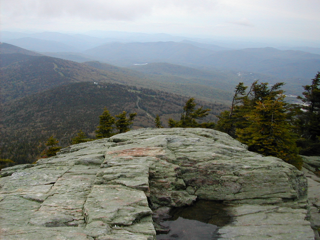
 View of the Moosilauke summit |
 The trail rises above treeline |
I reached the summit at 10:30. The weather was in the mid 60s, slightly overcast, with a nice breeze. The breeze was noticeably stronger at the top, but no, there was no hurricane and no blizzard. Chalk one up for unnecessary worry! A few other hikers arrived and I took the usual pictures, and one woman took one of me. I could see the Franconia Ridge and the Presidential Range beyond to the northeast. In all directions I could see miles and miles, but I'm afraid except for those I don't know exactly what all the land marks were. The trail down towards the north was laying before me, and wanting to get down to the road before any rain should come, I started down.
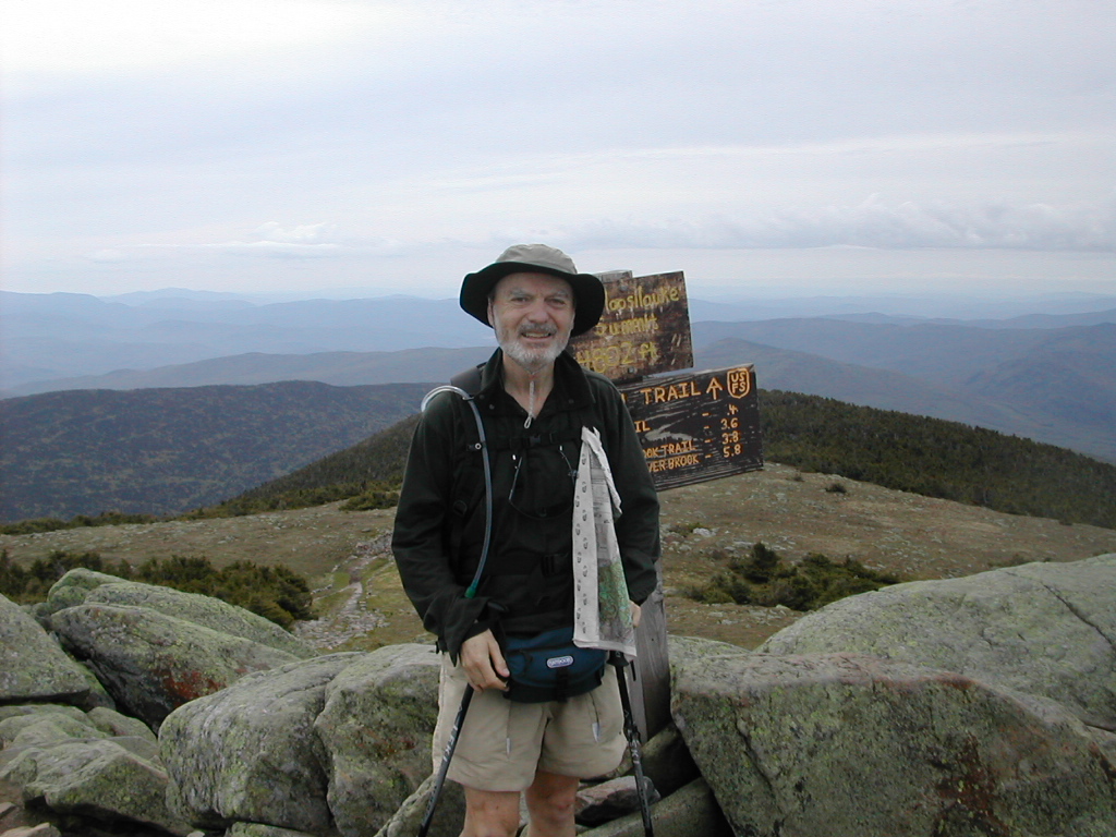 Papa Bear at the summit |
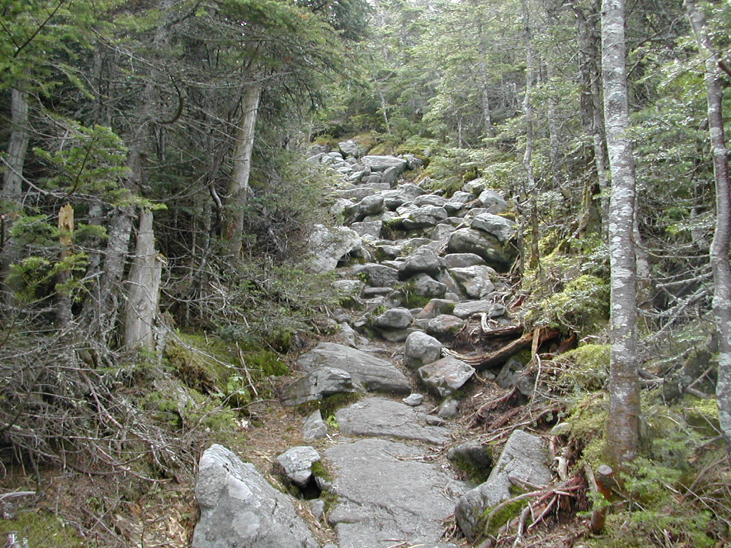
The terrain and vegetation followed the same pattern as on the way up. Once I hit treeline the trail became very steep and rocky. One thing I noticed here was that the trees above a certain height, around 6 - 8 ft. were dead. Killed, I think, by ice. Thus does Mother Nature enforce the laws determining the treeline on the mountain. Grow too tall and the ice gets you the next winter. The trail followed a precipitous ridge dropping off steeply towards the south. I took the side trail to Beaver Brook Shelter as this would be the last rest stop before the really steep part began.
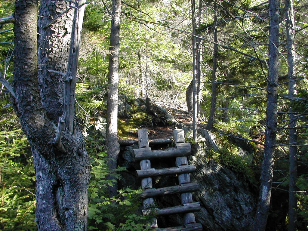
Beaver Brook was a lovely shelter facing the Franconia Ridge on a steep slope and looked like a really picturesque place to stay (in good weather). I decided to fold up my trekking poles here and fasten them to my pack and go down the last section of trail with hands free. I thought this would give me a bit better balance and enable me to use any necessary handholds. The steep section coming up was my last worry. Everyone, and all the trail guides had made a point of it. At just 12:00 noon I was off for the last descent.
I crossed a stream (actually Beaver Brook) and this would follow the trail the rest of the way down. Or actually you could say the trail would follow the stream. Soon the stream bounded down a long cascade, then another. It was simply beautiful. The trail bounded down as well with a cleverly constructed trail. There were steps cut into the rock and there were wooden steps imbedded in the rock face. There were metal hand holds. The trail building here was astounding, yet it was always subdued and natural looking. It never overpowered the trail. The whole thing was Awesomissimo!
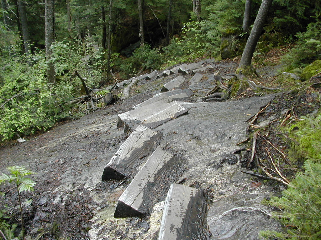 The trail falls rapidly Note the steps imbedded in the rock face |
 And the stream falls rapidly along side |
What was all the talk about steepness and danger? They never told me the real secret: this was incredibly beautiful. This rivaled Sage's Ravine way back in Massachusetts for sheer natural beauty. And hiking hands free in this section was the right choice. There were very few places where a pole or staff would have helped and those were offset by the greater balance and flexibility I had.
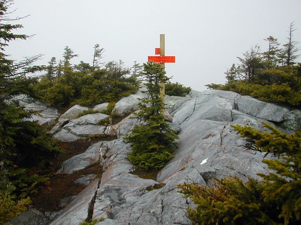
 End of the trail at Kinsman Notch (with my hat and sun glasses) |
I walked down the road a short ways to a place called The Lost River. The sign said "Waterfalls, Boulder caves". I smugly thought "Dumb tourists, you'll never seen the real thing! For that you have to work!"
I hitched a ride and got picked up by the first vehicle going down (a pickup). Soon I would be in North Woodstock, amidst a huge motorcycle rally. I would meeet Packrat at the Cascade Lodge and retrieve my backpack, returning the borrowed day pack to him. My hike was indeed over. For now!
Boots (EMS Mirage II): two problems solved:
Blisters: two days of proactive duck tape, then I was blister free the rest of the time.
Slight numbing of my right instep: I put a little piece of foam under the sock and the numbness went away.
New problem: got wet in the rain. Gortex failed. Why is no one surprised?
Digital Camera (Nikon Coolpix 775): Discovered close-up mode. Took over 250 pictures including many close ups of flowers. Very happy with this camera. Look at the gallery , the shots speak for themselves. The battery lasted about 200 pictures, had an extra.
Pack (Kelty Flight 4500): Better. There was a balance problem which was made better by adjusting the frame somewhat. Not perfect yet but better. Now I have to call them about a strap that came loose.
Trekking poles: I decided to get a pair of those little rubber tip covers and see how they did. They were supposed to 1) make the poles quieter and 2) prevent damage to rocks. Conclusion: I am going to take them off. Why? 1) they weren't quieter, 2) they lost traction particularly going up steep packed dirt, 2) careful observation and even trying to do it intentionally (but discreetly) showed the tips do not scratch rocks. The only scratched rocks I saw were up steep rocky slopes in cold areas (New Hampshire) which showed signs of crampon damage, 4) The real trail damage, that of compaction (on the margins, off the treadway), was exacerbated by the tips. The tip is about an inch in diameter and it tends to pound the soil down. The metal tips actually poke small holes in the soil which would help alleviate compaction.
Stove (MSR Pocket Rocket): Great. My partner measured that you can get 30 meals out of an 8 oz.
cannister. That's two weeks. Unbeatable in size, weight, quickness, cleanliness, etc.
Others who saw our stoves wanted one! (No, not everyone. Some loved their dirty, slow, expensive-to-fuel Esbits!
)
Water filter: I replaced my MSR with a PUR. It's lighter and pumps faster, albeit not as robust. (See I don't like everything I own with religious fervor, just the stove).
|
Click here for a complete album of photos from this hike Click for Papa Bear's Home Page Click for the Backpacking Page |